Click here for
September 2006 Hurricane and Severe Weather Outlook Click here for the
Introduction to The Weather AlternativeScroll down and check out fulfilled long-range forecast.
Oct 4-6:
A cold front over the Mississippi Valley triggers storms that push eastward.
Oct 5-7:
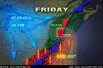
Storms hit from coastal North Carolina and Virginia through the Northeast.
A tropical moisture is indicated over the Bahamas, Cuba, and Jamaica.
A storm system will advance into the Pacific Northwest and Intermountain West, pushing showers and thunderstorms into those areas.
Oct 7-9:
Cold air funnels in over the Plains and pushes eastward triggering storms that eventually reach the Southeast, Mid-Atlantic, and Northeast.
Oct 8-10:
A storm system moves in over the West Coast States and pushes toward the Rockies.
Oct. 10-12:
Storms should rev up over the Plains and West Coast. After the 12th, falling temperatures and windy conditions are in store for the eastern U.S.
Oct 11-13:
Low pressure brings rain to the Bahamas, Cuba, and Jamaica. Storms will affect the coastal area of Florida, Georgia, and South Carolina.
Oct. 15-18:
The general weather pattern over California begins to change now as a warmer more moisture-laden air mass enters the region. This may result in tropical moisture being funneled into the area setting off heavy showers. Fog may also be a concern now.
Abundant moisture is also drawn up over the Plains creating severe weather potential along the Front Range of the Rockies.
The Mid-Atlantic States will have to deal with what promises to be some good-sized storms of their own.
Oct 19-21:
Showers and storms hit the Northeast down through Virginia, the coastal areas of Florida, Georgia, and South Carolina, as well as the Bahamas, Cuba, and Jamaica.
Oct. 19-21:
Storms continue to kick out into the Plains as contrasting air masses feed low pressure systems. The West Coast gets a new round of storms while temperatures drop over the eastern U.S.
Oct. 22-25:
A new wave of inclement weather reaches the West Coast States. The period climaxes with the potential for tempestuous, widespread storms and heavy downfall. The Plains should respond with an outbreak of severe weather, which may include possible tropical storm implications along the southwest coast of Texas.
The potential for major tropical activity is also shown for the eastern coast of India.
The eastern U.S. should be dealing with its own weather anomalies as temperatures skyrocket. The atmosphere may try and equalize the situation by unleashing strong storms over the Southeast and Mid-Atlantic regions. A tropical system cannot be ruled out.
Another Hurricane Hot Spot may develop off the eastern coast of Nicaragua threatening Central America, while the island of Jamaica is in for severe weather as well.
Oct 25-27:
A vigorous low pressure system will trek across the Rockies generating strong storms.
Oct 28-30:
A low pressure system off the California coast will hurl wind and rain into California and Oregon. Major changes should be underway for the Plains as well. A whirling dervish of a storm center over northern Minnesota and Wisconsin will most likely usher in windy conditions. Tropical moisture from the Gulf will help ignite hefty storms over the Ark Latex region.
A Hurricane Hotspot forms in the Eastern Pacific at 94 West Longitude and 10 North Latitude or about 400 miles south of Oaxaca, Mexico.