Tuesday, April 24, 2007

July 2007 Hurricane and Severe Weather Outlook


Probably the best thing about hurricanes is that they move us to help other people. Norman Rockwell captured that helpful spirit in his 1941 painting A Scout is Helpful. The painting was inspired by the 1938 New England Hurricane.
From a long-range weather perspective, the end of July shows the potential to be a very active period. Here are some dates, places, and comments about possible hurricane landfalls and severe weather outbreaks.

July 21-24, 2007

Hurricane scenario: A number of planetary indicators point toward the possibility of a tropical storm or hurricane being drawn northward off the North Carolina coast (around 73W/32N) to the Long Island/Connecticut area. The tropical system would then continue through the area and affect the rest of New England and eastern Canada.

Non-tropical scenario: If not an actual tropical system, abundant tropical moisture is drawn up over the eastern U.S. targeting the Northeast and New England areas. The resulting heavy rains will have the potential to cause flooding problems.

Monsoonal moisture comes to life over the Rockies resulting in showers and thunderstorms. Some of these may be possible flash-flood producers.

Gulf moisture is thrust northward over the central U.S. creating a severe weather threat over Missouri and the surrounding states. Heat and humidity are on the increase igniting storms, which will most likely reach severe limits.

July 24-27, 2007

The East Coast is still not out of the woods yet. Another round of severe storms, or perhaps just a continuation of the severe weather indicated in the July 21-24 forecast, will affect the Southeast, East Central, and Great Lakes area. Tropical moisture, either through a tropical system or some other weather mechanism, will be drawn up over the Carolinas and Northeast. Strong storms should result with the potential of reaching severe limits.

July 28-Aug 1, 2007

A low pressure system that may be tropical in nature forms off the Carolina coasts and heads towards the Long Island/Connecticut area. The area from New York City through New England shows the potential for storms of a severe nature and high velocity winds. A tropical system cannot be ruled out at this time.

The Plains will be dealing with its own severe weather as high heat unleashes dangerous storms over Nebraska, Iowa, Kansas, and Missouri. A similar scenario develops over Alabama, Georgia, and surrounding areas.
Click here for Hurricane Season 2007
Click here for April 2007 Forecast
Click here for Spring Out West

Thursday, April 19, 2007

Early Tropical System in the Gulf?


May 19-23, 2007:
The New Moon of May 16th will pave the way for the development of a possible early tropical storm system to affect the Gulf Coast region centering around Louisiana and Mississippi. Jupiter and Uranus, now forming a weather-disrupting 90 degree angle, will be jolted into action on the aforementioned dates by Mercury's opposition and cuadrature.

These planetary combinations are known to produce high velocity winds and stormy conditions. The New Moon localizes their influence in and around the Louisiana-Mississippi area.
Although this weather pattern has the potential to be tropical in nature, it may of course manifest as some other type of severe weather. Since severe weather is also indicated over the Rockies at this time with the likelihood of strong storms over the Colorado-New Mexico area. Another possible scenario is that the weather system over the Rockies transits eastward and intensifies over the Louisiana-Mississippi area.
Click here for Hurricane Season 2007

More May Long-range Forecasts
May 8-10, 2007:
Severe weather potential exists over the Rockies as well as over the Northeast and New England. Low pressure systems are indicated over both these areas.
May 27-29, 2007:
A storm system forming over the Mississippi Valley will intensify over the Northeast. One possible scenario calls for a strong surface low to crank up over the area ushering in gusty winds and rain as the system moves over the Northeast towards New England and Nova Scotia.

Click here for April Forecast
Click here for a few more May Forecasts
Dr. William Gray on Global Warming:

"I mean, there’s almost an equation you can write: the degree to which you believe global warming is causing major hurricanes to increase is inversely proportional to your knowledge about these storms."

Sunday, April 15, 2007

April 12-14, 2007 Forecast Results


The Weather Alternative long-range forecast for April 12-14, 2007 (posted March 20, 2007) called for a southerly air flow over the West Coast States and precipitation if enough moisture were available.
The following report is from the National Weather Service. (Bold is mine)
AREA FORECAST DISCUSSION
NATIONAL WEATHER SERVICE SPOKANE WA451 AM PDT SAT APR 14 2007
PRECIPITATION COVERAGE SHOULD BE GOOD TODAY...GIVEN THE GOOD SOUTHERLY FETCH OF MOISTURE INTO THE INLAND NORTHWEST.
THE SOUTHERLY WIND TRAJECTORIES IN THE LOW/MID LEVELS ALONG THE FRONT WILL NEGATE THE RAIN SHADOW OVER THE EAST SLOPES THROUGH THE COLUMBIA BASIN...SO MANY AREAS TODAY SHOULD RECEIVE A TENTH TO A QUARTER INCH OF RAIN BY THIS EVENING.
AREA FORECAST DISCUSSION
NATIONAL WEATHER SERVICE PENDLETON OR
249 AM PDT SAT APR 14 2007
A NEARLY PURE SOUTHERLY FLOW WILL KEEP TYPICAL SHADOWING EFFECTS FROMCOMING INTO PLAY.
April 14, 2007 - The Weather Channel
West

A new storm will move across the West Today through Monday, bringing showers and mountain snow to the Pacific Northwest, Great Basin and Rockies.
Click here for April Forecasts
Click here for Hurricane Season 2007

Monday, April 09, 2007

April 8-10 2007 Forecast Results

The Weather Alternative Long-range West Coast Forecast
for April 8-10, 2007 called for windy conditions. (Posted
March 20, 2007)

Here a just a few of the wind warnings issued through
out the western States and Canada. (Bold is mine)

400 AM PDT SUN APR 8 2007

THIS HAZARDOUS WEATHER OUTLOOK IS FOR PORTIONS OF
SOUTHWEST CALIFORNIA.


LOCAL STRONG GUSTY WEST WINDS WILL OCCUR OVER THE
MOUNTAINS AND DESERTS THROUGH THIS EVENING.

10:12 AM PDT Sunday 8 April 2007
Wind warning for West Vancouver Island continued

Strong southeast winds of 50 to 70 km/h expected today.
This is a warning that damaging winds are imminent or
occurring in these regions.

430 AM PDT MON APR 9 2007
THIS HAZARDOUS WEATHER OUTLOOK IS FOR CENTRAL AND
NORTHEAST OREGON AS WELL AS SOUTH CENTRAL AND SOUTHEAST
WASHINGTON.

STRONG WIND KITTITAS VALLEY, YAKIMA VALLEY, LOWER COLUMBIA
BASIN OF WASHINGTON, FOOTHILLS OF THE BLUE MOUNTAINS OF
WASHINGTON,LOWER COLUMBIA BASIN OF OREGON, FOOTHILLS OF
THE BLUE MOUNTAINS OF OREGON

MON APR 9 2007

THIS HAZARDOUS WEATHER OUTLOOK IS FOR PORTIONS OF SOUTH
CENTRAL IDAHO AND SOUTHWEST IDAHO.

A WIND ADVISORY IS IN EFFECT FROM 12 PM MDT TODAY
THROUGH 6 PM MDT TONIGHT A COLD FRONT WILL MOVE THROUGH
THE REGION TODAY PRODUCING SUSTAINED WINDS OF UP TO 30
MPH
WITH GUSTS OF 40 TO 50 MPH.

April 10, 2007- The Weather Channel

The Southwest continues to be dry, and winds will complicate matters today by increasing the fire danger today.

Click here for Hurricane Season 2007

Click here for April 2007 Forecast

Saturday, April 07, 2007

Mars, Jupiter, and Uranus

The ancients Greeks and Romans knew of only five wandering stars or planets. These were Mercury, Venus, Mars, Jupiter and Saturn. Following the discovery of a sixth planet in the 18th Century, the name Uranus was chosen as the logical addition to the series: for Mars (Greek Ares) was the son of Jupiter, Jupiter (Zeus) the son of Saturn, and Saturn (Cronus) the son of Uranus.


Jupiter, the fifth planet from the sun, is about 21 times the size of Mars, and almost 3000 times as heavy! Although it is so much more massive, it is not as dense as Mars.


The fantastic stories handed down to us through Greek and Roman mythology may have actually happened although not as finally portrayed in those myths, which are obviously quite embellished. There may have been something genuine, however, in their origin though somewhat distorted and exaggerated. One confirmation comes from an unlikely source: the Bible.


The pre-flood world according to the Bible was quite a different one. A canopy of water surrounded the earth and atmosphere filtering out the sun’s deadly rays that help cause aging. In such a world atmospheric pressure was much greater resulting in people and plants that were much larger.


It’s not surprising that researchers have occasionally found insects and air bubbles trapped in amber, which is petrified tree sap. The air bubbles have been found to contain 50 percent more oxygen than the air we breath today. The benefits of increased air pressure are no mystery to scientists of today. Hyperbaric treatments that apply increased air pressure and greater amounts of oxygen are used in promoting faster healing in patients suffering from stroke, multiple sclerosis, and leprosy. The Dallas Cowboys even have a hyperbaric chamber because they've discovered the injured players heal twice as fast.


Uranus, the seventh planet from the sun, is more than 7 times the size of Mars, and almost 135 times as heavy.

This increased air pressure and oxygen concentration explains how the 80-foot long brontosaurus could survive having nostrils the same size as a horse’s. It may very well be that pre-flood peoples were larger, stronger, and capable of some of the pretty far out exploits which have been handed down to us in even further embellished forms through mythology.

Regardless of what Mars, Jupiter, and Uranus may have done in the past, between the 28th and 30th of April, their planetary namesakes will align over the Rockies and Front Range. The alignments of Mars and Uranus are known for acute and energetic weather patterns. Those of Jupiter and Uranus bring intense cold fronts and high velocity winds.
Things may get under way as early as the 27th when the Moon triggers the configuration.

Monday, April 02, 2007

Hurricane Season 2007


Accuweather meteorologist Joe Bastardi is reminding us that it's time to start thinking about Hurricane Season 2007. Mr. Bastardi warns that the U.S. Gulf Coast is at a much higher risk of destructive tropical weather this year. Last year, Bastardi was correct in forecasting minimal hurricane activity for the Gulf Coast area.
As for the Northeast, Bastardi says that last year the area was able to dodge the bullet but it may not be so lucky this year. His forecast for last year called for the likelihood of seeing more hurricane activity along the East Coast than along the Gulf Coast. Most of 2006's storms did track farther east than those in 2005.
Even in years of minimal hurricane activity, devastating hurricanes and tropical storms can still wreak havoc for the U.S. as attested to by the destruction caused by Hurricane Andrew. According to Bastardi, last year was just a breather but the overall pattern shows no signs of reversing.
Although conventional meteorologists issue long-range hurricane outlooks, they are unable to pinpoint the time and place of hurricanes or other specific weather patterns if the forecast period is beyond a three or four day time period. Long-range weather forecasts based on planetary positions, however, afford the forecaster indications that enable him or her to make more specific forecasts months or years in advance. The following links are some examples of such forecasts made for Hurricane Season 2006.
The hurricane season runs from June through November. Below are a few dates in June when severe weather patterns are likely to develop. Because the planetary alignments upon which the following forecasts are based usually coincide with high wind and/or tropical moisture, the weather patterns indicated carry the potential for being tropical systems, however, non-tropical systems can also produce high wind and involve tropical mositure.
Over the next weeks, The Weather Alternative will post more long-range forecasts of potential hurricane hot spots.
June 5-8, 2007:
The opposition between the Sun and Jupiter will trigger the lunar eclipse of March 3, 2007, affecting the coastal areas of North and South Carolina between 77 and 79 West Longitude and 33 North Latitude. Its influence extends northward through New Jersey. The warm influence, characteristic of Sun-Jupiter alignments, and high velocity winds, indicated by aspects between Jupiter and Uranus (also present at this time), carry the potential for severe weather over this area, which may be tropical in nature.
June 15-17, 2007:
Seventy-seven West Longitude, running through Cuba, the Bahamas, and North Carolina is the focal point for increased wind velocities as Mercury makes its retrograde station. The Moon also adds to the mix by being at its closest approach to Earth and at maximum north declination as it conjoins Mercury. If not an actual tropical system, a cold front dropping through the Northeast pushes southward toward the Carolinas triggering windy conditions.
June 24-July 3, 2007:
This is an important time due to the opposition between Saturn and Neptune, which correlates with excessive humidity, prolonged heavy rains, and flood threats. (See specifics below)
June 24-27, 2007:
The central to eastern Gulf Coast is in jeapordy now as tropical moisture is shunted northward over the region pushing into the Mississippi Valley and Deep South.

Other areas worth watching for severe weather are western Canada around 117 West/51 North, and Ireland.
June 27-29, 2007:
The eastern Gulf and Gulf Coast are still under the gun as the Sun conjoins Mercury. These two coincide with increased wind velocity and, in season, hurricane formation. The central panhandle of Florida and northward through Atlanta are places in the line of fire now.
June 30-July 3, 2007:
Venus now triggers the Saturn-Neptune opposition drawing moisutre up over South Carolina and the Southeast.

Expect an influx of mositure from the south over the Baja California into the Desert Southwest.

When thou passeth through the waters, I will be with thee; and through the rivers, they shall not overflow thee: when thou walkest through the fire, thou shalt not be burned; neither shall the flame kindle upon thee ( Isa.43:2 ).

Tuesday, March 27, 2007

Remember Global Cooling?


Forecasts: Spring Out West

A little perspective – all from the New York Times…anyone remember these media beat-up reports??

EARTH'S WEATHER GROWING COLDER; U.S. Among the Exceptions, Rome Symposium HearsOctober 8, 1961, SundaySpecial to The New York Times.Page 66, 386 words

ROME, Oct. 7 -- The earth, with few regional exceptions, is undergoing "a persistent cold wave" that began in the Nineteen Forties, a United States weather man told a symposium on climate this week.

Weathermen Try to Explain the Why of Spring That Never Was in 1967May 31, 1967, WednesdayBy JOHN NOBLE WILFORDPage 29, 975 words

In the year 1816 the year without summer, they called it snow fell in New England and parts of New York in June, July and August. Crops failed. People were impoverished and mystified.

U.S. and Soviet Press Studies of a Colder Arctic; U.S. and Soviet Press Arctic StudiesJuly 18, 1970, SaturdayBy WALTER SULLIVANPage 1, 1398 words

The United States and the Soviet Union are mounting large-scale investigations to determine why the Arctic climate is becoming more frigid, why parts of the Arctic sea ice have recently become ominously thicker and whether the extent of that ice cover contributes to the onset of ice ages.

Climate Experts Assay Ice Age CluesJanuary 27, 1972, ThursdaySpecial to The New York TimesSection: BUSINESS/FINANCE, Page 74, 731 words

PROVIDENCE, R. I., Jan. 26 -- After invading Nebraska and Colorado, the armadillos, faced with increasingly frigid weather, are in retreat from those states toward their ancestral home south of the Mexican border. The winter snow accumulation on Baffin Island has increased 35 per cent in the last decade.

Scientist Fears Equable Climate Around World Could Be EndingOctober 31, 1972, TuesdayBy BOYCE RENSBERGERPage 25, 645 words

The current 12,000-year-old era of comfortable climates around the world may be coming to an end, closing another chapter in what a University of Miami scientist believes has been a history of frequent and relatively short-lived ice ages and warm ages.

Scientists Ask Why World Climate Is Changing; Major Cooling May Be Ahead; Scientists Ponder Why World's Climate Is Changing; a Major Cooling Widely Considered to Be InevitableMay 21, 1975, WednesdayBy WALTER SULLIVANPage 45, 2828 words

The world's climate is changing. Of that scientists are firmly convinced. But in what direction and why are subjects of deepening debate.

International Team of Specialists Finds No End in Sight to 30-Year Cooling Trend in Northern HemisphereJanuary 5, 1978, ThursdayBy WALTER SULLIVANSection: Sports, Page D17, 817 words

An international team of specialists has concluded from eight indexes of climate that there is no end in sight to the cooling trend of the last 30 years, at least in the Northern Hemisphere.

Climate Specialists, in Poll, Foresee No Catastrophic Weather Changes in Rest of Century; Warning About Carbon DioxideFebruary 18, 1978, SaturdayBy WALTER SULLIVAN Special to The New York TimesPage 9, 967 words

WASHINGTON, Feb. 17--A poll of climate specialists in seven countries has found a consensus that there will be no catastrophic changes in the climate by the end of the century. But the specialists were almost equally divided on whether there would be a warming, a cooling or no change at all.

Scientists at World Parley Doubt Climate Variations Are Ominous; Forgetting the Past Major Shifts in PastFebruary 16, 1979, FridayBy WALTER SULLIVAN Special to The New York TimesSection: Business & Finance, Page D13, 688 words

GENEVA, Feb. 15 This winter Chicago was paralyzed by snow. Last winter it was Boston. European Russia has just suffered its coldest December in a century. In Britain and Western Europe, the summer of 1976 was the hottest in 250 years.

Ken Ringhttp://www.predictweather.com/

Tuesday, March 20, 2007

Spring Out West


Spring officially started along the West Coast at 5:07 PM PDT today. As explained in a previous post, the planetary positions at the time of the official start of each season provide information on the weather patterns that will affect a given area. This information enables astro-meteorologists to make long-range weather predictions weeks, months, and years in advance.

The accompanying map shows that the planet Mercury (equated with windy and cooler conditions) was setting off the West Coast at the time of the Spring Equinox. All other planetary lines have been removed for ease of viewing. As we progress through the spring season and other planets transit or pass over the degree Mercury held, the atmosphere will respond according to the nature of the planet that transits this degree. Below are a few dates when this happens and an idea of the type of weather pattern to expect.
April 8-10, 2007:
Mars conjoins Mercury's position. This usually coincides with windy conditions.
April 12-14, 2007:
Venus aspects Mercury's position. A southerly air flow kicks in over the West Coast States. If enough moisture is available, precipitation ensues.
May 11-13, 2007:
Mercury activates its own position. Stormy and windy conditions affect the West Coast area.
May 22-24, 2007:
The Quarter Moon triggers Mercury's position. Unstettled conditions, wind likely.

Saturday, March 17, 2007

March 15-17, 2007 Forecast Results

Click here for the Introduction to the Weather Alternative


My March 5th post entitled "It's All Fair Weather," called for
a high pressure system over the West Coast region to bring fair weather between March 15-17, 2007 due to planetary configurations involving Jupiter, Saturn, Mercury, Venus, and Pluto. (Bold is mine)


March 16, 2007- The Weather Channel


High pressure will continue to dominate much of the west today and Saturday, providing mainly sunny skies and dry conditions from San Francisco, Salt Lake City, and Denver to Los Angeles and Phoenix.


March 16, 2007- Accuweather


It will be a wonderfully warm weekend in the West as a high pressure system hovering off the California coast continues to exert its influence on the region.


March 17, 2007- The Weather Channel


High pressure will continue to dominate much of the West, resulting in warm and dry conditions.

Monday, March 12, 2007

Global Warming Is Here

Following is a friend's reaction to a news clip on Global Warming!

WASHINGTON (AP) -- The harmful effects of global warming on daily life are already showing up, and within a couple of decades hundreds of millions of people won't have enough water, top scientists will say next month at a meeting in Belgium. At the same time, tens of millions of others will be flooded out of their homes each year as the Earth reels from rising temperatures and sea levels, according to portions of a draft of an international scientific report obtained by The Associated Press. Tropical diseases like malaria will spread. By 2050, polar bears will mostly be found in zoos, their habitats gone. Pests like fire ants will thrive.The rest of the story here:http://www.cnn.com/2007/TECH/science/03/10/climate.report.ap/index.html

Yes, the catastrophe is already upon us. The latest estimate of a warming by three thousandths of a degree per year reported over the whole globe by the IPCC makes frightening reading. This is a catastrophe of biblical proportion. The increase in sea levels of 7cm over the past century also has me fuming, as now I must park a whole 7cm further away from the waters edge. The dramatic increase in precipitation in all parts of the world and with it the relief of all droughts is not very welcome because now no one lacks fresh water which means famine-prone places like the Sudan will now be hard to govern from Washington.

With the warmer sea temps, the greater evaporation and thus more rain and snow everywhere has enabled deserts to become steppes, steppes to become forest and boreal forests to become rainforest. This is bad news for all the bumper sticker brigade because they must now remove their Save The Rainforest signs. Greenpeace have announced a barrage of new Save The Bumper Sticker campaigns. There is far more vegetation now which thrives on the increased CO2, heat, and extra humidity that increases under a warmer atmosphere. Having to eat all the free vegetables will result in new world epidemics, of extranutrition and jaw-fatigue not to mention the extra methane..The flow-on effect is more insects, birds and fish than ever before, in short, less species becoming extinct, which is a worry as we could do without streams so full of fish we can't drop a line in and gardens so full of produce there is no more room to walk on fields.

Countries to the far north and far south are now saying a permanent goodbye to cold winters and hello to tropical trees and shrubs. Bigger museums are being planned and built containing skis, snow shovels and cardigans, already relics of a bygone age. The sealevel is of course dropping everywhere due to the increased evaporation. As the sealevel is also rising this is very confusing for the poor old sea which finds itself having to rise and fall at the same time. You can sometimes see this confusion when you see waves go one way and then another. The resulting greater precipitation is causing a build-up of icesheets over both poles and surrounding regions, which means the poles are also confused, having to melt and accumulate more ice all at once. This is devastating for the poor old poles, which is why they have over time, noticeably migrated to the very ends of the earth so they can think about things and try to sort it out.

The approximately 25 million people currently classified as being "environmental refugees" have begun marching, catching planes, trains and buses out of towns. The longer queues at check-ins are examples of this mass exodus. This mass migration is projected to rise to 150 million by 2050 by the Intergovernmental Panel on Climate Change (IPCC), which is 8,000 per day starting from now, on top of the holidaymakers and business travellers already taking to international skies. Australian climate scientist Dr Graeme Pearman has predicted that a 2°C rise in temperature will place 100 million people 'directly at risk from just coastal flooding' by 2100. Where they are going to go to, as they cannot get off the globe is a decision too horrible to have to face, because wherever they do end up they all find they have to join new exoduses leaving the new country. Geographical confusion is thus rife, with people endlessly queuing at airports and landing and reboarding. This is fairly easy to spot any day when you are at the airport. Everyone will soon, if not now, live at the airport. I know I just about do.

Ken Ringwww.predictweather.com

Monday, March 05, 2007

It's Always Fair Weather


So say Gene Kelly and Dolores Gray in their 1955 musical. We could use some fair weather after the devastating tornadoes that hit on March 1st courtesy of the Saturn-Neptune opposition, which was exact the day before.
Planetary alignments on the 16th of March give hope of some fair weather for the Pacific Northwest and surrounding area around this time.
The trine between Jupiter and Saturn, and other favorable aspect involving Mercury, Venus, and Pluto should contribute together to produce a high pressure system over the West Coast region roughly between March 15-17.

Tuesday, January 30, 2007

Not What I Expected!


Click here for the Introduction to the Weather Alternative

My post of December 27, 2006 contained a long-range forecast for January 27-30, 2007. The forecast called for the following:

This January, roughly from the 27th through the 30th, shows that the solar eclipse of March 29, 2006 will be activated. The implications are that a powerful storm, perhaps a blizzard, will develop over the Plains and push eastward across the Mississippi Valley and toward the East Coast.

The main weather maker over the area at this time was not a powerful storm as I expected but a blast of very cold arctic air that entered through the Midwest and pushed eastward as seen on the Accuweather map above. For the Northeast this meant some of the coldest weather in two years. The cold front had a far-reaching effect in the Midwest ushering in significantly colder air as far south as North Texas. The northern branch of the jet stream responsible for the arctic outbreak even plunged deep into the southern half of the U.S., which led to Freeze Watches and Warnings in Florida.

Saturday, January 20, 2007

January 15-17, 2007 Forecast Results

Click here for the Introduction to The Weather Alternative

Read about a possible January Blizzard

My December 15, 2006 post contained a long-range forecast for January 15-17, 2007. The forecast pinpointed the West Coast States for intense cold fronts, precipitation, and high wind velocities.

Here's a recap of what happened.

Intense cold fronts...

Jan 16- Accuweather
...the cold has been a catastrophe for California's citrus industry. Widespread subfreezing temperatures may have damaged up to three-quarters of the state's billion-dollar citrus crop. A.G. Kawamura, secretary of the California Department of Food and Agriculture, tells Associated Press, "This is one of those freezes that, unfortunately, we'll all remember."


In days prior, arctic air sitting over Montana and western Canada produced temperatures well below zero. At the time, the cold had no reason to come south. Then the jet stream shifted. When that happened, nothing held back the cold, and arctic air had full access to the lower half of California and southern Nevada. That combined with crystal clear nights allowed the temperature to plummet, resulting in a widespread killer freeze. The total extent of the damage is not known, but it is estimated that 75 percent of the citrus crop is in ruin.

Precipitation...


Jan 15th- Accuweather

A quick-moving storm will move into the Northwest from tonight into Tuesday (16th). Precipitation, mainly in the form of rain, will push onto the Washington coastline late tonight. However, the rain will turn to snow as it runs into the colder air in place to the east. The cities along the I-5 Corridor are forecast to receive some snow from this storm.


Jan 18th-

Blizzard closes I-5 north of Los Angeles

A fast-moving cold storm dropped snow in the mountains above Malibu, left white coats of hail in the city and unleashed a blizzard Wednesday that closed Interstate 5 north of Los Angeles.


High velocity winds...


Jan 15th- Accuweather

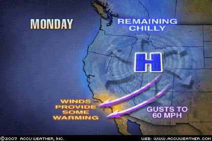
Gusty winds will blow through the mountain passes and canyons of Southern California today and into the first part of Tuesday. With an area of high pressure strengthening over the Rockies, the resultant offshore flow will cause winds to gust to 60 mph in the usual windy locations.

Wednesday, December 27, 2006

January Blizzard?


Click here for the Introduction to The Weather Alternative

How Long-Range Forecasts Are Made


January 12, 2007 will mark the 119th anniversary of the Children’s Blizzard. (see photo above) Also known as the Schoolhouse Blizzard or the Schoolchildren’s Blizzard, this powerful storm hit the U.S. Plains unexpectedly on January 12, 1888. Only those who lived close to telegraph offices or railroad stations received news of the approaching storm from the U.S. Signal Corps. Many people, however, were caught unaware. Children were trapped in one-room schoolhouses or met their fate trying to find their way back home. Farmers were caught without protection taking care of their livestock as were family members doing errands in town. It is estimated that 235 people died that day on the Dakota-Nebraska prairie—more than a hundred of them children.

The storm roared out of the northwest on a day mild enough for children to walk to school in their shirt-sleeves or without hats and jackets. Within just a few hours, temperatures dropped from around 70 degrees Fahrenheit to minus twenty or more accompanied by horizontal snow and hurricane-force winds.

The lives of surviving children, parents, farmers, and teachers were drastically altered. The new science of post-traumatic growth, to our surprise, finds that enduring such harrowing ordeals ultimately changes many people for the better. They are transformed by tribulation; giving credence to the old saying “What doesn’t kill you can actually make you stronger.”

Rich Tedeschi, a professor of psychology at the University of North Carolina in Charlotte, when talking about people that have survived traumatic experiences says, “People don’t say that what they went through was wonderful. They weren’t meaning to grow from it. They were just trying to survive. But in retrospect, what they gained was more than they anticipated.”

The astro-meteorology behind the Children’s Blizzard shows that on the 11th and 12th of January Mars conjoined Uranus as Mercury made a 90 degree angle to Mars and Uranus. Mars-Uranus contacts indicate acute, energetic, erratic action and provoke wind velocities of varying intensities. Mercury-Uranus is known to provoke falling temperatures and erratic gusts of wind. Mercury-Mars action indicates sudden brief spurts of whipping winds.

Solar and lunar eclipse charts frequently are the precursors of major weather phenomena. In the case of the Children’s Blizzard, the previous lunar eclipse boasted a Jupiter-Neptune opposition which correlates to low barometric pressure and above normal precipitation.

This January, roughly from the 27th through the 30th, shows that the solar eclipse of March 29, 2006 will be activated. The implications are that a powerful storm, perhaps a blizzard, will develop over the Plains and push eastward across the Mississippi Valley and toward the East Coast. I’m in no wise thinking that this storm will be anything like the Children’s Blizzard of 1888. The similarity resides in the fact that, in both cases, eclipse charts are involved. The planetary energies involved, however, are different. This January we will be dealing with a Mercury-Saturn opposition, a sure harbinger of a strong low pressure system.

Satellite view of the Blizzard of 1993

Friday, December 22, 2006

December 21, 2006 Forecast Results


Click here for the Introduction to The Weather Alternative

Some History of Astro-Meteorology

Included in my December 15th post was the following forecast:

If we zero in on the blue line running approximately over 113 west longitude through the Great Basin area , we should be able to time a couple of weather patterns that will develop there this winter. The blue line represents the planet Uranus. On the very day of the winter solstice, Mars will form a 90 degree angle to Uranus. The atmosphere should respond with an energetic winter storm over this area. Wind is usually a salient feature with this planetary combination. We usually give a day or so on either side of the exact date.

Looking a day or so before the 21st, we find the following Accuweather report on the 19th:

Potent Winter Storm Taking Shape (State College, PA) - A powerful storm will slowly emerge out of the Desert Southwest through Wednesday (20th), with heavy blowing snow over the eastern Rockies today and treacherous ice coating the southern Plains...The radar from Amarillo, Tex., indicates freezing rain is falling this morning as the potent storm spins over Arizona.

Dec 20th- Accuweather

Before emerging out of the Rockies, the storm on Tuesday (19th) brought a variety of precipitation to the Four Corners region and southern Plains. Snow fell in Las Vegas, Nev., and schools were closed in Albuquerque, NM.

Dec 20th- The Weather Channel

In the Pacific Northwest, another storm system is coming ashore today bring valley rain/mountain snow and wind to the Cascades today through Thursday (21st).

This second system will dive southeastward over the next several days bringing more wide spread wind/mountain snow/valley rain in the Northwest on Thursday, the Intermountain West by Friday, and to the Four Corners and southern Rockies by Saturday.

- - - - - - - - - - - - - - - - - - - -

Wind advisories are in effect over the forecast area. Below are a few examples.

NATIONAL WEATHER SERVICE LAS VEGAS NV

320 PM PST THU DEC 21 2006

...SYNOPSIS... A FAST MOVING LOW PRESSURE SYSTEM WILL MOVE ACROSS THE STATE TONIGHT AND FRIDAY BRINGING THE POTENTIAL OF RAIN AND SNOW TO PORTIONS OF THE REGION.

WINDS BEHIND THIS SYSTEM ARE FORECAST TO INCREASE FRIDAY NIGHT WITH MANY AREAS EXPERIENCING WINDY CONDITIONS THROUGH EARLY SATURDAY MORNING.

____________________________________________________________________

NATIONAL WEATHER SERVICE SALT LAKE CITY UT

844 PM MST THU DEC 21 2006

FRIDAY EVENING WILL BRING A WINDY PERIOD TO SOUTHWEST UTAH…

___________________________________________________________________

NATIONAL WEATHER SERVICE LOS ANGELES/OXNARD CA

351 PM PST THU DEC 21 2006

...HIGH WIND WATCHES CONTINUE FOR PORTIONS OF SOUTHWESTERN CALIFORNIA...

Friday, December 15, 2006

Signs of the Sky--How Long-Range Forecasts Are Made


Click here for the Introduction to The Weather Alternative

Some History of Astro-Meteorology

For those of you who are visiting The Weather Alternative after reading Accuweather meteorologist Katrina Voss's blog on Signs of the Sky, I thought I'd explain a bit more of the methodology used by ancient and present-day astro-meteorologists in formulating long-range weather forecasts based on planetary positions.

The basic premise of this branch of mundane astrology, which early researchers formulated by observation, is that the planets affect the meteorological process with each planet in particular governing a different aspect of the weather spectrum.

For example, Mercury was observed to be instrumental in governing wind direction and velocity. Venus, on the other hand, corresponded to a warm, moist influence tending to lower the barometer. Each of the other planets was also believed to correspond to different weather phenomena.

When two or more planets form certain geometrical patterns as seen from earth, astro-meteorologists observe that the atmosphere responds with a weather system that blends the nature of planets involved. These geometrical patterns are measured as angles that two or more planets make with earth as the center. Key angles are 0 degrees, 60 degrees, 90 degrees, 120 degrees, and 180 degrees.

The equinoxes and solstices provide key information in this respect since planetary positions at these moments show the geographic locales where high and low pressure systems originate or their effects are most potent.

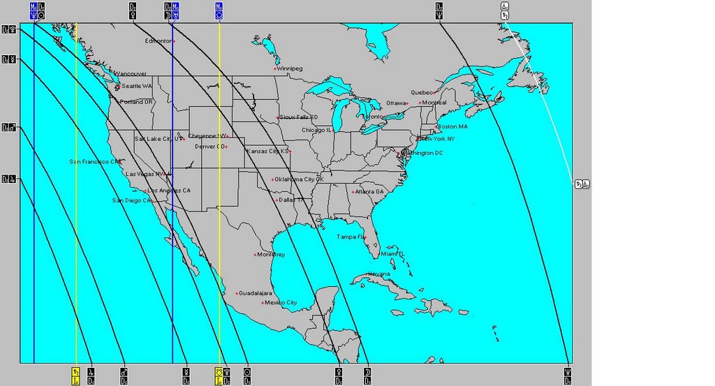
The map of the United States above shows the planetary positions at the moment of the upcoming winter solstice on December 21, 2006. The lines on the map correspond to the positions of some of the planets at that moment. The curved black lines show where certain planets will be setting at the time of the winter solstice. The straight blue lines show were certain planets will be overhead, and the straight yellow lines show where other planets will be exactly underneath the earth.

If we zero in on the blue line running approximately over 113 west longitude through the Great Basin area , we should be able to time a couple of weather patterns that will develop there this winter. The blue line represents the planet Uranus. On the very day of the winter solstice, Mars will form a 90 degree angle to Uranus. The atmosphere should respond with an energetic winter storm over this area. Wind is usually a salient feature with this planetary combination. We usually give a day or so on either side of the exact date.

January 15-17, 2007 looks like another key time for this area of the country as Jupiter will form a 90 degree aspect to Uranus on the 16th. These two are conducive to intense cold fronts, precipitation, and high wind velocities. So we may expect a strong weather system to be drawn into the area at this time.

Having worked with this system for a number of years, I never cease to be amazed at the beauty and the “down-to-earth” practicality that its designer bestowed upon the heavenly bodies. The members of our solar system no longer appear to be unrelated and meaningless masses of rock and gas circling the sun as science sometimes leaves us
feeling. But God has given purpose to the planets and equipped his offspring with a built-in, environmentally safe, long-range weather forecasting tool for our service.

Long-range weather forecasting is more than just observing planetary positions and their effects on our atmosphere. In the words of Johannes Kepler, a man of science, astrology, and astro-meteorology, it’s “thinking God’s thoughts after him.”

Monday, December 11, 2006

December 9-11, 2006 Forecast Results


Click here for the Introduction to The Weather Alternative


On November 30th, I posted the following forecast:

The next alignment between Mercury and Mars takes place on December 9, 2006. The atmosphere should once again respond with gusty winds and storms roughly from the 9th to the 11th. This time a few areas of the country should feel this influence. Windy conditions should push ashore over the West Coast and advance toward the Rockies. The Plains area should respond with gusty winds as should the Mid-Atlantic and Northeast.

Here's a recap of what happened. (Bold is mine)

West Coast

Dec 8, 2006- The Weather Channel

A third and much more potent Pacific system will be heading into the West Sunday (10th). Western Oregon and northwest California will experience strong gusty winds ahead of this third system.

Rockies

Dec 11, 2006- National Weather Service

PUEBLO CO 1011 AM MST MON DEC 11 2006

WEST TO SOUTHWEST WINDS OF 15 TO 25 MPH...WITH GUSTS UP TO35 MPH...WILL PRODUCE AREAS OF BLOWING AND DRIFTING SNOW.

GREAT FALLS MT1201 PM MST MON DEC 11 2006

...HIGH WIND WARNING REMAINS IN EFFECT FROM 11 PM THIS EVENING TO5 PM MST TUESDAY FOR THE ROCKY MOUNTAIN FRONT AND THE CUT BANKAREA...STRONG SOUTHWEST WINDS OF 25 TO 40 MPH ARE EXPECTED TO DEVELOPOVER THE ROCKIES AROUND MIDNIGHT...

Plains

Dec 8, 2006- The Weather Channel

Midwest
The Midwest will enjoy a dry and much milder weekend with increasingly gusty southwest to west winds from Kansas to the Great Lakes.

Mid-Atlantic and Northeast

Dec 8, 2006- The Weather Channel

As the lake snow and gusty winds end in the Northeast, cold will continue to grip the East overnight.

Thursday, November 30, 2006

Windy Weather Coming!


Click here for the Introduction to The Weather Alternative

Our sun and its celestial entourage constitute an amazing piece of machinery whose order and unfailing precision certainly make one think of intelligent design over random stellar evolution.

As far back as Genesis chapter 1, the sun, moon, and stars were given the role of a celestial timepiece to be for signs, seasons, days, and years. In other words, they have a practical function other than inspiring awe in humankind. The practical purpose of the sun and moon are well known. God obviously intended the sun to provide us with the heat, light, and food necessary to sustain life on earth in addition to providing those beautiful sunsets. Beside inspiring lovers to stroll beneath its silvery beams, the moon, of course, controls the ocean’s tides as well as regulating the rhythms of certain life forms.

Now it would stand to reason that the other heavenly bodies of our solar system have some practical function as well. Many brilliant minds throughout history have equated terrestrial weather patterns with celestial phenomena. Johannes Kepler, the 17th century astronomer and discoverer of the planetary laws of motion, first achieved fame due to his long-range weather forecasts based on planetary positions. Since planetary phenomena can be calculated years in advance, their effect on weather patterns can be known long before conventional meteorological forecasts can detect them if we follow Kepler’s method.

For centuries the planet Mercury has been equated with wind direction and velocity. When aligned with Mars, storms and whipping winds ensue. One of the last alignments between Mercury and Mars occurred on September 15, 2006. Based on this configuration, I prepared a forecast in December 2005 that was published in the July 2006 edition of Dell Horoscope calling for windy and stormy conditions over the Mississippi Valley. The result was strong gusty winds over the area. (Click here to see forecast results)

The next alignment between Mercury and Mars takes place on December 9, 2006. The atmosphere should once again respond with gusty winds and storms roughly from the 9th to the 11th. This time a few areas of the country should feel this influence. Windy conditions should push ashore over the West Coast and advance toward the Rockies. The Plains area should respond with gusty winds as should the Mid-Atlantic and Northeast.

It never ceases to amaze me how the Creator included in his handiwork a built-in and environmentally safe weather forecast system for our benefit. Good thinking!

Tuesday, November 28, 2006

Severe Weather for the Plains


Click here for the Introduction to The Weather Alternative

In fulfillment of my long-range weather forecast that appeared in the July 2006 edition of Dell Horoscope (see forecast), the Plains are rockin' and reelin' as a powerful cold front slides eastward through Wisconsin, Lake Michigan, Illinois, and Missouri.

The forecast called for severe weather over Missouri and Iowa. Today the Weather Channel confirms this, "Cloudbursts and thunderstorms, some severe (at least in Illinois and Missouri), will accompany the front."


The forecast also called for more weather woes for the West Coast. Accuweather reported the following yesterday:

Arctic Blast Follows the Snow and Rain
Arctic air that had been bottled up across Alaska and Canada's Yukon Territory pressed into Washington and Oregon Sunday and will continue to grip the Northwest through Wednesday before following the storm system to the east.

Thursday, November 23, 2006

November 28-30, 2006

Click here for the Introduction to The Weather Alternative

Here's a forecast of mine that was published in the July 2006 edition of Dell Horoscope:

Nov. 28-30, 2006:

This period boasts a double whammy as Mercury squares Neptune, and Mars squares Saturn. Atmospheric disturbances will develop over the Plains as warm, moist air collides with its cold, dry counterpart. An outbreak of deadly weather is indicated over Missouri and Iowa. More weather woes are also in store for the West Coast States. Additional tropical moisture is pumped into the area and should ignite storms producing flash floods.