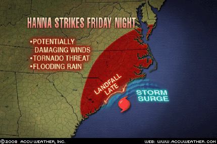
 Tropical Storm Hanna is forecast to strike the Carolina coast somewhere between Myrtle Beach, S.C., and Wilmington, N.C. today according to Accuweather.com. This will fulfill The Weather Alternative long-range forecast for Sept 6-9 issued on June 13th of this year.
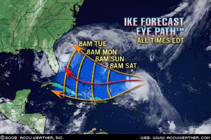
There are two long-range Weather Alternative forecasts that come into play here. One for Sept 10-14 shows a stormy East Coast based on the Venus-Mars conjunction of Sept 11th. The other forecast for Sept 14-18 warns of tropical storm or hurricane activity over New England. (Read forecasts here) Ike may be the fulfillment of this latter forecast if it reaches the New England area between the 14th and and 18th.

The cold front will move into the Northwest this weekend...
readings in Washington and Oregon behind the front will be 5 to 15 degrees below average...Sunday and Monday, the cold front will continue to plow through the West. High temperatures will be 5 to 30 degrees below average over much of the region.
Showers and thunderstorms will cover a wide area from Montana to Arizona and New Mexico. Snow will fall in the higher elevations of the northern Rockies.
Weather gets nasty over the Plains as Mercury and Mars parallel Uranus provoking windy conditions or severe thunderstorms packing damaging winds. Severe weather then pushes eastward over the Mississippi Valley.
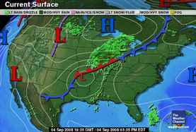
So far this has coincided with Gustav's arrival over the Plains and Mississippi Valley area as can be seen on this Weather Channel map for Sept 4th. Gustav brought heavy rain, flooding, and tornado wathes and warnings to the mid-Mississippi Valley and western Great Lakes area as well as soaking rains to nearly all of Arkansas and portions of Mississippi, eastern Oklahoma, western Tennessee, and much of Missouri.
Summer 2008: The Eastern United States
Summer 2008: The West Coast Part 1
Summer 2008: The Rockies Part 1
Summer 2008: The Plains and Mississippi Valley- Part 1
Introduction to the Weather Alternative
How Long-Range Forecasts Are Made
Check out my article and interview in Saptarishis Astrology Volume 3
10 excuses that are not recommended for ambitious men & women:
a) That's the way we've always done it.
b) I didn't know you were in a hurry for it.
c) That's not in my department.
d) No one told me to go ahead.
e) I'm waiting for an okay.
f) How did I know this was different?
g) That's his job, not mine.
h) Wait till the boss comes back & ask him.
i) I forgot.
j) I didn't think it was that important.
No comments:
Post a Comment