Monday, July 19, 2010

Experimental Forecasts Part 2- July-Sept 2010

Here are some more experimental forecasts for July, August, and September 2010 based on recent studies. If these pan out, these refinements will be included in my forecast method.

July 25-27, 2010
At this time Mercury and Neptune form an opposition. This has been observed to bring high relative humidity, sudden squalls, and low pressure areas. The Northeast and New England are the areas to watch at this time.

August 20-22, 2010
The Sun's opposition to Neptune is known to result in increased southerly airflow, rising temperatures and humidity, and low pressure areas bringing precipitation. In this case the area to be targeted is the eastern Plains and Mississippi Valley. Other factors show that this period of severe weather could start around the 18th.

September 3-5, 2010
The Hawaiian Islands may experience some severe weather at this time. One possibility is a tropical system that may come close to the area.

September 13-15, 2010
There is a chance for a severe weather pattern to develop over the Florida Panhandle now. If a tropical system, it may extend from the Texas-Louisiana state line eastward to the Florida Panhandle. I'm not too convinced yet about this one, but there may be something to this. Other possibilities include severe thunderstorms with damaging winds and hail.

Tropical Storm Alex Fulfills Long-range Prediction!

Experimental Forecasts July & August 2010

Hurricane Season 2010--Caribbean, Mexico, Central America

West Coast Weather Concerns July 23-31, 2010

Hurricane Season 2010--Forecast for July

Hurricane Season 2010--Forecasts for August

Hurricane Season 2010--Forecast for September

Hurricane Season 2010--Central America Part 2

Introduction to the Weather Alternative

How Long-Range Forecasts Are Made

Love Those Italian Girls
Did you hear about the 21 year old Italian girl who knelt in front of the statue of Madonna?
She said: "You who conceived without sin, let me sin without conceiving!"

Monday, July 12, 2010

Experimental Forecasts July & August 2010

As time permits, I like to study past forecasts that I've made with the objective of improving my forecast accuracy. Over time this study has repaid itself by leading me to include refinements in my forecast method. Not too much has been left us to study from past generations of astro-meteorologist. So, many areas of the field must be pioneered afresh. Below are some experimental forecasts that are based on recent studies. Some of these seem to confirm or add additional information to forecasts that I've already posted in the past few months.

July 21-23, 2010
A low pressure area, most likely centering in and around the Georgia-Tennessee area, or front affects the East Central and Deep South area. This is similar to the July 22-25, 2010 forecast made back in April.

July 26-28, 2010
High pressure and fair conditions embrace the southern Mississippi Valley area.

July 30-August 1, 2010
An increase in temperatures and moisture over the Oklahoma-Arkansas area. Most likely will manifest as a low pressure area bringing rain.

August 11-16, 2010
A noticeable increase in temperatures is indicated over the Southwest U.S. centering over New Mexico-Arizona area.

August 21-23, 2010
A high pressure area is shown over the southern California region resulting in warm and fair conditions.

Tropical Storm Alex Fulfills Long-range Prediction!

Hurricane Season 2010--Caribbean, Mexico, Central America

Hurricane Season 2010--Forecast for July

West Coast Weather Concerns July 23-31, 2010

Hurricane Season 2010--Forecasts for August

Hurricane Season 2010--Forecast for September

Hurricane Season 2010--Central America Part I

Hurricane Season 2010--Central America Part 2

Introduction to the Weather Alternative

How Long-Range Forecasts Are Made

Signs of Intelligence

“In the movie, scientists are scanning the skies for signs of intelligent life in space. Their radio-telescopes just receive static—random sounds from space. It’s reasonable to assume there’s no intelligence behind that. Then one day they begin receiving a transmission of prime numbers, which are numbers divisible only by themselves and one.

“The scientists reason that it’s too improbable that there would be a natural cause behind a string of numbers like that. This wasn’t merely unorganized static; it was information, a message with content. From that, they concluded there was an intelligent cause behind it. As Sagan himself once said, ‘The receipt of a single message from space’ would be enough to know there’s an intelligence out there. That’s reasoning by analogy—we know that where there’s intelligent communication, there’s an intelligent cause.”

Bradley’s eyes bored in on me as he delivered his conclusion. “And if a single message from space is enough for us to conclude there’s an intelligence behind it, then what about the vast amounts of information contained in the DNA of every living plant and animal?” he said.

“Each cell in the human body contains more information than in all thirty volumes of the Encyclopedia Britannica. It’s certainly reasonable to make the inference that this isn’t the random product of unguided nature, but it’s the unmistakable sign of an Intelligent Designer.”

Today it takes a great deal of faith to be an honest scientist who is an atheist.”

WALTER L. BRADLEY, PH.D. Quoted from The Case for Faith by Lee Strobel


Thursday, July 08, 2010

Recent Tropical Predictions

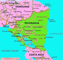
A recent long-range forecast for July 3-6, 2010 mentioned the likelihood of a tropical system developing on the Pacific side of Central America.

This comes from a post on April 8, 2010:

July 3-6

The same configuration of planets in the Full Moon chart on the Pacific side of Nicaragua, El Salvador, Costa Rica, Honduras, and Panama is activated once again between these dates. This is a strong argument for a powerful low pressure system affecting the area with heavy rains. Once again, a tropical storm or hurricane cannot be ruled out.

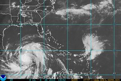
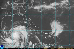
The above satellite view is for July 4th and shows the tropical disturbance developing over Honduras and Nicaragua but on the eastern side. This eventually became TD 2 that is hitting southern Texas and northeastern Mexico today.


On the 6th, the National Weather Service reported that this tropical wave at the time was bringing heavy rains to El Salvador and southern Guatemala.


Another forecast posted in April mentioned two other places that would experience severe weather that might be tropical.
The first area was over New England and Nova Scotia between June 23-26.

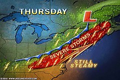
The Accuweather map at right shows the severe thunderstorms that targeted the region on June 24th.
Strong winds that could down trees and powerlines, as well as damage some structures were the main danger from the severe thunderstorms.


The next forecast was for the same period but for an area roughly around 240 to 270 miles north of the Dominican Republic where I envisioned the possible formation of a tropical system.


On the 25th The Weather Channel reported an area of disturbed weather just east of the northern Leeward Islands. Forecasters expected conditions for development to become more favorable for development over the next 2 or 3 days. This was, however, much further east than I was expecting.


Hurricane Season 2010--Caribbean, Mexico, Central America

Hurricane Season 2010--Forecasts for June

Hurricane Season 2010--Forecast for July

West Coast Weather Concerns July 23-31, 2010

Hurricane Season 2010--Forecasts for August

Hurricane Season 2010--Forecast for September

Hurricane Season 2010--Central America Part I

Hurricane Season 2010--Central America Part 2

Introduction to the Weather Alternative

How Long-Range Forecasts Are Made


We are but of yesterday and yet we already fill your cities, your palace, senate and forum, we have left to you only your temples. --Tertullian on the rapid spread of Christianity (born ca. 150-160, died ca. 220-240)

Saturday, June 26, 2010

Tropical Storm Alex Fulfills Long-range Prediction!

The Weather Alternative long-range for June 24-27, 2010 was posted on the preceding 8th of April. The forecast called for a strong low pressure area or possible tropical storm in and around the area of Panama, Costa Rica, and Honduras.


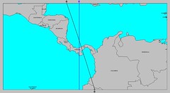
On June 25th, Tropical Depression 1 formed 90 miles off the coast of Honduras fulfilling the long-range forecast. TD-1 has now become Tropical Storm Alex. The National Weather Service map at left shows the area in which TD-1 formed.


Compare that area with the area that the astrometeorological map emphasized and that I used to formulate the forecast. It is this type of correspondence between planetary alignments and major weather patterns that has convinced just about every open-minded investigator as to the truth of astrometeorological influence.


The forecast also mentioned that other planetary alignments were affecting those same countries but on the Pacific side. As can be seen from the National Weather Service map at left, the influence of Tropical Storm Alex "spills over" in to that area as well.


Hurricane Season 2010--Caribbean, Mexico, Central America

Hurricane Season 2010--Forecasts for June

Hurricane Season 2010--Forecast for July

West Coast Weather Concerns July 23-31, 2010

Hurricane Season 2010--Forecasts for August

Hurricane Season 2010--Forecast for September

Hurricane Season 2010--Central America Part I

Hurricane Season 2010--Central America Part 2

Introduction to the Weather Alternative

How Long-Range Forecasts Are Made

Follow the Weather Alternative on Twitter Astroweatherman


God Makes Sense of the Universe’s Complexity
“In the last thirty-five years,” Craig said, “scientists have been stunned to discover that the Big Bang was not some chaotic, primordial event, but rather a highly ordered event that required an enormous amount of information. In fact, from the very moment of its inception, the universe had to be fine-tuned to an incomprehensible precision for the existence of life like ourselves. And that points in a very compelling way toward the existence of an Intelligent Designer.

“Scientifically speaking, it’s far more probable for a life-prohibiting universe to exist than a life-sustaining one. Life is balanced on a razor’s edge.”

As an example, he cited Hawking’s writings. “He has calculated,” Craig said, “that if the rate of the universe’s expansion one second after the Big Bang had been smaller by even one part in a hundred thousand million million, the universe would have collapsed into a fireball.”

In short order, Craig proceeded to go down a list of several other mind-boggling statistics to support his conclusion. Among them:

British physicist P. C. W. Davies has concluded the odds against the initial conditions being suitable for the formation of stars—a necessity for planets and thus life—is a one followed by at least a thousand billion billion zeroes.

Davies also estimated that if the strength of gravity or of the weak force were changed by only one part in a ten followed by a hundred zeroes, life could never have developed.

There are about fifty constants and quantities—for example, the amount of usable energy in the universe, the difference in mass between protons and neutrons, the ratios of the fundamental forces of nature, and the proportion of matter to antimatter—that must be balanced to a mathematically infinitesimal degree for any life to be possible. --The Case for Faith by Lee Strobel


Tuesday, June 22, 2010

West Coast Weather Concerns July 23-31, 2010

The U.S. West Coast may experience an anomalous weather pattern between July 23-31. The month of July is usually one of the sunniest and driest months for the West Coast States. A number of planetary alignments, however, especially between the 23rd and 26th, then again between the 30th and 31st, may bring out-of-season storminess to the region.

The ordeal starts on the 23rd as Jupiter makes its retrograde station. In other words, from our viewpoint on earth, Jupiter appears to travel backwards in the heavens. A key chart places Jupiter overhead along the 118th west longitude. This line runs through Washington, Oregon, Nevada, and California. Jupiter will be in a disruptive alignment with Pluto at this time.

Other disruptive alignments take place between Mercury and Neptune, and between Saturn and Uranus on the 26th. Key charts place these planets over the western Pacific between 130 and 135 west longitude. Since these alignments have been observed to coincide with storm conditions, we may conclude that a low pressure area or strong cold front will push eastward into the Pacific Northwest and perhaps California at this time.

Then on the 30th and 31st, the opposition of Mars and Uranus, a breeder of high velocity winds, and the conjunction of Mars and Saturn, known to produce severe weather systems, will operate off the U.S. West Coast and send a disruptive weather pattern eastward.

Businessmen and entrepreneurs are encouraged more and more to think out of the box. Well, if you like to think out of the box, which I do and one of the reasons that astrometeorology appeals to me, you'll find that these forecasts based on planetary cycles are just that. One really needs to break out of the mold of conventional approaches to weather forecasting to consider that there may actually be a connection between our weather and our solar system.


Hurricane Season 2010--Caribbean, Mexico, Central America

Hurricane Season 2010--Forecasts for June

Hurricane Season 2010--Forecast for July

Hurricane Season 2010--Forecasts for August

Hurricane Season 2010--Forecast for September

Hurricane Season 2010--Central America Part I

Hurricane Season 2010--Central America Part 2

Introduction to the Weather Alternative

How Long-Range Forecasts Are Made


Does suffering help prove or disprove the existence of God?


“It’s significant that most objections to the existence of God from the problem of suffering come from outside observers who are quite comfortable, whereas those who actually suffer are, as often as not, made into stronger believers by their suffering.”

That’s a phenomenon many writers have noted. After wide-ranging research into the topic of suffering, Philip Yancey wrote, “As I visited people whose pain far exceeded my own ... I was surprised by its effects. Suffering seemed as likely to reinforce faith as to sow agnosticism.” Scottish theologian James S. Stewart said: “It is the spectators, the people who are outside, looking at the tragedy, from whose ranks the skeptics come; it is not those who are actually in the arena and who know suffering from the inside. Indeed, the fact is that it is the world’s greatest sufferers who have produced the most shining examples of unconquerable faith.”

Saturday, June 19, 2010

Heavy Rains for Puerto Rico and Haiti

The Weather Alternative warning for a possible hurricane for Puerto Rico and HispaƱola between June 17-19 is finding some fulfillment in the tropical wave that is dumping heavy rains over the islands.

The Weather Channel reports that flash flood watches are posted through Sunday afternoon for the Virgin Islands and Puerto Rico. Locally heavy showers will spread westward into the Dominican Republic and Haiti as well.

The purpose of The Weather Alternative forecasts is to provide a look further into the future than conventional methods can at present provide. This is accomplished through the amazing correspondence that becomes obvious between planetary alignments and earthly weather systems when these alignments are properly interpreted. I don't always get them spot on and I've learned much over the years that has helped me understand how to better interpret them. So this site is to share the enthrallment I experience doing this and the practical benefits as well.

I also expected possible severe weather over the New England-Nova Scotia area between June 17-20. I thought it might be a result of a tropical system. I did mention that it could be A strong low pressure system and high velocity winds.

There is no tropical system but the National Weather Service today has posted the following:


THIS HAZARDOUS WEATHER OUTLOOK IS FOR NORTHERN NEW YORK...CENTRAL
VERMONT...NORTHEAST VERMONT...NORTHWEST VERMONT AND SOUTHERN
VERMONT.

.DAY ONE...TODAY AND TONIGHT.

THE POTENTIAL FOR STRONG TO POSSIBLY SEVERE THUNDERSTORMS WILL
EXIST LATER TODAY AND TONIGHT ACROSS THE NORTH COUNTRY. THUNDERSTORMS WILL DEVELOP IN ADVANCE OF A COLD FRONT OVER SOUTHEAST ONTARIO PROVINCE THIS AFTERNOON AND MOVE INTO THE SAINT LAWRENCE VALLEY OF NEW YORK BY MID ... STRONG GUSTY WINDS AND SMALL HAIL WILL BE
POSSIBLE WITH ANY OF THE THUNDERSTORMS.


A similar warning is posted for Maine, while Canada's weather service has issued the same for southerns Quebec.

A low pressure area also passed through the region on the 17th.


Hurricane Season 2010--Caribbean, Mexico, Central America

Hurricane Season 2010--Forecasts for June

Hurricane Season 2010--Forecast for July

Hurricane Season 2010--Forecasts for August

Hurricane Season 2010--Forecast for September

Hurricane Season 2010--Central America Part I

Hurricane Season 2010--Central America Part 2

Introduction to the Weather Alternative

How Long-Range Forecasts Are Made


“People don’t buy what you do. They buy why you do it.”

Check out Simon Sinek's video clip. Simon is author of Start With Why: How Great Leaders Inspire Everyone to Take Action

Saturday, June 12, 2010

Forecast Results June 9-11, 2010

In the first of my Hurricane 2010 forecasts posted on April 1, of this year, I mentioned that planetary cycles involving Mercury, Mars, and Neptune would expose the East Coast areas from Cape Hatteras to New England to possible tropical activity or if not an actual tropical system, some other type of severe weather pattern. The time frame was between June 9-11. I mentioned the possibility of a tropical system centering about 290 miles south of Cape Hatteras, North Carolina around the 10th of June and tracking along the East Coast to New England.

Fortunately, for the inhabitants of the East Coast, no tropical storm resulted. The Weather Channel map above is for June 11th and shows a low pressure area off the North Carolina coast.


The Accuweather map at right shows their weekend forecast for June 12-13. Notice the low pressure area over Virginia coast. Their article was entitled Humid Air Returns with Flash Flooding Risk this Weekend in the Northeast.

This is exactly what is happening. As we speak, the National Weather Service has issued the following types of Alerts for the area:


Massachusetts- Marine Alerts
New Jersey- Special Weather Alert
New York- Flash Flood, Flood, Marine
North Carolina- Special Weather Alerts
Pennsylvania- Flash Flood, Flood, Marine
Virginia- Flash Flood, Special Weather Alerts
West Virginia- Flash Flood, Special Weather Alerts

But even before these, which are a day late according to my forecast, on the 9th Accuweather reported thunderstorms capable of producing flash flooding, hail, damaging wind gusts and volleys of cloud-to-ground lightning strikes will stretch from Tennessee and northern Mississippi to southeastern Virginia and the Delmarva Peninsula through Wednesday evening.


Possible June Hurricane for HispaƱola and Puerto Rico

Hurricane Season 2010--Caribbean, Mexico, Central America

Hurricane Season 2010--Forecasts for June

Hurricane Season 2010--Forecast for July

Hurricane Season 2010--Forecasts for August

Hurricane Season 2010--Forecast for September

Hurricane Season 2010--Central America Part I

Hurricane Season 2010--Central America Part 2

Introduction to the Weather Alternative

How Long-Range Forecasts Are Made

What You Never Learned in School
Soccer player Kyle Rote Jr. remarked, “There is no doubt in my mind that there are many ways to be a winner, but there is really only one way to be a loser and that is to fail and not look beyond the failure.” How people see failure and deal with it—whether they possess the ability to look beyond it and keep achieving—impacts every aspect of their lives.

In Leadership Magazine, J. Wallace Hamilton states, “The increase of suicides, alcoholics, and even some forms of nervous breakdowns is evidence that many people are training for success when they should be training for failure. Failure is far more common than success; poverty is more prevalent than wealth; and disappointment more normal than arrival.”

Training for failure! That is a great concept, and it’s the idea that prompted me to write this book. I want to help you train for failure. I want you to learn how to confidently look the prospect of failure in the eye and move forward anyway. Because in life, the question is not if you will have problems but how you are going to deal with your problems. Are you going to fail forward or backward? --Failing Forward by John C. Maxwell


Sunday, June 06, 2010

Possible June Hurricane for HispaƱola and Puerto Rico

The Dominican Republic and Puerto Rico may be in for some hurricane or tropical storm activity between June 17-19, 2010.

The New Moon of June 12th, along with the Full Moon of May 27th, and the First Quarter Moon of June 18th all imply that these islands will be affected by a tropical system that strikes them after originating to the south of the islands or passing along their southern coasts.

At this time the Sun and Saturn will form a square aspect, which has been noted to result in atmospheric disturbance.


Hurricane Season 2010--Caribbean, Mexico, Central America

Hurricane Season 2010--Forecasts for June

Hurricane Season 2010--Forecast for July

Hurricane Season 2010--Forecasts for August

Hurricane Season 2010--Forecast for September

Hurricane Season 2010--Central America Part I

Hurricane Season 2010--Central America Part 2

Introduction to the Weather Alternative

How Long-Range Forecasts Are Made

The Power of Words

Here's an interesting link showing the power of our words and thoughts. It explains the work of Dr. Masaru Emoto, a Japanese scientist. Check it out here.

Friday, May 28, 2010

Hurricane Season 2010--Caribbean, Mexico, Central America

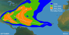
Conventional forecasters, such as those from the National Weather Service and Accuweather, are calling for a very active hurricane season. The astro-meteorological method is the only forecast device that I know of that can actually come up with the dates and places where anomalous weather patters, hurricanes included, can occur. Following are some of the dates and places for September 2010 where hurricanes are likely to develop.


Forecast
Sept 3-8, 2010

Atmospheric conditions over the central Caribbean may be ripe for tropical storm or hurricane formation during this five-day stretch. The Sun’s conjunction with a retrograde Mercury has often resulted in a hurricane when occurring during hurricane season. This is the case on the 3rd. Other factors point to the area around 77 west longitude and 15 north latitude or roughly 150 miles south of Jamaica as the place where cyclogenesis could take place. Panama is another area that may experience tropical activity or at least severe weather due to tropical moisture.


Forecast
Sept 2-4, 2010
The area along the Mexican coast from about 99 West to 105 West, which is roughly from 270 miles south east of Guadalajara to 145 miles southwest of Guad, stands a good chance of seeing a tropical system develop and travel the length of the coast.


Forecast
Sept 21-23, 2010

The Sun’s oppositions to Jupiter and Uranus, as well as the parallel of Mars to Neptune gather their influence together over the Central American countries of Panama, Costa Rica, and Nicaragua. The resultant weather pattern may be a tropical storm or hurricane that affects the area or a severe weather pattern ignited by tropical moisture.


Hurricane Season 2010--Forecasts for June

Hurricane Season 2010--Forecast for July

Hurricane Season 2010--Forecasts for August

Hurricane Season 2010--Forecast for September

Hurricane Season 2010--Central America Part I

Hurricane Season 2010--Central America Part 2

Introduction to the Weather Alternative

How Long-Range Forecasts Are Made

Bureaucracy

The bureaucrat's first objective, of course, is preservation of his job--provided by the big-government system, at taxpayer's expense....Whether real-world problems get solved or not is of secondary importance. It doesn't take much cynicism, in fact, to see that the bureaucrats have a vested interest in not having problems solved. If the problems did not exist (or had not been invented), there would be no reason for the bureaucrat to have a job.-- A Time For Action by former U.S. Treasury Secretary William Simon

Sunday, May 16, 2010

Hurricane Season 2010--Central America Part 2

Here are some more long-range weather forecasts for Central America. Learn about the dates when hurricane activity might be imminent and the places where they might develop or strike. The following forecasts are based on astrometeorolgy i.e. the study of planetary influence on terrestrial weather systems.


Forecast
August 2-6, 2010

This appears to be a very significant time for the area in and around Honduras and Nicaragua. Mars will trigger the Lunar Eclipse of June 26, 2010, which, coupled with other planetary goings-on, seems to point toward a severe weather pattern over this area. This, of course, could be a full-blown tropical storm or hurricane.

Forecast
August 7-9, 2010

The central Caribbean area about 550 miles east of the Nicaragua/Honduras border or 240 miles north of Colombia (75 west longitude/14 north latitude) is an area where tropical storm or hurricane formation is possible or an area over which a tropical system may pass. Panama is also liable to experience a severe weather pattern now, which may or may not be related to the aforementioned system in the Caribbean.


Forecast
August 9-12, 2010

June’s lunar eclipse is activated bringing a promise of severe weather over the area comprising Honduras, Nicaragua, El Salvador, and Costa Rica. The culprit may be a tropical system lurking off the Costa Rican coast around 85 west longitude and 8 north latitude in the eastern Pacific.


Forecast
August 19-22, 2010
The weather system that affects Honduras, Nicaragua, and surrounding areas at this time will be characterized by the possibility of heavy rain. This may be the result of a tropical system.


Hurricane Season 2010--Forecasts for June

Hurricane Season 2010--Forecast for July

Hurricane Season 2010--Forecasts for August

Hurricane Season 2010--Forecast for September

Hurricane Season 2010--Central America Part I

Introduction to the Weather Alternative

How Long-Range Forecasts Are Made

Check out Karen L. Anderson's 50 Best Astrology Blogs and other informative posts.

Food Rules

Check out Food Rules: An Eater's Manuel by Michael Pollan

Here's a little preview:


1. Eat food.
These days this is easier said than done, especially when seventeen thousand new products show up in the supermarket each year. But most of these items don’t deserve to be called food—I call them edible foodlike substances. They’re highly processed concoctions designed by food scientists, consisting mostly of ingredients derived from corn and soy that no normal person keeps in the pantry, and they contain chemical additives with which the human body has not been long acquainted. Today much of the challenge of eating well comes down to choosing real food and avoiding these industrial novelties.

2. Don’t eat anything your great-grandmother wouldn’t recognize as food.
Imagine your great-grandmother at your side as you roll down the aisles of the supermarket. You’re standing together in front of the dairy case. She picks up a package of Go-GURT Portable Yogurt tubes—and hasn’t a clue what this plastic cylinder of colored and flavored gel could possibly be. Is it a food or is it toothpaste? There are now thousands of foodish products in the supermarket that our ancestors simply wouldn’t recognize as food. The reasons to avoid eating such complicated food products are many, and go beyond the various chemical additives and corn and soy derivatives they contain, or the plastics in which they are typically packaged, some of which are probably toxic. Today foods are processed in ways specifically designed to get us to buy and eat more by stimulating our preferences for sweetness and fat and salt. These tastes are difficult to find in nature but cheap and easy for the food scientist to deploy, with the result that food processing induces us to consume much more of these rarities than is good for us. The great-grandma rule will help keep most of these items out of your cart.

Saturday, April 24, 2010

Hurricane Season 2010--Forecast for September

The following long-range forecasts indicate the time and place of likely hurricane or tropical storm activity for the United States.


Forecast
Sept 2-5, 2010
Sun-Mercury conjunctions during hurricane season often coincide with hurricane or tropical storm landfalls at times when Mercury is in retrograde motion. Of course, certain key charts must place the planets over hurricane prone areas of the States in order for this to happen. The Last Quarter Moon of Sept 1st presents this type of setup over longitude 78 west. This line passes through the Carolinas and Virginia.

Sun-Mercury conjunctions usually play out as very windy and stormy conditions. This is why hurricanes often result. If not an actual tropical system, the Mid-Atlantic could face storms producing gusty winds.


Forecast
Sept 18-23, 2010

During this period there exists the possibility of a low pressure area forming in the Gulf of Mexico about 200 miles south of Mobile, Alabama. Another area that could see tropical activity is along the west coast of Florida. So we may be dealing with a tropical system at this time that is drawn from the Gulf to the west coast of Florida. It could also manifest as a strong cold front that triggers severe thunderstorms.


Hurricane Season 2010--Forecasts for June

Hurricane Season 2010--Forecast for July

Hurricane Season 2010--Forecasts for August

Hurricane Season 2010--Central America Part I

Introduction to the Weather Alternative

How Long-Range Forecasts Are Made


Success is the child of drudgery and perseverance. It cannot be coaxed or bribed; pay the price and it is yours.—Orison Swett Marsden

A man either lives life as it happens to him, meets it head-on and licks it, or he turns his back on it and starts to wither away.—Gene Roddenberry

You may have a fresh start any moment you choose, for this thing that we call “failure” is not the falling down but the staying down.—Mary Pickford

Saturday, April 17, 2010

Hurricane Season 2010--Forecasts for August

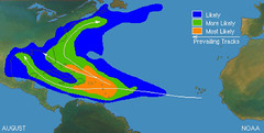
From an astrometeorological perspective, August 2010 could be a very active month for hurricanes. Following are some dates and places that may experience such activity.


August 2-3, 2010
Intense storms are expected throughout the East Central, Northeast, Mid-Atlantic, and Southeast. These storms may bring damaging winds, hail, or tornadoes. It is possible that a tropical system makes landfall over the Carolinas.

August 7-10, 2010
Venus will now activate the alignments between Jupiter, Saturn, Uranus, and Pluto. Since these are placed roughly between 79 and 81 west longitude, the Southeast and Mid-Atlantic areas are in for a round of severe weather. This may indicate tropical activity affecting the Florida Peninsula and the Carolinas. These planetary alignments also have the potential to affect Cuba and Panama.


August 14-18, 2010
The eastern Plains and Mississippi Valley are likely to be under severe weather threats now. This could manifest as powerful storms producing large hail, gusty winds, and tornadoes. A tropical system or abundant tropical moisture may affect the eastern Texas and Louisiana area.

Further east, heavy rainfall is indicated for the Mid-Atlantic area either due to tropical moisture being introduced over the area or from an actual tropical system that enters through the Carolinas.

August 18-22, 2010
Planetary alignments at this time suggest very volatile atmospheric conditions that will put the eastern Plains and Mississippi Valley at risk for severe weather. Dangerous thunderstorms and/or tornadoes are indicated in and around Missouri. This may be due to a tropical system that makes landfall over eastern Texas or Louisiana.

The Southeast and Mid-Atlantic are not out of harm’s way either. There are indications that suggest tropical storm or hurricane activity over the Carolinas at this time or at least some kind of severe weather system if not actually tropical in nature.

Hurricane Season 2010--Forecasts for June

Hurricane Season 2010--Forecast for July

Hurricane Season 2010--Central America Part I

Introduction to the Weather Alternative

How Long-Range Forecasts Are Made

Bits of Wisdom

Do more than you are paid for. There are never any traffic jams on the extra mile.—Brian Tracy
*

One man has enthusiasm for 30 minutes, another for 30 days, but it is the man who has it for 30 years who makes a success of his life.—Edward B. Butler

*

No one keeps up his enthusiasm automatically. Enthusiasm must be nourished with new actions, new aspirations, new efforts, new vision. It is one’s own fault if his enthusiasm is gone; he has failed to feed it.—Papyrus

Thursday, April 08, 2010

Hurricane Season 2010--Central America Part I

Astrometeorology is all about how the planets of our solar system affect our weather here on earth. One of the key charts used in determining where planetary influences will be localized on earth is the Summer Solstice chart. Two important planets will localize their influence near Panama, Costa Rica, and Honduras this summer season. As shown in the map at left, these planets "cross" as it were near those three countries and will be activated at the end of June and early July. Here are some possibilities of what that might mean weather wise.

June 24-27
The Sun's opposition to Pluto, and Mercury's square to Uranus will activate the aforementioned area in and around Panama, Costa Rica, and Honduras. This could trigger a strong low-pressure area there bringing the potential for heavy rain. Since we are in hurricane season at this time, one possibility is that this represents a tropical storm or hurricane.

The Full Moon of June 26th also localizes a strong grouping of planets near the same area but on the Pacific side of Nicaragua, El Salvador, Costa Rica, and Honduras. This could mean storm or hurricane formation on the western coast of Central America or a system that starts on one side and then crosses to the other.


July 3-6

The same configuration of planets in the Full Moon chart on the Pacific side of Nicaragua, El Salvador, Costa Rica, Honduras, and Panama is activated once again between these dates. This is a strong argument for a powerful low pressure system affecting the area with heavy rains. Once again, a tropical storm or hurricane cannot be ruled out.


Hurricane Season 2010--Forecast for July

Hurricane Season 2010--Forecasts for June

Introduction to the Weather Alternative

How Long-Range Forecasts Are Made


If You Think You're Beaten

If you think you're beaten, you are,
If you think you dare not, you don't.
If you'd like to win, but think you can't,
It's almost for sure, you won't.

If you think you're losing, you've lost.
For out in the world we find -
Success begins with a person's will,
It's all in the state of mind.

If you think you're outclassed, you are,
You've got to think high to rise.
You have to stay with it,
In order to win the prize.

Life's battles don't always go,
To the one with the better plan.
For more often than not, you will win,
If only you think you can.

Tuesday, April 06, 2010

Hurricane Season 2010--Forecast for July

On the following dates there is strong potential for severe weather patterns to develop over the hurricane-prone areas of the United States. While this does not guarantee that the weather patterns will manifest as tropical systems, there is the likelihood they might. These forecasts area based on planetary cycles also known as astrometeorology.


July 22-25

The potential for a low pressure system to develop off the southeast coast of Texas exists now. This could be a tropical system. Serious atmospheric disturbances are indicated along the central and eastern Gulf Coast as well. Once again, this could be indicative of a tropical system threatening the area.
Since a number of the influences at work at this time also affect the Mississippi Valley, another scenario is that destructive storms afflict the area and move eastward through the East Central States and Southeast.

July 23-26

Hurricanes can take crazy paths at times. Since there are indications of potential tropical storm or hurricane activity along the North and South Carolina coasts at this time and also further to the north along the New Jersey coast, one possible weather scenario is that the aforementioned hurricane in the July 22-25 forecast, cuts across Florida and reemerges along the Southeast U.S. coast. From there, the system could strike the Carolinas and parallel the coast until it reaches the New Jersey area. Of course, it could be a tropical system independent of the possible Gulf system, or the Carolinas and New Jersey could be subject to non-tropical severe weather systems.

July 27-31

This five-day stretch is likely to be replete with severe weather. The East Central states, Southeast, and Mid-Atlantic are apt to experience severe thunderstorms packing damaging winds, hail, and tornadoes. Since some of these influences affect the Florida Peninsula, it could mean a tropical system enters the U.S. from there and heads northward.


Hurricane Season 2010--Forecasts for June

Introduction to the Weather Alternative

How Long-Range Forecasts Are Made


Footprints
By Mary Stevenson

One night I dreamed I was walking along the beach with the Lord. Many scenes from my life flashed across the sky. In each scene I noticed footprints in the sand. Sometimes there were two sets of footprints, other times there were one set of footprints.

This bothered me because I noticed that during the low periods of my life, when I was suffering from anguish, sorrow, or defeat, I could see only one set of footprints.

So I said to the Lord, "You promised me, Lord, that if I followed You, You would walk with me always. But I have noticed that during the most trying periods of my life there has only been one set of footprints in the sand. Why, when I needed You most, have You not been there for me?"
The Lord replied, "The times when you have seen only one set of footprints in the sand, is when I carried you."

Thursday, April 01, 2010

Hurricane Season 2010--Forecasts for June

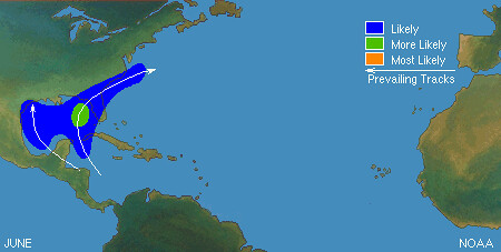
The above NOAA map shows the most likely places for tropical storm and/or hurricane formation to take place in June. On average we get about 1 hurricane forming in June every 2 years. Last year we didn't get a named storm in June. In 2008, we had Tropical Storm Arthur form on May 31st and hit the Yucatan. The year before, 2007, we had an early May subtropical storm--Andrea--form off the northeast coast of Florida, and then on June 1st, Tropical Storm Barry developed in the eastern Gulf of Mexico. And in 2006, Tropical Storm Alberto formed on June 10th in the northwest Caribbean.


Following are some dates and places that stand out to me as having potential for tropical storm and/or hurricane formation this June. Sometimes, of course, these weather patterns manifest as some non-tropical weather system, but since we are in hurricane season, it remains a possibility.
These long-range forecasts are based on planetary cycles.


June 9-11
Planetary cycles involving Mercury, Mars, and Neptune are active now. All together this exposes the East Coast areas from Cape Hatteras through New England to a good chance of hurricane or tropical storm activity. Of course, it may manifest as some other type of severe weather pattern that is not tropical in nature, but it is still a chance nonetheless. The tropical system could center about 290 miles due south of Cape Hatteras, North Carolina around the 10th of June and begin to track along the coast to Long Island and southern New England.

June 17-20

A severe weather event is indicated over the New England-Nova Scotia area between these dates. A strong low pressure system and high velocity winds are indicated, hence, this could be a tropical system affecting the area.

June 23-26

Two places stand out as likely to experience severe weather, which may manifest as a tropical system. The first is New England-Nova Scotia area again. The second is the area roughly around 240 to 270 miles north of the Dominican Republic. This area may be the spawning grounds for a tropical system. There is the possibility that this is the system that affects the New England-Nova Scotia area or these weather events may be unrelated.


Introduction to the Weather Alternative

How Long-Range Forecasts Are Made

Bodily exercise, when compulsory, does no harm to the body; But knowledge which is acquired under compulsion obtains no hold on the mind. --Plato

Saturday, March 20, 2010

St. Patrick's Day Forecast Results

The Weather Alternative forecast for the St. Patrick's Day week was posted on November 17, 2009. The forecast called for penetratingly cold air to descend over the Mississippi Valley and Great Lakes on gusty winds easily reaching the central and eastern Gulf Coast States between the 13th and the 17th of March.

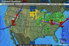
The weather activity started on the 12th with a a storm system over the Ohio Valley and Southeast that brought heavy rain and strong winds, which then moved into the Northeast on the 13th. The only thing missing that was called for in the forecast was penetratingly cold air. The gusty winds were present. The Weather Channel map at left is for March 13th.

I offered two scenarios in the forecast. The first scenario called for the cold air to bring a high pressure system all the way down to the Gulf Coast. The second scenario called for the cold air mass to bring significant precipitation in the form of a low pressure system and strong winter storm.

The actual weather resembled the second scenario more than the first. Significant precipitation was experienced in the form of heavy rain--first over the Mid-Mississippi Valley, Great Lakes, and Ohio Valley on the 12th, then three to four inches of rain on the 13th from New Jersey to Southern New England. The rain produced localized flooding, while the winds helped in producing dangerous surf, coastal flooding, and beach erosion. On the 13th and 14th, freezing rain was expected in parts of New England, and sleet and snow was forecast for the Adirondacks of New York. I thought we might see lake-effect snows over the Great Lakes, but it was not cold enough to produce snow there.

This weather event was billed as a major storm by conventional forecasters, while I called it a strong winter storm.

Blustery conditions and light showers continued over the Northeast and New England on the 16th.

For the St. Patrick's Day Parade in New York City, I mentioned that there would be a chance of rain, but the storm system had cleared the area by then.


United Kingdom
March 13-17, 2010
The forecast for the United Kingdom was for a cold air mass to work its way southward and eastward over the United Kingdom with windy conditions and precipitation likely.

The Accuweather map at right is for March 13th. High pressure west of Ireland brought a chilly northerly flow that resulted in showers and breezy conditions on the 13th and 14th. Showers lingered over northern portions on the 15th, and by the 16th and 17th fair conditions were experienced.

Introduction to the Weather Alternative

How Long-Range Forecasts Are Made

Can We Say We've Suffered?

If we are not in the way of His blessings, then would you like to go home and see why, and how you can get back and get those blessings? Friend, you live in the miserablest place on Earth, Great Britain. You’re the biggest lot of grumblers there is. And you’ve got nothing to grumble about, may God challenge you! Do you realize how many hungry people there are in India tonight? Have you ever been hungry? Do you realize how many people still live in refugee camps? Have you ever lived in a refugee camp? Do you know how many people live under the iron hand of communism? Have you ever lived under the iron hand of communism? Have you ever lived through an earthquake, like Turkey is right now? Do you know anything about a typhoon? Do you know anything about an enemy soldier standing in front of you, and you’re a woman? Do you? Of course you don’t. Do you think you know anything? No! You don’t know sorrow, you don’t know suffering. May God break your hearts, and through those breaking hearts pour His love. --Gladys Aylward Missionary to China, Mother to 100 orphans

Saturday, February 13, 2010

January 2010 Forecast Results Part II

These forecasts were posted on December 22, 2009.

Forecast
January 4-5
A storm system develops along the east side of the Rockies as moist air, drawn from the Gulf, collides with cooler air from the north. One scenario is that the storm system ejects into the Plains bringing cold and windy conditions behind the low. Or the cold and windy conditions may be the result of a front stretching from the central Plains to the western Great Lakes.

Results
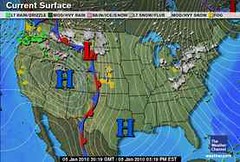
The above map is from the Weather Channel for January 5th. You can see the low along the east side of the Rockies over Montana and Wyoming. This later ejected (on the 6th) into the Plains. Very cold and windy conditions were behind the low and a front stretched from the southern Plains to the Western Great Lakes on the 7th. Temperatures in the Plains were in the single digits and teens.

Forecast
January 7-10
Warm, moist air begins to move northward over Texas and the southern Plains around the 7th bringing a chance of showers. By the 9th, the potential for storminess is heightened. Most of the activity may be over Texas.

Results
There were some showers over the coastal areas of Texas on the 7th, but the main event at this time was bitter cold from the 7th to the 9th. By the 10th, temperatures were 10 to 30 degrees higher.


Forecast

January 26-27
Cold air invades the Plains out of Canada creating stormy conditions as a powerful cold front pushes westward.

Results
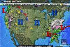
The Weather Channel map at right is for January 27th and shows a cold front entering the Plains. . By the 28th, this met up with a low over western Texas that developed into an ice storm over the southern Plains and the northern part of the cold front, connected to a low pressure system, intensified over the northeast U.S. bringing another blast of winter.

Rockies

Forecast
January 2-5

The arrival of warm, moisture-laden air over the Rockies on the 2nd and 3rd will battle with a cold Canadian air mass resulting in windy conditions or a storm center producing winds.

Results
(Refer to the first weather map of this post for January 5th) Windy conditions over the Rockies were reported as follows:

January 5th (Accuweather)

Gusty winds whipped the snow around across Montana. Whitewater, Mont., received 4.0 inches of snow, but winds created 2- to 3-foot high drifts.

January 5th (National Weather Service)

Albuquerque, NM
6:01 am MST, Tue., Jan. 5, 2010

THE COLD FRONT WILL BE ACCOMPANIED BY STRONG NORTHERLY WINDS OF 25 TO 35 MPH WITH GUSTS OF 40 TO 50 MPH.

Grand Junction, CO
8:07 am MST, Tue., Jan. 5, 2010

WINDS OF 15 TO 25 MPH WITH HIGHER GUSTS WILL CAUSE SOME BLOWING AND DRIFTING OF SNOW.


Forecast

January 7
A sharp cold front pushes southward over the Rockies lowering temperatures.

Results
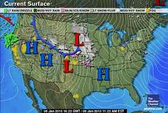
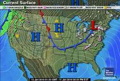
The Weather Channel map at left is for January 6th. Accuweather reported "A new blast of arctic air plunged into the northern Rockies and northern Plains on Wednesday (Jan 6th)."

Forecast

January 10
A trough of low pressure digs into the southern Rockies.

Results
On the 10th, the Weather Channel reported that a storm system was headed toward the southern Rockies and would arrive around the 12th and 13th. In their own words, "A second storm system helps push the rain and snow toward Southern California and the Southwest Tuesday night and Wednesday."


Forecast

January 21-22
A fresh push of cold air over the Rockies will react with its warm, moist counterpart resulting in a storm system.

The Weather Channel reported on the 21st:

Stormy conditions will rule the West right through Friday as the jet stream remains pointed at the region like a fire hose.

The brunt of the activity will be focused from California to portions of Nevada, Utah, western Colorado, Arizona, and New Mexico.


Forecast

January 24-25
Another period when contrary air masses clash over the Rockies resulting in showers.

Results

A storm system arrived late on the 25th and pushed into the Four Corners region spreading snow in the mountains on the 26th and 27th.


Forecast

January 13-16
Inclement weather will plague the Intermountain West as a strong front or low pressure area ushers in wind, rain, and snow.

Results

January 13 Accuweather
A more potent storm pushed rain and mountain snow from the West Coast into the Intermountain West…As the storm pressed into the Intermountain West and high pressure moved inland, gusty offshore winds developed over parts of Southern California. The above Weather Channel map is for January 13th.


Forecast

January 21-24
Another batch of wind and rain heads toward the Pacific Northwest and into the Intermountain West.

Results
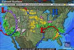
The Weather Channel map at left is for January 22nd. This was a very active time which actually started on the 17th. Here are some of Accuweather's headlines for the 21st through the 24th.

January 21
The latest storm to hit the West has been the strongest so far this month, breaking barometric pressure records along the coast.

January 22
Up to 8 Feet of Snow from West Storm

January 24
Farther west, another storm pressed onshore in the Pacific Northwest. By the afternoon, windswept rain soaked the coast from central California to Washington, while snow began piling up in the mountains.


Forecast

January 26-31
An active weather pattern develops off the Pacific Northwest coast and hurls wind and rain in Washington, Oregon, and California. It appears that a number of fronts will ride through the area between these dates and push into the Intermountain West.

Results
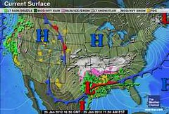
This Weather Channel map is for January 26th. Accuweather's reported that a new Pacific storm returned rain to southern California. On the 28th, some spotty rain, freezing rain, and snow fell over Washington, Oregon, and northwestern California. On the 29th, a new storm delivered rain to the Pacific Northwest and northwestern California. And on the 30th, a storm spread some showers and mountain snow across the Pacific Northwest.


Introduction to the Weather Alternative

How Long-Range Forecasts Are Made

Saint Patrick's Day 2010 Weather Forecast

What Is Greatness?

Do not confuse notoriety and fame with greatness. Many of the titled in today's world obtained their fame and fortune outside their own merit.

On the other hand, I have met great people in the most obscure roles. For greatness is a measure of one's spirit, not a result of one's rank in human affairs. Nobody, least of all mere human beings, confers greatness upon another, for it is not a prize but an achievement. And greatness can crown the head of a janitor just as readily as it can come to someone of high rank.
--Sherman G. Finesilver

Thursday, February 11, 2010

January 2010 Forecast Results Part I

These forecasts were posted on December 22, 2009. The first one read:

Forecast
January 4-5, 2009
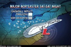
There is strong potential for a Nor’easter type storm to hit the New England area with cold, snow, and windy conditions.


Results

The storm hit earlier than forecast. The above map is for January 3rd dumping nearly 3 feet of snow in parts of northern New England. Howling winds and snow lashed a swath from northern New York to Maine. By the 4th, it was still blustery and snowy over the area.

Forecast

January 13-16, 2009
A major winter storm is indicated for the Great Lakes area southward through the Ohio Valley and into the Southeast. High wind, snow, and falling temperatures assail the area. The storm then moves into the Mid-Atlantic and the Northeast disrupting travel and causing power outages.


Results

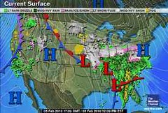
For most of the forecast period, the weather was a bit warmer and dry. By the 16th, however, travel was interrupted by heavy rain over the Southeast. Some communities from Alabama to the Florida Panhandle and southwestern Georgia were inundated by up to half a foot of rain. By the 17th, it was windy, rainy, and snowy over the Northeast. The above map is for January 16th.


Forecast

January 27-31
Another significant winter storm forms over the East Central States (Michigan southward to the Gulf Coast). By the 29th and 30th, storm warnings should be posted for New York, New Jersey, Pennsylvania, Maryland, and Delaware as the storm moves eastward into New England.


Results
On January 30th, a major snow storm brought travel to a standstill across the southern mid-Atlantic. Heavy snow shifted eastward across Virginia and parts of Maryland, Delaware and southern New Jersey, creating major disruptions to travel and affecting people from Richmond, Va., to Washington, D.C., and Cape May, N.J. Meanwhile, icy winds blasted parts of the Northeast.


Forecast

January 10-12
A storm system or front affects the southern Plains and Upper Mississippi Valley.

Results
The Weather Channel map at right is for January 11th and shows the leading edge of a cold front pushing past the Upper Mississippi Valley and into the southern Plains.

Forecast

January 25-27
A strong low pressure area is shown over the central Mississippi Valley.

Results

On the 25th, blizzard or near-blizzard conditions affected the northern Plains and Upper Mississippi Valley. By the 27th, a band of heavy snow developed from eastern New Mexico to southern Missouri and northern Arkansas.


Forecast

January 29-31
A strong storm system is indicated over the Mississippi Valley with an area of severe weather over Mississippi and Alabama around the 31st.

Results
The storm that swept through the southern Plains on the 28th, affected the lower Mississippi Valley on the 29th. The Weather Channel map at left is for Jan 29th. According to Accuweather, Northern Oklahoma to northern Arkansas and Tennessee saw the heaviest snow, while central Arkansas, and northern Mississippi and Alabama, saw freezing rain.

The following is a list of storm total rainfall in inches as of 1 p.m. CST, Friday, Jan 29:

•Shreveport, La.: 1.69
•Oakdale, La.: 1.55
•Alexandria, La.: 1.5
•Greenville, Miss.: 1.58

On January 3oth, the national high precipitation was 2.06 inches at Ozark, AL.

Introduction to the Weather Alternative

How Long-Range Forecasts Are Made

Saint Patrick's Day 2010 Weather Forecast

Greatness


Great men have but a few hours to be "great." Like the rest of us they must dress, bathe, & eat. And, being human, they must make visits to the dentist, doctor, & barber & have conferences with their wives about domestic matters. What makes men great is their ability to decide what is important, & then focus their attention on that.--Anonymous


Do not be dazzled by the World's false judgments. The common soldier is often nobler than the general. ... Nor is it otherwise on the battlefield of life. There is a yet harder & higher heroism--to live well in the quiet routine of life; to fill a little space because God wills it; to go on cheerfully with a petty round of little duties, little vocations; to accept unmurmuringly a low position; to smile for the joys of others when the heart is aching; to banish all ambition, all pride, & all restlessness, in a single regard to our Saviour's Work. To do this for a lifetime is a greater effort, & he who does this is a greater hero than he who for one hour stems a breach, or for one day rushes onward undaunted in the flaming front of shot & shell. His works will follow him. He may not be a hero to the World, but he is one of God's heroes, & though the builders of Nineveh & Babylon be forgotten & unknown, his memory shall live & shall be blessed.--Fredric W.Farrar

Monday, February 08, 2010

Recent Forecast Results

The Weather Alternative long-range weather forecast for Super Bowl 2010 was posted on November 14, 2009. The forecast was based on the conjunction of Venus and Neptune, which was to be activated the day before the Super Bowl on Feb 6. The forecast called for the possibility of heavy rain over Miami and Florida, which at times can lead to flash flooding. The forecast was pretty close--just off by a day--as the rain heavy rains hit by 5th. The Weather Channel map at left is for February 5th.

It wasn't until February 2nd that conventional forecasters began to see the potential for heavy rain over the Miami area on the 5th and 6th.


Christmas

The Christmas and New Year's forecasts posted on The Weather Alternative on November 7, 2009 were very successful. We don't have time to go through all of them but here are the most important.

The Weather Alternative forecast for December 20-22 for the East Coast and New England called for a heavy precipitation (which I thought would be rain but most of it was snow) from North Carolina through New England. A low pressure area over North Carolina became a Nor'easter that lashed the forecast area with with wind rain and snow. The Accuweather Map at right shows the low pressure area.


The Weather Alternative forecast for December 24-26 warned that a strong winter storm would cover the area from Michigan to Florida creating major travel problems and airport delays. Special intensity was expected over the Southeast U.S.

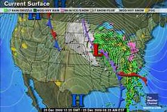
The Weather Channel map at left is for December 25th. During this period, a record-setting blizzard hit the northern Plains and moved eastward across the forecast area. The Southeast was hit by flooding downpours, damaging winds, and tornadoes. Strong winds,snow, sleet, freezing rain, and rain hit the Midwest.


The Weather Alternative forecast for Dec 20-22 also called for an energetic front to hit the West Coast. The Weather Channel map at right is for December 21st. The Weather Channel reported on the 22nd that a potent winter storm is bringing areas of heavy snow to the West today.


Europe

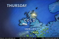
The Weather Alternative forecast for Europe called for a cold, dry air mass to descend over the United Kingdom between December 22-23. The Accuweather map at left shows the cold forecast for the 23rd.

The Weather Alternative also forecast that a powerful storm system would batter France, Germany, and the surrounding countries on December 24th and 25th. On the 24th, The Weather Underground reported "A strong low pressure system will continue moving eastward from central Europe and extend into eastern Europe. This will spread scattered showers over most of Europe, with snow anticipated at higher elevations. The strongest region of the system will move through Spain and into eastern France and Switzerland by evening. These areas will see periods of heavy rainfall with periods of heavy snow at high elevations of the Alps."


Introduction to the Weather Alternative

How Long-Range Forecasts Are Made

Saint Patrick's Day 2010 Weather Forecast

Greatness

The talent of success is nothing more than doing what you can do well, and doing well whatever you do without thought of fame. If it comes at all it will come because it is deserved, not because it is sought after. --Henry Wadsworth Longfellow

The heights by great men reached & kept
Were not attained by sudden flight,
But they, when their companions slept,
Were toiling upward in the night.
--Henry Wadsworth Longfellow