Friday, September 18, 2009

Southern Flooding Forecast Results for Sept 11-18, 2009

It's time to look at the results of the September 11-18, 2009 forecast, which was posted on September 1st.

...the Gulf Coast area, roughly from New Orleans to the Florida Peninsula, will be under some very severe weather patterns. This was based on the Saturn-Uranus opposition, among other things. The forecast also stated there may be some tropical storm or hurricane development in the Gulf of Mexico. The strike zone could be from New Orleans to the Florida Panhandle.

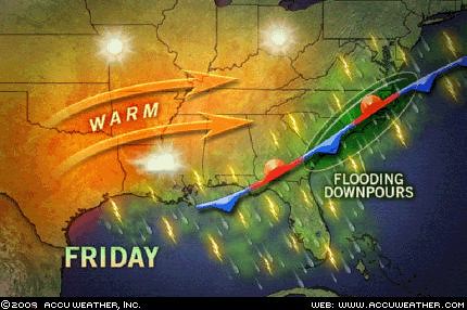
During the beginning of the forecast period, conventional meteorologists thought that a low pressure system in the Gulf might develop into some sort of tropical system. Although this never happened lots of moisture from the Gulf has been pumped up over the very forecast area mentioned, and as of today is still being pulled up over the area--thus fulfilling the severe weather prediction for the area from New Orleans to the Florida Peninsula.

A whopping 5.92 inches of rain has soaked Pensacola, Florida, and flash flooding problems have followed torrential rain from Arkansas and Louisiana through Georgia. Multiple high water rescues were preformed in Birmingham, Alabama just to mention some of the recent troubles due to the excessive rain.

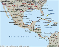
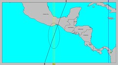
The next part of the forecast stated Central America also shows potential for severe weather; possibly a tropical storm or hurricane strike. No hurricanes were reported but on the 11th and 12th the National Weather Service announced that due to a tropical wave AN UPPER LEVEL LOW OVER NICARAGUA... HAS ENHANCED A LARGE CLUSTER OF NUMEROUS STRONG CONVECTION FROM 11N-16N BETWEEN 81W-85W. The map at right shows the low over Central America on the 11th.


The next portion of the forecast was for the Northeast and New England. Here's the forecast: Staring on the 11th, weather conditions are building in intensity and seem to be at their strongest from the 15th through the 18th when storms bringing heavy rainfall are likely. A tropical system cannot be ruled out.


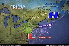
On the 11th, a coastal storm pounded the mid-Atlantic with flooding rain, gusty winds, rough surf, beach erosion and isolated tornadoes. The storm continued on the 12th and because it had tropical characteristics, Accuweather referred to it as The Unnamed Storm. The storm also affected the Northeast and southern New England with flooding rain. This was the main storm during the forecast period although I envisioned more intense storms to take place around the 15th through the 18th.

The last portion of the forecast had to do with Nova Scotia. From the 11th through the 18th, a build up of planetary influence points strongly to a severe weather pattern to affect the area or to the likelihood of a tropical system making landfall around the 17th and 18th.


On the 13th, the aforementioned Unnamed Storm passed by Nova Scotia. The Canadian Weather Service stated A low pressure system south of Nova Scotia will intensify as it tracks northeastward today and tonight. The low is forecast to track across Newfoundland Monday afternoon. Ahead of the low, southeast winds gusting to 100 km/hour...


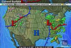
The 18th (see map at left) brought a low pressure system and front to the area triggering showers.

September 11-18, 2009 Forecast for Eastern U.S. and Nova Scotia
Solar Eclipse Action for August and September 2009
Solar Eclipse Action October and November 2009
Introduction to the Weather Alternative
How Long-Range Forecasts Are Made


Good Science
Good science--good physics, good biology, good chemistry and good economics--depend upon the ability to predict. In other words, if a physicist correctly predicts the moment at which a projectile will strike its target, or a biologist correctly predicts the effect a change in temperature will have on a population of insects, then we can say that these scientists are using good science. On the other hand, if the predictions are wrong, then the science is flawed. --Richard Maybury
Thursday, September 10, 2009

Sept 7-10, 2009 Forecast Results

The Weather Alternative long-range forecast for Sept 7-10 was based on the Solar Eclipse of March 29, 2006. Here's what the forecast called for:

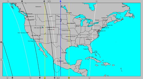
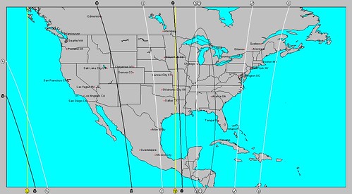
Mars will trigger the solar eclipse of March 29, 2006. The Sun and Moon ascended through Nova Scotia and transit Mars will cut through the Windward Islands at this time. Severe weather, which may be tropical in nature, may afflict these areas now.

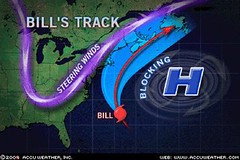
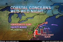
As can be seen from the Accuweather map above, the main action was a storm system along the U.S. East Coast. No storm system affected the Nova Scotia area as high pressure held on tight over eastern Canada.

As far as the Windward Islands go, the National Weather Service reported on September 8th that due to the approach of a tropical wave showers would increase in coverage across the Leeward Islands, which are just north of the Windwards.


September 11-18, 2009 Forecast for Eastern U.S. and Nova Scotia
Solar Eclipse Action for August and September 2009
Solar Eclipse Action October and November 2009
Introduction to the Weather Alternative
How Long-Range Forecasts Are Made

Many of life's failures are people who did not realize how close they were to success when they gave up.-- Thomas Edison

Tuesday, September 01, 2009

September 11-18, 2009 Forecast for Eastern U.S. and Nova Scotia

September 11-18, 2009


Forecast for the Southeast
Judging principally from the Solar Ingress chart and the main aspects such as Pluto’s direct station, the Saturn-Uranus opposition, the oppositions of Venus to Jupiter and Neptune, and Mercury’s square to Pluto, the Gulf Coast area, roughly from New Orleans to the Florida Peninsula, will be under some very severe weather patterns.

The crossings between planets in the Solar Ingress and the Lunar Eclipse chart suggest that there may be some tropical storm or hurricane development in the Gulf of Mexico. The strike zone could be from New Orleans to the Florida Panhandle. Central America also shows potential for severe weather; possibly a tropical storm or hurricane strike.

If not an actual tropical system, a severe weather system is possible from the Mississippi Valley eastward to the Southeast and Mid-Atlantic States. Pluto’s station suggests a cold air mass descending out of Canada. The Saturn-Uranus opposition suggests high wind velocities. The Venus oppositions to Jupiter and Neptune suggest warm and moist air masses. Taken together, a clashing of atmospheric elements have the potential to engender very strong storms packing damaging winds, hail, and maybe spawning tornadoes.


Northeast and New England
The New Moon and Full Moon charts place the planet Neptune in key positions over this area. The main aspects at this time are Venus opposition Jupiter and Venus opposition Neptune. These tend to increase warmth and moisture. In extreme cases, Neptune has to do with flooding conditions. Staring on the 11th, weather conditions are building in intensity and seem to be at their strongest from the 15th through the 18th when storms bringing heavy rainfall are likely. A tropical system cannot be ruled out.


Nova Scotia
The Last Quarter Moon places a special emphasis over this area. From the 11th through the 18th, a build up of planetary influence points strongly to a severe weather pattern to affect the area or to the likelihood of a tropical system making landfall around the 17th and 18th.

Solar Eclipse Action for August and September 2009
Solar Eclipse Action October and November 2009
Introduction to the Weather Alternative
How Long-Range Forecasts Are Made

Drinking

Don't try to drown your sorrow in alcohol because sorrow is an expert swimmer.

In ten years 46,000 Americans died in Vietnam. During that same time 250,000 persons were killed in the U.S. by drunk drivers.

Sunday, August 30, 2009

Danny's Track and Other Forecast Results

Astrometeorological indications showed that Danny would have a close encounter with the New England area due to configurations in the Full Moon chart of August 5, 2009. (See post)


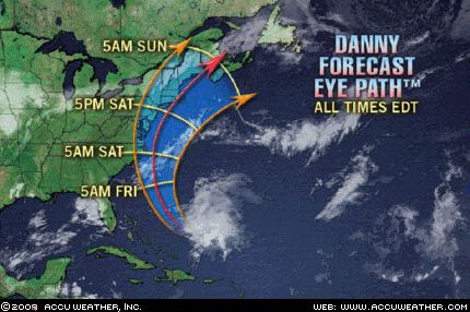
Accuweather reported today that While Danny was downgraded to a tropical rainstorm early Saturday morning, he still delivered a blow to eastern New England. Torrential downpours and flash flooding were the primary impacts as 2-4 inches of rain deluged places from southeast Massachusetts through eastern Maine. A few locations had even more than 5 inches of rain. Gusty winds added to the miserable weather, and gusts of 40-60 mph were recorded in Cape Cod and the islands of Massachusetts.


In a previous post, I mentioned the possibility of tropical storm development about 240 miles south of Hispaniola (70 west /15 north) between August 21-26. The National Weather Service reported a tropical wave over this area on August 23rd and 24th.


On the 24th they reported A CARIBBEAN SEA TROPICAL WAVE IS ALONG 73W TO THE SOUTH OF 18N MOVING WEST 15 TO 20 KT. DISORGANIZED ISOLATED MODERATE SHOWERS AND THUNDERSTORMS ARE FROM 11N TO 15N BETWEEN 69W AND 77W.


My post of June 8, 2009, warned of possible tropical storm development between August 22-24 in the intertropical convergence zone along longitude 128 west. Tropical Storm Ignacio was centered at at 124 west and 21 north on the 26th of August and at 126 west and 24 north on the 27th--a few days too late and too a bit further north and west to be called a "hit."


The June 8th post also contained a long-range forecast for August 23-26. This forecast warned of possible tropical trouble in the Gulf as well as severe storms for the Midwest.

No tropical development occurred in the Gulf but 23rd through the 25th brought a dose of strong thunderstorms across the Midwest and Plains. The main threats were damaging winds, large hail, and heavy rain.

Solar Eclipse Action for August and September 2009Solar Eclipse Action October and November 2009

Introduction to the Weather Alternative

How Long-Range Forecasts Are Made

Success and Failure


I don’t measure a man’s
success by how high he
climbs, but how high he
bounces when he hits
bottom.
—General George Patton (1885–1945)


A failure means you put
forth some effort. That’s
good. Failure gives you
an opportunity to learn a
better way to do it. That’s
positive. A failure teaches
you something and adds
to your experience. That’s
very helpful. Failure is an
event, never a person; an
attitude, not an outcome; a
temporary inconvenience;
a stepping stone. Our
response to it determines
just how helpful it can be.
Zig Ziglar (b. 1926)


Even a mistake may turn
out to be the one thing
necessary to a worthwhile
achievement.
—Henry Ford (1863–1947)

Wednesday, August 26, 2009

TS Danny Comin' At Ya!

Taking a quick look at some of the key charts used in astrometeorological forecasts we find that the Full Moon of August 5, 2009 may provide some information as to where Tropical Storm Danny is headed.

The lunation chart placed a crossing of planetary lines, shown at left, over New England. These two lines tell us that at the time of the Full Moon, Mercury and Mars set up an important influence over that area.

These will be spurred into action on the 27th just a few days before Danny moves near. This is one indication that the New England area might sustain a direct hit or a close brush with Danny. Of course, it could mean some other type of severe weather affects the area. Conventional meteorologists, however, seem to think that Danny will move closer to the East Coast than Bill did, and I'm thinking they may be right.


Solar Eclipse Action for August and September 2009
Solar Eclipse Action October and November 2009
Introduction to the Weather Alternative
How Long-Range Forecasts Are Made


It's what you do when you have nothing to do that reveals what you are.

Sunday, August 23, 2009

Bill's Track and Update on Recent Forecasts


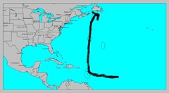
Hurricane Bill's track has pretty much followed the track that I pointed out in a recent post entitled Where Are the Atlantic Storms Headed?


This track took it north toward Nova Scotia but not close enough to the U.S. East Coast to be much of a problem.


Here is my crude little hand-drawn map showing the track headed toward Nova Scotia and Newfoundland. I did expect Bill to come closer to the Lesser Antilles then it did.


Recent Forecasts


A recent Weather Alternative post from July 31st entitled Atlantic Hurricane and Southern Texas Rain made a number of forecasts regarding upcoming hurricane activity in the Atlantic and Pacific Basins as well as forecasts regarding rain for southern Texas. Here's how the forecasts have shaped up.


I expected the Atlantic hurricane season to really get kick in between August 17-19. Things really started to get underway on the 15th with the formation of Tropical Storms Ana and Bill--a bit earlier and further west than I forecast.


Another area I expected to experience strong storms was the Arizona-New Mexico region around the same dates. There have been no storms, just high heat and wildfires further west.


From the 19th to the 21st I forecast rain for southern Texas. The only thing the atmosphere delivered at this time was isolated showers along the southern Texas coast on the 18th and 19th. I did mention that there was a chance of of things staying hot and dry with the planetary pair involved, but I was hoping for the needed rain.
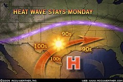
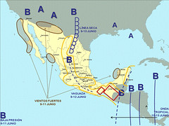
In re-studying key charts that might be involved in producing this extreme drought, I've come across what I think may be the culprit. The Solar Eclipse of Sept 11, 2007 places Mars, the author of heat and dryness, over this area of the country. I'm beginning to see that as long as this chart is active, or until another key chart replaces this one as occasionally happens (see Beneficial Rain for Texas), we might not see much drought relief. When this might happen is a project I'll be working on.


The last of the forecasts in the above mentioned post concerned the possible formation of a tropical system off the coast of Mexico around 102 west longitude and 15 north latitude between August 19th and 21st. The satellite image at left for today the 21st shows a tropical wave over the forecast area. It's the red, orange, and yellow glob at the lower left of the image.


Solar Eclipse Action for August and September 2009

Introduction to the Weather Alternative

How Long-Range Forecasts Are Made

Where is Hurricane Bill Headed?

Motives

How our smallest efforts are magnified when the motives behind them are unselfish!--Francis Gay


Sunday, August 16, 2009

Southeast Soaker and Where are the Atlantic Storms Headed?

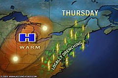
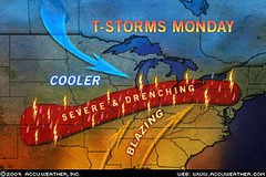
The Weather Alternative's long-range weather forecast for August 14th and 15th was posted on July 20th. Planetary alignments between Mercury, Venus, and Saturn were cited as the astrometeorological factors behind a storm system (possibly tropical in nature) that would affect the East Coast States of North Carolina, Maryland, Delaware, Pennsylvania, and New Jersey. Locally drenching rains moved into the Northeast and Mid-Atlantic on Thursday the 13th of August.


Thunderstorms dumped 2.72 inches of rain on Norfolk closing sections of Interstate 264. Flooding also occurred in Millville, N.J., Andover, N.Y., and Bridgeton, N.J.


As mentioned in the forecast, a special concentration of planetary influence was to take place over North Carolina, Maryland, and Delaware. The Accuweather map at right shows a stalled front over the Southeast U.S. on the 14th. This front sparked another round of soaking showers and thunderstorms along the Middle Atlantic, Southeast, and Gulf Coasts. The storms brought torrential downpours and flash flooding. Storms over the eastern Carolinas were expected to be particularly heavy.


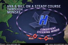
Meanwhile the tropical Atlantic has sprung to life and now boasts two tropical systems, Ana and Bill, with others expected to form soon off the coast of Africa. In a recent post, I mentioned the possibility of the Atlantic hurricane season getting underway around August 17th especially around 27 west longitude and 18 north latitude in the eastern Atlantic. Things have started a few days earlier but my guess is that even more powerful storms will form in this area around these dates.


Here are some observations of where some of these tropical systems might be headed. Between the 21st and 26th of August some very nasty planetary alignments take place. These frequently have coincided with hurricane or tropical storm systems. These aspects are Mercury opposition Uranus, Mercury square Mars, Mercury square Pluto, and Mars opposition Pluto. The map at right shows where the majority of these aspects play themselves out in certain key charts. The basic idea being that around the 21st the Lesser Antilles are in for some tropical storm or hurricane activity. This would probably coincide with Bill's passage at this time. The rest of the aspects between Mercury, Mars, and Pluto affect the area north of the islands up toward Nova Scotia. Perhaps Bill, or some other tropical system, will then head northward from there.

Another place that might show signs of tropical storm development or where a tropical system may pass through is about 240 miles south of Hispaniola around 70 west longitude and 15 north latitude.

A previous post entitled Solar Eclipse Action for August and September 2009 also contains other forecasts for both the Atlantic and Pacific during the period between August 22-26. The central Gulf is highlighted for possible tropical storm or hurricane activity then.

Atlantic Hurricane and Southern Texas Rain
Solar Eclipse Action for August and September 2009
August 10-15, 2009
Introduction to the Weather Alternative
How Long-Range Forecasts Are Made

Charity
With malice toward none, with charity for all. --Abraham Lincoln

Charity should begin at home, but should not stay there. --Phillip Brooks

The best thing to give to your enemy is forgiveness; to an opponent, tolerance; to a friend, your heart; to your child, a good example...to all men, charity. --Francis Maitland Balfour

Thursday, August 13, 2009

Recent Severe Weather Fulfills Long-range Forecast

The recent severe weather sustained over the Central and Northeast U.S. fulfilled The Weather Alternative's long-range forecast for August 10-12, 2009. The forecast, posted on July 20th, cited the Mars-Saturn square as a severe weather breeder for the area in and around Kansas, Nebraska, and Missouri. Pennsylvania and West Virgina were also pinpointed for strong storms.


The outbreak began as early as the 9th. Accuweather reported the following: Lycoming Co., Pa., was one place that was hit hard by the severe weather. The thunderstorms downed large trees throughout the county. These trees caused additional destruction by landing on numerous homes and cars. Trees littering Route 44 forced officials to close the road.

They also warned that Monday, the 10th of August, would bring more of the same: Places from upstate New York, northern Pennsylvania and portions of New England all the way to Kansas could be dealing with locally violent storms, especially during the afternoon and evening on Monday.

These are the exact locations (Pennsylvania and Kansas) that were mentioned in the long-range forecast.

The area of concern into tonight (Aug 10th) stretches from the northern Texas Panhandle, eastern Colorado and much of Kansas Kansas to Southwest Ontario, New York State, Pennsylvania, New Jersey and southern New England. As a cold front and the associated upper level trough swing eastward Tuesday, the storms will focus from Tennessee and Arkansas to southern Maine, southward to much of Virginia.


The National Weather Service reported the following on August 10th:

SEVERE WEATHER STRUCK PARTS OF NORTHERN AND CENTRAL KANSAS DURING THE LATE MORNING...PRODUCING DAMAGING WINDS...HAIL AND HEAVY RAIN. HAIL TO THE SIZE OF HALF DOLLARS WAS REPORTED FROM ONE STORM 6 MILES SOUTH OF ZURICH IN ROOKS COUNTY KANSAS AT 9 AM.

SHOWERS AND THUNDERSTORMS DEVELOPED OVER NORTHEAST COLORADO NEAR MIDNIGHT...AND THEN SPENT A GOOD PART OF THE LATE NIGHT AND EARLY MORNING HOURS OVER SOUTHWESTERN NEBRASKA. THE MOST INTENSE STORMS OCCURRED IN SOUTHERN CHASE COUNTY...WHERE AS MUCH AS 1.62 INCHES OF RAIN WAS REPORTED 5 MILES SOUTH OF ENDERS...THEY CAUSED WINDS TO GUST AS HIGH AS 47 MPH IN THE NORTH PLATTE AREA JUST BEFORE 7 AM CDT.

Atlantic Hurricane and Southern Texas Rain
Solar Eclipse Action for August and September 2009
August 10-15, 2009
Introduction to the Weather Alternative
How Long-Range Forecasts Are Made


Black Bart
A dropped handkerchief: a surprising end to the career of California's most colorful stage-coach robber. "Black Bart" had terrorized stages for six years, committing twenty-eight robberies between 1877 and 1883 in the rugged foothills of the Sierras. Dressed in a long linen duster with a flour sack over his head, he would brandish a shotgun while demanding, "Will you please throw down your treasure box, sir?"

Finally, near Copperopolis, Bart was wounded while escaping a holdup and dropped a handkerchief with the laundry mark "FX07." This was traced to San Francisco, where police made one of the most surprising arrests in the city's history. "Black Bart," the highwayman, turned out to be Charles E. Bolton, one of San Francisco's leading citizens with close connections in the police department.

Bolton had a reputation as a non-smoking, non-drinking, God-fearing man with big business interest in the gold mines. Amid much publicity he confessed his crime and was sentenced to six years in San Quentin for his deception.

Monday, August 10, 2009

August 6-9, 2009 Forecast Results

The Weather Alternative post of June 8th made note of the fact that Mars would trigger the Solar Eclipse degree of September 11, 2007. In astrometeorology, solar eclipses are sensitive to the hard aspects of the outer planets for about a 3 year period. The forecast mentioned a sensitive spot about 170 miles south of Guadalajara, Mexico where a tropical system may form. This is roughly 103 west longitude and 18 north latitude.

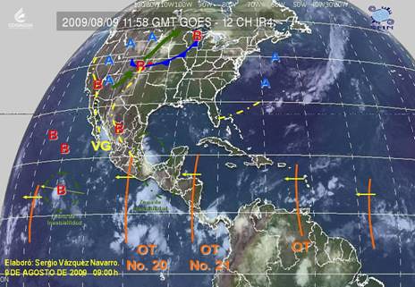
The weather map above from the Mexican Weather Service shows tropical wave #20 over this area on August 9th. (labeled OT No. 20) Their meteorologists reported on Aug 8th Onda tropical No. 20 A lo largo de 100°W y al Sur de 20°N, sobre el Centro y Sur de México, favorecerá fuerte actividad convectiva, con nublados densos y lluvias acompañadas de actividad eléctrica. (Tropical Wave # 10 along 100 west and south of 20 north, over central and southern Mexico, will favor strong convective activity with thick clouds and rain accompanied by electrical activity)


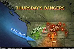
The forecast also warned of a low pressure system or front affecting the Rockies. The Accuweather map at left for August 6th shows a potent storm system that brought a wide variety of adverse weather. Thunderstorms brought damaging winds, hail, and drenching rain to Idaho and Montana.


The Weather Channel map at right is for August 7th. Notice the two low pressure systems over the northern Rockies. The Weather Channel reported A vigorous upper-level disturbance moving from the Northwest into the northern Plains will pop more thunderstorms across the Great Basin, Rockies and northern high Plains today.
The thunderstorms could become severe again especially in Montana.
Gusty winds will keep the fire danger high across the Four Corners Region.

Atlantic Hurricane and Southern Texas Rain
Solar Eclipse Action for August and September 2009
August 10-15, 2009
Introduction to the Weather Alternative
How Long-Range Forecasts Are Made

Success and Motive


Your success in life depends on your motive. There is an old fable about a dog that boasted of his ability as a runner. One day he chased a rabbit and failed to catch it. The other dogs ridiculed him on account of his previous boasting. His reply was, "You must remember that the rabbit was running for his life, while I was only running for my dinner." The incentive is all-important.

Tuesday, August 04, 2009

The Summer That Never Was

Accuweather has report that for residents of the Midwest and Northeast the month of July was strikingly cool. Cities like Chicago, Madison, and Cincinnati experienced their coolest July on record! Here are the stats: When record low temperatures and record low high temperatures are considered, more than 3,000 records were broken across the country, many of these were in the Midwest and Northeast. The reason? A storm system and the associated jet stream over Canada that continuously dipped farther south than usual.


The astrometeorological cause can be traced to the Cardinal Solar Ingress chart for the summer season. Above you'll see this chart set for Chicago. A few things will become apparent. The planet Uranus, associated with cold air masses is exactly on the Ascendant. This is the 9 o'clock position on the wheel where you see a blue symbol that is similar to the letter H. Let's go farther east to New York and view the chart from there.


Uranus is now far from the Ascendant, but another cold or cool weather maker is at work. My experience with long-range weather forecasting points to the fact that Pluto is associated with cooler weather patterns. At the time of the Carding Solar Ingress for the summer season, the Sun was forming an opposition to Pluto. You can see these in the sectors marked 3 and 9 in the above figure. The Sun occupies the 3rd sector and Pluto the 9th. These two sectors are important because they represent areas directly west of the place in question; in this case New York City. This is important since weather patterns in the mid-latitude areas of the globe travel from west to east.

Atlantic Hurricane and Southern Texas Rain

Solar Eclipse Action for August and September 2009

August 10-15, 2009

Introduction to the Weather Alternative

How Long-Range Forecasts Are Made

The Game of Love


Let the game of love occupy your mind and dictate your actions all the time. Remember, your game improves with practice. Never pass--always take that turn to show love and appreciation. Perform great feats of love when you can, but never underestimate the simple moves. You'll be surprised what the simple maneuvers will do. Simple little turns taken regularly and consistently add up the points!

Friday, July 31, 2009

Atlantic Hurricane and Southern Texas Rain

The Sun's aspect to the planets as viewed from the all-important seasonal Solar Ingress chart has led to some important long-range weather forecasts here at The Weather Alternative. This method allowed for the accurate forecast of the time and place of August 2007's Hurricane Dean. (See Switching On the Atlantic Hurricane Season and its fulfillment Atlantic Hurricane Season Gets Green Light)


August 17-19, 2009

This year the seasonal Solar Ingress chart sets up another important crossing between four heavenly bodies. We have a Jupiter-Neptune conjunction and a Moon-Mercury conjunction. These four cross in the eastern Atlantic around 27 west longitude and 18 north latitude. The transit Sun will activate part of this fearsome foursome between August 17th and 19th. As in the case of Hurricane Dean, we should expect tropical storm or hurricane formation over this area around those dates. If things follow Hurricane Dean's example, the storm could be long-lived and make it across the Atlantic.


The Sun's trigger to the Moon and planets will also affect the mainland U.S. at the same time. Jupiter, Neptune, the Moon, and Mercury made another crossing over northwestern Mexico just south of Arizona and New Mexico. We can expect a strong monsoonal flow over this area or perhaps the remnants of some tropical system shunted up over this area.


At the same time (Aug 17th), Mercury will conjoin Saturn. In the Solar Ingress this takes place over the Mississippi Valley area. This presages strong storms over the U.S. midsection, which probably involves Gulf moisture being drawn up over the southern Mississippi Valley feeding the storm machine.


August 19-21, 2009


Another interesting set-up involving planetary crossings is shown in the above astro-locality map for the August 13th Third Quarter Moon. There is a promise here for beneficial rains for the southern Texas area. Notice the circled area over extreme southern Texas and northeastern Mexico. Here, the Moon and Neptune cross. The planet Neptune, in astrometeorology, is associated with abundant tropical moisture and, in some cases, flooding rains. This is what I'm expecting over this area. Things could start gearing up as early as the 17th of August, but should definitely be in full swing around the 19th through the 21st. I haven't checked if southern Texas will receive a good soaking before these dates, but there should be a good one at this time. There is a slight chance that this alignment could manifest as a heat wave and bring no moisture at all. Hopefully, this will not be the case.


The second set of planetary crossings, as seen on the map above involves the Sun, Moon, and Jupiter off the southern coast of Mexico around 102 west longitude and 15 north latitude. Tropical storm and/or hurricane formation is possible here between the 19th and 21st as well.


Solar Eclipse Action for August and September 2009
August 10-15, 2009
Introduction to the Weather Alternative
How Long-Range Forecasts Are Made


Patience


People who fly into a rage always make a bad landing.


Funny thing about temper: You can't get rid of it by losing it.


The longer you keep your temper the more it will improve.


He that is slow to anger is better than the mighty, & he that ruleth his spirit than he that taketh a city. (Pro.16:32)


Be not hasty in thy spirit to be angry: for anger resteth in the bosom of fools. (Ecc.7:9)

Wednesday, July 29, 2009

Review of July 27-29, 2009 Forecast

I highlighted the need to watch the Gulf Coast area around eastern Texas and Louisiana during the July 27-29 period. The forecast posted at the end of May was based on planetary crossings that appeared in the New Moon chart of July 21st (actually a solar eclipse).


I was concerned that the build up of planetary energies there involving Mars, Jupiter, and Neptune might bring severe weather, although I was not sure how severe due to a fair weather influence of Venus at the same time.


It looks like (from the above Accuweather map for July 28th) that Mars, Jupiter, and Neptune were a bit too much for little ol' Venus. Nine inches of rain were reported on the morning of the 28th in the Ark-La-Tex region. Soaking rain and disruptive downpours also afflicted the area on the 27th as well.


Notice the circled region around the Gulf Coast area as shown in this astro-locality map used by astrometeorologists in formulating long-range weather forecasts. It coincides beautifully with the affected area in the above conventional weather graphic.

Solar Eclipse Action for August and September 2009

Solar Eclipse Action For June and July 2009

July 23-25, 2009 Forecast


August 10-15, 2009

Introduction to the Weather Alternative

How Long-Range Forecasts Are Made

The Game of Life


The name of the game, this whole game of life, is choices, constant choices! God sets choices before us all the time and then lets us make our own decisions and operate within certain bounds.


"Nobody grows old by merely living a number of years. People grow old only by deserting their ideals. Years may wrinkle the skin, but to give up interest wrinkles the soul. Worry, doubt, self-distrust, fear and despair... these are the long, long years that bow the head and turn the growing spirit back to dust.
"Whatever your years, there is in every being's heart the love of wonder, the undaunted challenge of events, the unfailing, childlike appetite for 'what next,' and the joy and the game of life.
"You are as young as your faith, as old as your doubt; as young as your self-confidence, as old as your fear; as young as your hope, as old as your despair."
--Douglas MacArthur


Get rid of the notion that children who do things early are way ahead of the game of life. Teaching your children to read at age two, & putting them through practice drills as pretoddlers (if not done correctly), could intensify their anxiety levels.
Hurrying children into advanced activities can represent an adult's need to have a precocious child rather than the best interest of the child. Check your motives! --
Dr. Wayne W. Dyer

Saturday, July 25, 2009

Review of Forecasts for July 21-23 and July 23-25, 2009

The long-range weather forecasts posted here on The Weather Alternative covered the period of July 21-25, 2009.


The first portion of the forecast covered July 21-23.


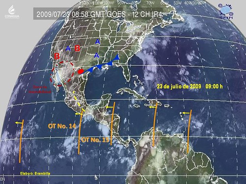
We expected an atmospheric reaction (perhaps a tropical system) over the Mexican coastal area around 103 west longitude and 18 north latitude. Nothing that dramatic occurred, but as can be seen from the weather map at left for July 22nd, that very area is circled in green and labeled "Zona de Inestabilidad." This zone of instability, as it was called by the Mexican weather service, was slated for intense storm activity.


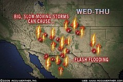
The same forecast mentioned the possibility of severe weather over the U.S. Rockies. The Accuweather map at right for the 21st shows the Southwest U.S. which during that time experienced big, slow-moving storms that caused flash flooding. The was brought about by storms dropping a quick 1 to 2 inches of rain.


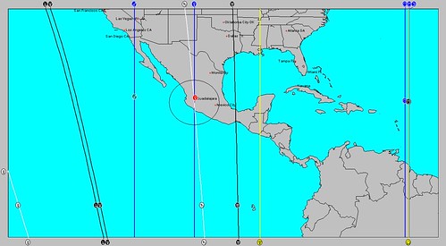
The next segment of the forecast was for July 23-25. The above link will show you the astro-weather map where with a circled area over Arizona, New Mexico, and northwest Mexico. This forecast called for strong storms or a heat anomaly over this area.

The accompanying weather map for July 23rd from the Mexican weather service shows this exact area circled in red and once again labeled "Zona de Inestabilidad" similar to the one mentioned above. The western U.S. at this time was continuing to experience a heat wave as did northern Mexico.

Solar Eclipse Action for August and September 2009
Solar Eclipse Action For June and July 2009
July 23-25, 2009 Forecast

August 10-15, 2009
Introduction to the Weather Alternative
How Long-Range Forecasts Are Made

Humility


Great men forget themselves. That is why they are remembered by others.


If you think you are humble, you probably aren't!


He who is full of self is very empty.


"Let another man praise thee & not thine own mouth, a stranger, & not thine own lips." (Pro. 27:2)


Success has made failures of many men.

Monday, July 20, 2009

Long-range Forecast: August 10-15, 2009

August 10-12, 2009
Mars will square Saturn on August 10th. Both the Solar Ingress and the New Moon chart places this troublesome pair over the United States. Taking these charts together, the Plains and Mississippi Valley areas are prone to strong storms at this time. It appears that the area in and around Kansas, Nebraska, and Missouri will be subject to a high concentration of severe weather.
The eastern U.S. will also experience strong storms with the highest concentration moving over Pennsylvania and West Virginia into New England. The severe weather over the Northeast continues with the next forecast for August 14-15.


August 14-15, 2009


The New Moon of July 21st placed a Venus-Saturn square at 18 Gemini-Virgo over 81 west longitude (through the Southeast U.S. into the eastern Great Lakes). The Saturn portion affects the East Coast through Maryland, Delaware, Pennsylvania, and New Jersey.

On the 15th, transit Mercury will trigger this set-up. Transit Mercury, along with transit Mars will cross over the North Carolina coast, Maryland, and Delaware. The transit Moon will aspect them all on the 15th.
This sounds like a storm system affecting the eastern U.S. with a special concentration along coastal area involving the coasts of North Carolina, Maryland, and Delaware. Aside from the risk of severe storms over this area another possibility is for a tropical system to affect the area on its way toward New England.

Solar Eclipse Action for August and September 2009

Solar Eclipse Action For June and July 2009

July 23-25, 2009 Forecast

Introduction to the Weather Alternative

How Long-Range Forecasts Are Made


Dare to Be Different


Dare to be different. Life is so full
Of people who follow the same push-and-pull.
Poor, plodding people who, other than name,
Try to pretend they're exactly the same.


God made men different; there never will be
A replica soul made of you or of me.
The charm--the glory of all creation
Rests on this very deviation.


Your charm--your own glory, too,
Lies in being uniquely you--
Lies in being true to your best,
That part of you different from all of the rest.
--Helen Marshall

Thursday, July 09, 2009

July 23-25, 2009 Forecast


The Solar Ingress chart for the summer 2009 season set up an interesting planetary crossing over the southwestern United States and northwestern Mexico. The circled area in the map above shows where four angular planets all cross. These are the Moon (called a planet in astrology), Mercury, Jupiter, and Neptune.


This area will be activated by transit Mars from July 23-25, 2009. This carries the potential to create strong storms over this area or other weather anomalies such as high heat. When coupled with a previous forecast for July 21-22, which was based on the Solar Eclipse of September 11, 2007, here's what may happen. As stated in the July 21-22 forecast, a tropical storm or hurricane may form on along the southern Mexican coast around 103 west longitude. This storm could then send moisture up to the area now being discussed, which lies just south of Arizona and New Mexico. Here's the map showing that location in Mexico.


Solar Eclipse Action for August and September 2009
Solar Eclipse Action For June and July 2009
Introduction to the Weather Alternative
How Long-Range Forecasts Are Made

Music

Music is a higher revelation than all wisdom and philosophy. Ludwig van Beethoven

Music is everybody's possession. It's only publishers who think that people own it. John Lennon

Music is my religion. Jimi Hendrix

Composers shouldn't think too much - it interferes with their plagiarism. Howard Dietz

I don't care much about music. What I like is sounds. Dizzy Gillespie

Tuesday, June 23, 2009

Hurricane Andres heads for Baja California

The National Weather Service shows Hurricane Andres heading for the southern portion of the Baja California peninsula by Thursday the 25th.


From an astrological view point, why would Andres be drawn toward this area?


The above astro-locality map is for the New Moon of of June 22nd. Notice that the Sun and Moon were overhead there. In other words, it was high noon over the Baja at the time of the New Moon. This New Moon also was also in exact opposition to Pluto. I've drawn a box around the positions of the Sun, Moon, and Pluto.


Looking at the New Moon from the standard astrological chart, one can see the Sun and Moon conjoining on the Midheaven while they oppose Pluto on the 4th house cusp. All three heavenly bodies square the Ascendant degree.

Solar Eclipse Action for August and September 2009

Solar Eclipse Action For June and July 2009

Introduction to the Weather Alternative

How Long-Range Forecasts Are Made

Change


The largest room in the world is the room for improvement.


Take life as you find it, but don't leave it so.

Change is inevitable - except from a vending machine. --Robert C. Gallagher

If we don't change, we don't grow. If we don't grow, we aren't really living. --Gail Sheehy

Tuesday, June 16, 2009

Solar Eclipse Action October and November 2009

Here are more weather patterns signified by the transits of outer planets to sensitive recent solar eclipse degrees.


Solar Eclipse of February 6, 2008
Oct 11-14, 2009: Jupiter lingers in conjunction to the solar eclipse degree for all of October and the last third of September. One particular time that may be important is when Jupiter turns direct on this degree. Jupiter will be at its strongest over 52 west and 15 north where a tropical system may originate.


Solar Eclipse of March 18, 2007
October 12-15, 2009:
The Venus-Saturn conjunction on the 13th will oppose the solar eclipse degree off the US West Coast at 129 west. Venus and Saturn are parallel on the 12th. The eclipse was square Pluto. This may bring a strong storm system into the US west coast and/or tropical activity along 128 west in the tropical regions.


Solar Eclipse of July 21, 2009
October 14-17, 2009:
Mars conjoins the eclipse degree over the Rockies, which will most likely result in storm formation over the area.


Solar Eclipse of July 21, 2009
October 21-24, 2009:
The transit Sun will make it’s first square to the eclipse degree. The Rockies once again should see a front triggering storms or low pressure area.


Solar Eclipse of Sept 22, 2006
Oct 22-25, 2009:
Saturn conjoins the solar eclipse along 88 west longitude, which is roughly the Mississippi Valley area. Since the Gulf of Mexico, and Central America are also affected, this should be a time of strong storms and possible hurricane activity there.


Solar Eclipse of Jan 26, 2009
October 29-Nov 2, 2009:
The Sun, Mars, and Mercury form a series of triggers to the solar eclipse degree which ran through the Intermountain West along 115 west longitude. First the Sun-Mars square triggers the eclipse, then Mercury squares it as it squares transit Mars. This will affect the Intermountain West with a storm system, but tropical activity could take place about 540 miles southwest of Cabo San Lucas around 115 west/17 north.


Solar Eclipse of February 6, 2008
October 30-November 2, 2009:
Although Jupiter has been on this degree all month, it is now exact. The area to watch for possible tropical storm formation is in the western Atlantic around 52 west and 15 north.


Solar Eclipse of Aug 1, 2008
Nov 5-7, 2009:
Mars conjoins the solar eclipse degree over the Northeast U.S. Expect storms through the area. This may also affect the Windward Islands, which may see some tropical activity.


Solar Eclipse Action for August and September 2009
Solar Eclipse Action For June and July 2009
Introduction to the Weather Alternative
How Long-Range Forecasts Are Made


Get Organized!


There may be nothing wrong with you,
The way you live, the work you do,
But I can very plainly see
Exactly what is wrong with me.
It isn't that I'm indolent
Or dodging duty by intent;
I work as hard as anyone,
And yet I get so little done,
The morning goes, the noon is here,
Before I know, the night is near,
And all around me, I regret,
Are things I haven't finished yet.
If I could just get organised!
I oftentimes have realised
Not all that matters is the man:
The man must also have a plan!

Monday, June 15, 2009

Solar Eclipse and Texas Heat

The recent Weather Alternative long-range forecast for June 12-15 called for severe storms over the Pennsylvania, Maryland, Delaware area. This was based on Mars' triggering of the August 1, 2008 solar eclipse degree.


The Accuweather map at left for June 12th shows a low pressure system hitting the forecast area. Accuweather meteorologists stated that on the 11th "Areas of drenching rain and thunderstorms will plague the Northeast into tonight. Spotty afternoon and evening thunderstorms may follow both days of the weekend."
"A storm tracking from the Midwest to northern New England into tonight will deliver drenching rain and locally strong thunderstorms. The steadiest and heaviest rain will focus from northwestern Pennsylvania, north and west to the eastern Great Lakes and interior New England."


Drenching rain then continued into New England on the 12th.


Texas has been experiencing some very high temperatures over the last few days--just about the time that Mars triggered the aforementioned solar eclipse. Yuzuru, a Weather Alternative reader was wondering if maybe Mars and the solar eclipse were responsible for the heat in Texas.

I think the two places are too far removed to say that the Texas heat is also a reaction to the solar eclipse that fell over the Northeast U.S. I'm inclined to believe that the New Moon chart of May 24th, which placed the Jupiter-Neptune conjunction on the Midheaven through Dallas and eastern Texas is probably responsible for the heat wave there. Both Jupiter and Neptune are equated with rising temperatures and at the time the heat wave started transit Mars formed contraparallels with both Jupiter and Neptune.

Solar Eclipse Action for August and September 2009

Solar Eclipse Action For June and July 2009

Introduction to the Weather Alternative

How Long-Range Forecasts Are Made

Driving

Drive with care. Life has no spare.
Most accidents are caused by motorists who drive in high while their minds are in neutral.
If you think a seat belt is uncomfortable, you've never tried a stretcher!

Friday, June 12, 2009

Tropical Update

Between June 8th and 10th, Mars triggered the Solar Eclipse of January 26, 2009. The Weather Alternative mentioned that this indicated storm potential, possibly tropical in nature, that would affect the southern coast of Mexico centering around 95 west longitude and 13 north latitude.


The Mexican Weather Service issued a special advisory for the southern coast during this period. Mexican meteorologists warned the potential for locally strong to intense rains and electrical storms. (See Spanish quote below) The areas marked with red boxes show the areas in question.

Potencial de lluvias fuertes a localmente intensas con actividad eléctrica en Sureste del país.

Solar Eclipse Action For June and July 2009
Introduction to the Weather Alternative
How Long-Range Forecasts Are Made

Habits


-A man spends the first half of his life learning habits that shorten the other half.
-A habit cannot be tossed out the window; it has to be coaxed down the stairs one step at a time.
-It's not so bad making mistakes so long as you don't make a habit of it.
-We first make our habits, & then our habits make us.

Monday, June 08, 2009

Solar Eclipse Action for August and September 2009

Here are some more long-range weather forecasts based on recent solar eclipses. Since we're in hurricane season, some of the resulting weather patterns may indicate tropical systems.


This astrometeorological technique notes the time when the outer planets make hard aspects to previous solar eclipse degrees. Hard aspects are conjunctions, squares, and oppositions. There is usually an atmospheric reaction that accompanies these aspects over the areas where the Sun and Moon were angular at the time of eclipse.


Forecast
August 6-9, 2009
Mars squares the degree of the September 11, 2007 solar eclipse on the August 7th. The Sun and Moon were rising through the Rockies and Mexico. A particularly vulnerable spot is the area about 170 miles south of Guadalajara, Mexico, (see the circled area in the above map) which may respond with the formation some sort of tropical system. The U.S. Rockies may also experience a low pressure system or front triggering storms at this time.


Forecast
August 22-24, 2009
Mars and Mercury will square the solar eclipse of March 18, 2007. The Sun and Moon were setting off the U.S. West Coast and square Pluto at the time of eclipse. This could indicate the development of a tropical system in the intertropical convergence zone at this time. I’m referring roughly here to the area around 128 west longitude and between 10 to 20 degrees north latitude.


Forecast
August 23-26, 2009

Mars and Mercury will also conjoin the September 22, 2006 solar eclipse degree as they square each other. The 88th degree of west longitude is where these will play out. This highlights the area from Chicago down through Mobile. The southern portion, from Mobile into the Gulf and through the Yucatan into Belize, Honduras, and El Salvador are in a hurricane strike zone. In other words the continental U.S. may experience strong storms and windy conditions, but the Gulf on into Central America could very well see the formation of a tropical system. The Solar Ingress chart also highlights this very same area adding a confirmation of the possibility. See the large circled area in the above map.


Forecast
Sept 7-10, 2009

Mars will trigger the solar eclipse of March 29, 2006. The Sun and Moon ascended through Nova Scotia and transit Mars will cut through the Windward Islands at this time. Severe weather, which may be tropical in nature, may afflict these areas now.


Forecast
Sept 23-26, 2009

Mercury will oppose Uranus on the 23rd. During hurricane season these two are known to coincide with tropical storm and/or hurricane development. Jupiter will also get into the act by triggering the solar eclipse of February 6, 2008. The area between 52 and 60 west longitude and around 17 north latitude, in other words about 450 miles east of the Windward Islands is an area where tropical storm or hurricane development is likely.

Solar Eclipse Action For June and July 2009

Introduction to the Weather Alternative

How Long-Range Forecasts Are Made

Silence


We have two ears and only one tongue in order that we may hear more and speak less.


A good listener is not only popular everywhere, but after a while he knows something.

Wednesday, May 27, 2009

Solar Eclipse Action For June and July 2009


The long-range weather forecasting technique used by astrometeorologists in part relies on watching for the outer planets (Mars through Pluto) to make hard aspects to recent solar eclipse degrees. Here is a list of some of those triggers to solar eclipses and an idea of how weather patterns will respond.


June 8-11, 2009
Mars will trigger the solar eclipse of January 26, 2009 on these dates. An interesting planetary set-up forms of the southern coast of Mexico at this time as Mercury squares the Jupiter-Neptune conjunction as shown in the map at left. Here we see that Mercury, Jupiter, and Neptune are all angular around 95 west longitude and 13 north latitude. Storm potential is indicated by this combination. We are at the beginning of hurricane season at this point. So a tropical system is one possibility.


June 12-15, 2009
Mars will activate the solar eclipse of August 1, 2009 on these dates affecting the areas in and around Pennsylvania, Maryland, and Delaware. Mars action is usually energetic and related to heat. This may be the trigger that sets off severe storms over this area.


July 21-23, 2009
The Venus-Saturn square at 18 degrees of Virgo and Gemini will fall exactly on the solar eclipse degree of September 11, 2007. This double influence on the sensitive eclipse degree will affect weather patterns over the west coast of Mexico on into the Mexican interior along 103 west longitude. As can be seen from the accompanying astro-locality map, Venus crosses with Saturn around 18 north latitude concentrating their stormy influence there. This is another possible tropical storm breeder. The Mexican interior may also experience severe weather as can the U.S. Rocky Mountains.


July 27-29, 2009
The solar eclipse of July 21, 2009 sets up an interesting crossing between Mars, Jupiter, and Neptune. As shown in the astro-locality map, this crossing forms along the Gulf Coast over the Texas-Louisiana state line. This may trigger severe weather there but since Venus will contribute a fair weather influence at this time, it remains to be seen if the normal severe weather indicated by this crossing materializes or not.

Introduction to the Weather Alternative
How Long-Range Forecasts Are Made

Not Another Missing Link!!

The True Facts about the Fictitious 'Missing Link' Ida That Darwinists Never Mention

This next article explains the many fraudulent missing links of the past.

Scientists Are Embarrassed by the IDA Circus

Sunday, April 26, 2009

April 24-26, 2009 Forecast Results

Recent aspects between Mercury and Neptune were forecast to affect weather patterns over the Pacific Northwest and Rockies. The Weather Alternative forecast posted on April 12th called for a low pressure system to enter the Pacific Northwest on the 23rd and to strengthen over the Nevada-Utah-Arizona around the 24th.


The Weather Channel map at left for April 25th shows a low pressure over the very Nevada-Utah-Arizona area. The National Weather Service issued a number of wind warnings over this area on the 24th due to the low.


The second portion of the forecast called for the Mars-Pluto square to affect the eastern U.S. stating that a storm system would originate over the Mississippi Valley and push eastward intensifying over the Virginia-North Carolina area.

As can be seen from today's Accuweather map at right, storms are affecting the Mississippi Valley area but a high pressure system is intensifying over the eastern U.S. not a low pressure system. This high is bringing summer-like warmth to the area.

Introduction to the Weather Alternative

How Long-Range Forecasts Are Made

Famous Quotes

“Don’t go around saying the world owes you a living. The world owes you nothing. It was here first.” -Mark Twain

“They that can give up essential liberty to obtain a little temporary safety, deserve neither liberty nor safety.” -Benjamin Franklin

“A government which robs Peter to pay Paul, can always count on the support of Paul.” -George Benard Shaw

“The duty of a patriot is to protect his country from its government.” -Thomas Paine

“A nation of sheep will beget a government of wolves.” -Edward Murrow

Saturday, April 18, 2009

Mars-Uranus Results

The Weather Alternative forecast for April 14-16, 2009 relied on the Mars-Uranus conjunction for an energetic storm system to affect the Mississippi Valley and head eastward to New England.

The Weather Channel map at left for April 14th shows a low pressure system and front affecting those very areas. Meteorologists expected locally heavy rain (one to two inches) from the Great Lakes to the Mid-Atlantic Coast.

Conventional forecasters also expected severe storms over the Southeast with damaging winds, large hail, with the possibility of a few tornadoes. Some rain was expected over the New England area on the 15th.

April 23-26, 2009 Forecast
Introduction to the Weather Alternative
How Long-Range Forecasts Are Made

Money and History

In my opinion, the quickest and easiest way to understand history is to study the history of money, especially gold and silver. This is because money is a mirror of civilization. Throughout history, whenever we find good, reliable non-inflated money, we almost always find a strong, healthy civilization. Whenever we find unreliable, inflated money we almost always find a civilization in decay.

The quality of money reflects the quality of ethics. This brings up an interesting question. Does good money create a healthy civilization or does a healthy civilization create good money? Which comes first, the chicken or the egg? --Richard J. Maybury