On January 18th, I posted forecasts for potent storms to afflict the Northwest and Northeast U.S. between January 26-28, 2006. (Click here for forecast)
Here are the results:
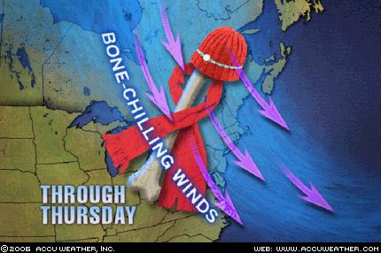
Graphic courtesy of Accuweather
The Weather Channel reported that on January 25th "Strong winds behind a departing low will continue to affect the Northeast with gusty winds as high as 40 mph through Thursday (Jan 26) in some locales. Lake-effect snow will be falling across Northeast Ohio, Northwest Pennsylvania and Western and Northern New York state where some locations will see as much as 6-12" of snow into Thursday."
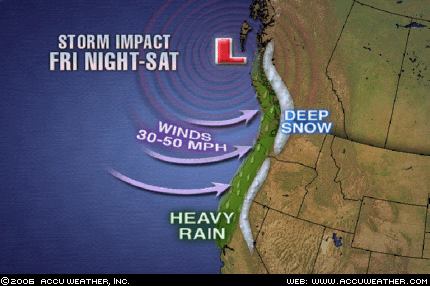
Graphic courtesy of Accuweather
The Weather Channel reports today that "A moisture-ladened Pacific storm is crashing ashore this morning along the coastal areas of the Pacific Northwest. The storm is packing plenty of wind, heavy rain and snow. Winds along coastal Oregon gusted late last night and this morning between 60 and 90 mph. Cape Blanco, Ore. has consistently gusted over 80 mph this morning. Precipitation should slide down into California and a winter storm warning is in effect for the Lake Tahoe area where at lake level 3 to 6 inches of snow is expected combined with winds gusting to 50 mph. Winds could gust to 120 mph over the ridge tops of the Sierra and 80 mph through the foothills of western Nevada."