Monday, April 18, 2016

April 6-10, 2016 Forecast Results

On March 16, 2016, I posted some long-range weather forecasts for April of this year. The first one was for the period between April 6-10. Here's the original forecast.

Forecast
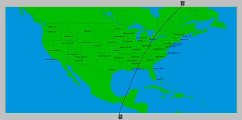
Between these dates the Sun will participate in the Jupiter-Uranus configuration adding important energy to the mix. The potential exists for a strong front to move into the West Coast states bringing precipitation. The eastern portion of the country should see a strong cold front that ignites storm activity from the eastern Great Lakes through the Mid-Atlantic area as it moves eastward.

Results
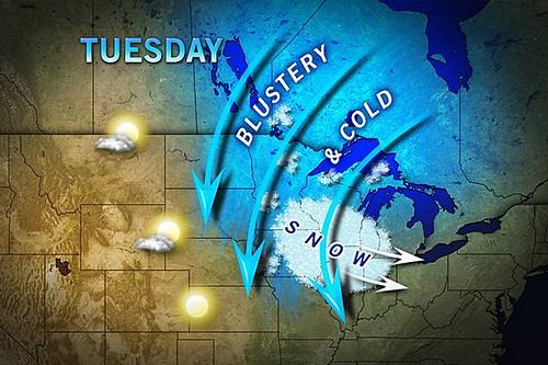
The strong cold front forecast over the eastern portions of the country arrived as scheduled. Here's the AccuWeather map showing the arctic push between the 7th and 10th.


07 When Will It Warm

AccuWeather also reported that the cold threatened significant losses of fruit crop in the northeastern U.S. and high winds for the New England area.

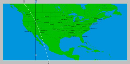
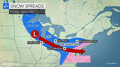
In addition, the forecast called for storm activity from the eastern Great Lakes through the Mid-Atlantic area. The next AccuWeather map shows that storm system on the 8th and 9th.

07 Snowy wintry mix

Forecast
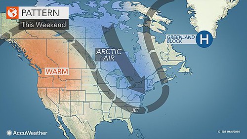
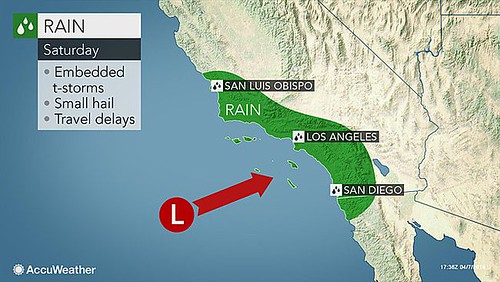
For the West Coast, the forecast mentioned a strong front bringing precipitation. On the 8th, AccuWeather meteorologists warned "Storm to soak San Diego to San Francisco this weekend." The storm was forecast to roll onto the California coast, threatening to bring flash flooding, gusty thunderstorms and travel delays. The AccuWeather map below shows the areas to be affected.

08 San Diego

The National Weather Service reported that another upper-level low would move in over the Pacific Northwest affecting Southern California and the Southwest. The low then remained nearly stationary from southern Idaho to the southern Rockies bringing numerous showers over the Desert Southwest and California.


Links to Other Long-range Weather Forecasts and Forecast Results

May 2016 Long-range Weather Forecasts 
April 2016 Long-range Weather Forecast 
Hurricane Dolores Fulfills Long-range Weather Forecast
Hurricane Season 2015 Long-range Weather Predictions
Tropical Cyclone Hadi
Hurricane Erick Fulfills Long-range Forecast
Tropical Storm Andrea Fulfills Long-range Forecast!
Timing the Relief for Drought-Stricken U.S. Plains
Testing Astrometeorology Part 2
Hurricane Sandy Fulfills Long-range Weather Prediction!
Testing Astrometeorology Part 1
Hurricane Season 2011 Forecast Results
Hurricane Risk-Management
New Weather Alternative Website
Fulfilled Long-range Forecasts for Hurricane Season 2010
Introduction to the Weather Alternative

Ex-Christian Defends the Existence of the Historical Jesus


Saturday, April 02, 2016

May 2016 Long-range Weather Forecasts

About six times a year the Sun and Mercury form a conjunction. A conjunction is when two or more celestial bodies are located along the same celestial longitude when observed from the earth. About 3 of those conjunctions occur when Mercury is in retrograde motion. This means that Mercury appears to be moving backward in the sky. In astro-meteorology, these conjunctions with a retrograde Mercury are known to excite windy, stormy conditions and cold fronts.

May 8-13, 2016

On May 9th of this year, we have one such conjunction. Our key chart for the spring season places the Sun and Mercury over the eastern Plains roughly from Texas through Missouri to the western Great Lakes. Another important chart is the solar eclipse chart of May 9, 2013. The Sun-Mercury conjunction will fall exactly on this degree. The astro-locality map below shows the area to be affected which lies over the eastern central portion of the US. Taken together the US midsection should feel the effects of the conjunction.

Sun Mercury May 2016

To get an idea of what actually can happen during one of these conjunctions, we can look at the weather pattern formed over the US Midwest on March 5, 2013 when a Sun-Mercury conjunction took place with a retrograde Mercury over the eastern Plains and Mississippi Valley. A winter storm affected the area with heavy snow and then high winds disrupted travel. Here's the AccuWeather map for that day.

04 Minneapolis

So we should expect a strong cold front or storm system bringing windy conditions to the area from the eastern Plains through the east central US.

May 12-15, 2016

Another interesting setup is the Mercury-Venus conjunction of May 13th. Mercury is still retrograde at this time. One of our key charts places Mercury, Venus, and the Moon over the Rocky Mountains and Great Basin areas of the US as seen in the map below.

Mercury Venus May 2016

The last time a Mercury-Venus conjunction affected the US West was on August 6, 2015. At that time the National Weather Service reported an increase in temperatures over the area and an upper level disturbance crossing California and the Intermountain West which increased showers and thunderstorms. We may expect a similar increase in temperatures and in shower and thunderstorm activity at this time.


Links to Other Long-range Weather Forecasts and Forecast Results

April 2016 Long-range Weather Forecast 
Hurricane Dolores Fulfills Long-range Weather Forecast
Hurricane Season 2015 Long-range Weather Predictions
Tropical Cyclone Hadi
Hurricane Erick Fulfills Long-range Forecast
Tropical Storm Andrea Fulfills Long-range Forecast!
Timing the Relief for Drought-Stricken U.S. Plains
Testing Astrometeorology Part 2
Hurricane Sandy Fulfills Long-range Weather Prediction!
Testing Astrometeorology Part 1
Hurricane Season 2011 Forecast Results
Hurricane Risk-Management
New Weather Alternative Website
Fulfilled Long-range Forecasts for Hurricane Season 2010
Introduction to the Weather Alternative