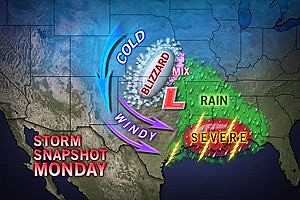
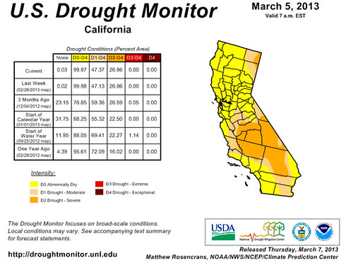
In a recent Accuweather post entitled Concerns
Mount for California Water Shortage, Jillian Macmath informs us of a
possible upcoming water shortage for California if there is below-normal
precipitation going into the spring season. November and December of last year
resulted in an above-average water supply for northern California, but January
and February were the driest combined months on record. Meteorologists are
concerned that the spring season may be a dry one and thus worsen the
situation.
Looking back at the planetary influences at work in
January and February, we can see the reason for the dryness of those two
months. Basing our investigation off the key season chart, we see that from
January 10th through the 20th, Mars, the planet of heat
and dryness was transiting over the Golden State. Then between the 25th
and 31st of January, Mercury, another planet associated with high
pressure, passed over California. The Sun also transited across the state from
January 30th till February 10th in the sign
Aquarius—another dry sign.
This spring, the seasonal chart places Saturn in
Scorpio just off the West Coast. Although Saturn is not the only player
involved in formulating a long-range forecast, it would be beneficial to know
if aspects to Saturn coincide with precipitation. The last time Saturn
transited Scorpio was during 1982-84. Doing a little research, I found that
there’s good evidence to support the idea that Saturn in Scorpio does bring
some precipitation. The current seasonal chart for this winter also placed
Saturn in Scorpio over California. I found that hard aspects to Saturn by other
planets did coincide with rain events. In looking at different charts for the
spring season in California, I discovered that other astrometeorological events
such as another transit of Mars over the state and the Sun’s conjunction to Mars
apparently will outweigh the Saturn factor. Below are some of the dates these
important aspects take place. So in conclusion, the spring season does look
predominantly dry.
Forecast
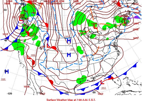
March 22
Around this date, a stormy and windy system is indicated over southern California that may bring precipitation.
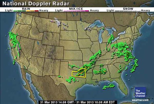
March 31
In and around this date, another storm system is indicated over southern California.
April 13-25
During this period, Mars transits over the state of California in the Full Moon chart. This usually coincides with a dry period.
April 17
Specifically around this date, the Sun conjoins Mars and is localized over California in the Full Moon chart. This corresponds to warmer temperatures and dry conditions. At times, storms can ensue after the heat.
April 22
At this time one of the above mentioned aspects to Saturn takes places. We should see a front or low pressure area form off the U.S. West Coast, which may bring precipitation inland.
April 27
At this time Mars triggers the Full Moon chart increasing heat and dryness. Sometimes this results in storms being generated after the heat.
April 28
Around this time, the Sun will oppose Saturn off the U.S. West Coast bringing a front or low pressure system there. The opposition should also affect areas of southeastern California.
May 1
A vigorous low pressure area or front forms around now and moves inland bringing stormy conditions.
May 3
Warm and dry conditions with the possibility of increased wind velocities are indicated in and around this date.
May 5-20
In another key chart, Mars will transit across California now bringing warm and dry conditions.
May 7-8
Mercury's aspect to Mars will bring and warm and dry atmosphere with increased wind velocities around this time.
May 11
The Sun's conjunction to Mercury is known to bring high pressure, which we should expect around this date.
May 12-31
The majority of aspects at this time indicate fair weather with not much chance of rain.
June 3
Due to an aspect involving Saturn, somewhat cooler weather and higher humidity may be expected but this is not necessarily a rainmaker.
June 7-8
Mercury makes some important aspects to Uranus and Pluto. This may bring an anomalous weather pattern to the Pacific Northwest and California. It may mean stormy or windy conditions or perhaps extremes of cold before and after these dates.
June 12
Around this time a cold front lowers temperatures and perhaps triggers a little precipitation.
June 13-20
The rest of the season appears to be mostly dry.
Timing the Relief for Drought-Stricken U.S. Plains
Testing Astrometeorology Part 2
Hurricane Sandy Fulfills Long-range Weather Prediction!
Testing Astrometeorology Part 1
Fall Weather 2012: Eastern U.S.
Fall Weather 2012: New England
Fall Weather 2012: Central U.S.
Fall Weather 2012: The U.S. West Coast
Mars Conjunct Saturn August 15, 2012
Jupiter-Neptune and Heavy Rain
Long-range effects of the May 20, 2012 Solar Eclipse
Long-range effects of the May 20, 2012 Solar Eclipse Part 2
Hurricane Season 2011 Forecast Results
Hurricane Risk-Management
New Weather Alternative Website
Overview of UK Winter 2012-13
The Winters of 2011-14
Fulfilled Long-range Forecasts for Hurricane Season 2010
Introduction to the Weather Alternative
 Dr. Craig's response to atheist mom's article on CNN