Friday, October 30, 2009

Thanksgiving 2009 Forecast

The Weather Alternative long-range weather forecast based on planetary cycles for November 23-27, 2009.


West U.S.

Forecast
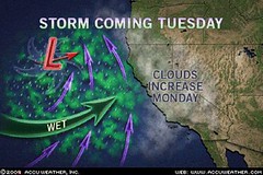
Most charts coincide with a storm system moving through the Pacific Northwest into the Intermountain West on the 23rd and 24th. The coastal Pacific Northwest might get some pleasant weather on the 25th, but further inland over the Intermountain West the 26th and 27th looks stormy.

Plains

Forecast
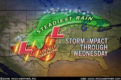
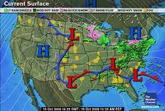
The 23rd starts with moist air being drawn up over Texas and the southern and eastern Plains initiating storms. Cooler air is drawn southward at this time over the Rockies triggering storms along the Front Range area. Around the 24th, the southern Rockies area centering around New Mexico will have unsettled weather. More cooler Canadian air makes it way southward on the 25th and 26th over the Northern Plains and then meets with moist air creating storms over the Plains.


Mississippi Valley

Forecast
The mid-Mississippi Valley area in and around Missouri shows a low pressure area or front bringing rain around the 24th. By the 25th and 26th this develops into more rainy weather for the Mississippi Valley.
East U.S.

Forecast
On the 23rd, a front is indicated running the length of the East Coast from Florida through New York generating showers. On the 24th, with more moisture being funneled up over Florida and the Southeast, storms are indicated over the area in and around North Carolina and Virginia. Fair conditions seem to make it into the Southeast, Mid-Atlantic, and Northeast by the 25th and 26th.

New England

Forecast

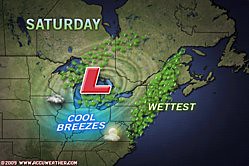
The 26th and 27th are very stormy over the New England area. Indications of severe weather in the lunar eclipse chart of August 5, 2009 will be activated now. The last time these were triggered tropical rainstorm Danny gave a glancing blow to the New England area bringing winds gusting between 40-60 mph and flash flooding due to torrential rainfall that dropped between 2-5 inches of rain. Yikes!

Introduction to the Weather Alternative

How Long-Range Forecasts Are Made

Solar Eclipse Action October and November 2009

Here's an interesting video clip on the polar bear photo used by Global Warming advocates. You know, the one with the polar bears floating on the ice.

Saturday, October 24, 2009

More October 2009 Forecast Results

Here are the results of a number of long-range weather forecasts for various dates in October. The first was for October 21-24, 2009. The forecast was posted on June 16th of this year.

Forecast
October 21-24, 2009: The transit Sun will make it’s first square to the eclipse degree. The Rockies once again should see a front triggering storms or low pressure area.

Results
The Accuweather map above is for October 21st showing a low pressure system over the southern Rockies. Heavy snow buried the mountains of southern Colorado and northern New Mexico. Seventeen inches of snow fell near Cuchara, Colorado. Other portions of Colorado received between 4 to 15 inches.


Another Weather Alternative forecast posted back in June is the following:

Forecast

Oct 22-25, 2009: Saturn conjoins the solar eclipse along 88 west longitude, which is roughly the Mississippi Valley area. Since the Gulf of Mexico, and Central America are also affected, this should be a time of strong storms and possible hurricane activity there.

Results

The Weather Channel map (above right) is for October 22nd and shows a strong low pressure area and front affecting the Mississippi Valley. Accuweather reported the area was hit with drenching rain. Moisture from Hurricane Rick enhanced the torrential downpours.


The forecast also mentioned possible strong storms or hurricane activity in the Gulf of Mexico and Central America.

Nothing tropical developed in the Gulf but, as shown in the Accuweather Map at left for October 22nd, an area of low pressure formed in the southwestern Caribbean causing heavy rain and thunderstorms across Costa Rica, Nicaragua, and Honduras.


Another forecast for eastern Texas read as follows:

Forecast

Oct 23-24, 2009 ...the weather over eastern Texas at this time should include storms that generate strong winds be they from a tropical system, tornadoes, or severe thunderstorms etc.

Results

As shown in the Accuweather map for the 22nd (a day before my forecast) eastern Texas was getting flooding downpours. There were tornadoes and damaging wind gusts. (See below)

Accuweather, Oct 22nd: In only 3 hours, 4.29 inches of rain poured down and inundated Fannett, Texas, on Thursday. Arkadelphia, Ark., had 5 inches of rain. High floodwaters stranded motorists and kept firefighters busy with high water rescues. Water was up to windows of cars in Beaumont, Texas. Some communities located along swollen bodies of water had flooding. Many homes and businesses were flooded by up to a foot of water in Farmerville, La. Some of the storms became severe and produced damaging wind gusts on top of the heavy downpours. Tornadoes touched down in the Cameron and Jefferson Davis Parishes of Louisiana during the midday and afternoon hours.


This next forecast was posted in September.

Forecast

Oct 24-26, 2009 Moisture is drawn up over the Plains resulting in storms over the Dakotas and Nebraska.

Results

From Accuwether October 24:

The latest storm system will put a damper on some outdoor plans through Monday (Oct 26) as it spreads rain from the Dakotas and Nebraska to the Great Lakes and Ohio Valley.
The rain will mix with or change over to snow on the western fringe, including in places like Scottsbluff, Neb., Rapid City, S.D., and Bismarck, N.D., through Sunday. Several inches could accumulate in the Black Hills of South Dakota by Sunday.

Introduction to the Weather Alternative

How Long-Range Forecasts Are Made

Solar Eclipse Action October and November 2009

Is Obama Poised to Cede US Sovereignty? Check out these comments by Lord Christopher Monckton

Monday, October 19, 2009

Recent Forecast Results for October 2009

Here are the results of three recent long-range weather forecasts posted here on The Weather Alternative. The first forecast, posted on June 16, 2009 was for possible tropical storm formation in the western Atlantic (around 52 west longitude and 15 north latitude) between Oct. 11-14, 2009.

On Oct 13, the National Weather Service reported the following:

TROPICAL WAVE EXTENDS FROM 14N 4W TO 8N 6W MOVING W NEAR 15 KT....AS THE WAVE CURRENTLY INTERACTS WITH AN UPPER LEVEL LOW CENTERED NEAR 15N 5W...SCATTERED MODERATE CONVECTION IS FROM 8N-14N BETWEEN 52W-59W.


The next forecast was for October 14-17. The conjunction of Mars to the July 21, 2009 solar eclipse degree was forecast to generate storms over the Rockies. As can be seen from the Weather Channel map at left for Oct 16, no storms resulted. High pressure brought warm and dry air to the region. Why I thought storms, I can't figure out. Mars is historically the author or hot and dry conditions, which was exactly what was experienced.


The last forecast was for Oct 16-17, 2009, which was to bring a low pressure area to eastern Texas. The Weather Channel map at right for October 15th, shows a low pressure system over Texas and a front over eastern Texas, which hit a day earlier than anticipated.

Introduction to the Weather Alternative
How Long-Range Forecasts Are Made
Solar Eclipse Action October and November 2009
A Few More Forecasts for October 2009
October 2009 Severe Weather Outlook for Eastern Texas


"To one who has faith, no explanation is necessary. To one without faith, no explanation is possible."--Thomas Aquinas (1224-1274), philosopher and theologian

Just for Fun

Four Catholic men and a Catholic woman were having coffee. The first Catholic man tells his friends, "My son is a priest. When he walks into a room, everyone calls him 'Father'."
The second Catholic man chirps, "My son is a Bishop. When he walks into a room people call him 'Your Grace'."

The third Catholic gent say s, "My son is a Cardinal. When he enters a room everyone says 'Your Eminence'."

The fourth Catholic man chirps, "My son is the Pope. When he walks into a room people call him 'Your Holiness'."

Since the lone Catholic woman was sipping her coffee in silence, the four men give her a subtle, "Well....?" She replies, "I have a daughter. She is slim, tall and 38D-24-36. When she walks into a room, people say, 'Oh My God'."

Wednesday, October 14, 2009

October 12-15, 2009 Forecast Results

The long-range astrometeorological forecast for October 12-15, 2009 was posted here on The Weather Alternative on June 16 of this year.


The first part of the forecast stated:


Solar Eclipse of March 18, 2007

October 12-15, 2009: The Venus-Saturn conjunction on the 13th will oppose the solar eclipse degree off the US West Coast at 129 west. Venus and Saturn are parallel on the 12th. The eclipse was square Pluto. This may bring a strong storm system into the US west coast and/or tropical activity along 128 west in the tropical regions.


No tropical activity was reported but on Tuesday, Oct. 13, a major storm system slammed into the U.S. West Coast unleashing torrential rainfall and producing tropical storm-force winds across California. Among the hindrances caused by the storm are mudslides and flooding, airport delays, and potential power outages.


In part, the storm is made up of the remnants of Typhoon Melor, which struck Japan late last week. Some locations along California's central coast have picked up 4 inches of rain. Many other places have had rainfall totals of 1.5 to 3 inches. The storm is one of the strongest to hit the area in decades.

Introduction to the Weather Alternative

How Long-Range Forecasts Are Made

Solar Eclipse Action October and November 2009

A Few More Forecasts for October 2009

October 2009 Severe Weather Outlook for Eastern Texas

Got Flu Vaccine?

Flu vaccines revealed as the greatest quackery ever pushed in the history of medicine

Monday, October 12, 2009

October 10-12, 2009 Forecast Results

The Weather Alternative's long-range forecast for October 10-22, 2009 was posted 17 days beforehand. The forecast described a storm system pushing through the Plains and a low pressure system tracking to the south affecting eastern Texas and Oklahoma as it continued into the Mississippi Valley and the Southeast.

The low over eastern Texas and Oklahoma hit a day earlier (Oct 9th) than forecast. Thunderstorms over southeastern Texas were expected to turn severe. Three inches of rain were common across east Texas and Oklahoma.

Today, Oct 12, heavy rain is expected across the Southeast as Gulf moisture overrides a stalled frontal boundary.

Introduction to the Weather Alternative
How Long-Range Forecasts Are Made
Solar Eclipse Action October and November 2009
A Few More Forecasts for October 2009
October 2009 Severe Weather Outlook for Eastern Texas

Vaccine revolt! Swine flu vaccine support crumbles

Tuesday, October 06, 2009

October 3-5, 2009 Forecast Results

The Weather Alternative long-range forecast for October 3-5, 2009 was posted on September 22nd.


The forecast read as follows:


Oct 3-5, 2009 Stormy conditions are shown for the northern Plains. A low pressure system, perhaps an Alberta Clipper, affects the Great Lakes area as it moves into the Northeast. Another low pressure system or front affects the Delmarva Peninsula.


The Accuweather map above is for Oct 5th and shows a low pressure system hitting the northern Plains. The storm system spread a cold, soaking rain over the northern Plains into the Upper Midwest. Three to six inches of snow was expected as well over the Black Hills, Buffalo, S.D. , and Bowman and Dickinson, N.D.


The same forecast called for a low pressure system, perhaps and Alberta Clipper, to affect the Great Lakes area and Northeast. Another low or front was to affect the Delmarva Peninsula.

The Accuweather map at right is for Saturday, October 3rd. A low pressure system sits squarely over the Great Lakes area as it moves toward the Northeast. The rain extends down over the Delmarva Peninsula as well.

Introduction to the Weather Alternative

How Long-Range Forecasts Are Made

Solar Eclipse Action October and November 2009

A Few More Forecasts for October 2009

October 2009 Severe Weather utlook for Eastern Texas


The Art of Praise
There is a very basic courtesy that should apply in all human relations--taking the time to thank people who help us. My friend Mike Somdal is a specialist at this. One reason he is so successful in business is that he has mastered the fine art of making people feel good by thanking them regularly. Often he will call customers simply to thank them again for the order they placed last week or for the recommendation they made to another customer, or for the lunch. Anything. And before the conversation is over, Mike has often secured another order. Of course, if he called simply with ulterior motives, his clients would recognize the manipulation and resist. But Mike has made gratitude a lifelong habit, and those of us who do business with him appreciate that quality. And we respond.


The art of praise--what is known as positive reinforcement in the current psychological jargon--is an essential art for an executive or teacher [or anyone dealing with people] to master. If there is a complaint employees most often express, it is this: "I never get any feedback from the boss--except when something goes wrong." And the teenagers who sit in my office tell me again and again, "My dad gets all over my case when I mess up at school, but when I bring home a good grade he acts as if it's nothing--that I'm finally doing what I should have been doing all along." Stop and think. How long has it been since you took a full 60 seconds to talk to your son or daughter about some fine thing they've just done? Or your secretary, or the managers who work under you?


When someone comes along who genuinely thanks us, we will follow that person a very long way.--Alan Loy McGinnis

Friday, October 02, 2009

October 2009 Severe Weather Outlook for Eastern Texas


The Full Moon of October 4th, 2009 sets up a sensitive planetary crossing over eastern Texas. Here we find the Sun, Moon, and Mars in angular positions. As explained many times on The Weather Alternative blog, when planets are in these angular positions they manifest their influence on the weather in and around that location.


There are three sets of dates when there will likely be a manifestation of severe weather over this area which includes eastern Texas, Oklahoma, Louisiana, and Arkansas. The first time period was brought out in a previous post. It read as follows:


Oct 10-12, 2009
A storm system pushes through the Plains. The low pressure system may track to the south affecting the area in and around eastern Texas and Oklahoma as it pushes into the Mississippi Valley and Southeast.


Oct 16-17, 2009
The planetary crossing is activated once again and should result in a low pressure system affecting the area.


Oct 23-24, 2009
This third time slot also coincides with another forecast posted earlier calling for tropical storm or hurricane formation in the central Gulf of Mexico between October 22-25. One possible scenario is that the severe weather indicated for the eastern Texas area is related to the Gulf of Mexico forecast. This could mean that if a storm forms in the Gulf it could head to the Louisiana, eastern Texas, Arkansas, and Oklahoma region. Of course, it could play out differently as sometimes the weather indicated by these different planetary alignments are not describing one event but separate events. In any case, the weather over eastern Texas at this time should include storms that generate strong winds be they from a tropical system, tornadoes, or severe thunderstorms etc.


Introduction to the Weather Alternative
How Long-Range Forecasts Are Made
Solar Eclipse Action October and November 2009
A Few More Forecasts for October 2009


Change


Change is the wind catching you—the kite—and sending you soaring into the sky. My wind of change is always there, you just have to be in position for it, and charge into it with your whole heart. At first, change may not look like it’s helping, as it buffets and bounces you around, but as you face it head-on—accepting it wholeheartedly—it will lift you high.


I hold your kite strings, and I know just when to pull you forward into the winds of change and when to let them carry you along for a while. You just have to keep facing the wind and you’ll feel the thrill of riding high, even when there’s nothing visible to support you.


Close your eyes and feel the wind as I point you ever upward. It’s time to fly once more!