Click here for long-range forecasts for
November 2005.
October 13-15, 2005
A
strong cold front will push across the
eastern US lowering temperatures and exciting
gusty winds. There is a possibility that the front will interact with a
tropical system in the
eastern Gulf of Mexico around 84 West Longitude and 25 North Latitude threatening the
Florida Panhandle and
eastern Gulf States.
The
Mississippi Valley will see
stormy conditions while the
West Coast gets a shot of
colder air and
windy weather that moves into the
Great Basin.
October 14-15, 2005
A developing
storm will take aim on the
New England area as moisture is drawn up from the south and interacts with colder Canadian air.
Tropical moisture heads toward the
Yucatan of Mexico resulting in
heavy rain.
October 15-18, 2005
Tropical storm formation or passage is indicated in the
northwestern Gulf of Mexico around 94 West Longitude and 26 North Latitude. Long-range forecast models show that the coastal areas of
eastern Texas and
western Louisiana will most likely feel the effects of this tropical influence.
Extreme
southern Mexico, around the State of
Oaxaca should experience
heavy rains due to an influx of tropical moisture.
Tropical storm formation seems likely
north of Haiti near 72 West Longitude and 22 North Latitude. The island itself should feel the effects of
tropical downpours at this time.
October 20-21, 2005
Relative
humidities will
increase over the
Mississippi Valley and
eastward. This may result in
fog potential or
lower barometer resulting in
precipitation.
The potential for
tropical downpours is indicated over the southern Mexican State of
Chiapas.
October 22-23, 2005
What appears to be a
powerful storm system will leave its mark over the
Four Corners region of the
Rockies and
Nevada as it brings
gusty winds and
rain to the region.
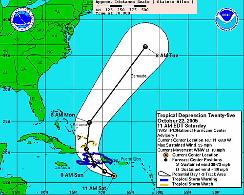
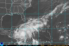
October 25-26, 2005
The inhabitants the
Dominican Republic should prepare for possible
tropical storm or
hurricane passage as the area just south of there (69W/17N) has the potential to attract a low pressure system.
In the
eastern Pacific, the area in and around
120 West Longitude and
15 North Latitude (about 850 miles southwest of Cabo San Lucas) is another potential area for
hurricane or
tropical storm genesis.
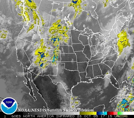
October 28-30, 2005
As
cold air pushes through the
Northeast US,
storm conditions will develop over
Maryland,
Delaware, and surrounding States.