These long-range forecasts were posted in April 2010.
ForecastAugust 2-3, 2010Intense storms are expected throughout the East Central, Northeast, Mid-Atlantic, and Southeast. These storms may bring damaging winds, hail, or tornadoes. It is possible that a tropical system makes landfall over the
Carolinas.
Results
Except for a few gusty thunderstorms with heavy downpours in the Southeast, the main intense weather during this period was from the heat.
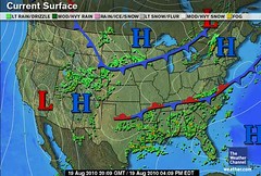
ForecastAugust 7-10, 2010
Venus will now activate the alignments between Jupiter, Saturn, Uranus, and Pluto. Since these are placed roughly between 79 and 81 west longitude, the Southeast and Mid-Atlantic areas are in for a round of severe weather. This may indicate tropical activity affecting the Florida Peninsula and the
Carolinas. These planetary alignments also have the potential to affect Cuba and Panama.
Results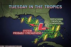
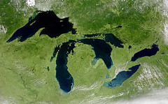
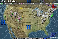
The main weather event at this time was heavy rain over Florida on the 8
th, 9
th, and 10
th. Above is the
Accuweather map for the 10
th when a non-tropical low pressure system spread 1 to 5 inches of rain south of a line from
Daytona to Tampa.
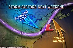
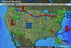
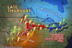
ForecastAugust 14-18, 2010The eastern Plains and Mississippi Valley are likely to be under severe weather threats now. This could manifest as powerful storms producing large hail, gusty winds, and tornadoes. A tropical system or abundant tropical moisture may affect the eastern Texas and Louisiana area.
Further east, heavy rainfall is indicated for the Mid-Atlantic area either due to tropical moisture being introduced over the area or from an actual tropical system that enters through the
Carolinas.
Resutls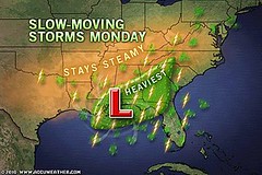
The remnants of Tropical Depression 5 lingered over the central Gulf Coast during this forecast period and and brought heavy showers and drenching downpours fulfilling the long-range forecast.
This was also a rough period for the Plains and Mississippi Valley. Here are some
Accuweather headlines that appeared during the forecast period.
Aug 14:
More Rounds of Severe Weather Loom for the MidwestAug 16:
Gusty Storms Loom for the Central PlainsAug 17:
Wichita, Oklahoma City Brace for Damaging ThunderstormsThe Mid-Atlantic was also hit as indicated in the forecast. Here are more
Accuweather headlines.
Aug 18:
Flooding Rain Threatening Washington, D.C., TodayUp to 2 inches of rain is expected across the mid-Atlantic into this evening.
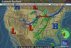
ForecastAugust 18-22, 2010Planetary alignments at this time suggest very volatile atmospheric conditions that will put the eastern Plains and Mississippi Valley at risk for severe weather. Dangerous thunderstorms and/or tornadoes are indicated in and around Missouri. This may be due to a tropical system that makes landfall over eastern Texas or Louisiana.
The Southeast and Mid-Atlantic are not out of harm’s way either. There are indications that suggest tropical storm or hurricane activity over the
Carolinas at this time or at least some kind of severe weather system if not actually tropical in nature.
ResultsMuch of this forecast was covered in a
recent post.The Southeast was hit on the 19
th. The Weather Channel headline read:
Heavy rain and flood threat for SouthShowers and thunderstorms should fire up along and south of a stationary boundary that stretches from southern Virginia west-southwestward to central Texas.
The heaviest rain should fall across eastern Tennessee and North Carolina today. Average rainfall in those two states should be around an inch, but a few areas could pick up 2 to 3 inches.
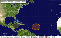
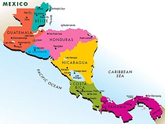
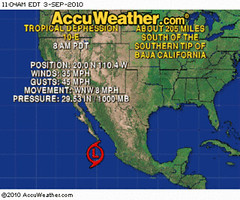
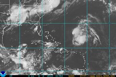
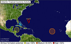
Experimental Forecasts Part 2- July-Sept 2010Tropical Storm Alex Fulfills Long-range Prediction!Bonnie Fulfills Long-range Forecast!Experimental Forecasts July & August 2010Hurricane Season 2010--Caribbean, Mexico, Central America
Hurricane Season 2010--Forecast for SeptemberHurricane Season 2010--Central America Part 2 Introduction to the Weather AlternativeHow Long-Range Forecasts Are Made Sure there are dishonest men in local government. But there are dishonest men in national government too.
Richard M. Nixon
37
th president of US (1913 - 1994)