Thursday, August 31, 2006

More Fulfilled Hurricane Predictions

Click here for September 2006 Hurricane and Severe Weather Outlook.

Click here for August 2006 Hurricane and Severe Weather Outlook.

Besides accurately predicting the time and place of Ernestos' landfall (click link), a close Weather Alternative forecast for hurricane activity over the Baja California is being fulfilled.
Hurricane John will begin to affect the Baja tomorrow. (These forecasts were prepared in December 2005)

The forecast read:

Aug. 28-30:

Tropical storm formation is possible over the central Baja Peninsula.

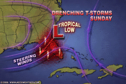
Today the Weather Channel reported:
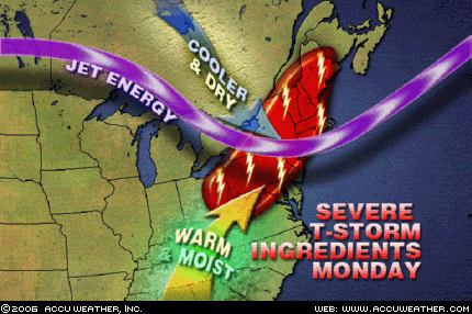
After its close encounter with Mexico's southwest Pacific coast, John will then head towards the southern Baja Peninsula by Friday afternoon remaining as a Category 3 hurricane. A hurricane warning is in effect for the Southern Baja Peninsula from Las Pas southward on the East Coast and from Santa Fe Southward on the West Coast. This does include Cabo San Lucas. Reports are indicating that 10,000 people have been evacuated in and around the Los Cabos beach resort in preparation for John's arrival.


Hurricane Kristy is the fulfillment of another long-range forecast published in the July issue of Dell Magazine (not posted on this blog).

The forecast read:

August 30-Sept 1:
A Hurricane Hot Spot in the eastern Pacific is likely to develop near 119 West Longitude and 16 North Latitude...

The National Weather Service reported on August 30th:

TROPICAL STORM KRISTY CENTERED NEAR 16.7N 115.1W AT 30/1500 UTC MOVING NW OR 305 DEG AT 5 KT.

Monday, August 28, 2006

Ernesto Fulfills Long-Range Prediction


Click here for September 2006 Hurricane and Severe Weather Outlook.

Click here for August 2006 Hurricane and Severe Weather Outlook.

The Weather Alternative Forecast for August 28-30, 2006 stated "Tropical troubles are still brewing over a broad area from western Cuba through western Florida and into Georgia and South Carolina." This forecast was prepared in December 2005 and posted on The Weather Alternative July 23, 2006.

Today Tropical Storm Ernesto is hitting southern Cuba. A Hurricane Watch has been issued for parts of mainland South Florida.

Sunday, August 27, 2006

August 19-22, 2006 Forecast Results

Click here for September 2006 Hurricane and Severe Weather Outlook.

Click here for August 2006 Hurricane and Severe Weather Outlook.

Forecast for August 19-22, 2006

These forecasts were developed during the first two weeks of December 2005.

Aug. 19-22:

Several atmospheric ingredients will come together over the Southeastern States from the Big Bend of Florida into Georgia creating a threat of severe weather. The threat will extend into the Ohio Valley as well. It is possible that this signifies a tropical system or at least abundant tropical moisture that drops heavy rain over the Southeast.

Results

August 19, 2006- Accuweather

The cold front that triggered these storms is steadily moving east and showers and strong storms are expected later today across the Ohio Valley and into the eastern Great Lakes.

August 19, 2006- Map by Accuweather


August 21, 2006- Accuweather

Drenching Southern Storms

(State College, PA) - The front that brought soaking rain to parts of the Northeast over the weekend is stalling in the South. AccuWeather.com is forecasting that showers and thunderstorms through the end of the week may lead to localized flooding problems.

August 16-18, 2006 Forecast Results

Click here for September 2006 Hurricane and Severe Weather Outlook.

Click here for August 2006 Hurricane and Severe Weather Outlook.

Forecast for August 16-18, 2006

These forecasts were developed during the first two weeks of December 2005.

Aug. 16-18:
A strong storm system is indicated over New England and the Canadian Maritimes as energy moving from the west interacts with a warm, moist air mass.

Results

Aug 19, 2006- Weather Channel (Storms arrived a day later than my forecast period)
Northeast

High pressure moving to the east will allow a storm system to approach from the west. Numerous showers and thunderstorms will spread across western New England and the Upper Ohio Valley today, along with the potential for an isolated severe thunderstorm or two, as well as heavy downpours and localized flooding.

Thursday, August 24, 2006

September 2006 Hurricane and Severe Weather Outlook

Click here for August 2006 Hurricane and Severe Weather Outlook.

Most of these forecasts were prepared in December 2005.

August 30-Sept 1:
Look for increasing moisture over the southern California coast resulting in foggy conditions or rain.
Storms will be active over the Rockies.

Sept. 2-5:
A potential Hurricane Hot Spot is activated off the eastern coast of Mexico in the Gulf around the 2nd or 3rd. At the same time, a broad area encompassing the central Caribbean, Cuba, Florida, and the Carolinas may be the breeding grounds for more tropical activity.

Sept. 3-5:
Changes are also underway for the West Coast States and the Rockies. Look for lower temperatures and windy conditions there. The New England area should expect strong storms that head to the Canadian Maritimes.
A tropical disturbance may flare up over the Bahamas.

Sept. 5-7:
More moisture is drawn up over southern California resulting in an increased chance of showers and thunder storms.
The Rockies warm up as winds from the south increase temperatures and precipitation.
Texas and the Plains at this time will deal with unseasonable heat that cranks up the storm machine over the area.

Sept 6-8:
Tropical troubles may be brewing for the island of Hispañola and surrounding areas.
The US East Coast will attract a tropical flow over Virginia and northward through the eastern Great Lakes. If not an actual tropical system, strong storms will drop heavy rain with the potential for flash flooding and bring windy conditions.

Sept. 8-9:
A stormy period continues for the U.S. West Coast and the Plains.

Sept. 12-14:
Gusty winds hit the Plains, and storms affect the Mid-Atlantic, Northeast and New England. These storms over the eastern U.S. should bring abundant moisture and cause flooding problems. The culprit may be a tropical system drawn up over North Carolina or Virginia.
Moisture increases over the southern California area. A front triggers showers and storms over the Rockies.
Heavy rain is indicated for the island of Hispañola, which may be due to some type of tropical system.

Sept. 14-16:
Tropical activity is shown for the area in and around Puerto Rico. Meanwhile, a new cold front hits the West Coast States dropping temperatures and increasing moisture.
The Mississippi Valley and eastward will be the focal point for windy and stormy conditions.

Sept. 16-17:
A potential tropical disturbance may get its act together over Cuba and Florida. A low pressure system will develop over the Front Range of the Rockies.

Sept 19-21:
Storm potential is shown for the island of Hispañola and the Mid-Atlantic through the Northeast.

Sept 20-22:
Heavy downpours are shown over the Florida Peninsula and western Cuba.

Sept. 21-23:
The U.S. West Coast shows severe weather in the form of extreme temperature changes and/or storms.

The insurgence of warm, moist air over the Gulf Coast States from Texas to Florida will act as a potential storm breeder on its journey northward into the central U.S.

Severe storms will break out over the Mid-Atlantic States and Northeast.

Sept. 23-25:
A tropical weather system may be brewing near the Dominican Republic and tropical moisture unloads over the Florida Panhandle.

Sept. 24-26:
A blast of cold air will assault the Mid-Atlantic and Southeast generating gusty winds and slashing temperatures.
A new Hurricane Hot Spot emerges for the fall portion of the hurricane season off the coast of Africa. The formation of a significant tropical system is possible now along the African West Coast around 18 West Longitude and 18 North Latitude, which should move westward toward 31 West-16 North.
Another danger spot is shown along the eastern Central American coast of Belize, Guatemala, and Honduras.
Noteworthy weather events are in store for the U.S. West Coast bringing abnormally wet conditions. Such will be the case for coastal California especially around the 26th when an influx of tropical moisture is drawn northward over the State from southern regions. The western Plains carry the potential for excessive humidity and abnormal rainfall to dominate now and move eastward through the Mississippi Valley.

Sept 26-28:
The potential for heavy rainfall is shown over the eastern US from the eastern Great Lakes southward to Virginia. Storms are indicated for the Plains.

Sept. 28-30:
The Central Gulf of Mexico may spawn a tropical disturbance that is drawn up over the Mississippi-Alabama costal area and into the Deep South. If not an actual tropical system, at the least tropical moisture should be funneled into the area from the Gulf. Rain is indicated over the Florida Peninsula. Low pressure may form off the Baja sending moisture over southern California.

Sept. 29-Oct. 1:
A tropical system may be indicated between Puerto Rico and the Lesser Antilles now.

Monday, August 21, 2006

August 14-15, 2006 Forecast Results

Click here for August 2006 Hurricane and Severe Weather Outlook.

These forecasts were developed during the first two weeks of December 2005.

Forecast

Aug 14-15:
Meteorological mayhem breaks out over the Southeast U.S. through the Ohio Valley as atmospheric elements combine over the area. One scenario shows a tropical system approaching the west coast of Florida and pushing inland with soaking rains. Another model suggests strong storms with damaging winds and flooding.

Results

August 14, 2006- The Weather Channel

A few severe storms Ohio Valley Monday

A stalled front off the coast of northeast Florida may drift slightly southward into an area of lower wind shear aloft over the next day or two. This could provide the opportunity for a tropical or subtropical low pressure system to develop somewhere along the front in the vicinity of enhanced thunderstorms over the Gulf Stream.


August 16, 2006- The Weather Channel

A flare-up of heavy showers associated with a low pressure center about 125 miles southeast of Myrtle Beach, S. C., is being monitored closely. Air force reserve Hurricane Hunters are tasked to investigate the disturbance this afternoon. It's possible a tropical depression could form later today or tonight if the convection--the heavy showers--persists. Upper-level winds are light (minimal wind shear) and the disturbance is near the Gulf Stream (plenty of warm water).

Sunday, August 20, 2006

August 11-13, 2006 Forecast Results

Click here for August 2006 Hurricane and Severe Weather Outlook.

There forecasts were prepared during the first two weeks of December 2005.

Forecast

Aug. 11-13:
Gusty winds will prevail along the West Coast with storm potential further inland.

Results

August 11, 2006- Accuweather

Farther south, it will continue to be active across the Southwest, mainly in Arizona, New Mexico and Colorado, as monsoonal moisture streaming into the area will spark the development of thunderstorms. Some storms will dump heavy rains that could create a threat of flash flooding.

AREA FORECAST DISCUSSION
NATIONAL WEATHER SERVICE MEDFORD OR
858 PM PDT SAT AUG 12 2006

.DISCUSSION...LITTLE CHANGE. WEAK 500 MB TROUGH EXTENDS FROM THE NORTHERN ROCKIES TO SOUTHERN OREGON. THERMAL TROUGH OVER NORTHERN CALIFORNIA IS PULLING SOME MODERATE NORTHERLIES DOWN THE SOUTH COAST. SHOULD AGAIN SEE BREEZY OFFSHORE WINDS ACROSS THE RIDGES OF SOUTHWEST OREGON WITH MARGINAL HUMIDITY RECOVERY TONIGHT.


AREA FORECAST DISCUSSION
NATIONAL WEATHER SERVICE MEDFORD OR
315 AM PDT SUN AUG 13 2006

.DISCUSSION...ONLY A FEW CHANGES NEEDED AFTER THE EVENING SHIFT
UPDATES. ABOVE NORMAL HIGHS LOOK GOOD THIS AFTERNOON AS THERMAL TROUGH POSITION SHIFTS FROM THE SOUTHERN OREGON COAST TO NEAR THE CASCADES THIS AFTERNOON. AIR MASS IS DRY AND STABLE TODAY. WILL SEE GUSTY WINDS ALONG THE COAST WITH STRONG HIGH PRESSURE OFFSHORE AND THE THERMAL TROUGH NOT FAR INLAND.

Wednesday, August 16, 2006

August 9-12, 2006 Forecast Results

Click here for August 2006 Hurricane and Severe Weather Outlook.

These forecasts were prepared during the first two weeks of December 2005.

Forecast

Aug. 9-12:

A tropical system may get its act together over Cuba and the Bahamas. Tropical moisture from this system or elsewhere should be pulled up over the Florida Peninsula and the Carolinas. Severe storms will develop over the Ohio Valley as well. Another hot spot for hurricane development is shown off the eastern coast of Mexico in the western Gulf around 96 West Longitude and 22 North Latitude.

Results

A tropical system may get its act together over Cuba and the Bahamas. Tropical moisture from this system or elsewhere should be pulled up over the Florida Peninsula nad the Carolinas.

South Florida rain

9:25 a.m. ET 8/9/2006
Senior Meteorologist, The Weather Channel

South
A tropical wave plus a weather system aloft combined to dump pockets of heavy rain on parts of southern Florida on Tuesday (8th) and more rain is likely into Wednesday (9th). Look for some localized flooding, especially on streets.


Tropical wave eyes Florida

5:55 a.m. ET 8/9/06
Matthew Newman, Sr. Meteorologist, The Weather Channel

A tropical wave over the Bahamas is interacting with an upper low near southern Florida may produce pockets of heavy rain for southern Florida.

August 11, 2006- The Weather Channel

One area to watch however will be off the eastern Carolinas where a front is expected to stall. While unlikely, stalled fronts in these areas can sometimes generate areas of low pressure.

Severe storms will develop over the Ohio Valley as well.

August 10, 2006- Accuweather

Before the drier air pushes into the Ohio Valley, a strong disturbance moving through the Plains and western Midwest states will spark another round of severe thunderstorms across these areas today…By Saturday (12th), the Ohio Valley will be rid of the storms…

Another Hurricane Hot Spot is shown off the eastern coast of Mexico in the western Gulf around 96 West Longitude and 22 North Latitude.

August 11, 2006- NWS

...DISCUSSION...
GULF OF MEXICO...
THE UPPER LEVEL LOW REMAINS IN THE W GULF NEAR 25N95W COVERING
THE AREA W OF 86W…

August 11, 2006- Mexican Weather Bureau

Vaguada en el Golfo de México
Del 11 al 16 de agosto

El sistema se encuentra en el Norte del Golfo de México, avanzará hacia el Oeste y se espera que alcance la costa de Tamaulipas a partir del día 11. Entrará a tierra el día 12, originando una amplia zona de inestabilidad, misma que estará asociada a tiempo severo en el Noreste de México.

A rough translation of the above states that a low pressure system in the northern Gulf of Mexico will move toward the West affecting the coast of Tamaulipas on the 11th. The low pressure system will then be over land on the 12th bringing an unstable air mass, which will be associated with severe weather in the northeast of Mexico.


Monday, August 07, 2006

August 6-7, 2006 Forecast Results

Click here for August 2006 Hurricane and Severe Weather Outlook.

This forecast was developed during the first two weeks of December 2005.

Forecast

Aug. 6-7:
The coastal areas from Virginia and North Carolina through New England are in for some severe weather in the form of storms producing wind and rain.

Results

August 6, 2006-Accuweather


The Northeast is primed for strong to severe thunderstorms Monday...Storms will produce heavy downpours, damaging winds and large hail, with an isolated tornado possible.

August 7, 2006- The Weather Channel

Northeast
Scattered showers and thunderstorms, some severe, will gallop through the Northeast today in advance of a Canadian cold front. Gusty winds will prevail as the front approaches, and winds in some of the storms could be quite strong.

August 7, 2006- National Weather Service
BULLETIN - IMMEDIATE BROADCAST REQUESTEDSPECIAL MARINE WARNING
NATIONAL WEATHER SERVICE
WAKEFIELD VA629 AM EDT MON AUG 7 2006

THE NATIONAL WEATHER SERVICE IN WAKEFIELD HAS ISSUED A* SPECIAL MARINE WARNING FOR... CHESAPEAKE BAY FROM WINDMILL POINT TO NEW POINT COMFORT VA CHESAPEAKE BAY FROM SMITH POINT TO WINDMILL POINT VA

SPECIAL WEATHER STATEMENT
NATIONAL WEATHER SERVICE
WAKEFIELD VA851 AM EDT MON AUG 7 2006

ACCOMACK VA-INLAND WORCESTER MD-MARYLAND BEACHES MD-NORTHAMPTON VA-851 AM EDT MON AUG 7 2006

...THUNDERSTORMS MOVING THROUGH THE EASTERN SHORE...

Thursday, August 03, 2006

July 31-August 2 Forecast Results

Click here for August 2006 Hurricane and Severe Weather Outlook.

These forecasts were calculated between November 16, 2005 and November 28, 2005.

July 31-August 2 Forecast:
Tropical storm or hurricane development is now likely east of the Lesser Antilles. New England is also slated for more severe weather now.

Results (Bold text, mine)

Tropical storm of hurricane development is now likely east of the Lesser Antilles.

August 1, 2006:
By AccuWeather.com News Director Steve Penstone
(State College, PA) - As residents of Florida join millions of Americans trying to beat the searing heat, they are also keeping a wary eye on the third named tropical system of the 2006 Atlantic hurricane season. Tropical Storm Chris formed early this morning east of the Leeward Islands. As of 1 p.m. EDT, the storm was located approximately 65 miles east-northeast of Antigua, moving west-northwest at about 10 mph. Chris has maximum sustained winds of 40 mph with higher gusts.

New Enlgand is also slated for more severe weather now.

August 2, 2006- Accuweather

Drenching thunderstorms will be a concern again today across New England and from Michigan to the Central Plains States as a cold front slices into the sizzling air mass over the East.

The daytime heating also sparked outbreaks of severe weather in eastern Canada and New England. A powerful thunderstorm in Quebec last evening left one man dead and 400 thousand Hydro Quebec customers without power. Canada Press reports a motorist was killed by a falling tree branch as the storm ripped through Montreal. Winds gusted to close to 100 km/h (60 mph). The storms also tore through New England, downing trees in New Hampshire and Maine.