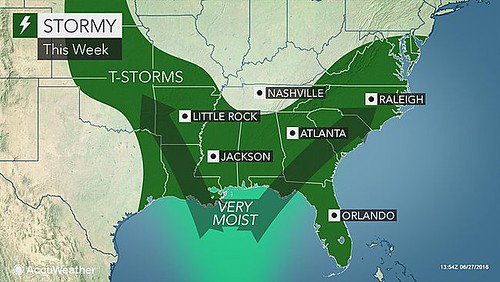
On June 27th, Accuweather reported "Downpours to offer relief to drought-stricken parts of southern US into July." They continued, "The lower Mississippi Valley and areas along the southern Atlantic Seaboard will be most likely to experience frequent downpours."
These were some of the areas pinpointed in the long-range forecast that was posted on June 5th. The following Accuweather map shows some of the activity over the areas mentioned in the forecast: the Mississippi Valley, the Deep South, and the Eastern Seaboard.
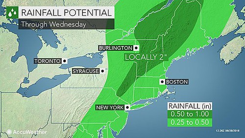
Accuweather then reported on June 28th that storms would drench parts of the northeastern US that have gone without rain since the first week of June. In the following Accuweather map, we see the rain continuing along the the Eastern Seaboard.
Links to Other Long-range Weather Forecasts and Forecast Results
Potential Hurricane August 24-28, 2016
Hurricane Dolores Fulfills Long-range Weather Forecast
Hurricane Season 2015 Long-range Weather Predictions
Tropical Cyclone Hadi
Hurricane Erick Fulfills Long-range Forecast
Tropical Storm Andrea Fulfills Long-range Forecast!
Timing the Relief for Drought-Stricken U.S. Plains
Testing Astrometeorology Part 2
Hurricane Sandy Fulfills Long-range Weather Prediction!
Testing Astrometeorology Part 1
Hurricane Season 2011 Forecast Results
Hurricane Risk-Management
New Weather Alternative Website
Fulfilled Long-range Forecasts for Hurricane Season 2010
Introduction to the Weather Alternative