The long-range weather forecast posted back on December 17, 2011 is finding its fulfillment in the windy conditions over the Rockies. The forecast was posted over 2 months ago and read as follows:
Winter 2011-12 The Rockies
February 27, 2012
Similar conditions should generate cold and windy conditions around this time as well.
Results
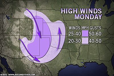
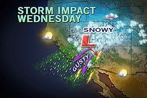
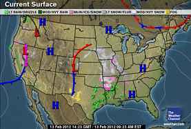
The National Weather Service has been issuing warnings for various parts of the Rockies since yesterday. Here's a quick sampling.
...SNOW AND GUSTY WINDS WILL AFFECT PARTS OF NEVADA MONDAY AND MONDAY EVENING...
...STRONG WINDS EXPECTED ACROSS ARIZONA ON MONDAY...
...DEVELOPING WINTER STORM TAKES AIM AT COLORADO AND UTAH MOUNTAINS MONDAY AND TUESDAY...
...STRONG WINDS WITH POSSIBLE LOCALLY DAMAGING WIND GUSTS TONIGHT AND TUESDAY FOR PORTIONS OF SOUTHWEST AND SOUTH CENTRAL NEW MEXICO AND FAR WEST TEXAS...
...STRONG WINDS POSSIBLE OVER THE WIND PRONE AREAS OF SOUTHEAST WYOMING TUESDAY EVENING THROUGH WEDNESDAY MORNING...
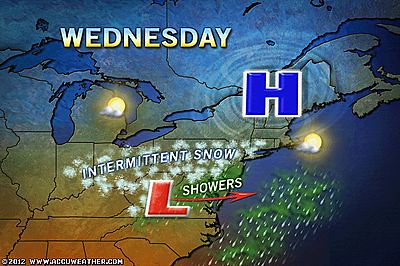
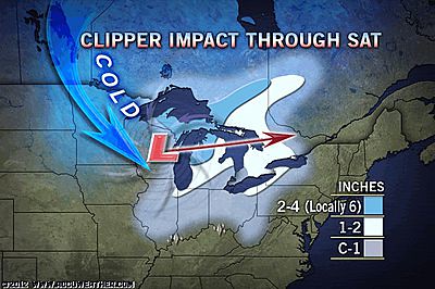
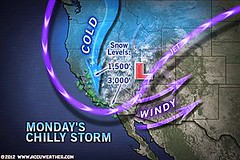
The Accuweather maps below show the storm pattern and the snowfall expected.

Winter 2011-12 The Rockies
February 27, 2012
Similar conditions should generate cold and windy conditions around this time as well.
Results
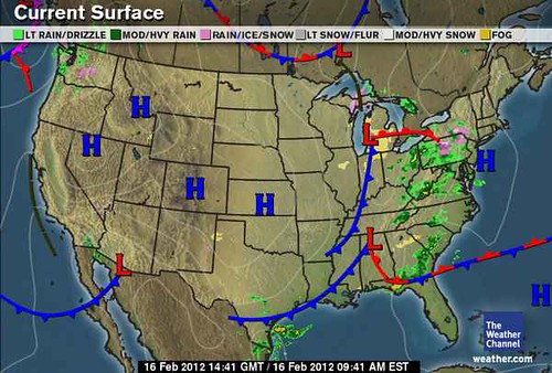
The National Weather Service has been issuing warnings for various parts of the Rockies since yesterday. Here's a quick sampling.
...SNOW AND GUSTY WINDS WILL AFFECT PARTS OF NEVADA MONDAY AND MONDAY EVENING...
...STRONG WINDS EXPECTED ACROSS ARIZONA ON MONDAY...
...DEVELOPING WINTER STORM TAKES AIM AT COLORADO AND UTAH MOUNTAINS MONDAY AND TUESDAY...
...STRONG WINDS WITH POSSIBLE LOCALLY DAMAGING WIND GUSTS TONIGHT AND TUESDAY FOR PORTIONS OF SOUTHWEST AND SOUTH CENTRAL NEW MEXICO AND FAR WEST TEXAS...
...STRONG WINDS POSSIBLE OVER THE WIND PRONE AREAS OF SOUTHEAST WYOMING TUESDAY EVENING THROUGH WEDNESDAY MORNING...
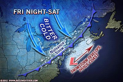
The Accuweather maps below show the storm pattern and the snowfall expected.
Winter 2011-12 The Rockies
Winter 2011-12 West Coast
Hurricane Season 2011 Forecast Results
Hurricane Risk-Management
Update on Winter 2011-12
Texas Summer 2012
New Weather Alternative Website
Overview of UK Winter 2012-13
The Winters of 2011-14
Fulfilled Long-range Forecasts for Hurricane Season 2010
Introduction to the Weather Alternative
Life isn't waiting for the storm to pass, it's learning to dance in the rain.