Wednesday, December 27, 2006
January Blizzard?
Click here for the Introduction to The Weather Alternative
How Long-Range Forecasts Are Made
January 12, 2007 will mark the 119th anniversary of the Children’s Blizzard. (see photo above) Also known as the Schoolhouse Blizzard or the Schoolchildren’s Blizzard, this powerful storm hit the U.S. Plains unexpectedly on January 12, 1888. Only those who lived close to telegraph offices or railroad stations received news of the approaching storm from the U.S. Signal Corps. Many people, however, were caught unaware. Children were trapped in one-room schoolhouses or met their fate trying to find their way back home. Farmers were caught without protection taking care of their livestock as were family members doing errands in town. It is estimated that 235 people died that day on the Dakota-Nebraska prairie—more than a hundred of them children.
The storm roared out of the northwest on a day mild enough for children to walk to school in their shirt-sleeves or without hats and jackets. Within just a few hours, temperatures dropped from around 70 degrees Fahrenheit to minus twenty or more accompanied by horizontal snow and hurricane-force winds.
The lives of surviving children, parents, farmers, and teachers were drastically altered. The new science of post-traumatic growth, to our surprise, finds that enduring such harrowing ordeals ultimately changes many people for the better. They are transformed by tribulation; giving credence to the old saying “What doesn’t kill you can actually make you stronger.”
Rich Tedeschi, a professor of psychology at the University of North Carolina in Charlotte, when talking about people that have survived traumatic experiences says, “People don’t say that what they went through was wonderful. They weren’t meaning to grow from it. They were just trying to survive. But in retrospect, what they gained was more than they anticipated.”
The astro-meteorology behind the Children’s Blizzard shows that on the 11th and 12th of January Mars conjoined Uranus as Mercury made a 90 degree angle to Mars and Uranus. Mars-Uranus contacts indicate acute, energetic, erratic action and provoke wind velocities of varying intensities. Mercury-Uranus is known to provoke falling temperatures and erratic gusts of wind. Mercury-Mars action indicates sudden brief spurts of whipping winds.
Solar and lunar eclipse charts frequently are the precursors of major weather phenomena. In the case of the Children’s Blizzard, the previous lunar eclipse boasted a Jupiter-Neptune opposition which correlates to low barometric pressure and above normal precipitation.
This January, roughly from the 27th through the 30th, shows that the solar eclipse of March 29, 2006 will be activated. The implications are that a powerful storm, perhaps a blizzard, will develop over the Plains and push eastward across the Mississippi Valley and toward the East Coast. I’m in no wise thinking that this storm will be anything like the Children’s Blizzard of 1888. The similarity resides in the fact that, in both cases, eclipse charts are involved. The planetary energies involved, however, are different. This January we will be dealing with a Mercury-Saturn opposition, a sure harbinger of a strong low pressure system.
Satellite view of the Blizzard of 1993
Friday, December 22, 2006
December 21, 2006 Forecast Results
Click here for the Introduction to The Weather Alternative
Some History of Astro-Meteorology
Included in my December 15th post was the following forecast:
If we zero in on the blue line running approximately over 113 west longitude through the Great Basin area , we should be able to time a couple of weather patterns that will develop there this winter. The blue line represents the planet Uranus. On the very day of the winter solstice, Mars will form a 90 degree angle to Uranus. The atmosphere should respond with an energetic winter storm over this area. Wind is usually a salient feature with this planetary combination. We usually give a day or so on either side of the exact date.
Looking a day or so before the 21st, we find the following Accuweather report on the 19th:
Potent Winter Storm Taking Shape (State College, PA) - A powerful storm will slowly emerge out of the Desert Southwest through Wednesday (20th), with heavy blowing snow over the eastern Rockies today and treacherous ice coating the southern Plains...The radar from Amarillo, Tex., indicates freezing rain is falling this morning as the potent storm spins over Arizona.
Dec 20th- Accuweather
Before emerging out of the Rockies, the storm on Tuesday (19th) brought a variety of precipitation to the Four Corners region and southern Plains. Snow fell in Las Vegas, Nev., and schools were closed in Albuquerque, NM.
Dec 20th- The Weather Channel
In the Pacific Northwest, another storm system is coming ashore today bring valley rain/mountain snow and wind to the Cascades today through Thursday (21st).
This second system will dive southeastward over the next several days bringing more wide spread wind/mountain snow/valley rain in the Northwest on Thursday, the Intermountain West by Friday, and to the Four Corners and southern Rockies by Saturday.
- - - - - - - - - - - - - - - - - - - -
Wind advisories are in effect over the forecast area. Below are a few examples.
NATIONAL WEATHER SERVICE LAS VEGAS NV
320 PM PST THU DEC 21 2006
...SYNOPSIS... A FAST MOVING LOW PRESSURE SYSTEM WILL MOVE ACROSS THE STATE TONIGHT AND FRIDAY BRINGING THE POTENTIAL OF RAIN AND SNOW TO PORTIONS OF THE REGION.
WINDS BEHIND THIS SYSTEM ARE FORECAST TO INCREASE FRIDAY NIGHT WITH MANY AREAS EXPERIENCING WINDY CONDITIONS THROUGH EARLY SATURDAY MORNING.
____________________________________________________________________
NATIONAL WEATHER SERVICE SALT LAKE CITY UT
844 PM MST THU DEC 21 2006
FRIDAY EVENING WILL BRING A WINDY PERIOD TO SOUTHWEST UTAH…
___________________________________________________________________
NATIONAL WEATHER SERVICE LOS ANGELES/OXNARD CA
351 PM PST THU DEC 21 2006
...HIGH WIND WATCHES CONTINUE FOR PORTIONS OF SOUTHWESTERN CALIFORNIA...
Friday, December 15, 2006
Signs of the Sky--How Long-Range Forecasts Are Made
Click here for the Introduction to The Weather Alternative
Some History of Astro-Meteorology
For those of you who are visiting The Weather Alternative after reading Accuweather meteorologist Katrina Voss's blog on Signs of the Sky, I thought I'd explain a bit more of the methodology used by ancient and present-day astro-meteorologists in formulating long-range weather forecasts based on planetary positions.
The basic premise of this branch of mundane astrology, which early researchers formulated by observation, is that the planets affect the meteorological process with each planet in particular governing a different aspect of the weather spectrum.
For example, Mercury was observed to be instrumental in governing wind direction and velocity. Venus, on the other hand, corresponded to a warm, moist influence tending to lower the barometer. Each of the other planets was also believed to correspond to different weather phenomena.
When two or more planets form certain geometrical patterns as seen from earth, astro-meteorologists observe that the atmosphere responds with a weather system that blends the nature of planets involved. These geometrical patterns are measured as angles that two or more planets make with earth as the center. Key angles are 0 degrees, 60 degrees, 90 degrees, 120 degrees, and 180 degrees.
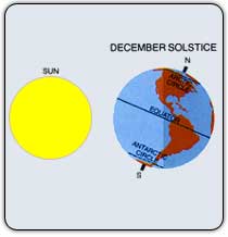
The equinoxes and solstices provide key information in this respect since planetary positions at these moments show the geographic locales where high and low pressure systems originate or their effects are most potent.
The map of the United States above shows the planetary positions at the moment of the upcoming winter solstice on December 21, 2006. The lines on the map correspond to the positions of some of the planets at that moment. The curved black lines show where certain planets will be setting at the time of the winter solstice. The straight blue lines show were certain planets will be overhead, and the straight yellow lines show where other planets will be exactly underneath the earth.
If we zero in on the blue line running approximately over 113 west longitude through the Great Basin area , we should be able to time a couple of weather patterns that will develop there this winter. The blue line represents the planet Uranus. On the very day of the winter solstice, Mars will form a 90 degree angle to Uranus. The atmosphere should respond with an energetic winter storm over this area. Wind is usually a salient feature with this planetary combination. We usually give a day or so on either side of the exact date.
January 15-17, 2007 looks like another key time for this area of the country as Jupiter will form a 90 degree aspect to Uranus on the 16th. These two are conducive to intense cold fronts, precipitation, and high wind velocities. So we may expect a strong weather system to be drawn into the area at this time.
Having worked with this system for a number of years, I never cease to be amazed at the beauty and the “down-to-earth” practicality that its designer bestowed upon the heavenly bodies. The members of our solar system no longer appear to be unrelated and meaningless masses of rock and gas circling the sun as science sometimes leaves us
feeling. But God has given purpose to the planets and equipped his offspring with a built-in, environmentally safe, long-range weather forecasting tool for our service.
Long-range weather forecasting is more than just observing planetary positions and their effects on our atmosphere. In the words of Johannes Kepler, a man of science, astrology, and astro-meteorology, it’s “thinking God’s thoughts after him.”
Monday, December 11, 2006
December 9-11, 2006 Forecast Results
Click here for the Introduction to The Weather Alternative
On November 30th, I posted the following forecast:
The next alignment between Mercury and Mars takes place on December 9, 2006. The atmosphere should once again respond with gusty winds and storms roughly from the 9th to the 11th. This time a few areas of the country should feel this influence. Windy conditions should push ashore over the West Coast and advance toward the Rockies. The Plains area should respond with gusty winds as should the Mid-Atlantic and Northeast.
Here's a recap of what happened. (Bold is mine)
West Coast
Dec 8, 2006- The Weather Channel
A third and much more potent Pacific system will be heading into the West Sunday (10th). Western Oregon and northwest California will experience strong gusty winds ahead of this third system.
Rockies
Dec 11, 2006- National Weather Service
PUEBLO CO 1011 AM MST MON DEC 11 2006
WEST TO SOUTHWEST WINDS OF 15 TO 25 MPH...WITH GUSTS UP TO35 MPH...WILL PRODUCE AREAS OF BLOWING AND DRIFTING SNOW.
GREAT FALLS MT1201 PM MST MON DEC 11 2006
...HIGH WIND WARNING REMAINS IN EFFECT FROM 11 PM THIS EVENING TO5 PM MST TUESDAY FOR THE ROCKY MOUNTAIN FRONT AND THE CUT BANKAREA...STRONG SOUTHWEST WINDS OF 25 TO 40 MPH ARE EXPECTED TO DEVELOPOVER THE ROCKIES AROUND MIDNIGHT...
Plains
Dec 8, 2006- The Weather Channel
Midwest
The Midwest will enjoy a dry and much milder weekend with increasingly gusty southwest to west winds from Kansas to the Great Lakes.
Mid-Atlantic and Northeast
Dec 8, 2006- The Weather Channel
As the lake snow and gusty winds end in the Northeast, cold will continue to grip the East overnight.