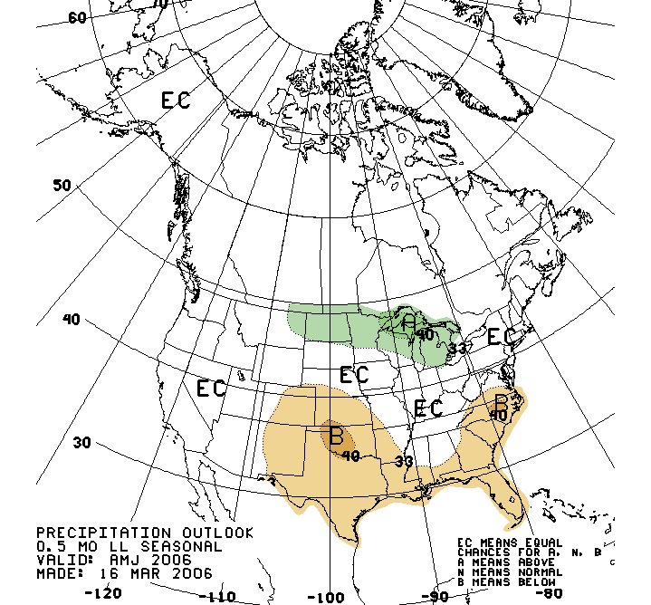
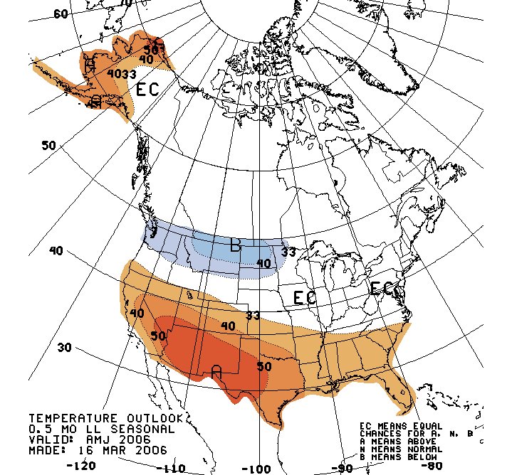
The two maps above show the “Three Month Outlook” for April, May and June 2006 from the Climate Prediction Center. They were prepared in March 2006. The map on the top shows the precipitation outlook, and the map on the bottom shows the temperature outlook.
On the precipitation map, the areas where precipitation may be above average are marked by an "A". The areas where precipitation is forecast to be below average are marked with a "B". The areas marked "EC" are areas where there are equal chances of it being above or below average, or according to their own definition "the probability of the most likely category cannot be determined." The same three A, B, and EC designations apply to the temperature map.
If we look at the Northeast U.S., we see that Climate Prediction Center could not determine what to forecast regarding temperature and precipitation. By following Kepler’s long-range forecast method, however, we can make some long-range predictions that give us much more information regarding what the Northeast might expect during this time period. Since this article would grow too long if we were to list all the information this method might provide, we shall limit our observations to a few of the more outstanding weather patterns that will affect the Northeast U.S. during the month of May. Kepler's method can provide us with three key pieces of information:
1) the time the weather pattern will manifest
2) the type of weather
3) the location
Forecasts for the Northeast U.S. and surruounding areas:
May 4-6, 2006: Fair and dry conditions with a lower range of temperatures are indicated for the area after a storm system hits around the 3rd.
May 6-8, 2006: The arrival of a colder air mass over the Northeast will result in precipitation.
May 10-12, 2006: Winds over the Northeast blow out of the south now elevating temperatures and bringing a chance of rain.
May 16-18, 2006: A cold front with its attendant cloudiness and precipitation will offer a break from relatively high temperatures.
May 22-23, 2006: Southerly winds will transport heat and humidity into the the Northeast and New England resulting in atmospheric disturbance.
May 26-27, 2006: A storm system headed for the Canadian Maritimes will drop rain and kick up windy conditions over the Northeast and New England.
May 30-June 1, 2006: Warmth makes its way through the eastern U.S. only to trigger stormy conditions from the Mid-Atlantic region to the Northeast. If not enough moisture is available to result in precipitation, wind will be the salient feature.
No comments:
Post a Comment