Friday, October 29, 2010

Forecast Results for Sept 18-23, 2010 and Experimental Forecasts

The forecast for the U.S. at this time warned of a possible low-pressure system about 200 miles south of Mobile and another area of possible tropical activity along the west coast of Florida.
Sept 19
The closest conditions came to fulfilling this forecast was on the 19th when, according to the National Weather Service, a low pressure system off of Matagorda, Texas brought 5 to 6 inches of rain. (See above map) This, of course, was farther west than what the forecast stated. Florida had just normal thunderstorm activity at times during the forecast period.
The results of the Experimental Forecasts Part 2 seem to suggest that the particular techniques experimented with are not that reliable and will not be included in my forecast method.


“Use what talents you possess; the woods would be very silent if no birds sang except those that sang best.”—Henry Van Dyke

“What is to give light must endure burning.”—Viktor E. Frankl

Friday, October 22, 2010

Central American Forecast Results

Here's a look at the results of The Weather Alternative long-range forecasts for Central America. These four forecasts cover the month of August and were posted on May 16, 2010.
The first forecast was for August 2-6, 2010 and called for a severe weather pattern or possible tropical system over Honduras and Nicaragua.


The Weather Channel reported on the 2nd, "In the western Caribbean, there is a tropical wave moving ashore in Central America near Nicaragua that should produce some locally heavy rainfall over Central America in the next day or two. This system is not expected to develop into a tropical cyclone."


06 Tropics2


The above weather graphic from the National Weather Service is for August 6, 2010 and shows a circled area over Honduras and Nicaragua. The NWS stated: SHOWERS AND THUNDERSTORMS HAVE INCREASED OVER THE WESTERN CARIBBEAN
SEA IN ASSOCIATION WITH A TROPICAL WAVE.

The second forecast was for August 7-9 and pinpointed an area in the Central Caribbean (75W/14N) as a place where a tropical system could either form or pass through. Severe weather was also forecast for Panama. The NWS posted the following comment on August 9th.


NWS

Aug 9, 2010


CARIBBEAN SEA...
SCATTERED MODERATE TO HEAVY SHOWERS COVER THE FAR SW CARIBBEAN SOUTH OF 13N WEST OF 75W ENHANCED BY SURFACE CONVERGENCE NEAR AN EXTENSION OF THE ITCZ ACROSS COSTA RICA...PANAMA...AND NRN COLOMBIA.

The third forecast was for August 9-12, 2010. This forecast mentioned severe weather for Honduras, Nicaragua, El Salvador, and Costa Rica with a possible tropical system of the Costa Rican coast at 85W/8N.

The NWS report for August 12th below mentions enhanced convection over Panama and Costa Rica.


Aug 12

SCATTERED SHOWERS AND TSTMS ARE
FOCUSED FARTHER SOUTH OVER THE SW CARIBBEAN SEA. THIS ACTIVITY
IS LOCATED SW OF A LINE FROM 15N83W TO NORTHERN COLOMBIA NEAR
12N73W. CLOSE PROXIMITY TO THE ITCZ AXIS ALONG 09N/10N AND AN
UPPER LEVEL DIFFLUENT ENVIRONMENT IS ENHANCING THE CONVECTION S
OF 12N INCLUDING PANAMA AND COSTA RICA.


The fourth forecast was for August 19-22 specifying heavy rain for Honduras and Nicaragua. The accompanying map is for August 21st.

The NWS commentary below talks of abundant moisture over Panama, Costa Rica, Nicaragua, and Honduras.

21 Tropics2


Aug 21

CARIBBEAN SEA...
ABUNDANT MOISTURE AND INSTABILITY IS NOTED ACROSS THE INTERIOR CENTRAL AMERICA AND SURROUNDING WATERS COVERING THE SW CARIBBEAN GENERATING SCATTERED SHOWERS AND ISOLATED TSTMS W OF 74W S OF 17N. SATELLITE IMAGERY DENOTES THE STRONGEST ACTIVITY LIES WITHIN 100 NM OFFSHORE OF WESTERN PANAMA...COSTA RICA...NICARAGUA...AND HONDURAS.


4PY5YGXSE929

“Choose to be a love-finder rather than a fault-finder.”—Gerald Jampolsky

“Obstacles are those frightful things you see when you take your eyes off your goals.”—Hannah More

Saturday, October 16, 2010

December 2010 Nor'easter Forecast

Nor-easter Time


Image by Cool Text: Free Logos and Buttons - Create An Image Just Like This


December 18-20, 2010


The Northeast U.S. and New England are highlighted at this time for an onslaught of severe weather which may very likely be a Nor'easter. Mercury is retrograde now, which has been known to increase wind velocities when in conjunction with the Sun. Mercury's conjunction with the Sun takes place on the 19th but the day before and after, the Sun and Mercury will aspect Uranus. Taken all together stormy and windy conditions are a strong possibility for this area of the country.


December 29 2010- January 1, 2011

Weather conditions over the New England area may put on quite a display as the New Year is ushered in. The approaching Jupiter-Uranus conjunction and Mars' square to Saturn spell severe weather for the New England area. This could manifest as a Nor'easter. Other indications suggest the storm begins to form over the Northern Plains and makes its way across the Great Lakes/Midwest area and strengthens over New England.


Tropical Storm Matthew Fulfills Long-range Forecast!


Hurricane Earl and T.D. 10E Fulfill Long-range Forecasts!


Tropical Storm Alex Fulfills Long-range Prediction!


Bonnie Fulfills Long-range Forecast!

Experimental Forecasts Part 2- July-Sept 2010


Hurricane Season 2010--Forecast for September


Hurricane Season 2010--Central America Part 2


Introduction to the Weather Alternative


How Long-Range Forecasts Are Made


Thoughts


“Don’t water your weeds.” —Harvey Mackay


“In love, one and one are one.”—Jean-Paul Sartre


“Set your goals high, because what a person accomplishes is in proportion to what they attempt.”—Mitchell Naufell

Saturday, October 02, 2010

Nicole and Other Resutls

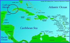
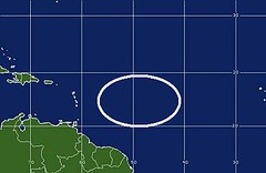
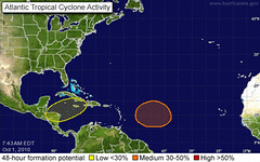
The first of the two maps below show where
Nicole (Tropical Depression 16) formed on the 29th. The second map, from my September 26th post, shows where the planetary alignments according to astro-meteorology indicated it would form. They coincide perfectly.

29 Tropical Atlantic

CaribbeanMap

I also indicated in the same post another area that would be a good bet for tropical development between September 30th and October 3rd. Here are the maps back to back.

The first one shows where I said "another broad area" likely for tropical development would lie. The second map is from the National Weather Service for October 1st. Once again they coincide perfectly. My map was calculated using only astro-meteorological indicators. This area is still being watched for development.

catl-m

01 Tropical Atlantic

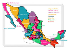
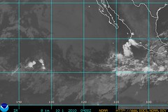
A third area mentioned in my post was for the western coast of Mexico, specifically over the states of Michoacán, Guerrero, and Colima. Below is the map where I circled the area in question. Under that is a map for September 30th from the NWS. The Mexican weather service reported the follow:

Baja presión de 1004 hPa frente a las costas de Colima y Michoacán, cerca de 18°N y 108°W, se asocia con nublados de convección moderada a fuerte. Baja presión de 1008 hPa localizada en 9.5°N y 115°W, se asocia con nublados de convección moderada a fuerte.

This roughly translates that an area of low pressure over the coasts of Colima and Michoacán is producing strong to moderate convection.

estados_mexico

30 Tropical Pacific


Tropical Storm Matthew Fulfills Long-range Forecast!

Hurricane Earl and T.D. 10E Fulfill Long-range Forecasts!

Tropical Storm Alex Fulfills Long-range Prediction!

Bonnie Fulfills Long-range Forecast!

Experimental Forecasts Part 2- July-Sept 2010

Hurricane Season 2010--Forecast for September

Hurricane Season 2010--Central America Part 2

Introduction to the Weather Alternative

How Long-Range Forecasts Are Made

On Stephen Hawking's new book The Grand Design

Stephen Hawking's big bang gaps The laws that explain the universe's birth are less comprehensive than Stephen Hawking suggests