Nicole (Tropical Depression 16) formed on the 29th. The second map, from my September 26th post, shows where the planetary alignments according to astro-meteorology indicated it would form. They coincide perfectly.

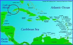
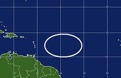
I also indicated in the same post another area that would be a good bet for tropical development between September 30th and October 3rd. Here are the maps back to back.
The first one shows where I said "another broad area" likely for tropical development would lie. The second map is from the National Weather Service for October 1st. Once again they coincide perfectly. My map was calculated using only astro-meteorological indicators. This area is still being watched for development.
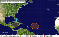
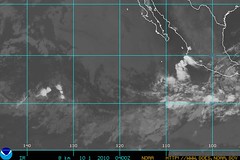
A third area mentioned in my post was for the western coast of Mexico, specifically over the states of Michoacán, Guerrero, and Colima. Below is the map where I circled the area in question. Under that is a map for September 30th from the NWS. The Mexican weather service reported the follow:
Baja presión de 1004 hPa frente a las costas de Colima y Michoacán, cerca de 18°N y 108°W, se asocia con nublados de convección moderada a fuerte. Baja presión de 1008 hPa localizada en 9.5°N y 115°W, se asocia con nublados de convección moderada a fuerte.
This roughly translates that an area of low pressure over the coasts of Colima and Michoacán is producing strong to moderate convection.
Tropical Storm Matthew Fulfills Long-range Forecast!
Hurricane Earl and T.D. 10E Fulfill Long-range Forecasts!
Tropical Storm Alex Fulfills Long-range Prediction!
Bonnie Fulfills Long-range Forecast!
Experimental Forecasts Part 2- July-Sept 2010
Hurricane Season 2010--Forecast for September
Hurricane Season 2010--Central America Part 2
Introduction to the Weather Alternative
How Long-Range Forecasts Are Made
On Stephen Hawking's new book The Grand Design
Stephen Hawking's big bang gaps The laws that explain the universe's birth are less comprehensive than Stephen Hawking suggests
No comments:
Post a Comment