Forecast
August 9-13, 2011
This forecast called for an active weather period over the U.S. Northeast and New England as well as eastern Cuba, Haiti, and the Bahamas. A similar forecast was posted here on July 25, 2011. The possibilities were for intense storms or a tropical system to affect these areas.
Results
Accuweather reported on August 9th that storms and a possible tornado caused damage in Delaware leaving 19,000 people without power in New Castle County. Storms ripped through parts of Delaware, southeastern Pennsylvania and southern New Jersey causing power outages, traffic snarls and possibly a tornado over northern Delaware.
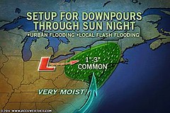
The above Accuweather map shows the downpours of 1 to 3 inches of rain to hit the Northeast and New England starting on the 13th triggering flash flooding. Conventional forecasters pointed out that this is due to a strong storm system that typically is found in the U.S. during autumn months.
Part of the forecast pinpointed eastern Cuba, Haiti, and the Bahamas as areas that would see possible tropical storm development. The National Weather Service reported on the 14th, one day after my forecast ended that a surface trough brings continued convection over Hispaniola. But the main tropical activity was further north than the area I mentioned.

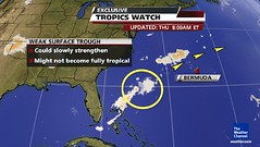
On the 11th, The Weather Channel showed this area north of the Bahamas that could slowly develop. This eventually became Tropical Storm Franklin, which was directed away from the U.S. coast.

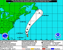
On the 13th, Tropical Depression 7 formed southeast of Bermuda around 61 west longitude and 27 north latitude. In the Dell article I did pinpoint the area around 67 west longitude and 24 north latitude as an area to generally watch for tropical activity throughout August and September.
Forecast
Aug 12-13, 2011
A low pressure system may form in the eastern Gulf of Mexico off the coast of Tampa, FL It remains to be seen if it develops tropical characteristics.
Results
Not much happened in this area at the time. The National Weather Service reported the following on the 13th:
GEORGIA...AND THE FLORIDA BIG BEND
AND PANHANDLE...AND ADJACENT COASTAL WATERS.
SCATTERED SHOWERS AND THUNDERSTORMS ARE EXPECTED THIS AFTERNOON AND
EVENING. SOME MAY BE STRONG WITH GUSTY WINDS AND SMALL HAIL AND WE
CANNOT DISCOUNT AN ISOLATED SEVERE STORM WITH DAMAGING WINDS.
Forecast
August 12-15, 2011
A couple of tropical waves in the western Caribbean may show signs of strengthening as
they approach Honduras and the Yucatan Peninsula.

Results
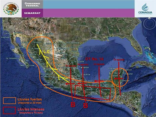
On the 11th, the NWS reported a tropical wave moving westward in the central Caribbean. Then on the 13th they reported isolated moderate convection inland over Honduras and El Salvador due to the wave. The Mexican weather service reported strong to very strong rains over the Yucatan on the 13th. The above map shows the tropical wave's position on the 13th.
General Weather Indications for August 2011
August 16-18, 2011 Long-range Weather Forecast
Hurricane Season 2011 Baja, Mexico
Hurricane Risk-Management
Hurricane Season 2011 Predictions
Overview of UK Winter 2012-13
The Winters of 2011-14
Fulfilled Long-range Forecasts for Hurricane Season 2010
Introduction to the Weather Alternative
How Long-Range Forecasts Are Made
Excerpts from Tidal Dynamics by Fergus J. Wood

No comments:
Post a Comment