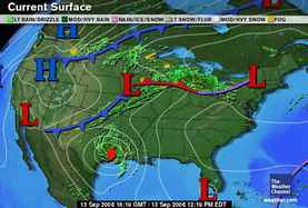
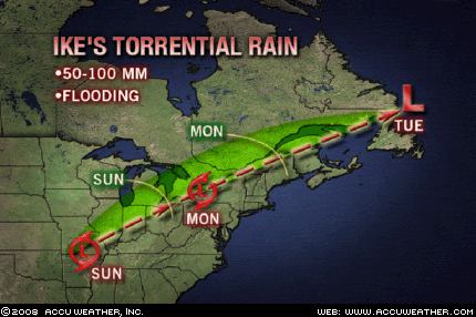
 Hurricane Ike's arrival over eastern Texas on September 12th and 13th fulfilled The Weather Alternative's long-range weather forecast posted on May 12th of this year. The forecast called for possible tropical storm or hurricane formation in the western Gulf of Mexico between September 9th and 14th.
 A more recent post (Sept 7) pinpointed Ike's landfall over eastern Texas. Conventional forecasters were somewhat perplexed as to Ike's track. As can be seen from the National Weather Service map for Sept 9th, the main track they thought Ike would take was further to the southwest. The Weather Alternative post stated It seems like the greater danger lies over eastern Texas.
 It also seems that Ike's arrival over the Northeast and New England on Sept 15th and 16th may fulfill another Weather Alternative long-range forecast. This one was posted on June 13th and stated:
Sept 14-18
The conjunction of Mercury and Venus over the New England area keeps the astro-meteorological window open for tropical storm/hurricane activity to affect the region or for severe thunderstorms to afflict the area.
Summer 2008: The Eastern United States
Summer 2008: The West Coast Part 1
Summer 2008: The Rockies Part 1
Summer 2008: The Plains and Mississippi Valley- Part 1
Introduction to the Weather Alternative
How Long-Range Forecasts Are Made
Check out my article and interview in Saptarishis Astrology Volume 3
2 comments:
Nice job. Looks like you nailed it. Did you have to evacuate?
Yes. We got out early Friday morning before it hit--and we're glad we did. We'll see you soon!
Post a Comment