Here are some more long-range weather forecasts for Central America. Learn about the dates when hurricane activity might be imminent and the places where they might develop or strike. The following forecasts are based on
astrometeorolgy i.e. the study of planetary influence on terrestrial weather systems.
Forecast
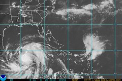
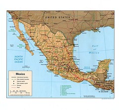
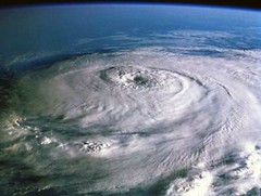
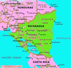
August 2-6, 2010This appears to be a very significant time for the area in and around Honduras and Nicaragua. Mars will trigger the Lunar Eclipse of June 26, 2010, which, coupled with other planetary goings-on, seems to point toward a severe weather pattern over this area. This, of course, could be a full-blown tropical storm or hurricane.
Forecast
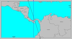
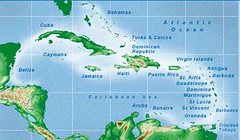
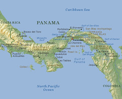
August 7-9, 2010The central Caribbean area about 550 miles east of the Nicaragua/Honduras border or 240 miles north of Colombia (75 west longitude/14 north latitude) is an area where tropical storm or hurricane formation is possible or an area over which a tropical system may pass. Panama is also liable to experience a severe weather pattern now, which may or may not be related to the aforementioned system in the Caribbean.
 Forecast
August 9-12, 2010June’s lunar eclipse is activated bringing a promise of severe weather over the area comprising Honduras, Nicaragua, El Salvador, and Costa Rica. The culprit may be a tropical system lurking off the Costa
Rican coast around 85 west longitude and 8 north latitude in the eastern Pacific.
Forecast
August 19-22, 2010
The weather system that affects Honduras, Nicaragua, and surrounding areas at this time will be characterized by the possibility of heavy rain. This may be the result of a tropical system.
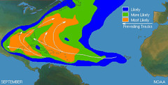
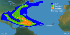
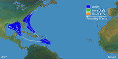
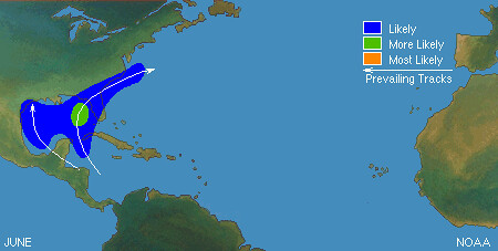
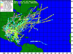
Hurricane Season 2010--Forecasts for JuneHurricane Season 2010--Forecast for July Hurricane Season 2010--Forecasts for AugustHurricane Season 2010--Forecast for September Hurricane Season 2010--Central America Part IIntroduction to the Weather AlternativeHow Long-Range Forecasts Are MadeCheck out Karen L. Anderson's
50 Best Astrology Blogs and other informative posts.
Food RulesCheck out Food Rules: An Eater's Manuel by Michael Pollan
Here's a little preview:
1.
Eat food.These days this is easier said than done, especially when seventeen thousand new products show up in the supermarket each year. But most of these items don’t deserve to be called food—I call them edible
foodlike substances. They’re highly processed concoctions designed by food scientists, consisting mostly of ingredients derived from corn and soy that no normal person keeps in the pantry, and they contain chemical additives with which the human body has not been long acquainted. Today much of the challenge of eating well comes down to choosing real food and avoiding these industrial novelties.
2.
Don’t eat anything your great-grandmother wouldn’t recognize as food.Imagine your great-grandmother at your side as you roll down the aisles of the supermarket. You’re standing together in front of the dairy case. She picks up a package of Go-
GURT Portable Yogurt tubes—and
hasn’t a clue what this plastic cylinder of colored and flavored gel could possibly be. Is it a food or is it toothpaste? There are now thousands of
foodish products in the supermarket that our ancestors simply
wouldn’t recognize as food. The reasons to avoid eating such complicated food products are many, and go beyond the various chemical additives and corn and soy derivatives they contain, or the plastics in which they are typically packaged, some of which are probably toxic. Today foods are processed in ways specifically designed to get us to buy and eat more by stimulating our preferences for sweetness and fat and salt. These tastes are difficult to find in nature but cheap and easy for the food scientist to deploy, with the result that food processing induces us to consume much more of these rarities than is good for us. The great-grandma rule will help keep most of these items out of your cart.