Friday, February 04, 2011

Feb 2-5, 2011 Forecast Results

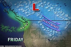
The Feb 2-5 forecast expected an energetic storm system to hit the Pacific Northwest and West Coast.
04 Seattle

Results

Feb 2nd saw strong Santa Ana winds over southern California and the Southwest.

Feb 3rd brought rain to western Washington and snow to the Cascades.

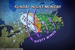
Feb 4th and 5th-- Starting today a series of upper level disturbances will keep the chance of rain and mountain snow in the forecast for the Pacific Northwest along with gusty winds. (see above Accuweather map)

Australia
02 Yasi Map

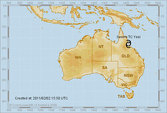
As mentioned in the last post, Cyclone Yasi fulfilled the second half of the Feb 2-5 forecast, which called for strong storms or a tropical cyclone to affect northeastern Australia.

The Winters of 2011-14

South Texas Wet Weather Feb 16-18, 2011

Significant West Coast Storm February 20-23, 2011

Midwest Winter Cold and Heating Oil

Tropical Storm Matthew Fulfills Long-range Forecast!

Hurricane Earl and T.D. 10E Fulfill Long-range Forecasts!

Tropical Storm Alex Fulfills Long-range Prediction!

Bonnie Fulfills Long-range Forecast!

Introduction to the Weather Alternative

How Long-Range Forecasts Are Made


The Gas Formula
Gas untitled

Monday, January 31, 2011

Groundhog Day Blizzard and Australian Cyclone Yasi

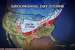
A crippling winter storm, nicknamed the Groundhog Day Blizzard, will impact much of the eastern two-thirds of the United States over the next few days.

31 Groundhog Day Blizzard

Between Monday and Wednesday (Jan 31-Feb 2), both a major blizzard and an ice storm will affect a large portion of the Midwest and continue its trek eastward through New England.
The storm coincides perfectly with the New Moon of February 2nd and its conjunction to Mars. The planet Mars in astro-meteorology is known for acute and energetic storm systems. A number of charts place the Sun-Moon-Mars combination over the eastern United States but the most outstanding one is the last Lunar Eclipse of December 21, 2010.
Australia

In my post of January 15, 2010, which contained forecasts for Feb 2-5, 2011, I commented on how the Sun-Mars conjunction strongly affected Australia, especially the northeastern part. I concluded by saying that since it's cyclone season down under, a tropical system could not be ruled out.

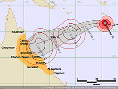
31 Australia

This forecast will be fulfilled in Severe Tropical Cyclone Yasi. As shown on the weather map from the Australian Bureau of Meteorology, the cyclone is predicted to hit northeastern Australia on February 2nd.
J. C. Penny

J.C. Penny, one of twelve children of an unpaid (not merely underpaid) minister in Missouri, went to the Rockies to cure his tuberculosis. In a 25-ft wide building on a side street of a small Wyoming coal mining town, he started a store. He lived in a sloping-roofed attic above the store with his bride. He built that store into a chain of more than 1500 stores, all of them on main streets. "It is neglect of little things," he said, "not hard luck nor lack of talent, that trips up most men."

Friday, January 28, 2011

January 25-27, 2011 Forecast Results

In my post of December 29, 2010, I pinpointed the New England and Nova Scotia areas for storm activity due to astronomical cycles involving the Sun, Mercury, Saturn, and Pluto. In another post (Nov 14, 2010) I also forecast stormy conditions for the Great Lakes and Midwest. 26 Mid-Atlantic Northeast
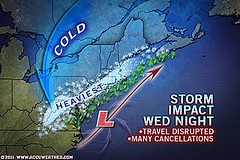
The above Accuweather map for January 26th shows the storm impact over the Northeast and New England that resulted in travel disruptions and many flight cancellations.

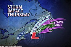
The next map for the 27th shows the storms impact over eastern Canada.
27 Canada

Snow tallies exceeded a foot throughout the corridor from Philadelphia to New York City. Places across southern New England have joined this list with South Windsor, Conn. picking up 19 inches and Milford, Mass reporting 13.9 inches.

A fast moving system affected the Great Lakes as well on the 24th and 25th.

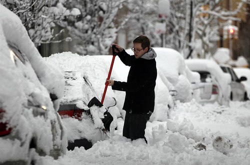
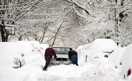
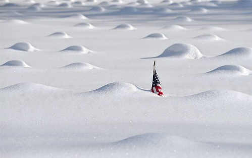
Here are some pictures of the snow left over the Northeast.
ss-101127-EC-snow-03_ss_full

ss-110127-snow-005_ss_full

ss-110127-snow-003_ss_full

The Weather Alternative has just been mentioned on a very interesting website. Check out Online Masters Degree.

The Winters of 2011-14

Feb 2-5, 2011 U.S. West Coast and Australia

South Texas Wet Weather Feb 16-18, 2011

Significant West Coast Storm February 20-23, 2011

Midwest Winter Cold and Heating Oil

Tropical Storm Matthew Fulfills Long-range Forecast!

Hurricane Earl and T.D. 10E Fulfill Long-range Forecasts!

Tropical Storm Alex Fulfills Long-range Prediction!

Bonnie Fulfills Long-range Forecast!

Introduction to the Weather Alternative

How Long-Range Forecasts Are Made

Kepler on Astrology
When Johannes Kepler was asked how he could believe in the nonsense of astrology, he replied "As a Lutheran astrologer I discard the nonsense but retain the substance."

Monday, January 24, 2011

The Winters of 2011-14

In his recent Accuweather video entitled "A La Nina That Is King?...More Cold to Follow!" meteorologist Joe Bastardi explains the current cold conditions found over the United States and other parts of the globe.

Based on a double La Nina followed by an El Nino, Bastardi concludes that "There are things going on that are bigger than the normal course of affairs." He concludes that the trend for coming winters will be toward colder weather. As a result of the La Nina influence,"When the Pacific cools," he states, "the globe cools."

How does Joe's synopsis square away with astro-meteorological indications for future winters? One of the most important tools in astro-meteorology is the Cardinal Solar Ingress chart set for the beginning of each season and valid throughout the entire season in question. Based on indications in the Ingress chart for the winter of 2010-11, I concluded that the U.S. Midwest would experience a cold winter due to the placement of Uranus over the 88th degree of west longitude. This is exactly what is happening.

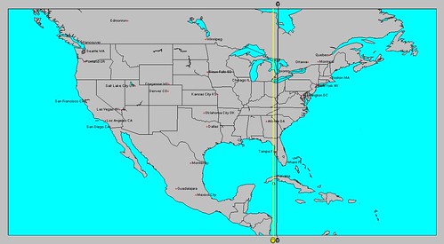
Since the position of Uranus in an Ingress chart is a good indication of where colder conditions will originate and proceed eastward, it's interesting to note the positions of Uranus in the Cardinal Solar Ingresses for the next three winters. The three maps shown below show where Uranus will be in each seasonal winter chart. I've stripped most of the other planetary lines for ease of viewing.

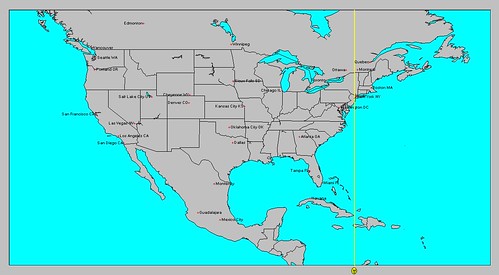
The first map is for the winter of 2011-12. Here we see the area Uranus will influence shown by the darker line which runs through 82 west longitude or the area from the eastern Great Lakes through Florida. The yellow line next to it shows the Sun's influence which is square to Uranus. This is a disruptive influence resulting in stormy conditions there.

Winter 2011-12

The next map is for the winter of 2012-13. The influence of Uranus affects 74 west longitude that runs through the Northeast U.S. specifically New York and New Jersey.

Weather 2012-13

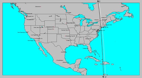
The third map is for the winter of 2013-14. Here, once again we see Uranus (the white line) affecting the U.S. Northeast. The black line represents the planet Mars, which at that time will be in opposition to Uranus indicating a tempestuous winter season.

Weather 2013-14

The general trend shown here is for the center of cold to migrate progessively eastward over the next few winters. All in all, the eastern U.S. should be in for a few winters comparable to this year's winter. So I think Joe Bastardi is correct in his assesment of future winters. One thing not shown in the above maps is the fact that as we progress toward 2014, Uranus forms a number of squares to Pluto. My research classifies Pluto as a cold planet--thus intensifying the storminess and coldness of the winters to come.

Feb 2-5, 2011 U.S. West Coast and Australia

January 25-27, 2011 New England and Eastern Canada

South Texas Wet Weather Feb 16-18, 2011

Significant West Coast Storm February 20-23, 2011

Major Storm January 3-5, 2011

Midwest Winter Cold and Heating Oil

Tropical Storm Matthew Fulfills Long-range Forecast!

Hurricane Earl and T.D. 10E Fulfill Long-range Forecasts!

Tropical Storm Alex Fulfills Long-range Prediction!

Bonnie Fulfills Long-range Forecast!

Introduction to the Weather Alternative

How Long-Range Forecasts Are Made

SNOW!

I just got off the phone with a friend living in northern North Dakota near the Canadian border. She said that since this morning the snow has been nearly waist high and is still falling. The temperature is dropping way below zero and the north wind is increasing to near gale force. Her husband has done nothing but look through the kitchen window and stare. She says that if it gets worse, she may have to let him in.

Saturday, January 22, 2011

Next Week 's Big Storm

22 Next Week

Both Accuweather and the Weather Channel have been talking about the potential "big storm" that will likely hit the East Coast next Tuesday and Wednesday (Jan 25-26). This will likely be the fulfillment of my long-range forecast for January 25-27, 2011 that I posted last December 29th.

Accuweather is saying this storm may be right up there with the Christmas Weekend Blizzard. They're thinking it could be a big deal. My forecast made note of the fact that "astronomical cycles involving the Sun, Mercury, Saturn, and Pluto culminate between January 25-27, 2011 and bring storm potential for New England, Nova Scotia and surrounding areas."

Thought of the Day

“If you can’t change your fate, change your attitude.”—Amy Tan

Wednesday, January 19, 2011

Saturday, January 15, 2011

Feb 2-5, 2011 U.S. West Coast and Australia

sun-conjunct-mars
The Sun-Mars conjunction, occurring at intervals of 25.7 months, is normally equated with heat and dryness. The conjunction of February 4th follows on the heels of the New Moon of the 2nd. This will add energy to the Sun-Mars conjunction and may give us more than the normal increase in temperatures.

For the United States, the conjunction affects the West Coast area. Since we're in the middle of winter, the heat indicated by Mars may trigger an energetic storm system over the Pacific Northwest and West Coast.

The conjunction also strongly affects Australia. Given that Australia is in the middle of their summer season, heat is more easily manifested. But due to the New Moon effect on the Sun-Mars conjunction, I think strong storms may ensue especially over the northeastern part of Australia and southward. It's also tropical cyclone season down under so a tropical system cannot be ruled out.

January 25-27, 2011 New England and Eastern Canada

South Texas Wet Weather Feb 16-18, 2011

Significant West Coast Storm February 20-23, 2011

Major Storm January 3-5, 2011

Midwest Winter Cold and Heating Oil

Tropical Storm Matthew Fulfills Long-range Forecast!

Hurricane Earl and T.D. 10E Fulfill Long-range Forecasts!

Tropical Storm Alex Fulfills Long-range Prediction!

Bonnie Fulfills Long-range Forecast!

Introduction to the Weather Alternative

How Long-Range Forecasts Are Made

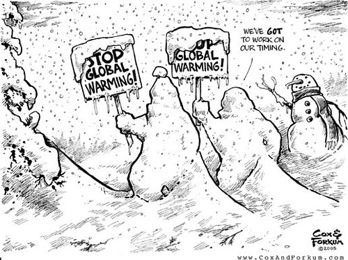
Global Warming


Gobal Warming3

Tuesday, January 11, 2011

January 10-13, 2011 Forecast Results

At the end of December, The Weather Alternative forecast warned of an invasion of cold air, a low pressure system, and high wind warnings to affect the Great Lakes, the Pacific Northwest, and the Northeast between January 10-13, 2011.

Jan 11b
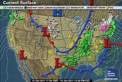
The above Weather Channel map for today, January 11th, shows the three storm systems as predicted. The storm system over the Great Lakes has dropped 3 to 6 inches of snow and is currently producing winds of 25 to 30 mph.
Meanwhile, a major snowstorm is in the making over the Northeast. Conventional meteorologists foresee 6 to 10 inches of snow across New Jersey, and about a foot of snow in the lower Hudson Valley and New York City. Long Island may see over a foot of snow. When factoring in the wind, which could gust as high as 50 mph in New England, forecasters are expecting blizzard conditions there as well as over Long Island.
The Northwest is no exception. A disruptive winter storm, tonight into tomorrow, could bring 1 to 3 inches of snow to Seattle, which is an unusual occurrence. High wind warnings are in effect for the Pacific Northwest coast as 30 to 40 mph winds and gusts up to 60 mph affect the area.

January 25-27, 2011 New England and Eastern Canada

South Texas Wet Weather Feb 16-18, 2011

Significant West Coast Storm February 20-23, 2011

Major Storm January 3-5, 2011

Midwest Winter Cold and Heating Oil

Tropical Storm Matthew Fulfills Long-range Forecast!

Hurricane Earl and T.D. 10E Fulfill Long-range Forecasts!

Tropical Storm Alex Fulfills Long-range Prediction!

Bonnie Fulfills Long-range Forecast!

Introduction to the Weather Alternative

How Long-Range Forecasts Are Made

Global Warming and Recent Weather

Global Warming

Friday, January 07, 2011

January 6-8, 2011 Forecast Results

The Weather Alternative forecast for January 6-8 was posted on November 14, 2010 and called for a low pressure system to affect Chicago and the Great Lakes area.
Jan 07
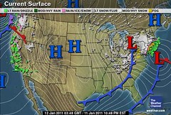
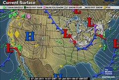
Since yesterday (Jan 6), a storm system moved through the Great Lakes bringing light snow and snow showers. Heavy lake-effects snows are possible around the Great Lakes today (7th) and tomorrow (8th) fulfilling the long-range forecast. The above Weather Channel map is for today.

January 25-27, 2011 New England and Eastern Canada

Great Lakes Winter Storm Jan 10-13, 2011

South Texas Wet Weather Feb 16-18, 2011

Significant West Coast Storm February 20-23, 2011

Major Storm January 3-5, 2011

Midwest Winter Cold and Heating Oil

Tropical Storm Matthew Fulfills Long-range Forecast!

Hurricane Earl and T.D. 10E Fulfill Long-range Forecasts!

Tropical Storm Alex Fulfills Long-range Prediction!

Bonnie Fulfills Long-range Forecast!

Introduction to the Weather Alternative

How Long-Range Forecasts Are Made

The Wish List


Do you wish you had a bodyguard--
someone to stand by you, protect you, and reassure you whenever you feel afraid?

Do you wish you had a confidant--
someone you could tell anything to, knowing that person would understand and be sympathetic?

Do you wish you had a special friend--
the kind who’s always there, who doesn’t abandon you when you’re feeling miserable, and who stands up for you when you’re being laughed at?

Do you wish you had an adviser--
someone who could give you the right kind of advice when you’re in a sticky or difficult situation?

Well, there is someone who wants to enter your life and be all those things for you--and more! He loves you so much, and He just wants a chance to prove it to you.

It’s Jesus, God’s son!

He sacrificed everything to bring you happiness, and all you have to do is reach out and receive it.

It’s simple to invite Him into your life! Just say this little prayer, and mean it:

“Dear Jesus, I really need a friend like You--someone who will never let me down, someone I can talk to, someone who will protect me and advise me when I need help. Please come into my heart and life and be that friend for me. I want to get to know You more, Jesus. You sound almost too good to be true, but I want to give You a chance to be a part of my life. Thank You for Your friendship, and for Your love.”

Tuesday, January 04, 2011

January 3-5, 2011 Forecast Results

A low pressure system is affecting the Great Lakes area with lake-effect snow. I mentioned this time period in two different posts. The first was last Nov. 14th and the second on Dec. 16th.
04 Great Lakes

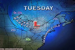
The low is not nearly the major storm I thought it would be in the Dec 16th post, although as we'll see below, it will strengthen east of the Great Lakes. I did forecast windy conditions in the Nov. 14th post. Accuweather reports that blustery winds will accompany the system. These are labeled in the above weather map as "bitter breezes."

04 Northeast
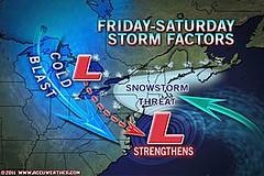
Another low will affect the Great Lakes tomorrow and then is expected to strengthen off the New England coast on Friday and Saturday threatening the area with another snowstorm. This will coincide beautifully with the Sun's square to Saturn over that area on Friday, January 7th.

January 25-27, 2011 New England and Eastern Canada

Great Lakes Winter Storm Jan 10-13, 2011

South Texas Wet Weather Feb 16-18, 2011

Significant West Coast Storm February 20-23, 2011

Major Storm January 3-5, 2011

Midwest Winter Cold and Heating Oil


Tropical Storm Matthew Fulfills Long-range Forecast!

Hurricane Earl and T.D. 10E Fulfill Long-range Forecasts!

Tropical Storm Alex Fulfills Long-range Prediction!

Bonnie Fulfills Long-range Forecast!

Introduction to the Weather Alternative

How Long-Range Forecasts Are Made

This Year

This year …
I’ll take more time to laugh and smile,
To feel the wind upon my face,
To learn true wisdom from a child,
Give my soul the needed space,
To live life pure and clear …
… this year.

This year …
I’ll learn to turn off my computer,
Interact with human beings,
Spend less time in online stupor,
More time learning, breathing, seeing
All that life holds dear …
… this year.

This year …
I will resolve to write that letter
That I have too long neglected,
Make an aching heart feel better,
Cheer a friend who feels dejected,
Bring someone some cheer …
… this year.

This year …
I’ll not be hijacked by my deadlines,
Or imprisoned by ambitions.
Or let dismal, gloomy headlines
Dictate my heart’s disposition.
I’ll choose faith, not fear …
… this year.

This year …
I’ll see the struggling flower beneath
The hard, frosty exterior
Of one who lets frustration see the
Because they feel inferior.
I’ll try to draw them near …
… this year.

This year …
No high and mighty resolutions
Fit for presidents and kings.
I’ll start a quiet revolution,
Seek these simple loving things
Above wealth or career …
… this year.— Ian Bach

Saturday, January 01, 2011

Mid-January Arctic Blast and Nor'easter Forecast Results

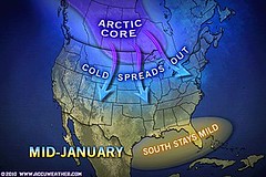
Accuweather's Joe Bastardi recently issued a forecast calling for a blast of arctic air in mid January to affect the Plains and Upper Midwest and then spread over much of the nation. Joe's post confirms my long-range forecast posted on November 14, 2010 entitled Midwest Winter Cold and Heating Oil.
31 Arctic Mid-January
He also concludes that "new burst of cold will have consumers using more heating fuel than previously thought and may stress their budgets."

In the winter season chart, the planets Jupiter and Uranus affect the 88th and 89th line of west longitude. Uranus when thus stationed predicates unseasonably low temperatures. Since Bastardi mentions that the cold outbreak gets underway around the middle of January, it's interesting to note that on January 13, 2011, the Jupiter-Uranus parallel is exact. This parallel has been observed by astro-meteorologists to coincide with high wind velocities, sudden abnormally high pressure areas, and low temperatures.

The Sun's sextile to Uranus takes place on January 17th. This crystali

zing 60 degree aspect intensifies the cold as temperatures decline sharply.

Nor'easter Forecast

On another note, my forecast for a nor'easter-like storm to affect the New England area between December 29, 2010 - January 1, 2011 did not materialize.

31 Northern Plains Blizzard
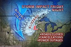
The forecast, however, did mention that "the storm begins to form over the Northern Plains and makes its way across the Great Lakes/Midwest area..." This is exactly what happened as blizzard conditions impacted the the Northern Plains and Great Lakes area between the 29th and 31st.

January 25-27, 2011 New England and Eastern Canada

Great Lakes Winter Storm Jan 10-13, 2011

South Texas Wet Weather Feb 16-18, 2011

Significant West Coast Storm February 20-23, 2011

Major Storm January 3-5, 2011

Midwest Winter Cold and Heating Oil


Tropical Storm Matthew Fulfills Long-range Forecast!

Hurricane Earl and T.D. 10E Fulfill Long-range Forecasts!

Tropical Storm Alex Fulfills Long-range Prediction!

Bonnie Fulfills Long-range Forecast!

Introduction to the Weather Alternative

How Long-Range Forecasts Are Made

New Year

Wednesday, December 29, 2010

January 25-27, 2011 New England and Eastern Canada

Astronomical cycles involving the Sun, Mercury, Saturn, and Pluto culminate between January 25-27, 2011 and bring storm potential for New England, Nova Scotia and surrounding areas.
CapitalsEasternCanada
At this time Saturn will begin its retrograde motion, which by itself, is an indicator of cold, damp weather. On the day it turns retrograde, it also receives a square from Mercury. Negative aspects from Mercury coincide with low pressure systems. The Sun's parallel to Pluto is also operating at this time and has been observed to breed cold weather.

Great Lakes Winter Storm Jan 10-13, 2011

South Texas Wet Weather Feb 16-18, 2011

Significant West Coast Storm February 20-23, 2011

Major Storm January 3-5, 2011

Midwest Winter Cold and Heating Oil

December 2010 Nor'easter Forecast

Tropical Storm Matthew Fulfills Long-range Forecast!

Hurricane Earl and T.D. 10E Fulfill Long-range Forecasts!

Tropical Storm Alex Fulfills Long-range Prediction!

Bonnie Fulfills Long-range Forecast!

Introduction to the Weather Alternative

How Long-Range Forecasts Are Made

The Faith Value of The US Dollar

Financial Crisis

american-dollar-toilet-paper

Unfettered greed, plain usury, outsourcing and endless wars have hollowed out from the inside the American Economy. And the black horse of the Apocalypse is running free collecting his dues.

The once mighty dollar has been reduced to nothing more than worthless paper devalued to but a shadow of its former glory. The UN, China, Russia, Arab Nations and World economic leaders are all calling for a new world currency, In essence, the report calls for a new Bretton Woods-style system of managed international exchange rates, meaning central banks would be forced to intervene and either support or push down their currencies depending on how the rest of the world economy is behaving.

How ironic that the idol that so many worshiped has come down bring with it its mighty temples and threatens to bury its devotees. Is not a question of if but when will the US Dollar collapse. Panicked investors have reacted by driving the price of gold to new heights never seen in world history.

Thursday, December 23, 2010

Great Lakes Winter Storm Jan 10-13, 2011

Between January 10th and 13th, 2011 the formation of a low pressure system and an invasion of cold air over the Great Lakes will likely result in winter storm and high wind warnings over the area.

Cold fronts on weather maps are depicted by the following symbol.

cold_front

Many readers, however, prefer Gil Elvgren's depiction of a Cold Front.
514+7HFTVUL__SS500_
While we're on the subject of heavenly bodies, it is precisely the angular relationships involving the Sun, Mercury, Mars, Jupiter, and Uranus that, according to astro-meteorology, will trigger the intense low pressure system over the Great Lakes area.

The Sun's parallel to Mercury accelerates wind velocities. Mercury's parallel to Mars also has the same effect. Bleak, penetrating, blustery cold weather accompanies the square of Mercury to Uranus, and high-velocity winds attend the parallel between Jupiter and Uranus.

The Pacific Northwest and British Columbia, as well as the Northeast U.S. will also be affected by these planetary alignments.

South Texas Wet Weather Feb 16-18, 2011

Significant West Coast Storm February 20-23, 2011

Major Storm January 3-5, 2011

Midwest Winter Cold and Heating Oil

December 2010 Nor'easter Forecast

Tropical Storm Matthew Fulfills Long-range Forecast!

Hurricane Earl and T.D. 10E Fulfill Long-range Forecasts!

Tropical Storm Alex Fulfills Long-range Prediction!

Bonnie Fulfills Long-range Forecast!

Introduction to the Weather Alternative

How Long-Range Forecasts Are Made

3 Kings

Tuesday, December 21, 2010

South Texas Wet Weather Feb 16-18, 2011

The First Quarter Moon of February 11, 2011 sets up a potentially wet weather pattern for the South Texas Plains region.

Untitled

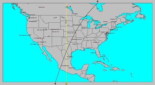
As shown on the accompanying map, at the time of the First Quarter Moon, Neptune and the Moon occupy angular positions. That is to say as the Moon is setting to the west, Neptune will be anti-culminating or reaching its lowest point (directly underneath the earth).

Around the 17th, the Sun will oppose Neptune and spark this planetary combination over the Rio Grande about 150 miles southwest of San Antonio, Texas. Neptune , the most pluvial of all the celestial bodies, foreshadows abundant moisture and threatens flooding in those regions where it occupies the meridian.

Significant West Coast Storm February 20-23, 2011

Major Storm January 3-5, 2011

Midwest Winter Cold and Heating Oil

December 2010 Nor'easter Forecast

Tropical Storm Matthew Fulfills Long-range Forecast!

Hurricane Earl and T.D. 10E Fulfill Long-range Forecasts!

Tropical Storm Alex Fulfills Long-range Prediction!

Bonnie Fulfills Long-range Forecast!

Introduction to the Weather Alternative

How Long-Range Forecasts Are Made


Tree

Sunday, December 19, 2010

Significant West Coast Storm February 20-23, 2011

Expect whipping winds and a strong low pressure system to bring precipitation to coastal areas of British Columbia, the Pacific Northwest, Idaho, and Nevada as it pushes eastward.
anonymous-gene-kelly-singing-in-the-rain-2400101
The planet Neptune occupies the 116th line of west longitude through Idaho, Nevada, and southern California in the winter seasonal chart. Neptune's influence has been observed by astro-meteorologists to correspond with increased atmospheric moisture, southerly air flows, and heavy downpours when aspected negatively by other planets. Between the 20th and 23rd of February 2011, both Mercury and Mars will conjoin Neptune triggering its pluvial influence.

Conjunctions of Mercury and Mars bring acute weather systems characterized by whipping westerly winds. The conjunction of Mars and Neptune induce a rapidly falling barometer and semi-tropical-like low pressure systems. Mercury's conjunction to Neptune also lowers the barometer and increases precipitation.
!B64m,fgB2k~$(KGrHqUOKjcEycuPoW)WBMyj7SogLQ~~-1_1
The Mars-Neptune conjunction occurs about every two years. Our last one was the conjunction of March 8, 2009. The seasonal chart for the winter of 2008-9 also placed Neptune over the West Coast States. That particular storm, which was also was the subject of a long-range forecast brought winter storm warnings and winter weather advisories across the Pacific Northwest, Idaho, and western Montana. Snow levels in western Washington and northwest Oregon were about at sea level causing driving problems. This year's Mars-Neptune conjunction is exacerbated by the additional energy of the Mercury-Mars conjunction.
rainy2
The celestial waterworks may actually get underway a few days beforehand when the Sun makes its conjunction to Neptune on the 17th. Then, the Full Moon of February 18th falls in close conjunction to Neptune drawing moisture up from southern regions.

The same planetary configurations affect the eastern portion of Australia which may now be subject to heavy rain.

Major Storm January 3-5, 2011

Midwest Winter Cold and Heating Oil

December 2010 Nor'easter Forecast

Tropical Storm Matthew Fulfills Long-range Forecast!

Hurricane Earl and T.D. 10E Fulfill Long-range Forecasts!

Tropical Storm Alex Fulfills Long-range Prediction!

Bonnie Fulfills Long-range Forecast!

Introduction to the Weather Alternative

How Long-Range Forecasts Are Made


Breaking News!
Click to enlarge


xn-chris

Thursday, December 16, 2010

Major Storm January 3-5, 2011

The ingredients for a major storm to form over the Great Lakes area will come together between the 3rd and 5th of January 2011. According to the long-range forecast method based on Johannes Kepler's use of planetary cycles, the alignments of Jupiter and Uranus coupled with the configuration between Venus and Neptune will provide the cold and moisture needed to create a powerful atmospheric disturbance.


greatlakeswater


The conjunction of Jupiter and Uranus recurs at average periods of 13.81 years and have been observed by astro-meteorologists to coincide with intense cold fronts and high velocity winds. During the 2010-11 winter season, Jupiter and Uranus set up residence over 87 west longitude ranging southward through Chicago, Illinois, western Kentucky and Tennessee, and on through Mobile, Alabama.


The configurations between Venus and Neptune, the pluvial planet par excellence,
have been observed to induce southerly air flows, lower barometer, and the heaviest downpours. The New Moon chart at this time localizes their influence over the Great Lakes area.


low


It appears that a cold air mass from the northern Plains will push eastward and collide with warm, moist air over the Great Lakes at this time and affect an area as far southward as Tennessee. The storm should then move eastward over the U.S. Northeast.

Midwest Winter Cold and Heating Oil

December 2010 Nor'easter Forecast

Tropical Storm Matthew Fulfills Long-range Forecast!

Hurricane Earl and T.D. 10E Fulfill Long-range Forecasts!

Tropical Storm Alex Fulfills Long-range Prediction!

Bonnie Fulfills Long-range Forecast!

Introduction to the Weather Alternative

How Long-Range Forecasts Are Made


cartoon

Wednesday, December 15, 2010

Approaching Storm Appears On Schedule

Accuweather meteorologists over the last few days have become aware of a snowstorm that may affect the Northeast and New England this weekend. This is the storm that I posted about 2 months ago based on astro-meteorological indicators.

15 Weekend Storm I-95

Accuweather meteorologists have stated that the odds are increasing for the storm to affect the Northeast and New England but they are not sure yet if it will track that close to the coast.


In my post of October 16, 2010, I explained the astro-meteorological reasoning behind the storm. The combination of the Sun's conjunction to a retrograde Mercury (a classic storm breeder) and their squares to Uranus between December 18th and 20th led to the forecast for a possible Nor'easter-type storm to affect the area.


Midwest Winter Cold and Heating Oil

December 2010 Nor'easter Forecast

Tropical Storm Matthew Fulfills Long-range Forecast!

Hurricane Earl and T.D. 10E Fulfill Long-range Forecasts!

Tropical Storm Alex Fulfills Long-range Prediction!

Bonnie Fulfills Long-range Forecast!

Introduction to the Weather Alternative

How Long-Range Forecasts Are Made


AO1

Monday, December 06, 2010

Near Blizzard Conditions for New England

In a recent post, I commented on the
storm potential for December 3-5, 2010. I explained the astro-meteorological influences at work and which of the three scenarios that Accuweather presented were the most likely.
05 Near Blizzard

At the time they felt that either
1) a big snowstorm would affect the Northeast
2) nothing at all would happen or
3) it would track too far east or west.

My take was that a good-sized storm would hit the Northeast, New England, and Nova Scotia and that if it were to track anywhere it would track to the east.

On the 4th, Accuweather reported that two long-duration storms would take aim on northern New England and part of Quebec. The heaviest snow would be in Vermont, Maine, and Quebec.

On the 5th, they reported "Near Blizzard Set to Pound Maine."

Today's Weather Channel map (Dec 6) shows the area still under the gun.

Dec 06

Midwest Winter Cold and Heating Oil

December 2010 Nor'easter Forecast

Tropical Storm Matthew Fulfills Long-range Forecast!

Hurricane Earl and T.D. 10E Fulfill Long-range Forecasts!

Tropical Storm Alex Fulfills Long-range Prediction!

Bonnie Fulfills Long-range Forecast!

Introduction to the Weather Alternative

How Long-Range Forecasts Are Made

He who has not Christmas in his heart will never find it under a tree.
—Roy L. Smith

Sunday, November 28, 2010

Northeast Storm Dec 3-5, 2010

400x266_11261840_stormfactors

Accuweather meteorologists are toying with the idea that a sizable snowstorm could develop over the Northeast U.S. this coming weekend. They are a bit hesitant to say it will happen as, for them, issuing a forecast for a week ahead is stretching their capabilities. They offer three possibilities: 1- A very big snowstorm will affect the Northeast. 2- Nothing will happen. 3- The storm will track too far east or west and will not bring snow or will just bring rain.


The planetary activity at this time involves the alignments of Jupiter and Saturn, as well as Mars and Uranus on December 3rd. Then on the 5th we have the conjuction of Mercury and Pluto and the station of Uranus. We find these planets congregating over the U.S. Northeast, New England, and Nova Scotia. There is also some activity off the coast of the Northeast.


To me that says that of the three possibilities mentioned by Accuweather, number 1 is very likely. I would discount number 2 and as for number 3, the possibility of the storm tracking further east is more likely than it tracking further west. So I would prepare to experience a good-sized storm over the Northeast and New England at this time.


Some of these same planetary alignments affect the western Atlantic in the tropics. I wonder if we'll even see a bit of out-of-season tropical activity or perhaps some kind of storm system approaching the Windward Islands then.


Midwest Winter Cold and Heating Oil

December 2010 Nor'easter Forecast

Tropical Storm Matthew Fulfills Long-range Forecast!

Hurricane Earl and T.D. 10E Fulfill Long-range Forecasts!

Tropical Storm Alex Fulfills Long-range Prediction!

Bonnie Fulfills Long-range Forecast!

Introduction to the Weather Alternative

How Long-Range Forecasts Are Made


How Science and Religion are Relevant to Each Other


Science can both falsify and verify claims of religion.


Examples of religious claims science has falsified include:

1- The sky rested on the shoulders of Atlas or the back of a turtle

2- The Geocentric Theory- The Church's misinterpretation of scripture

3- The Taoist and Hindu belief that the world is eternal.


Examples of religious claims science has verified:

1- The universe was created out of nothing a finite time ago.

2- The world is the product of intelligent design. (This is seen in

the delicate balance of physical constants and quantities. If any one of these were to be slightly altered, the balance would be destroyed and life would not exist. Life-prohibiting universes are vastly more probable than any life-permitting universe like ours.)--based on the writing of Dr. William Lane Craig

Sunday, November 14, 2010

Midwest Winter Cold and Heating Oil

Winter weather conditions, in part, affect the price of heating oil. An astro-meteorological chart for the winter season shows a cold influence over the U.S. Midwest. Below are some dates when this cold influence will be activated.

oil_1010_jcw


January 2-4, 2011

An intense cold front and windy conditions possibly triggering precipitation is indicated at this time.


January 6-8, 2011

A low pressure system affects Chicago and the Great Lakes area.


January 10-11, 2011

A good-sized storm system affects the Great Lakes area ushering in cold conditions.


January 12-13, 2011

Windy and cold conditions.


January 16-18, 2011

A cold high pressure system is indicated.


January 25-27, 2011
Stormy conditions over the Great Lakes and Midwest.


350px-Map-USA-Midwest01


February 1-2, 2011

Damp and cold conditions.


February 12-13, 2011

Cold front.


February 17-19, 2011

A low pressure area is indicated over the Great Lakes and Midwest.


February 28-March 2, 2011

Fair and cold.


March 5-7, 2011

A cold front triggers storms over the Midwest down into Kentucky and Tennessee.


March 8-10, 2011

Blustery conditions over the Midwest as a cold front punches through the area.


March 13-14, 2011

A cold front may bring precipitation.


March 17-19, 2011

A strong cold front brings stormy conditions over the Midwest and into the Deep South.


December 2010 Nor'easter Forecast

Tropical Storm Matthew Fulfills Long-range Forecast!

Hurricane Earl and T.D. 10E Fulfill Long-range Forecasts!

Tropical Storm Alex Fulfills Long-range Prediction!

Bonnie Fulfills Long-range Forecast!

Introduction to the Weather Alternative

How Long-Range Forecasts Are Made


Bad leaders think they are better than those who serve them. Great leaders believe they are only half as good as those they serve. --Simon Sinek


Emotions aren't smooth & shiny, they are rough & uncertain. Yet despite that, we still have to risk sharing them before they have value. --Simon Sinek

Friday, October 29, 2010

Forecast Results for Sept 18-23, 2010 and Experimental Forecasts

The forecast for the U.S. at this time warned of a possible low-pressure system about 200 miles south of Mobile and another area of possible tropical activity along the west coast of Florida.
Sept 19
The closest conditions came to fulfilling this forecast was on the 19th when, according to the National Weather Service, a low pressure system off of Matagorda, Texas brought 5 to 6 inches of rain. (See above map) This, of course, was farther west than what the forecast stated. Florida had just normal thunderstorm activity at times during the forecast period.
The results of the Experimental Forecasts Part 2 seem to suggest that the particular techniques experimented with are not that reliable and will not be included in my forecast method.


“Use what talents you possess; the woods would be very silent if no birds sang except those that sang best.”—Henry Van Dyke

“What is to give light must endure burning.”—Viktor E. Frankl

Friday, October 22, 2010

Central American Forecast Results

Here's a look at the results of The Weather Alternative long-range forecasts for Central America. These four forecasts cover the month of August and were posted on May 16, 2010.
The first forecast was for August 2-6, 2010 and called for a severe weather pattern or possible tropical system over Honduras and Nicaragua.


The Weather Channel reported on the 2nd, "In the western Caribbean, there is a tropical wave moving ashore in Central America near Nicaragua that should produce some locally heavy rainfall over Central America in the next day or two. This system is not expected to develop into a tropical cyclone."


06 Tropics2


The above weather graphic from the National Weather Service is for August 6, 2010 and shows a circled area over Honduras and Nicaragua. The NWS stated: SHOWERS AND THUNDERSTORMS HAVE INCREASED OVER THE WESTERN CARIBBEAN
SEA IN ASSOCIATION WITH A TROPICAL WAVE.

The second forecast was for August 7-9 and pinpointed an area in the Central Caribbean (75W/14N) as a place where a tropical system could either form or pass through. Severe weather was also forecast for Panama. The NWS posted the following comment on August 9th.


NWS

Aug 9, 2010


CARIBBEAN SEA...
SCATTERED MODERATE TO HEAVY SHOWERS COVER THE FAR SW CARIBBEAN SOUTH OF 13N WEST OF 75W ENHANCED BY SURFACE CONVERGENCE NEAR AN EXTENSION OF THE ITCZ ACROSS COSTA RICA...PANAMA...AND NRN COLOMBIA.

The third forecast was for August 9-12, 2010. This forecast mentioned severe weather for Honduras, Nicaragua, El Salvador, and Costa Rica with a possible tropical system of the Costa Rican coast at 85W/8N.

The NWS report for August 12th below mentions enhanced convection over Panama and Costa Rica.


Aug 12

SCATTERED SHOWERS AND TSTMS ARE
FOCUSED FARTHER SOUTH OVER THE SW CARIBBEAN SEA. THIS ACTIVITY
IS LOCATED SW OF A LINE FROM 15N83W TO NORTHERN COLOMBIA NEAR
12N73W. CLOSE PROXIMITY TO THE ITCZ AXIS ALONG 09N/10N AND AN
UPPER LEVEL DIFFLUENT ENVIRONMENT IS ENHANCING THE CONVECTION S
OF 12N INCLUDING PANAMA AND COSTA RICA.


The fourth forecast was for August 19-22 specifying heavy rain for Honduras and Nicaragua. The accompanying map is for August 21st.

The NWS commentary below talks of abundant moisture over Panama, Costa Rica, Nicaragua, and Honduras.

21 Tropics2


Aug 21

CARIBBEAN SEA...
ABUNDANT MOISTURE AND INSTABILITY IS NOTED ACROSS THE INTERIOR CENTRAL AMERICA AND SURROUNDING WATERS COVERING THE SW CARIBBEAN GENERATING SCATTERED SHOWERS AND ISOLATED TSTMS W OF 74W S OF 17N. SATELLITE IMAGERY DENOTES THE STRONGEST ACTIVITY LIES WITHIN 100 NM OFFSHORE OF WESTERN PANAMA...COSTA RICA...NICARAGUA...AND HONDURAS.


4PY5YGXSE929

“Choose to be a love-finder rather than a fault-finder.”—Gerald Jampolsky

“Obstacles are those frightful things you see when you take your eyes off your goals.”—Hannah More

Saturday, October 16, 2010

December 2010 Nor'easter Forecast

Nor-easter Time


Image by Cool Text: Free Logos and Buttons - Create An Image Just Like This


December 18-20, 2010


The Northeast U.S. and New England are highlighted at this time for an onslaught of severe weather which may very likely be a Nor'easter. Mercury is retrograde now, which has been known to increase wind velocities when in conjunction with the Sun. Mercury's conjunction with the Sun takes place on the 19th but the day before and after, the Sun and Mercury will aspect Uranus. Taken all together stormy and windy conditions are a strong possibility for this area of the country.


December 29 2010- January 1, 2011

Weather conditions over the New England area may put on quite a display as the New Year is ushered in. The approaching Jupiter-Uranus conjunction and Mars' square to Saturn spell severe weather for the New England area. This could manifest as a Nor'easter. Other indications suggest the storm begins to form over the Northern Plains and makes its way across the Great Lakes/Midwest area and strengthens over New England.


Tropical Storm Matthew Fulfills Long-range Forecast!


Hurricane Earl and T.D. 10E Fulfill Long-range Forecasts!


Tropical Storm Alex Fulfills Long-range Prediction!


Bonnie Fulfills Long-range Forecast!

Experimental Forecasts Part 2- July-Sept 2010


Hurricane Season 2010--Forecast for September


Hurricane Season 2010--Central America Part 2


Introduction to the Weather Alternative


How Long-Range Forecasts Are Made


Thoughts


“Don’t water your weeds.” —Harvey Mackay


“In love, one and one are one.”—Jean-Paul Sartre


“Set your goals high, because what a person accomplishes is in proportion to what they attempt.”—Mitchell Naufell