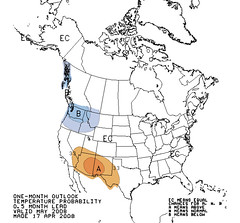
The forecasts that follow are based on planetary aspects and how they are viewed from Sun's ingress into Aries, which is the main chart for the spring season. The month of May brings us aspects such as Mercury square Saturn, Sun trine Jupiter, and Jupiter sextile Uranus. We also note that Merucy and Neptune will both turn retrograde on May 26th. In the ingress chart these planets are found on the eastern and western sides of the country. Hence at that time the eastern portion of the country will be experiencing "mercurial" weather, which relates to colder and sometimes windier conditions, while the western portion of the country at that time will experience "neptunian" weather. This relates to increased moisture (sometimes extreme) due to southerly air flows.
These forecasts are pretty basic since I have not included information from the lunation charts such as Full Moon and New Moon charts. Nor have I included other charts such as solar and lunar eclipse charts. All of these can add other information that can be useful in formulating forecasts.
May 2-5
Saturn turns direct on May 2nd followed by a square from Mercury to Saturn on May 3rd. Venus parallels Saturn on the 5th. All this infers major storm activity associated with a cold front over the West Coat, Intermountain West, and Rockies.
May 3-5
Mercury is parallel Mars on the 3rd and also square Saturn. This presages a storm system with energetic winds over the Plains.
May 7-8
Windy conditions and precipitation over the Rockies pushing out into the Plains are indicated at this time.
May 10-13
The Sun's sextile to Uranus and its trine to Jupiter should result in fair conditions over the Rockies, which spreads to the Plains and Mississippi Valley.
May 13-15
On the 14th, the Sun will square Neptune over the western US. Warm moist air collides with cold air bring precipitation.
May 13-31 Mercury's Influence
Transit Mercury sets up residence over the eastern US by the 13th. The Southeast, mid-Atlantic, and Northeast should begin to feel its effects from this time on. Mercury is associated with cooler air masses and windy conditions. On the 13th the Moon will square Mercury propelling some cold air throughout the region.
By the 21st, Mercury will descend along the length of the US east coast. As the Moon opposes Mercury, another good shot of colder air should lower temperatures.
On the 26th, Mercury begins its retrograde motion, which will once again bring cold air spilling into the the region with windy and/or stormy results.
By the 28th, the Moon squares Mercury again. This, coupled with the Sun's parallel to Mercury should trigger colder conditions, wind, and storms from the Mississippi Valley to the East Coast from the 28th through the 31st.
May 17-19
Venus sextiles Uranus and trines Jupiter. Fair conditions are expected over the Rockies.
At the same time a cold air mass will trigger storms and windy conditions over the Plains and on into the Mississippi Valley.
May 19-20
Venus' square to Neptune over the western US at 118 west longitude will bring warm moist air resulting in precipitation.
May 20-23
As the Sun parallels Mars, warm air surges northward over the Plains raising temperatures over Texas, Oklahoma, and Kansas. Storms will ensue as the Sun squares Saturn on the 22nd.
May 22-25
The Sun squares Saturn on the 22nd (111 West) while Venus parallels Mars on the 24th. These together should trigger a clashing of cold and warm air masses as represented by Saturn and Mars resulting in storms over the Rockies.
May 25-29
Neptune goes retrograde on the 26th over the West Coast states as the Moon conjoins and parallels it. Neptune pulls moisture up from the south in large quantities. Venus also squares Saturn, which is found over the Rockies and is also triggered by the Moon. A good-sized storm should be the results for the West Coast and Rockies.
May 28-31
A stormy period for the Rockies.
Introduction to the Weather Alternative
How Long-Range Forecasts Are Made
Temperature Monitors Report Widescale Global Cooling
Better Understanding Of Hurricane Trajectories Learned From Patterns On Soap Bubbles
ScienceDaily (Apr. 15, 2008) — Researchers at the Centre de Physique Moléculaire Optique et Hertzienne (CPMOH) (CNRS/Université Bordeaux (1) and the Université de la Réunion(1) have discovered that vortices created in soap bubbles behave like real cyclones and hurricanes in the atmosphere. Soap bubbles have enabled the researchers to characterize for the first time the random factor that governs the movement and paths of vortices. These results, published in the journal Physical Review Letters, could lead to a better understanding of such increasingly common and often devastating atmospheric phenomena.
2 comments:
I enjoy this blog and find your research fasinating.
Thanks!
Ken
Post a Comment