Saturday, October 02, 2010

Nicole and Other Resutls

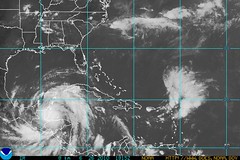
The first of the two maps below show where
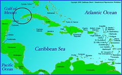
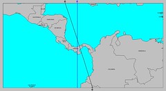
Nicole (Tropical Depression 16) formed on the 29th. The second map, from my September 26th post, shows where the planetary alignments according to astro-meteorology indicated it would form. They coincide perfectly.

29 Tropical Atlantic

CaribbeanMap

I also indicated in the same post another area that would be a good bet for tropical development between September 30th and October 3rd. Here are the maps back to back.

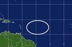
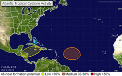
The first one shows where I said "another broad area" likely for tropical development would lie. The second map is from the National Weather Service for October 1st. Once again they coincide perfectly. My map was calculated using only astro-meteorological indicators. This area is still being watched for development.

catl-m

01 Tropical Atlantic

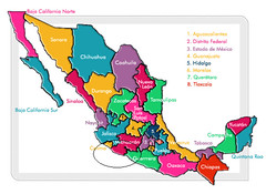
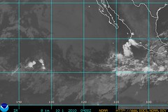
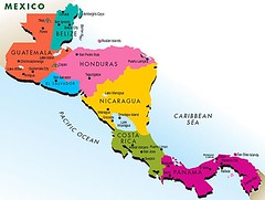
A third area mentioned in my post was for the western coast of Mexico, specifically over the states of Michoacán, Guerrero, and Colima. Below is the map where I circled the area in question. Under that is a map for September 30th from the NWS. The Mexican weather service reported the follow:

Baja presión de 1004 hPa frente a las costas de Colima y Michoacán, cerca de 18°N y 108°W, se asocia con nublados de convección moderada a fuerte. Baja presión de 1008 hPa localizada en 9.5°N y 115°W, se asocia con nublados de convección moderada a fuerte.

This roughly translates that an area of low pressure over the coasts of Colima and Michoacán is producing strong to moderate convection.

estados_mexico

30 Tropical Pacific


Tropical Storm Matthew Fulfills Long-range Forecast!

Hurricane Earl and T.D. 10E Fulfill Long-range Forecasts!

Tropical Storm Alex Fulfills Long-range Prediction!

Bonnie Fulfills Long-range Forecast!

Experimental Forecasts Part 2- July-Sept 2010

Hurricane Season 2010--Forecast for September

Hurricane Season 2010--Central America Part 2

Introduction to the Weather Alternative

How Long-Range Forecasts Are Made

On Stephen Hawking's new book The Grand Design

Stephen Hawking's big bang gaps The laws that explain the universe's birth are less comprehensive than Stephen Hawking suggests

Sunday, September 26, 2010

October 2010 Hurricane Outlook

Tropical Storm Matthew Fulfills Long-range Forecast!

Accuweather meteorologists are warning of the potential development of a tropical
system at the end of this month in the Caribbean. Based on the planetary alignments during this period, I think that is what will happen.

CaribbeanMap

The above map shows where one planetary model places a strong emphasis around the 30th of September. Accuweather meteorologists also state the possibility of this system affecting Florida and the East Coast. I would agree with them as other planetary indicators do highlight the East Coast area through October 3rd.

Another broad area that is accentuated around September 30th through October 3rd lies in and around 50 west longitude roughly between 15 and 23 north latitude.

catl-m

This is roughly about 700 miles east of the Lesser Antilles. We may see some tropical development there.

A third area that stands out during this period falls in and around 104 west longitude and 19 north latitude.


estados_mexico

The area encompasses the Mexican states of Michoacán, Guerrero, and Colima. We may see tropical development there or a severe weather pattern.

Hurricane Earl and T.D. 10E Fulfill Long-range Forecasts!

Tropical Storm Alex Fulfills Long-range Prediction!

Bonnie Fulfills Long-range Forecast!

Experimental Forecasts Part 2- July-Sept 2010

Hurricane Season 2010--Forecast for September

Hurricane Season 2010--Central America Part 2

Introduction to the Weather Alternative

How Long-Range Forecasts Are Made


“There is a God-shaped vacuum in the heart of every man which cannot be filled by any created thing, but only by God, the Creator, made known through Jesus”—Blaise Pascal

Thursday, September 23, 2010

Tropical Storm Matthew Fulfills Long-range Forecast!

Tropical Storm Matthew formed today in the Caribbean fulfilling the long-range forecast posted here on May 28th almost 4 months ago.


23 Matthew


The Accuweather map above shows Tropical Storm Matthew's position and the area it will effect over the next few days.


The Weather Alternative forecast read as follows:


Sept 21-23, 2010

The Sun’s oppositions to Jupiter and Uranus, as well as the parallel of Mars to Neptune gather their influence together over the Central American countries of Panama, Costa Rica, and Nicaragua. The resultant weather pattern may be a tropical storm or hurricane that affects the area or a severe weather pattern ignited by tropical moisture.


I posted a reminder again on September 6th.


Current thinking is the Matthew will affect Nicaragua, Honduras, and Belize over the next few days with heavy rain. This path is a bit more to the north than I had envisioned.


So far this hurricane season The Weather Alternative long-range forecasts have found their fulfillment in Hurricane Alex, Tropical Storm Bonnie, Tropical Depression 5, Hurricane Earl, Tropical Depression 10E and now Tropical Storm Matthew.

Hurricane Earl and T.D. 10E Fulfill Long-range Forecasts!


Tropical Storm Alex Fulfills Long-range Prediction!


Bonnie Fulfills Long-range Forecast!


Experimental Forecasts Part 2- July-Sept 2010


Hurricane Season 2010--Forecast for September


Hurricane Season 2010--Central America Part 2


Introduction to the Weather Alternative


How Long-Range Forecasts Are Made


Our political way of life is by the laws of nature, of nature's God, and of course presupposes the existence of God, the moral ruler of the universe, and a rule of right and wrong, of just and unjust, binding upon man, preceding all institutions of human society and of government. --John Quincy Adams President of the United States, 1825-1829

Wednesday, September 08, 2010

Experimental Forecast Results

Hurricane Earl and T.D. 10E Fulfill Long-range Forecasts!


portraitofascholar
In July I posted some experimental forecasts. These were based on some research I was doing to improve forecast accuracy. I called them experimental because the techniques I was basing these forecasts on are not the regular techniques I normally use. This particular series of forecasts covered July and August.

To me, the results are not very convincing and so this particular technique doesn't look like something I'll be using.

Forecast

July 21-23, 2010
A low pressure area, most likely centering in and around the Georgia-Tennessee area, or front affects the East Central and Deep South area.

Results

The main weather event at this time was high heat.

Forecast

July 26-28, 2010
High pressure and fair conditions embrace the southern Mississippi Valley area.

Results

There was a lot of rain over the area between these dates.

Forecast

July 30-August 1, 2010
An increase in temperatures and moisture over the Oklahoma-Arkansas area. Most likely will manifest as a low pressure area bringing rain.

Results

No low pressure formed over the area.

Forecast

August 11-16, 2010
A noticeable increase in temperatures is indicated over the Southwest U.S. centering over New Mexico-Arizona area.

Results

The Weather Channel reported rising temperatures on the 12th and 14th.

Forecast

August 21-23, 2010
A high pressure area is shown over the southern California region resulting in warm and fair conditions.

Results

The area was warm and fair as predicted.

Central America Hurricane Potential Sept 18-23, 2010

Experimental Forecasts Part 2- July-Sept 2010

Tropical Storm Alex Fulfills Long-range Prediction!

Bonnie Fulfills Long-range Forecast!

Hurricane Season 2010--Caribbean, Mexico, Central America

Hurricane Season 2010--Forecast for September

Hurricane Season 2010--Central America Part 2

Introduction to the Weather Alternative

How Long-Range Forecasts Are Made


“No one ever drowned in sweat.”—Author Unknown

“Quality is not an act. It is a habit.” -- Aristotle

"Applaud us when we run, console us when we fall, cheer us when we recover, but for God's sake, let us pass on!" -- Edmund Burke

Monday, September 06, 2010

Central America Hurricane Potential Sept 18-23, 2010

Hurricane Earl and T.D. 10E Fulfill Long-range Forecasts!

So far this year The Weather Alternative long-range hurricane forecasts have pinpointed Hurricane Alex, Tropical Storm Bonnie, Tropical Depression 5, Hurricane Earl, and Tropical Depression 10E. Here's an upcoming scenario that might develop into some tropical activity in the Central America area.
CentralAmericaMap


A region senstive to planetary influences sets up approximately over 81 west longitude and 11 north latitude. This area is in the southwestern Caribbean off the eastern coasts of Panama, Costa Rica, and Nicaragua.


4503738599_4e8c3d8c67_m

Starting with the conjunction of Jupiter and Uranus on the 18th, we then move into the Sun's oppositions to Jupiter and Uranus on the 21st. The Full Moon of the 23rd also heightens activity over the area.

The result just very well could be another tropical system that organizes over the area affecting Panama, Costa Rica, and Nicaragua. Short of an all-out tropical system my next guess would be a severe weather pattern bringing heavy rains.


Experimental Forecasts Part 2- July-Sept 2010

Tropical Storm Alex Fulfills Long-range Prediction!

Bonnie Fulfills Long-range Forecast!

Experimental Forecasts July & August 2010

Hurricane Season 2010--Caribbean, Mexico, Central America

Hurricane Season 2010--Forecast for September

Hurricane Season 2010--Central America Part 2

Introduction to the Weather Alternative

How Long-Range Forecasts Are Made

Education

The student who has to cram through a school or a college course, who has made himself merely a receptacle for the teacher's thoughts and ideas, is not educated; he has not gained much. He is a reservoir, not a fountain. One retains, the other gives forth. Unless his knowledge is converted into wisdom, into faculty, it will become stagnant like water.

--J.E. Dinger

Friday, September 03, 2010

Earl and T.D. 10E Fulfill Long-range Forecasts!

The Weather Alternative post of April 24, 2010, forecast hurricane or tropical storm activity over the Carolinas and Virginia between Sept. 2-5, 2010. Hurricane Earl lashed the coast of North Carolina today prompting mandatory evacuations from a couple of the islands of the Outer Banks. Hurricane and Tropical Storm warnings were also posted for Virginia. Thus Earl fulfills the long-range forecast of about 4 and 1/2 months ago.
Sept 02

In a more recent post of August 27th entitled Hurricane Strike Zones for Sept 3rd, I mentioned that another place due for tropical activity was in and around the tip of the Baja Peninsula. I included the following map that highlighted both the Carolinas and the southern Baja.


Untitled

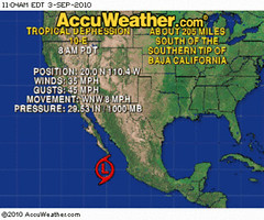
Today, the area of low pressure that had been forming over the last couple of days became Tropical Depression 10E effectively fulfilling the August 27th forecast. Below is an Accuweather map showing it's current position.

03 TD 10E Accu

So far this hurricane season The Weather Alternative long-range forecasts have found their fulfillment in Hurricane Alex, Tropical Storm Bonnie, Tropical Depression 5, and now Hurricane Earl, and Tropical Depression 10E.


Experimental Forecasts Part 2- July-Sept 2010

Tropical Storm Alex Fulfills Long-range Prediction!

Bonnie Fulfills Long-range Forecast!

Experimental Forecasts July & August 2010

Hurricane Season 2010--Caribbean, Mexico, Central America

Hurricane Season 2010--Forecast for September

Hurricane Season 2010--Central America Part 2

Introduction to the Weather Alternative

How Long-Range Forecasts Are Made


"If we are not governed by God, then we will be ruled by tyrants." -- William Penn

Friday, August 27, 2010

Hurricane Strike Zones for Sept 3rd

The Atlantic Basin has livened up over the last day or so and forecasters are now concerned that Tropical Storm Earl might make it to the Atlantic Seaboard by late next week. My September Hurricane Forecast posted on April 24, 2010 pinpointed the Carolinas as a very likely area for hurricane landfall between Sept 2-5, 2010. This is within the time frame that forecasters are now talking about. Below is a map highlighting the areas that could be affected by tropical storm or hurricane conditions on those dates.
Untitled

As can be seen, I've also pinpointed the area in and around the southern tip of the Baja Peninsula as well. According to Johannes Kepler's astro-meteorological forecast system based on planetary cycles, these areas could be subject to tropical activity or at least some type of severe weather pattern.


Experimental Forecasts Part 2- July-Sept 2010

Tropical Storm Alex Fulfills Long-range Prediction!

Bonnie Fulfills Long-range Forecast!

Experimental Forecasts July & August 2010

Hurricane Season 2010--Caribbean, Mexico, Central America

Hurricane Season 2010--Forecast for September

Hurricane Season 2010--Central America Part 2

Introduction to the Weather Alternative

How Long-Range Forecasts Are Made

Faith is one of the forces by which men live and the total absence of it means collapse.--William James
American psychologist and philosopher

Wednesday, August 25, 2010

August 2010 Forecast Results

These long-range forecasts were posted in April 2010.

Forecast
August 2-3, 2010
Intense storms are expected throughout the East Central, Northeast, Mid-Atlantic, and Southeast. These storms may bring damaging winds, hail, or tornadoes. It is possible that a tropical system makes landfall over the Carolinas.

Results
images

Except for a few gusty thunderstorms with heavy downpours in the Southeast, the main intense weather during this period was from the heat.


Forecast
August 7-10, 2010
Venus will now activate the alignments between Jupiter, Saturn, Uranus, and Pluto. Since these are placed roughly between 79 and 81 west longitude, the Southeast and Mid-Atlantic areas are in for a round of severe weather. This may indicate tropical activity affecting the Florida Peninsula and the Carolinas. These planetary alignments also have the potential to affect Cuba and Panama.

Results
10 Tropical Gulf
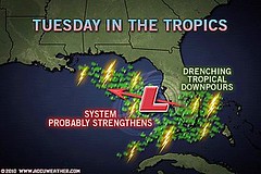
The main weather event at this time was heavy rain over Florida on the 8th, 9th, and 10th. Above is the Accuweather map for the 10th when a non-tropical low pressure system spread 1 to 5 inches of rain south of a line from Daytona to Tampa.

Forecast
August 14-18, 2010
The eastern Plains and Mississippi Valley are likely to be under severe weather threats now. This could manifest as powerful storms producing large hail, gusty winds, and tornadoes. A tropical system or abundant tropical moisture may affect the eastern Texas and Louisiana area.

Further east, heavy rainfall is indicated for the Mid-Atlantic area either due to tropical moisture being introduced over the area or from an actual tropical system that enters through the Carolinas.

Resutls
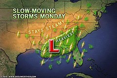
16 Central Gulf Coast
The remnants of Tropical Depression 5 lingered over the central Gulf Coast during this forecast period and and brought heavy showers and drenching downpours fulfilling the long-range forecast.

This was also a rough period for the Plains and Mississippi Valley. Here are some Accuweather headlines that appeared during the forecast period.

Aug 14: More Rounds of Severe Weather Loom for the Midwest
Aug 16: Gusty Storms Loom for the Central Plains
Aug 17: Wichita, Oklahoma City Brace for Damaging Thunderstorms

The Mid-Atlantic was also hit as indicated in the forecast. Here are more Accuweather headlines.

Aug 18: Flooding Rain Threatening Washington, D.C., Today
Up to 2 inches of rain is expected across the mid-Atlantic into this evening.

Forecast
August 18-22, 2010
Planetary alignments at this time suggest very volatile atmospheric conditions that will put the eastern Plains and Mississippi Valley at risk for severe weather. Dangerous thunderstorms and/or tornadoes are indicated in and around Missouri. This may be due to a tropical system that makes landfall over eastern Texas or Louisiana.

The Southeast and Mid-Atlantic are not out of harm’s way either. There are indications that suggest tropical storm or hurricane activity over the Carolinas at this time or at least some kind of severe weather system if not actually tropical in nature.

Results
Much of this forecast was covered in a recent post.
The Southeast was hit on the 19th. The Weather Channel headline read:

Heavy rain and flood threat for South
Showers and thunderstorms should fire up along and south of a stationary boundary that stretches from southern Virginia west-southwestward to central Texas.

The heaviest rain should fall across eastern Tennessee and North Carolina today. Average rainfall in those two states should be around an inch, but a few areas could pick up 2 to 3 inches.


Experimental Forecasts Part 2- July-Sept 2010

Tropical Storm Alex Fulfills Long-range Prediction!

Bonnie Fulfills Long-range Forecast!

Experimental Forecasts July & August 2010

Hurricane Season 2010--Caribbean, Mexico, Central America

Hurricane Season 2010--Forecast for September

Hurricane Season 2010--Central America Part 2

Introduction to the Weather Alternative

How Long-Range Forecasts Are Made

Sure there are dishonest men in local government. But there are dishonest men in national government too.
Richard M. Nixon
37th president of US (1913 - 1994)

Sunday, August 22, 2010

August 19-21, 2010 Forecast Results

Four areas were highlighted in the August 19-21 forecast for severe weather.
Aug 19b
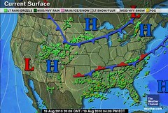
The first area was the eastern Texas/Louisiana area. I'd been expecting tropical activity there. The above map is for August 19th. The Weather Channel reported that eastern Louisiana and southern Mississippi was picking up 1 to 3 inches of rain due to the prolonged stay of the remnants of Tropical Depression 5. On the 20th, torrential rains hit western Alabama.


Aug 21d
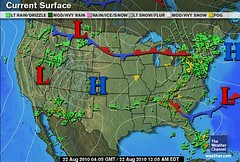
The next area mentioned in the forecast was the Bahamas/Southern Florida area. I expected tropical storm formation around this time. We were spared the tropical system but as can be seen from the Weather Channel map above for August 21st, strong thunderstorms developed over the area.

On the 20th the National Weather Service issued a Flood Advisory for the Miami-Dade county area as 2 to 3 inches of rain had fallen. A Significant Weather Advisory was issued for Broward county for frequent to excessive lightning and gusty winds of 45 mph. Strong thunderstorms were also reported in Seminole and Volusia counties. Today, locally heavy downpours continue over Florida.

19 Northern Plains
The third area mentioned for severe weather was the Minnesota/Wisconsin area. The above Accuweather map is for August 19th. The northern Plains was hit by severe thunderstorms and on the 20th, severe storms threatened areas from Upper Peninsula of Michigan and Wisconsin southwestward through eastern and central Kansas and northern Oklahoma.

The fourth area mentioned was the U.S. Desert Southwest in and around Arizona. On the 19th, Flash Flood Warnings and Severe Thunderstorm Warnings were issued for Utah as storm produced 1 to 2 inches of rain per hour. On the 21st, Flash Flood Warnings were issued for Arizona due to heavy rainfall. Nevada had Red Flag Warnings prompted by dry conditions and sustained winds of 20 to 25 mph with gusts up to 40 mph.


Experimental Forecasts Part 2- July-Sept 2010

Tropical Storm Alex Fulfills Long-range Prediction!

Bonnie Fulfills Long-range Forecast!

Experimental Forecasts July & August 2010

Hurricane Season 2010--Caribbean, Mexico, Central America

Hurricane Season 2010--Forecasts for August

Hurricane Season 2010--Forecast for September

Hurricane Season 2010--Central America Part 2

Introduction to the Weather Alternative

How Long-Range Forecasts Are Made

Did you hear about the 21 year old Italian girl who knelt in front of the statue of Madonna?
She said: "You who conceived without sin, let me sin without conceiving!"

Thursday, August 12, 2010

August 19-21, 2010 Experimental Forecast

Important planetary alignments form on the 20th and 21st of August. The accompanying map shows where the astro-meteorological influence is likely to manifest.
Aug 20
The Sun will oppose Neptune, and Venus will conjoin Mars on the 20th. These will be followed by Saturn's square to Pluto on the 21st. In previous posts, I've mentioned the likelihood of possible tropical systems or perhaps severe weather patterns to develop over the Louisiana and east Texas coasts at this time as well as the same potential for the U.S. Southeast and Mid-Atlantic.

Further experimentation with some experimental forecast techniques confirm this but add a few extra bits of information. For example, these experimental models suggest that approximately between the 19th and 21st of August a strong low pressure system or tropical cyclone will form or be drawn to the area in and around the Bahamas and southern Florida. From there, it could travel northward to the Carolinas.

Another area to keep our eyes on at this time is the Wisconsin-Minnesota area, which stands a good chance of seeing some very strong thunderstorms and the usual accompanying hail, gusty winds, and heavy rain.

The U.S. desert Southwest also stands out in these models as an area that could see some strong monsoonal moisture causing storms and flash flooding. Stay informed with your local or national weather stations at this time for more specifics and stay safe.


Experimental Forecasts Part 2- July-Sept 2010

Tropical Storm Alex Fulfills Long-range Prediction!

Bonnie Fulfills Long-range Forecast!

Experimental Forecasts July & August 2010

Hurricane Season 2010--Caribbean, Mexico, Central America

Hurricane Season 2010--Forecasts for August

Hurricane Season 2010--Forecast for September

Hurricane Season 2010--Central America Part 2

Introduction to the Weather Alternative

How Long-Range Forecasts Are Made

An atheist was walking through the woods.

"What majestic trees"!

"What powerful rivers"!

"What beautiful animals"!

He said to himself.

As he was walking alongside the river, he heard a rustling in the bushes behind him. He turned to look. He saw a 7-foot grizzly charge towards him. He ran as fast as he could up the path. He looked over his shoulder & saw that the bear was closing in on him.

He looked over his shoulder again, & the bear was even closer. He tripped & fell on the ground. He rolled over to pick himself up but saw that the bear was right On top of him, reaching for him with his left paw & raising his right paw to strike him. At that instant the Atheist cried out, "Oh my God!"

Time Stopped.
The bear froze.
The forest was still.

As a bright light shone upon the man, a voice came out of the sky. "You deny my existence for all these years, teach others I don't exist and even credit creation to cosmic accident." "Do you expect me to help you out of this predicament? Am I to count you as a believer"?

The atheist looked directly into the light, "It would be hypocritical of me to suddenly ask You to treat me as a Christian now, but perhaps You could make the BEAR a Christian"?

"Very Well," said the Voice.

The light went out. The sounds of the forest resumed. And the bear dropped his right paw, brought both paws together, bowed his head & spoke:

"Lord bless this food, which I am about to receive from thy bounty through Christ our Lord, Amen."

Thursday, August 05, 2010

August 2-6, 2010 Forecast Results

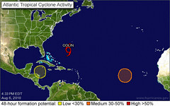
The Weather Alternative forecast for August 2-6, 2010 specified that the area in and around Nicaragua and Honduras would experience a severe weather pattern or a possible tropical storm or hurricane.
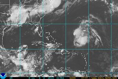
05 Tropics

On August 2nd, the Weather Channel reported a tropical wave moving ashore in Central America near Nicaragua that produced some locally heavy rainfall over Central America for the next day or two.


The National Weather Service map below is for today, August 6th. The yellow circle to the left is over Nicaragua and Honduras. This is represents a tropical wave that is bringing increased showers and thunderstorms over the region for the next couple of days but will most likely not develop into a tropical cyclone.
06 Tropics2


Experimental Forecasts Part 2- July-Sept 2010

Tropical Storm Alex Fulfills Long-range Prediction!

Bonnie Fulfills Long-range Forecast!

Experimental Forecasts July & August 2010

Hurricane Season 2010--Caribbean, Mexico, Central America

Hurricane Season 2010--Forecasts for August

Hurricane Season 2010--Forecast for September

Hurricane Season 2010--Central America Part 2

Introduction to the Weather Alternative

How Long-Range Forecasts Are Made

Thought of the Day

“In the end, it’s not the years in your life that count. It’s the life in your years.”—Abraham Lincoln

He who every morning plans the transactions of the day and follows out that plan, carries a thread that will guide him through the labyrinth of the most busy life.—Victor Hugo

Tuesday, August 03, 2010

July 27-31, 2010 Forecast Results

The long-range forecast for July 27-31, 2010 warned of severe thunderstorms with damaging winds, hail, and tornadoes to affect the East Central U.S., Southeast and Mid-Atlantic with a possible tropical system over Florida.
27 Soaking South
The above Accuweather map for Juy 27 accompanied their forecast which called for soaking, locally severe storms to rattle the South. The storms were to cause travel disruptions, damage, and flash floods.


29 Big Storms Mid-Atlantic
The next Accuweather map is for July 29th. Its headline was Big Storms in the Mid-Atlantic and Plains. This brought isolated severe storms to parts of the mid-Atlantic.


Experimental Forecasts Part 2- July-Sept 2010

Tropical Storm Alex Fulfills Long-range Prediction!

Bonnie Fulfills Long-range Forecast!

Experimental Forecasts July & August 2010

Hurricane Season 2010--Caribbean, Mexico, Central America

Hurricane Season 2010--Forecasts for August

Hurricane Season 2010--Forecast for September

Hurricane Season 2010--Central America Part 2

Introduction to the Weather Alternative

How Long-Range Forecasts Are Made

Parents and Children

"The footsteps a child follows are most likely to be the ones his parents thought they covered up."

Sunday, August 01, 2010

July 23-26, 2010 Forecast Results

The long-range weather forecast for July 23-26, 2010 called for either a tropical system or a severe weather pattern to affect the area from the Carolinas through New Jersey.

On the 25th and 26th, a severe weather pattern developed over the region. The Accuweather map at left shows an area of damaging storms for the 25th of July.

Accuweather reported on the 25th that powerful thunderstorms will rumble from the Delmarva into Kentucky. Aided by daytime heating, southern Illinois and Kentucky into the Delmarva and southern New Jersey will be at risk for strong storms this afternoon.

The map at right is for the 26th. Accuweather reported Drenching Storms to Wipe Out Extreme Heat in Carolinas

A slow-moving cold front in the Southeast will be the focal point for drenching and locally severe storms this afternoon. The thunderstorms will help to wipe out the extreme and oppressive heat in the southern mid-Atlantic and much of the Carolinas.


Experimental Forecasts Part 2- July-Sept 2010

Tropical Storm Alex Fulfills Long-range Prediction!

Bonnie Fulfills Long-range Forecast!

Experimental Forecasts July & August 2010

Hurricane Season 2010--Caribbean, Mexico, Central America

Hurricane Season 2010--Forecasts for August

Hurricane Season 2010--Forecast for September

Hurricane Season 2010--Central America Part 2

Introduction to the Weather Alternative

How Long-Range Forecasts Are Made


A Greek and an Italian

A Greek and Italian were sitting in a Starbuck's one day discussing who had the superior culture. Over triple lattes the Greek guy says, "Well, we have the Parthenon."

Arching his eyebrows, the Italian replies, "We have the Coliseum." The Greek retorts, "We Greeks gave birth to advanced mathematics."

The Italian, nodding agreement, says, "But we built the Roman Empire."

And so on and so on until the Greek comes up with what he thinks will end the discussion. With a flourish of finality he says, "We invented sex!"

The Italian replies, "That is true, but it was the Italians who introduced it to women!"

July 23-26, 2010 Forecast Results

Friday, July 30, 2010

July 23-31, 2010 Forecast Results

The Weather Alternative post of June 22, 2010 concerned a forecast for the West Coast for July 23-31, 2010. The forecast called for an anomalous weather pattern to bring a low pressure area or strong cold front over the Pacific Northwest and possibly California.

By the end of the forecast period a windy system was to develop off shore and progress eastward over the West Coast states.

The main events from the 23rd onward related to hotter than average temperatures over the Pacific Northwest sometimes threatening record high temperatures, and many days of Fire Weather Warnings by the National Weather Service due to dry storms generating lightning that could spark wildfires.

As we approach the end of the forecast period, the gusty winds expected are beginning to materialize as well as a low pressure system off the Oregon coast. Here's what the NWS issued yesterday.

...GUSTY WINDS AND DRY CONDITIONS FRIDAY (30th) AND SATURDAY (31st)...

.LOW PRESSURE NEARING THE OREGON COAST WILL BRING INCREASING
AFTERNOON AND EVENING WINDS AND VERY DRY CONDITIONS WITH POOR
OVERNIGHT RECOVERY THROUGH SATURDAY.

Jul. 30, 2010

... RED FLAG WARNING REMAINS IN EFFECT UNTIL 10 PM PDT THIS EVENING FOR GUSTY WINDS AND LOW HUMIDITY FOR NORTHEAST CALIFORNIA AND NORTHWEST NEVADA...

For tomorrow, the 31st, The Weather Channel reports An upper level trough moving through the Pacific Northwest into the Northern Rockies and High Plains will bring a chance for some severe storms in Idaho and Montana. The Accuweather map above shows the area to be affected.


Experimental Forecasts Part 2- July-Sept 2010

Tropical Storm Alex Fulfills Long-range Prediction!

Bonnie Fulfills Long-range Forecast!

Experimental Forecasts July & August 2010

Hurricane Season 2010--Caribbean, Mexico, Central America

West Coast Weather Concerns July 23-31, 2010

Hurricane Season 2010--Forecast for July

Hurricane Season 2010--Forecasts for August

Hurricane Season 2010--Forecast for September

Hurricane Season 2010--Central America Part 2

Introduction to the Weather Alternative

How Long-Range Forecasts Are Made

An Italian Man Gets One Wish

An Italian man walking along a California beach was deep in prayer. All of a sudden he said out loud, "Lord, grant me one wish."

Suddenly the sky clouded above his head and in a booming voice the Lord said, "Because you have had the faith to ask, I will grant you one wish." The man said, "Build a bridge to Hawaii, so I can drive over anytime I want to."

The Lord said, "Your request is very materialistic. Think of the logistics of that kind of undertaking. The supports required to reach the bottom of the Pacific! The concrete and steel it would take! I can do it, but it is hard for me to justify your desire for worldly things. Take a little more time and think of another wish, a wish you think would honor and glorify me."

The Italian man thought about it for a long time. Finally he said, "Lord, I have been married and divorced four times. All of my wives said that I am uncaring and insensitive. I wish that I could understand women. I want to know how they feel inside, what they are thinking when they give me the silent treatment, why they cry, what they mean when they say "nothing" and how I can make a woman truly happy?"

After a few minutes God said, "You want two lanes or four on that bridge?"

Friday, July 23, 2010

Here Comes Bonnie!

Tropical Storm Bonnie, besides being on its way toward the Louisiana area, appears to be on its way to fulfill The Weather Alternative long-range forecast posted back in April.

The forecast, for July 22-25, 2010, stated:

The potential for a low pressure system to develop off the southeast coast of Texas exists now. This could be a tropical system. Serious atmospheric disturbances are indicated along the central and eastern Gulf Coast as well. Once again, this could be indicative of a tropical system threatening the area.

The National Weather Service map above puts T.S. Bonnie over the Louisiana coast on Sunday, July 25.

Experimental Forecasts Part 2- July-Sept 2010

Tropical Storm Alex Fulfills Long-range Prediction!

Experimental Forecasts July & August 2010

Hurricane Season 2010--Caribbean, Mexico, Central America

West Coast Weather Concerns July 23-31, 2010

Hurricane Season 2010--Forecast for July

Hurricane Season 2010--Forecasts for August

Hurricane Season 2010--Forecast for September

Hurricane Season 2010--Central America Part 2

Introduction to the Weather Alternative

How Long-Range Forecasts Are Made


100 points to get into Heaven

A man dies and goes to heaven. St. Peter meets him at the pearly gates.

St. Peter says, "Here's how it works. You need 100 points to make it into heaven. You tell me all the good things you've done, and I give you a certain number of points for each item, depending on how good it was. When you reach 100 points, you get in."

"Okay" the man says, "I attended church every Sunday"
"That's good, says St. Peter, " that's worth two points"

"Two points?" he says. "Well, I gave 10% of all my earnings to the church"
"Well, let's see," answers Peter, "that's worth another 2 points. Did you do anything else?"

"Two points? Golly. How about this: I started a soup kitchen in my city and worked in a shelter for homeless veterans."
"Fantastic, that's certainly worth a point, " he says.

"hmmm...," the man says, "I was married to the same woman for 50 years and never cheated on her, even in my heart."
"That's wonderful," says St. Peter, "that's worth three points!"

"THREE POINTS!!" the man cries, "At this rate the only way I get into heaven is by the grace of God!"

"Come on in!"

Monday, July 19, 2010

Experimental Forecasts Part 2- July-Sept 2010

Here are some more experimental forecasts for July, August, and September 2010 based on recent studies. If these pan out, these refinements will be included in my forecast method.

July 25-27, 2010
At this time Mercury and Neptune form an opposition. This has been observed to bring high relative humidity, sudden squalls, and low pressure areas. The Northeast and New England are the areas to watch at this time.

August 20-22, 2010
The Sun's opposition to Neptune is known to result in increased southerly airflow, rising temperatures and humidity, and low pressure areas bringing precipitation. In this case the area to be targeted is the eastern Plains and Mississippi Valley. Other factors show that this period of severe weather could start around the 18th.

September 3-5, 2010
The Hawaiian Islands may experience some severe weather at this time. One possibility is a tropical system that may come close to the area.

September 13-15, 2010
There is a chance for a severe weather pattern to develop over the Florida Panhandle now. If a tropical system, it may extend from the Texas-Louisiana state line eastward to the Florida Panhandle. I'm not too convinced yet about this one, but there may be something to this. Other possibilities include severe thunderstorms with damaging winds and hail.

Tropical Storm Alex Fulfills Long-range Prediction!

Experimental Forecasts July & August 2010

Hurricane Season 2010--Caribbean, Mexico, Central America

West Coast Weather Concerns July 23-31, 2010

Hurricane Season 2010--Forecast for July

Hurricane Season 2010--Forecasts for August

Hurricane Season 2010--Forecast for September

Hurricane Season 2010--Central America Part 2

Introduction to the Weather Alternative

How Long-Range Forecasts Are Made

Love Those Italian Girls
Did you hear about the 21 year old Italian girl who knelt in front of the statue of Madonna?
She said: "You who conceived without sin, let me sin without conceiving!"

Monday, July 12, 2010

Experimental Forecasts July & August 2010

As time permits, I like to study past forecasts that I've made with the objective of improving my forecast accuracy. Over time this study has repaid itself by leading me to include refinements in my forecast method. Not too much has been left us to study from past generations of astro-meteorologist. So, many areas of the field must be pioneered afresh. Below are some experimental forecasts that are based on recent studies. Some of these seem to confirm or add additional information to forecasts that I've already posted in the past few months.

July 21-23, 2010
A low pressure area, most likely centering in and around the Georgia-Tennessee area, or front affects the East Central and Deep South area. This is similar to the July 22-25, 2010 forecast made back in April.

July 26-28, 2010
High pressure and fair conditions embrace the southern Mississippi Valley area.

July 30-August 1, 2010
An increase in temperatures and moisture over the Oklahoma-Arkansas area. Most likely will manifest as a low pressure area bringing rain.

August 11-16, 2010
A noticeable increase in temperatures is indicated over the Southwest U.S. centering over New Mexico-Arizona area.

August 21-23, 2010
A high pressure area is shown over the southern California region resulting in warm and fair conditions.

Tropical Storm Alex Fulfills Long-range Prediction!

Hurricane Season 2010--Caribbean, Mexico, Central America

Hurricane Season 2010--Forecast for July

West Coast Weather Concerns July 23-31, 2010

Hurricane Season 2010--Forecasts for August

Hurricane Season 2010--Forecast for September

Hurricane Season 2010--Central America Part I

Hurricane Season 2010--Central America Part 2

Introduction to the Weather Alternative

How Long-Range Forecasts Are Made

Signs of Intelligence

“In the movie, scientists are scanning the skies for signs of intelligent life in space. Their radio-telescopes just receive static—random sounds from space. It’s reasonable to assume there’s no intelligence behind that. Then one day they begin receiving a transmission of prime numbers, which are numbers divisible only by themselves and one.

“The scientists reason that it’s too improbable that there would be a natural cause behind a string of numbers like that. This wasn’t merely unorganized static; it was information, a message with content. From that, they concluded there was an intelligent cause behind it. As Sagan himself once said, ‘The receipt of a single message from space’ would be enough to know there’s an intelligence out there. That’s reasoning by analogy—we know that where there’s intelligent communication, there’s an intelligent cause.”

Bradley’s eyes bored in on me as he delivered his conclusion. “And if a single message from space is enough for us to conclude there’s an intelligence behind it, then what about the vast amounts of information contained in the DNA of every living plant and animal?” he said.

“Each cell in the human body contains more information than in all thirty volumes of the Encyclopedia Britannica. It’s certainly reasonable to make the inference that this isn’t the random product of unguided nature, but it’s the unmistakable sign of an Intelligent Designer.”

Today it takes a great deal of faith to be an honest scientist who is an atheist.”

WALTER L. BRADLEY, PH.D. Quoted from The Case for Faith by Lee Strobel


Thursday, July 08, 2010

Recent Tropical Predictions

A recent long-range forecast for July 3-6, 2010 mentioned the likelihood of a tropical system developing on the Pacific side of Central America.

This comes from a post on April 8, 2010:

July 3-6

The same configuration of planets in the Full Moon chart on the Pacific side of Nicaragua, El Salvador, Costa Rica, Honduras, and Panama is activated once again between these dates. This is a strong argument for a powerful low pressure system affecting the area with heavy rains. Once again, a tropical storm or hurricane cannot be ruled out.

The above satellite view is for July 4th and shows the tropical disturbance developing over Honduras and Nicaragua but on the eastern side. This eventually became TD 2 that is hitting southern Texas and northeastern Mexico today.


On the 6th, the National Weather Service reported that this tropical wave at the time was bringing heavy rains to El Salvador and southern Guatemala.


Another forecast posted in April mentioned two other places that would experience severe weather that might be tropical.
The first area was over New England and Nova Scotia between June 23-26.

The Accuweather map at right shows the severe thunderstorms that targeted the region on June 24th.
Strong winds that could down trees and powerlines, as well as damage some structures were the main danger from the severe thunderstorms.


The next forecast was for the same period but for an area roughly around 240 to 270 miles north of the Dominican Republic where I envisioned the possible formation of a tropical system.


On the 25th The Weather Channel reported an area of disturbed weather just east of the northern Leeward Islands. Forecasters expected conditions for development to become more favorable for development over the next 2 or 3 days. This was, however, much further east than I was expecting.


Hurricane Season 2010--Caribbean, Mexico, Central America

Hurricane Season 2010--Forecasts for June

Hurricane Season 2010--Forecast for July

West Coast Weather Concerns July 23-31, 2010

Hurricane Season 2010--Forecasts for August

Hurricane Season 2010--Forecast for September

Hurricane Season 2010--Central America Part I

Hurricane Season 2010--Central America Part 2

Introduction to the Weather Alternative

How Long-Range Forecasts Are Made


We are but of yesterday and yet we already fill your cities, your palace, senate and forum, we have left to you only your temples. --Tertullian on the rapid spread of Christianity (born ca. 150-160, died ca. 220-240)

Saturday, June 26, 2010

Tropical Storm Alex Fulfills Long-range Prediction!

The Weather Alternative long-range for June 24-27, 2010 was posted on the preceding 8th of April. The forecast called for a strong low pressure area or possible tropical storm in and around the area of Panama, Costa Rica, and Honduras.


On June 25th, Tropical Depression 1 formed 90 miles off the coast of Honduras fulfilling the long-range forecast. TD-1 has now become Tropical Storm Alex. The National Weather Service map at left shows the area in which TD-1 formed.


Compare that area with the area that the astrometeorological map emphasized and that I used to formulate the forecast. It is this type of correspondence between planetary alignments and major weather patterns that has convinced just about every open-minded investigator as to the truth of astrometeorological influence.


The forecast also mentioned that other planetary alignments were affecting those same countries but on the Pacific side. As can be seen from the National Weather Service map at left, the influence of Tropical Storm Alex "spills over" in to that area as well.


Hurricane Season 2010--Caribbean, Mexico, Central America

Hurricane Season 2010--Forecasts for June

Hurricane Season 2010--Forecast for July

West Coast Weather Concerns July 23-31, 2010

Hurricane Season 2010--Forecasts for August

Hurricane Season 2010--Forecast for September

Hurricane Season 2010--Central America Part I

Hurricane Season 2010--Central America Part 2

Introduction to the Weather Alternative

How Long-Range Forecasts Are Made

Follow the Weather Alternative on Twitter Astroweatherman


God Makes Sense of the Universe’s Complexity
“In the last thirty-five years,” Craig said, “scientists have been stunned to discover that the Big Bang was not some chaotic, primordial event, but rather a highly ordered event that required an enormous amount of information. In fact, from the very moment of its inception, the universe had to be fine-tuned to an incomprehensible precision for the existence of life like ourselves. And that points in a very compelling way toward the existence of an Intelligent Designer.

“Scientifically speaking, it’s far more probable for a life-prohibiting universe to exist than a life-sustaining one. Life is balanced on a razor’s edge.”

As an example, he cited Hawking’s writings. “He has calculated,” Craig said, “that if the rate of the universe’s expansion one second after the Big Bang had been smaller by even one part in a hundred thousand million million, the universe would have collapsed into a fireball.”

In short order, Craig proceeded to go down a list of several other mind-boggling statistics to support his conclusion. Among them:

British physicist P. C. W. Davies has concluded the odds against the initial conditions being suitable for the formation of stars—a necessity for planets and thus life—is a one followed by at least a thousand billion billion zeroes.

Davies also estimated that if the strength of gravity or of the weak force were changed by only one part in a ten followed by a hundred zeroes, life could never have developed.

There are about fifty constants and quantities—for example, the amount of usable energy in the universe, the difference in mass between protons and neutrons, the ratios of the fundamental forces of nature, and the proportion of matter to antimatter—that must be balanced to a mathematically infinitesimal degree for any life to be possible. --The Case for Faith by Lee Strobel


Tuesday, June 22, 2010

West Coast Weather Concerns July 23-31, 2010

The U.S. West Coast may experience an anomalous weather pattern between July 23-31. The month of July is usually one of the sunniest and driest months for the West Coast States. A number of planetary alignments, however, especially between the 23rd and 26th, then again between the 30th and 31st, may bring out-of-season storminess to the region.

The ordeal starts on the 23rd as Jupiter makes its retrograde station. In other words, from our viewpoint on earth, Jupiter appears to travel backwards in the heavens. A key chart places Jupiter overhead along the 118th west longitude. This line runs through Washington, Oregon, Nevada, and California. Jupiter will be in a disruptive alignment with Pluto at this time.

Other disruptive alignments take place between Mercury and Neptune, and between Saturn and Uranus on the 26th. Key charts place these planets over the western Pacific between 130 and 135 west longitude. Since these alignments have been observed to coincide with storm conditions, we may conclude that a low pressure area or strong cold front will push eastward into the Pacific Northwest and perhaps California at this time.

Then on the 30th and 31st, the opposition of Mars and Uranus, a breeder of high velocity winds, and the conjunction of Mars and Saturn, known to produce severe weather systems, will operate off the U.S. West Coast and send a disruptive weather pattern eastward.

Businessmen and entrepreneurs are encouraged more and more to think out of the box. Well, if you like to think out of the box, which I do and one of the reasons that astrometeorology appeals to me, you'll find that these forecasts based on planetary cycles are just that. One really needs to break out of the mold of conventional approaches to weather forecasting to consider that there may actually be a connection between our weather and our solar system.


Hurricane Season 2010--Caribbean, Mexico, Central America

Hurricane Season 2010--Forecasts for June

Hurricane Season 2010--Forecast for July

Hurricane Season 2010--Forecasts for August

Hurricane Season 2010--Forecast for September

Hurricane Season 2010--Central America Part I

Hurricane Season 2010--Central America Part 2

Introduction to the Weather Alternative

How Long-Range Forecasts Are Made


Does suffering help prove or disprove the existence of God?


“It’s significant that most objections to the existence of God from the problem of suffering come from outside observers who are quite comfortable, whereas those who actually suffer are, as often as not, made into stronger believers by their suffering.”

That’s a phenomenon many writers have noted. After wide-ranging research into the topic of suffering, Philip Yancey wrote, “As I visited people whose pain far exceeded my own ... I was surprised by its effects. Suffering seemed as likely to reinforce faith as to sow agnosticism.” Scottish theologian James S. Stewart said: “It is the spectators, the people who are outside, looking at the tragedy, from whose ranks the skeptics come; it is not those who are actually in the arena and who know suffering from the inside. Indeed, the fact is that it is the world’s greatest sufferers who have produced the most shining examples of unconquerable faith.”

Saturday, June 19, 2010

Heavy Rains for Puerto Rico and Haiti

The Weather Alternative warning for a possible hurricane for Puerto Rico and Hispañola between June 17-19 is finding some fulfillment in the tropical wave that is dumping heavy rains over the islands.

The Weather Channel reports that flash flood watches are posted through Sunday afternoon for the Virgin Islands and Puerto Rico. Locally heavy showers will spread westward into the Dominican Republic and Haiti as well.

The purpose of The Weather Alternative forecasts is to provide a look further into the future than conventional methods can at present provide. This is accomplished through the amazing correspondence that becomes obvious between planetary alignments and earthly weather systems when these alignments are properly interpreted. I don't always get them spot on and I've learned much over the years that has helped me understand how to better interpret them. So this site is to share the enthrallment I experience doing this and the practical benefits as well.

I also expected possible severe weather over the New England-Nova Scotia area between June 17-20. I thought it might be a result of a tropical system. I did mention that it could be A strong low pressure system and high velocity winds.

There is no tropical system but the National Weather Service today has posted the following:


THIS HAZARDOUS WEATHER OUTLOOK IS FOR NORTHERN NEW YORK...CENTRAL
VERMONT...NORTHEAST VERMONT...NORTHWEST VERMONT AND SOUTHERN
VERMONT.

.DAY ONE...TODAY AND TONIGHT.

THE POTENTIAL FOR STRONG TO POSSIBLY SEVERE THUNDERSTORMS WILL
EXIST LATER TODAY AND TONIGHT ACROSS THE NORTH COUNTRY. THUNDERSTORMS WILL DEVELOP IN ADVANCE OF A COLD FRONT OVER SOUTHEAST ONTARIO PROVINCE THIS AFTERNOON AND MOVE INTO THE SAINT LAWRENCE VALLEY OF NEW YORK BY MID ... STRONG GUSTY WINDS AND SMALL HAIL WILL BE
POSSIBLE WITH ANY OF THE THUNDERSTORMS.


A similar warning is posted for Maine, while Canada's weather service has issued the same for southerns Quebec.

A low pressure area also passed through the region on the 17th.


Hurricane Season 2010--Caribbean, Mexico, Central America

Hurricane Season 2010--Forecasts for June

Hurricane Season 2010--Forecast for July

Hurricane Season 2010--Forecasts for August

Hurricane Season 2010--Forecast for September

Hurricane Season 2010--Central America Part I

Hurricane Season 2010--Central America Part 2

Introduction to the Weather Alternative

How Long-Range Forecasts Are Made


“People don’t buy what you do. They buy why you do it.”

Check out Simon Sinek's video clip. Simon is author of Start With Why: How Great Leaders Inspire Everyone to Take Action

Saturday, June 12, 2010

Forecast Results June 9-11, 2010

In the first of my Hurricane 2010 forecasts posted on April 1, of this year, I mentioned that planetary cycles involving Mercury, Mars, and Neptune would expose the East Coast areas from Cape Hatteras to New England to possible tropical activity or if not an actual tropical system, some other type of severe weather pattern. The time frame was between June 9-11. I mentioned the possibility of a tropical system centering about 290 miles south of Cape Hatteras, North Carolina around the 10th of June and tracking along the East Coast to New England.

Fortunately, for the inhabitants of the East Coast, no tropical storm resulted. The Weather Channel map above is for June 11th and shows a low pressure area off the North Carolina coast.


The Accuweather map at right shows their weekend forecast for June 12-13. Notice the low pressure area over Virginia coast. Their article was entitled Humid Air Returns with Flash Flooding Risk this Weekend in the Northeast.

This is exactly what is happening. As we speak, the National Weather Service has issued the following types of Alerts for the area:


Massachusetts- Marine Alerts
New Jersey- Special Weather Alert
New York- Flash Flood, Flood, Marine
North Carolina- Special Weather Alerts
Pennsylvania- Flash Flood, Flood, Marine
Virginia- Flash Flood, Special Weather Alerts
West Virginia- Flash Flood, Special Weather Alerts

But even before these, which are a day late according to my forecast, on the 9th Accuweather reported thunderstorms capable of producing flash flooding, hail, damaging wind gusts and volleys of cloud-to-ground lightning strikes will stretch from Tennessee and northern Mississippi to southeastern Virginia and the Delmarva Peninsula through Wednesday evening.


Possible June Hurricane for Hispañola and Puerto Rico

Hurricane Season 2010--Caribbean, Mexico, Central America

Hurricane Season 2010--Forecasts for June

Hurricane Season 2010--Forecast for July

Hurricane Season 2010--Forecasts for August

Hurricane Season 2010--Forecast for September

Hurricane Season 2010--Central America Part I

Hurricane Season 2010--Central America Part 2

Introduction to the Weather Alternative

How Long-Range Forecasts Are Made

What You Never Learned in School
Soccer player Kyle Rote Jr. remarked, “There is no doubt in my mind that there are many ways to be a winner, but there is really only one way to be a loser and that is to fail and not look beyond the failure.” How people see failure and deal with it—whether they possess the ability to look beyond it and keep achieving—impacts every aspect of their lives.

In Leadership Magazine, J. Wallace Hamilton states, “The increase of suicides, alcoholics, and even some forms of nervous breakdowns is evidence that many people are training for success when they should be training for failure. Failure is far more common than success; poverty is more prevalent than wealth; and disappointment more normal than arrival.”

Training for failure! That is a great concept, and it’s the idea that prompted me to write this book. I want to help you train for failure. I want you to learn how to confidently look the prospect of failure in the eye and move forward anyway. Because in life, the question is not if you will have problems but how you are going to deal with your problems. Are you going to fail forward or backward? --Failing Forward by John C. Maxwell


Sunday, June 06, 2010

Possible June Hurricane for Hispañola and Puerto Rico

The Dominican Republic and Puerto Rico may be in for some hurricane or tropical storm activity between June 17-19, 2010.

The New Moon of June 12th, along with the Full Moon of May 27th, and the First Quarter Moon of June 18th all imply that these islands will be affected by a tropical system that strikes them after originating to the south of the islands or passing along their southern coasts.

At this time the Sun and Saturn will form a square aspect, which has been noted to result in atmospheric disturbance.


Hurricane Season 2010--Caribbean, Mexico, Central America

Hurricane Season 2010--Forecasts for June

Hurricane Season 2010--Forecast for July

Hurricane Season 2010--Forecasts for August

Hurricane Season 2010--Forecast for September

Hurricane Season 2010--Central America Part I

Hurricane Season 2010--Central America Part 2

Introduction to the Weather Alternative

How Long-Range Forecasts Are Made

The Power of Words

Here's an interesting link showing the power of our words and thoughts. It explains the work of Dr. Masaru Emoto, a Japanese scientist. Check it out here.