Thursday, July 28, 2011

General Weather Indications for August 2011

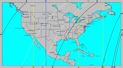
Some general weather trends can be gleaned from lunation charts and the Solar Ingress chart. Here we'll quickly go over the four lunation charts for August. These include the New Moon, Full Moon, First Quarter, and Last Quarter charts or maps.
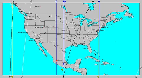
August New Moon

The first map above is the New Moon of July 30, 2011, which will be in effect for all of August until the 28th.

The New Moon in Leo occupies the the 98th degree of west longitude through the central Plains and Texas. This is a hot, dry influence. The New Moon is square Jupiter, which also indicates warmth but can bring atmospheric disturbances. Let's hope this means some rain for Texas and the surrounding area. Jupiter influences the Mississippi Valley in this regard.

Venus is also in Leo through the Front Range and Plains. Venus usually increases atmospheric moisture so along with the heat symbolized by Leo we might get some precipitation during the month of August. The 1st through the 4th is a period when there could be some action along these lines.

The Northeast is under the influence of the Mercury-Neptune opposition. This increases temperatures and humidity leading to low pressure areas and rain through out the month of August. Since Mercury will go retrograde on August 2nd and then oppose Neptune on the 8th strong storms are possible with lots of moisture. This has been mentioned in another post for August 9-13.

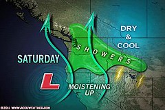
Saturn affects the West Coast states of Washington, Oregon, and northern California arguing for cooler conditions and some precipitation. It's interesting to note that Accuweather just posted an article entitled Northwest Continues to Chill This Summer. With Saturn in this position, cool weather seems likely to continue for the region during August, which is their conclusion as well. There are two stormy periods indicated for the West Coast states in the Solar Ingress around the 16th when coastal regions of northern California and the Pacific Northwest could see a strong front pushing inland and around 21st when monsoonal moisture might trigger storms in the desert Southwest.

Uranus and Pluto are off the West Coast at 132 west longitude calling for cooler conditions and a possible low pressure system or front around August 9-11.
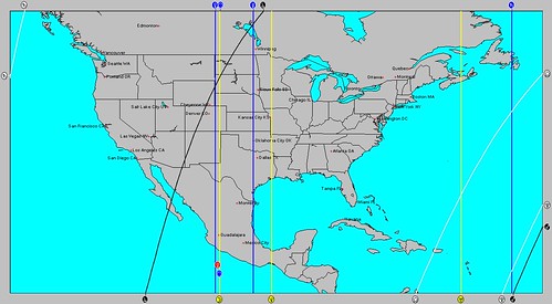
August Full Moon

Full Moon August 13, 2011

This Full Moon heavily bombards the Plains. The Sun, Moon, Venus, and Jupiter concentrate their influence over the Dakotas, eastern Montana, and eastern Wyoming. While all these indicate heat, Venus does increase moisture. One possibility is that this area will periodically be subject to increasing temperatures and storm systems--for example around the 20th and 21st.

The triple conjunction of the Sun, Mercury, and Venus around the 16th will also strongly affect the Plains with a heat wave, but I'm hoping the heat will provoke thunderstorms and rain. I've mentioned extreme southern Texas in this regard in another post.

Mercury and Neptune also affect the Plains. While Mercury retrograde can signify high pressure and wind (something we don't need over the southern Plains right now), Neptune is associated with humidity and rain. Neptune's position along the 94th degree of west longitude affects the eastern Plains and signifies atypical rainfall during this Full Moon period. We may get some good rain around the 21st and 22nd as moisture is pull up out of the Gulf of Mexico and drawn northward over the Arklatex region.
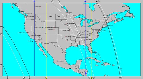
August First Quarter

First Quarter Moon August 6, 2011

Uranus and Saturn affect the western states and the Rockies exercising a cooler influence. The rain-making Mercury-Neptune pair resides over the New England area extending the same influence in the New Moon chart farther eastward.

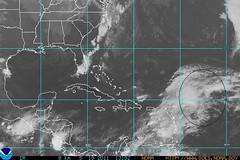
This chart indicates some possible tropical activity in the eastern Gulf off the west Florida coast around August 12th and 13th and in the central Caribbean around the same time.
August Third Quarter

Third Quarter Moon August 21, 2011

Uranus and Saturn also affect the western states and the Rockies indicating cooler conditions. Mars and Jupiter over the eastern Great Lakes indicate a stormy time especially around the 27th and 28th.


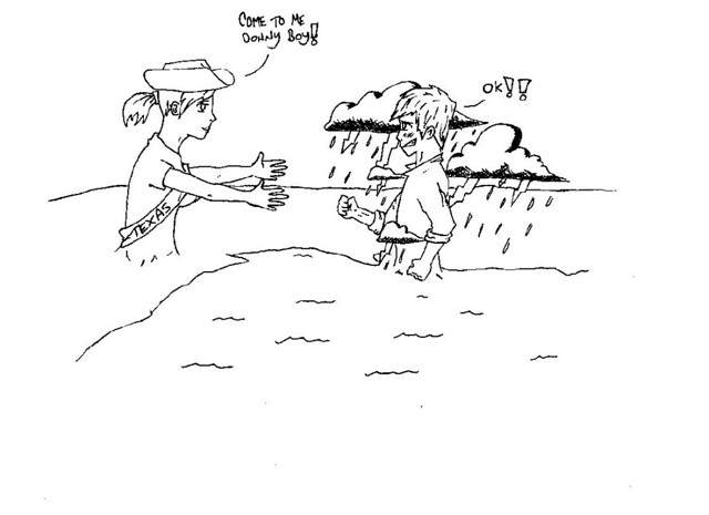
Texas Needs Tropical Storm Don
Don

August 9-13, 2011 Long-range Forecast

August 16-18, 2011 Long-range Weather Forecast

Hurricane Beatriz Fulfills Long-range Weather Prediction!

Hurricane Season 2011 Baja, Mexico

Hurricane Risk-Management

Hurricane Season 2011 Predictions

Overview of UK Winter 2012-13

The Winters of 2011-14

Cyclone Yasi fulfills long-range prediction!

Tropical Storm Matthew Fulfills Long-range Forecast!

Hurricane Earl and T.D. 10E Fulfill Long-range Forecasts!

Tropical Storm Alex Fulfills Long-range Prediction!

Bonnie Fulfills Long-range Forecast!

Introduction to the Weather Alternative

How Long-Range Forecasts Are Made

Excerpts from Tidal Dynamics by Fergus J. Wood
Monday, July 25, 2011

August 9-13, 2011 Long-range Weather Forecast

An active weather period is indicated for the U.S. East Coast, Northeast, and New England between August 9-13, 2011 as the square of Mars to Uranus and the Mars-Pluto opposition continue to stir up the atmosphere. During this time, a retrograde Mercury will oppose Neptune as well.
hurricane

Mercury's role in hurricane formation is usually greater when it is in retrograde motion, which it begins this year on August 2nd. Mars is no slouch when it comes to severe weather either. Mars-Uranus incites wind velocities that add violence to storms. Mars-Pluto generates intense storms as well.

img268

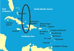
Not only is the eastern U.S. involved, the area affected also includes the region in and around eastern Cuba, Haiti, and the Bahamas. There's a strong chance that a tropical system will develop in this area and head northward affecting the Carolinas and northward to the Northeast and New England. Other possibilities include severe storms throughout these areas.

August 16-18, 2011 Long-range Weather Forecast

Hurricane Beatriz Fulfills Long-range Weather Prediction!

Hurricane Season 2011 Baja, Mexico

Hurricane Risk-Management

Hurricane Season 2011 Predictions

Overview of UK Winter 2012-13

The Winters of 2011-14

Cyclone Yasi fulfills long-range prediction!

Tropical Storm Matthew Fulfills Long-range Forecast!

Hurricane Earl and T.D. 10E Fulfill Long-range Forecasts!

Tropical Storm Alex Fulfills Long-range Prediction!

Bonnie Fulfills Long-range Forecast!

Introduction to the Weather Alternative

How Long-Range Forecasts Are Made

Excerpts from Tidal Dynamics by Fergus J. Wood

Been Hot Enough Lately?
Heat

Wednesday, July 20, 2011

August 16-18, 2011 Long-range Weather Forecast

On August 16th, a triple conjunction will take place involving the Sun, Mercury, and Venus is the hot sign Leo. Mercury is retrograde now and its conjunction with the Sun during hurricane season has been observed to coincide with the formation of tropical systems.
img120
The conjunction when viewed from key charts affects the East Coast states of North Carolina and Virginia northward through Pennsylvania. Since the conjunction takes place in the thermal sign Leo, one of the initial reactions over this area could be a heat wave. Severe thunderstorms are also a strong possibility now as is the likelihood of a tropical system.


Further south in the Caribbean, a tropical system may make its way from the Windward Islands affecting Puerto Rico and Hispaniola as it passes south of them on its way past Jamaica towards Honduras and Nicaragua.


The southernmost portions of Texas around Brownsville are also affected by the triple conjunction, where severe thunderstorms or an influx of tropical moisture is likely.

Saturday, July 16, 2011

Typhoon Ma-On Targets Japan

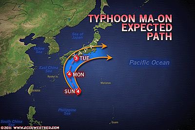
Typhoon Ma-On is expected to approach and hit Japan around July 17-19. Ma-On is now the equivalent of a category 3 hurricane and may become a super typhoon with sustained winds near 150 mph. Ma-On is expected to dump between 10 to 20 with flooding and mudslides.
Ma-on
Certain planetary alignments usually coincide with these monster storms. But what if there are no major planetary alignments at the time--such as is the case with Ma-On? When this type of scenario arises, you can be sure that some planet is triggering or activating a previous planetary alignment or eclipse.
Ma-On2
On May 20, 2011 Mercury conjoined Mars. This combination of planets is known for its whipping winds and energetic storm systems. As shown on the astro-locality map, the conjunction was right overhead through Japan. On the 16th and 17th, Jupiter will reach the degree of this conjunction, which was at 7 degrees Taurus, activating its windy and stormy potential.
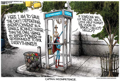
Captain Incompetence

Captain

Tuesday, July 12, 2011

Results of June 2011 Hurricane Hot Spots

On May 31st I posted a few dates and places that might have been worth watching for tropical activity or other forms of severe weather in June. Here are the results.
hurrican2_rgb

The first one was for June 17-20 that pinpointed an area east of the Bahamas and southward through Haiti (Hispaniola) where there might be tropical activity.

The Weather Channel reported on the 18th, "Another tropical wave will bring some showers to the Virgin Islands, Puerto Rico, and Hispaniola over the weekend."

A severe weather pattern over New England was also forecast for the same time period. The Weather Channel reported on the 17th that a low pressure organized and strengthened over the region and on the 18th that "some showers and thunderstorms are possible in New England from a departing system."
economy-rain-umbrella

Possible tropical storm development was forecast for June 20-23 around 67 west 25 north but no system developed there.

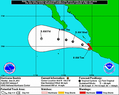
I've already covered the forecast that Hurricane Beatriz fulfilled in another post.

The Rockies were also highlighted for severe weather at this time. On the 20th, the Weather Channel reported that rain and thunderstorms were expected in Montana, Wyoming, and Colorado. The next day they stated that "the big storm departed," and "lingering northwest wind gusts will top 40 mph in eastern Wyoming and eastern Colorado."

Hurricane Beatriz Fulfills Long-range Weather Prediction!

July 1-11 Long-range Weather Forecast

Hurricane Hot Spots for June 2011

Hurricane Season 2011 Baja, Mexico

Hurricane Risk-Management

Hurricane Season 2011 Predictions

Overview of UK Winter 2012-13

The Winters of 2011-14

Cyclone Yasi fulfills long-range prediction!

Tropical Storm Matthew Fulfills Long-range Forecast!

Hurricane Earl and T.D. 10E Fulfill Long-range Forecasts!

Tropical Storm Alex Fulfills Long-range Prediction!

Bonnie Fulfills Long-range Forecast!

Introduction to the Weather Alternative

How Long-Range Forecasts Are Made

Excerpts from Tidal Dynamics by Fergus J. Wood

Austerity Riots – A Glimpse Of America’s Future? (read more here)
greece-austerity-riots-370x277

Thursday, June 30, 2011

Heat Alerts Fulfill Long-range Forecast

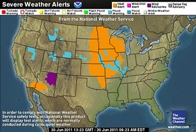
The long-range weather forecast for July 1-11, 2011 is beginning to shape up as excessive heat warnings are being issued for the central U.S. The Weather Channel map below shows where the heat alerts are for today.
30 heat alerts
The long-range forecast posted on June 18th talked about how the astrometeorological effect of Venus would begin being felt around July 1st. Venus' influence was described as increasing the moisture content of the atmosphere accompanied by a southerly air flow and increasing temperatures.

The mercury is starting to rise over the central U.S. with temperatures in some of these locations reaching between 100 to 110 degrees! Accuweather warns that the heat will continue for the next couple of days and be accompanied by high levels of humidity as well. As we progress into the forecast period, we'll look at how the rest of the forecast fared.


July 1-11 Long-range Weather Forecast

Hurricane Hot Spots for June 2011

Hurricane Season 2011 Baja, Mexico

Hurricane Risk-Management

Hurricane Season 2011 Predictions

Overview of UK Winter 2012-13

The Winters of 2011-14

Cyclone Yasi fulfills long-range prediction!

Tropical Storm Matthew Fulfills Long-range Forecast!

Hurricane Earl and T.D. 10E Fulfill Long-range Forecasts!

Tropical Storm Alex Fulfills Long-range Prediction!

Bonnie Fulfills Long-range Forecast!

Introduction to the Weather Alternative

How Long-Range Forecasts Are Made

Excerpts from Tidal Dynamics by Fergus J. Wood
Big Dreamers

All successful people men and women are big dreamers. They imagine what their future could be, ideal in every respect, and then they work every day toward their distant vision, that goal or purpose. -- Brian Tracy

Monday, June 27, 2011

Rockies Forecast Result

In the May 21st post Neptune and Rockies Flood Potential, I explained how the astrometeorological influence of the planet Neptune correlates with southerly air flows, winter thaws, and snow slides. In other posts, I've mentioned Neptune's tendency toward flooding.
Flood
Since Neptune was influencing the western U.S. during the spring season, I gave some dates when those weather patterns would be activated.

The first one was May 22nd when the Sun squared Neptune. The Weather Channel reported on that date that a potent storm was moving into the Pacific Northwest and that "the threat of flooding from the rain, snow melt, or a combination of those will continue in Washington, Montana, Idaho, and Wyoming."

June 3rd brought Mercury's square to Neptune. This date saw a very unusual low pressure system whose end result brought "periods of rain (locally heavy), high elevation snow in the Sierra Nevada and perhaps a few severe storms with hail, gusty winds..." according to the Weather Channel.

June 8th was the date of the Jupiter-Neptune sextile. On June 7th the National Weather Service reported, "Moderate to heavy rainfall is expected to continue today across the northern Rockies and northern Plains, with flooding is possible throughout parts of Montana, Wyoming, Idaho, and western Washington and Oregon. Flash Flood and Flood Watches and Warnings are in effect for these areas."

Venus square Neptune was exact on the June 10th. More showers and thunderstorms hit the Pacific Northwest and Northern Rockies. Some showers and thunderstorms also were possible in the higher elevations of Colorado.

Mercury's trine to Neptune was on June 16th. The National Weather Service reported on that date that "in Utah, large creeks and mainstem rivers will periodically rise above flood stage for the next several weeks due to warmer temperatures and resultant snowmelt increases. In California, snowmelt from the Sierra Nevada has resulted in minor flooding of the Merced River in Yosemite National Park."

Hurricane Beatriz Fulfills Long-range Weather Prediction!

Hurricane Hot Spots for June 2011

Hurricane Season 2011 Baja, Mexico

Hurricane Risk-Management

Hurricane Season 2011 Predictions

Overview of UK Winter 2012-13

The Winters of 2011-14

Cyclone Yasi fulfills long-range prediction!

Tropical Storm Matthew Fulfills Long-range Forecast!

Hurricane Earl and T.D. 10E Fulfill Long-range Forecasts!

Tropical Storm Alex Fulfills Long-range Prediction!

Bonnie Fulfills Long-range Forecast!

Introduction to the Weather Alternative

How Long-Range Forecasts Are Made

Excerpts from Tidal Dynamics by Fergus J. Wood


Henry Ford on Failure

Failure is merely an opportunity to more intelligently begin again.

Saturday, June 18, 2011

July 1-11 Long-range Weather Forecast

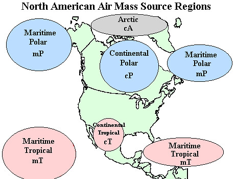
Around July 1st, from an astrometeorological view, Venus begins to affect the Mississippi Valley. The influence of Venus on the weather tends to increase the moisture content of the atmosphere. Winds are generally from the south accompanied by rising temperatures. This corresponds to a maritime tropical air mass, which should be especially pronounced around the 4th.
stpptam

As we move into the 7th through the 10th and Venus makes its square to Uranus and its opposition to Pluto, the indications are for a more disruptive influence on the weather. Coupled with other aspects, moisture will be drawn up from the Gulf generating storms up through the central Mississippi Valley. There is a chance that a tropical system will form in the Gulf around 90 west longitude and 23 north latitude.

The area in and around the Bahamas is another area that may show signs of tropical storm development around July 7-10.


Hurricane Hot Spots for June 2011

Neptune and Rockies Flood Potential

Hurricane Season 2011 Baja, Mexico

Hurricane Risk-Management

Hurricane Season 2011 Predictions

Overview of UK Winter 2012-13

The Winters of 2011-14

Cyclone Yasi fulfills long-range prediction!

Tropical Storm Matthew Fulfills Long-range Forecast!

Hurricane Earl and T.D. 10E Fulfill Long-range Forecasts!

Tropical Storm Alex Fulfills Long-range Prediction!

Bonnie Fulfills Long-range Forecast!

Introduction to the Weather Alternative

How Long-Range Forecasts Are Made

Excerpts from Tidal Dynamics by Fergus J. Wood


Father

Wednesday, June 15, 2011

Forecast Results June 10-16, 2011

Two areas of the country were specified for severe weather in the long-range weather forecast for June 10-16. The first area encompassed the Texas and Oklahoma panhandles northward through Nebraska. A strong low pressure area was forecast to bring severe weather that would continue eastward to the Mississippi Valley.
12 Midwest
Accuweather reported that as early as Saturday (June 11th)destructive thunderstorms tore over a zone from far southeastern Montana into the panhandles of Oklahoma and Texas. The storms continued to march eastward bringing flooding downpours to eastern Kansas and Missouri on the 12th.

14 Oklahoma to Illinios
By the 14th, severe thunderstorms shifted eastward into parts of the Mississippi and Tennessee Valleys with damaging winds, hail, and some possible tornadoes according to Accuweather. The above Accuweather map shows the area in question fulfilling the long-range forecast based on planetary cycles involving Saturn, the Sun, and Mercury.
The second part of the forecast stated that the Gulf of Mexico from north of the Yucatan (around 89W/23N) to western Cuba might be worth watching for signs of tropical activity between June 10-14. No major system developed at this time. The National Weather Service did mention that a cyclonic center developed around 85W/28N on the 11th, which was the general area I pinpointed. Other than that, the Gulf was largely lifeless. For those tuning into the planetary aspects that these forecasts are based on, the Sun's conjunction to Mercury was the basis for this forecast, however, the Sun's conjunction to a retrograde Mercury (the inferior conjunction) seems to be more powerful in spawning tropical systems when occurring during hurricane season than the Sun's conjunction to a direct Mercury (the superior conjunction). The conjunction on June 12th was a superior conjunction.

Should we only believe what can be scientifically proven?

Wednesday, June 08, 2011

June 3-7, 2011 Forecast Results

We've had some interesting weather out west in recent days from record-shattering rain in California due to an out-of-season low pressure system, the third-largest wildfire in Arizona's history, and the first tropical depression of 2011. Since this period and area of the country were the focus of my long-range weather forecast for June 3-7, let's see how the forecast turned out.

My May 26 post began by pointing out that on the 3rd of June Mercury would make a 90-
degree or storm-breeding aspect to Neptune at the same time that Neptune began its apparent retrograde motion, which has been observed to coincide with excessive humidity and abundant moisture. I mentioned that these planets affected the western U.S. the Baja Peninsula, and the area around Guadalajara, Mexico. I concluded that the aforementioned areas would receive an influx of moisture due to low pressure systems or fronts. This was definitely the case with the California storm, although I didn't mention California in particular but just the western U.S.

03 California Rain

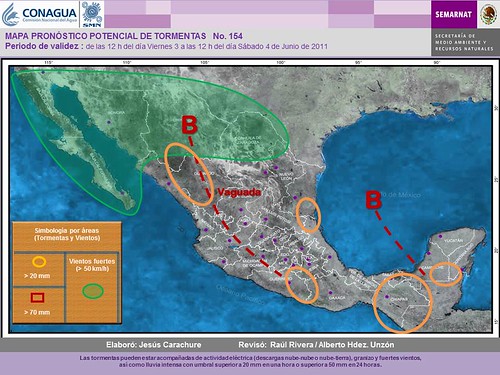
I thought that the Arizona area would see an increase in monsoonal flow bringing abundant moisture. On the contrary, dry and windy conditions have brought one of the largest wildfires to Arizona during this period. What's up with that? While I focused on Neptune's pluvial influence, one of the major ingredients was Mercury's square to Neptune. Mercury is known for its connection with windy conditions and as McCormack stated in his "Astrotech Weather Guide," "Mercury is largely concerned with wind direction and velocity and predicates sporadic strong winds." Looks like I missed that one completely. Throughout the forecast period numerous red flag warnings were in effect for Arizona due to the strong winds. Even the Baja Peninsula, one of the areas I included in the forecast, began the forecast period with warnings for strong winds as shown by the green area on the following map. The map legend relates the green area to "vientos fuertes" or strong winds.

03 Mexico2

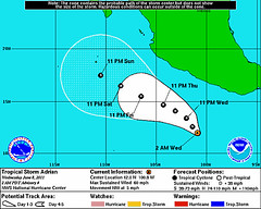
The forecast period ended with the formation of Tropical Storm Adrian. In the forecast I suggested the possibility of the Guadalajara and Baja areas being affected by a tropical system or other type of severe weather. As it stands now, Accuweather commented this morning that one possible path for Adrian takes it toward Mexico somewhere between Jalisco (Guadalajara) and Michoacan or northern Guerrero although it takes it there or near there a bit later than I thought.

08 Adrian

June 2011: Long-range Weather Forecasts

Hurricane Hot Spots for June 2011

Neptune and Rockies Flood Potential

Hurricane Season 2011 Baja, Mexico

Hurricane Risk-Management

Hurricane Season 2011 Predictions

Overview of UK Winter 2012-13

The Winters of 2011-14

Cyclone Yasi fulfills long-range prediction!

Tropical Storm Matthew Fulfills Long-range Forecast!

Hurricane Earl and T.D. 10E Fulfill Long-range Forecasts!

Tropical Storm Alex Fulfills Long-range Prediction!

Bonnie Fulfills Long-range Forecast!

Introduction to the Weather Alternative

How Long-Range Forecasts Are Made

Excerpts from Tidal Dynamics by Fergus J. Wood

Science, Health, and Double Blind Studies
Read here

492981055v9_480x480_Front_padToSquare-true

Tuesday, May 31, 2011

Hurricane Hot Spots June 2011

The following long-range weather forecasts reveal some dates and places worth watching for tropical activity and other forms of severe weather. The slower moving planets can have a major impact on the weather as they align in important configurations. During June of this year, Uranus and Pluto will be only 2 degrees shy of an exact square. The square or 90 degree aspect between planets in astrometeorology brings low pressure systems and disruptive atmospheric conditions.
map_caribbean

June 17-20
On the 18th and 19th of June, Mercury will trigger this square by squaring Uranus and then opposing Pluto. One of the areas vulnerable to their influence is just east of the Bahamas and southward through Haiti. This is an area that has the potential to develop a tropical system or some type of severe weather pattern. New England is another area, which most likely will experience a severe weather pattern of its own.

The Baja California also stands out as an area where tropical storm or severe weather conditions may develop. Since I'm already expecting a low pressure or tropical system around June 21-23, this may be a build up of that. The Rockies appear to be affected by a strong front or low pressure system at this time as well.
baja

June 20-23
Mercury will square Saturn on the 21st and Mars will square Neptune on the 22nd. One area that stands out for possible tropical storm development is around 67 west longitude and 25 north latitude. This is roughly 550 miles east of the Bahamas and 430 miles north of Puerto Rico. This may be the same system mentioned in the above June 17-20 forecast or an independent one. The Rockies are also highlighted again for severe weather conditions in the form of a front or storm system. This could be a time when the melting snowpack brings flooding conditions to the area.

Gas Prices

Thursday, May 26, 2011

June 2011: Long-range Weather Forecasts

Johannes Kepler, the discoverer of the planetary laws of motion, developed a long-range weather forecast system based on planetary cycles. His success as a long-range weather forecaster or astro-meteorologist preceded his success as the discoverer of the laws of motion. Here are some forecasts for June based on his system.
Southwest

On June 3rd, Mercury will square Neptune. The square or 90 degree aspect is a storm-breeding relationship between two planets. On the same day, Neptune will begin its retrograde motion. This means that from our viewpoint on earth, Neptune will appear to move backwards in the heavens. The retrograde motion of Neptune has been observed to coincide with excessive humidity and abundant moisture.

Key charts used in making astro-meteorological forecasts show the influence of Mercury and Neptune over the western U.S., the Baja Peninsula, and the area around Guadalajara, Mexico. The above astro-locality map shows the area in and around Arizona to be particularly affected by Neptune's pluvial influence. In my experience, the effects of a retrograde planet build up over the days after it begins its retrograde motion. I think the period between June 3rd and 7th should show that the above mentioned areas will receive an influx of moisture due to low pressure systems or fronts. The Guadalajara area and the Baja could see a tropical system affecting them since the eastern Pacific is now in hurricane season or it could be some other type of severe weather pattern. The Arizona area may see an increased monsoonal flow triggering abundant moisture at this time.

The-Planet-Saturn

On June 12th, Saturn will also change its apparent motion after about 4 1/2 months of its backward boogie. Saturn will now appear to move forward in the heavens. This change of motion has been observed to correspond to cold and damp conditions. When coupled with the Sun's conjunction to Mercury on the same day, which can excite windy conditions, these can all work together to bring noticeable weather patterns.

Astro-locality maps draw our attention to a number of places. One place where the Sun, Mercury, and Saturn join forces is in and around the Texas and Oklahoma panhandles up through Nebraska. One possibility is that a strong low pressure system is ejected out of the Rockies into the central Plains bringing severe weather in eastward transit to the Mississippi Valley area. Our time frame is roughly between the 12th and the 16th.

Another area that might be worth watching from around the 10th through the 14th is the Gulf of Mexico. The area just north of the Yucatan Peninsula (around 89W/23N) over to western Cuba and northward to the Central Gulf Coast may show signs of tropical activity.

Neptune and Rockies Flood Potential

Hurricane Season 2011 Baja, Mexico

Hurricane Risk-Management

Hurricane Season 2011 Predictions

Overview of UK Winter 2012-13

The Winters of 2011-14

Cyclone Yasi fulfills long-range prediction!

Tropical Storm Matthew Fulfills Long-range Forecast!

Hurricane Earl and T.D. 10E Fulfill Long-range Forecasts!

Tropical Storm Alex Fulfills Long-range Prediction!

Bonnie Fulfills Long-range Forecast!

Introduction to the Weather Alternative

How Long-Range Forecasts Are Made

Excerpts from Tidal Dynamics by Fergus J. Wood

Alister McGrath on Science and the New Atheism

Saturday, May 21, 2011

Neptune and Rockies Flood Potential

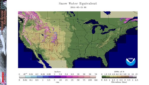
Conventional weather forecasters are concerned that the snowpack that has accumulated in the northern and central Rockies, Cascades, and Sierra Nevada due to a long-running winter with deep snowfall may mean downstream flooding for those areas when warmer conditions melt the snowpack. The light pink and white areas on the map below depict snow water content over 30 inches. Image appears courtesy of NOAA.
nsm_swe_2011052105_National
A great deal of the snowpack is still intact due to unseasonably cool conditions and with the combination of cool, wet weather, more snow continues to fall. Some meteorologists, however, are forecasting above-normal warmth through the Rockies during the month of June. A rapid thaw could lead to dangerous flooding.

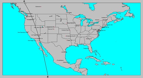
According to astro-meteorology, which ventures long-range forecasts based on planetary cycles, the influence of the planet Neptune affects the western United States during the spring season as shown on the map below.

Melt
Some of the effects of Neptune on weather conditions due to its connection with southerly airflows according to the late George J. McCormack are thaws and snow slides in mountain areas. Times when this influence is activated should be when Neptune is aspected by other planets. Here are some approximate dates to watch for.
May 22nd- Sun square Neptune
June 3rd- Mercury square Neptune
June 8th- Jupiter sextile Neptune
June 10th- Venus square Neptune
June 16th- Mercury trine Neptune

End

Wednesday, May 18, 2011

May 8-17, 2011 Forecast Results

The close conjunction of Mercury and Venus throughout the May 8-17 period was the basis of the long-range forecast posted on April 29th. There were basically three areas that were emphasized: the Plains, the western Atlantic, and the West Coast.

The Plains
The first portion of the forecast for the Plains spoke of increasing temperatures due to a moist, southerly airflow and the possibility of damaging thunderstorms, hail, and tornadoes. The areas to be affected were the Texas and Oklahoma panhandles and eastward toward the Mississippi Valley.

The first Accuweather map shows the severe thunderstorm threat for the 8th through the 10th over Texas and Oklahoma and continuing toward the Mississippi River Valley.
06 Next Week
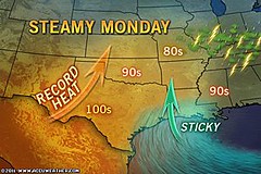
The next Accuweather map for the 9th confirms the increasing temperatures and moisture talked about in the forecast.

09 Record heat
Greatly enhanced storm potential was the forecast for the Plains during the May 10-12 period.
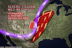
This next map for the 11th shows the area slated for tornadoes, large hail, and severe thunderstorms.

10 Heartland
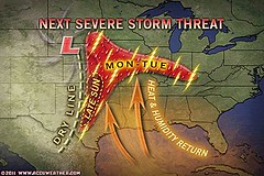
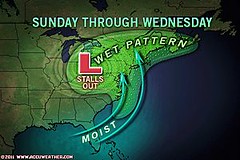
The forecast for the final period, May 14-17, specified through the Plains, Deep South, and East Central States. This next map shows the lingering low pressure area affecting the East Central and Northeast States from the 15th through the 18th.
15 Northeast

The Western Atlantic
The forecast for the whole period mostly concentrated on an area roughly 420 to 475 miles northeast of the Lesser Antilles centering around 54 west longitude and 19 north latitude, and looked for a low pressure system (not necessarily tropical) that would affect the area. A strong low was forecast to develop between the 14th through the 17th.

The National Weather Service made the following comments throughout the period:
May 9: Low-level moisture continues to pool along a surface trough from 18N55W into the NE Caribbean...
May 11: A SURFACE TROUGH IS OVER THE W TROPICAL ATLC INTO THE NE CARIBBEAN EXTENDING FROM 21N55W ACROSS THE VIRGIN ISLANDS NEAR 18N63W.
May 15: ANOTHER LOW PRESSURE SYSTEM IS IMPACTING THE CENTRAL ATLC. AN UPPER LEVEL TROUGH IS ALONG 53W...

The following weather map is for May 15 and shows the area mentioned.

15 Tropics
This low pressure area around May 15th was broad enough that it affected Puerto Rico and the Virgin Islands with strong storms. Accuweather reported "More Drenching Storms for Puerto Rico, Virgin Islands. Drenching showers and thunderstorms will continue to soak the northeastern Caribbean Islands through at least early next week..."

West Coast
Between the 10th and the 17th, the West Coast was forecast to experience an increase in heat and moisture leading to storms over California, Washington, Oregon, and Idaho.

On the 14th, a low pressure area hit the West Coast States of Washington, Oregon, and Idaho as shown in the following Accuweather map. Their title was "Storm to Slam West Coast this Weekend."
13 West Coast

On the 16th, Accuweather reported "The next shot of rain will advance onshore over northern California later today. " Here's their weather graphic.

16 West


If Evolution Were Really True, It Would Look Like This...

img119

Saturday, May 14, 2011

Hurricane Season 2011 Baja, Mexico

The map below shows the planetary influences at work over the Baja California at the time of the summer solstice. The summer solstice chart is used by astro-meteorologists to assess weather patterns for the summer season and issue long-range weather forecasts.
Baja
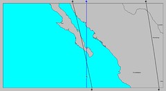
This map for the summer of 2011 in particular is of interest because of the planetary influences that concentrate over the Baja California. The two crossing lines represent the influences of Mars and Neptune. In addition to their crossing, the two planets are in a 90 degree relationship which indicates a distruptive influence on weather patterns.

Neptune's influence on the weather correlates with tropical moisture, high humidity, and heavy downpours. Mars adds energy to weather patterns through heat. Together this planetary combination can indicate low pressure areas that bring strong storms and heavy rainfall. Tropical storms and hurricanes fit this description as well.

Vacationers considering the Baja California as their destination this year should note the following dates as times when low pressure areas and/or tropical systems could threaten the area. My Hurricane Season 2011 forecasts will appear in the August edition of Dell Horoscope.

June 21-23, 2011
This is when the summer solstice chart takes effect and the square or 90 degree aspect between Mars and Neptune makes their initial contact.

July 29-31, 2011
Mercury triggers the Mars-Neptune set up now. This has the potential to result in a low pressure that generates strong winds and rain.

August 5-8, 2011
Mercury retrograde, itself an indication of windy conditions, triggers Mars-Neptune again bringing the potential a tropical system.

August 20-25, 2011
Conditions are now conducive for a low pressure system to form over the area as Venus triggers Mars and Neptune.

September 7-10, 2011
Mercury once again enters the equation and brings the possibility of a low pressure area or tropical system over the Baja.

May 8-17, 2011 Forecast

Hurricane Risk-Management

Hurricane Season 2011 Predictions

Overview of UK Winter 2012-13

The Winters of 2011-14

Cyclone Yasi fulfills long-range prediction!

Tropical Storm Matthew Fulfills Long-range Forecast!

Hurricane Earl and T.D. 10E Fulfill Long-range Forecasts!

Tropical Storm Alex Fulfills Long-range Prediction!

Bonnie Fulfills Long-range Forecast!

Introduction to the Weather Alternative

How Long-Range Forecasts Are Made

Alister McGrath on Faith and the New Atheism

Friday, May 06, 2011

Hurricane Risk-Management

As of April 2011 Colorado State University, Weather Service International, and Tropical Storm Risk have lowered the number of hurricanes they're expecting in the Atlantic Basin for the 2011 season. Nevertheless, they all agree the season should be well above average. CSU expects 16 named storms and 9 hurricanes while Weather Service International foresees a more impactful season along the U.S. coastline. They estimate 15 named storms and 8 hurricanes. Tropical Storm Risk calls for 14 named storms and 7 to 8 hurricanes. They realize that it is, of course, impossible to precisely predict this or any season's hurricane activity in early April.

hurricane

Because a land-falling hurricane can cause extensive damage, risk management experts work with models that are designed to estimate insured losses due to these tricky tropical tempests. What has presented even more of a problem for these experts is trying to anticipate where and how many hurricanes will make landfall. The three major catastrophe modelers, AIR Worldwide, EQECAT, and Risk Management Solutions (RMS) have recently concluded that their near term hurricane models have significantly overestimated losses due to land-falling hurricanes. For example, they initially projected insured loss levels for the 2006-2010 period at 35 percent above the long-term average. The actual cumulative losses, however, were less than one third of the long-term cumulative average.

global_running_ace

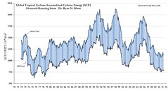
Here's where the Hurricane Frequency Paradox comes into play which states that although there has been an increase in Atlantic tropical activity since the 19th century, there has not been an increase in hurricane landfalls for the United States. The answer may be due to improved observational techniques according to NOAA researchers. For example, in the days before satellite technology, some tropical systems that formed and died out at sea went undetected. Now they are tallied up with each season's hurricanes if and when they occur.

As pointed out above, the near term hurricane models can't produce credible estimates of losses at specific locations, which is what insurance companies and the average citizen are most interested in, because conventional meteorology is unable to generate long-range forecasts of hurricane strikes for specific locations. The study of astro-meteorology offers some assistance to this very problem. As put forth by Johannes Kepler, the discoverer of the planetary laws of motion, astro-meteorology is a long-range weather forecast system based on planetary cycles. The system allows the formulation of long-range weather forecasts months or years in advance that can pinpoint, not just general trends, but specific forecasts that cover the time, place, and type of weather to be expected. Although no forecast method can claim 100 percent accuracy, and astro-meteorology is no exception, it can give a much clearer picture. Tropical systems Alex, Bonnie, Earl, Matthew, and Tropical Depression 10E were all forecast months in advance last year using this method. Although no hurricane made a direct U.S. landfall last year all of these systems affected land areas in the western hemisphere. Where ever there's a problem, God has a solution--astro-meteorology may very well be, in more ways than one, heaven helping us.

May 8-17, 2011 Forecast

Hurricane Season 2011 Predictions

April 18-24, 2011 Severe Weather Window

Overview of UK Winter 2012-13

The Winters of 2011-14

Cyclone Yasi fulfills long-range prediction!

Tropical Storm Matthew Fulfills Long-range Forecast!

Hurricane Earl and T.D. 10E Fulfill Long-range Forecasts!

Tropical Storm Alex Fulfills Long-range Prediction!

Bonnie Fulfills Long-range Forecast!

Introduction to the Weather Alternative

How Long-Range Forecasts Are Made

Excerpts from Tidal Dynamics by Fergus J. Wood
Encouragement
Everyone craves encouragement. If you feel like you have no time, no energy, no expertise, no money, or little to give, don’t worry; that’s common to many of us. But we can all give through our words of encouragement, through which our lives can have influence, and we can spread God’s love wherever we go. In just five minutes or less, we can make a difference at a bus stop, on the metro, crossing the street, at the shop, at work, at school, online, going for a walk, and the list goes on.

Friday, April 29, 2011

May 8-17, 2011

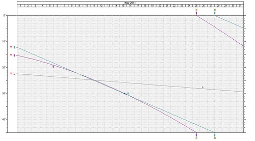
There's about a two week period in May where the planets Mercury and Venus are traveling side by side in close conjunction, which doesn't normally happen. The graph below gives an idea of this. Notice the two lines that run together from the left down the the lower right. At one point they cross a third line, which represents their conjunction to Jupiter. Let's see what weather these conjunctions might engender. I'll try and mention the most outstanding dates and places.
SFEphem

May 7-10, 2011
There is an indication that the tropics will begin to awaken at this time. It doesn't necessarily mean that a tropical system will result but there's a strong possibility that a low pressure system will develop now about 420 northeast of the Lesser Antilles.
Another area that stands out for severe weather is the Texas and Oklahoma panhandles. Mercury and Venus together indicate increasing temperatures due to a moist, southerly airflow. This can indicate the ingredients necessary to trigger damaging thunderstorms, hail, and tornadoes. These storms could then continue in eastward transit toward the Mississippi Valley.

May 10-12, 2011
At this time the three planets, Mercury, Venus, and Jupiter all conjoin. A broad area in the west central Atlantic to the Lesser Antilles is activated now so we may continue to see low pressure areas that may be monitored for development.

The Plains continues to be an area of concern as more warm, moist air will be available as a mechanism for thunderstorm generation. Storm potential is therefore greatly enhanced now.
The Full Moon and New Moon charts place these aspects over the West Coast States of California, Washington, and Oregon. Increasing heat and moisture could very well manifest as an increased monsoonal flow triggering storms over the area.
May 14-17, 2011
The West Coast States are still responding to increases in temperatures or at least warm, moist air masses. The area in and around Idaho is emphasized where storm development is a likely response.
Generally, the Plains through the Deep South and East Central States are experiencing an influx of warm, moist air from the Gulf which continues to provide the ingredients for storms.
A strong low pressure area seems likely to develop or strengthen about 475 miles northeast of the Lesser Antilles (around 54 west longitude and 19 north latitude).

untitled

Monday, April 25, 2011

April 18-24, 2011 Forecast Results

At the end of March, I posted a long-range forecast for April 18-24, 2011. The forecast zeroed in on areas that might experience "wild weather." Three areas were highlighted: Puerto Rico, the area from Northwest Texas through Tennessee and Georgia, and area about 600 miles off the coast of California.

21 Tropical
As can be seen from the above Accuweather map of April 21, conventional meteorologists were watching a low-pressure system about 460 northeast of San Juan, Puerto Rico. Forecasters were concerned that it might develop tropical characteristics. The low lingered in the area and by the 23rd, the National Weather Service issued its last advisory on the low pressure.

The next area for wild weather was from Northwest Texas through Tennessee and Georgia.
22 Texas Through Ohio
This was a very volatile time for this section of the States. Prior to the forecast period there were already deadly tornadoes. Within the April 18-24 window there were violent thunderstorms that hit central Texas to northern parts of Mississippi, Alabama and Georgia. There were reports of damaging winds and hail.

The above map is for the 22nd and shows the area slated for severe storms, tornadoes, and flash flooding. This is roughly the same area I pinpointed in my long-range forecast. The St. Louis airport was hit by a tornado.

23 Ohio Valley to Texas
The above Accuweather map is for the 23rd and shows roughly the same area that I had specified. Severe weather continued to threaten the area.
The 3rd area mentioned in the forecast was 600 miles off the coast of California. I was unable to verify either way if a low developed there or not.