Tuesday, October 14, 2008

Omar's Close Fulfillment

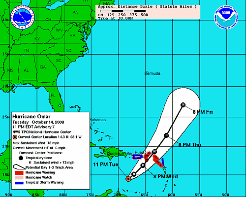
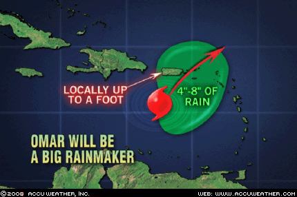
Hurricane Omar will be a very close fulfillment of The Weather Alternative's long-range forecast for October 16-19, 2008. The forecast, posted on September 23rd, mentioned how Mars would square the August 1, 2008 solar eclipse degree and result in a semi-tropical to tropical low pressure system south of Puerto Rico threatening the island with heavy downpours and flash flooding.


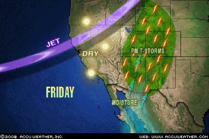
Accuweather reports tonight that Hurricane Omar will produce very heavy rainfall over Puerto Rico and the Virgin Islands through Wednesday (Oct 15th). This is very close to The Weather Alternative's time frame.


The National Weather Service places Omar northeast of Puerto Rico by the morning of the 16th still in close proximity to Puerto Rico. I'll post the results of the rest of this long-range forecast in a few days.

Solar Eclipse Activation Fall 2008 Part 1

August's Lunar Eclipse and November's Storm

Introduction to the Weather Alternative

How Long-Range Forecasts Are Made

Will you be a winner or a looser. Check out this viewpoint on the current geopolitical and economic situation.

Saturday, October 11, 2008

What A Storm!!

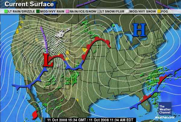
A major storm is impacting the western United States this week end with heavy snow over Idaho, Montana, and Wyoming, and windy conditions over New Mexico, Arizona, and California northward to Idaho, Wyoming, and Montana. Sustained winds between 20 and 40 mph will be experienced with gusts exceeding 70 mph in a few locations.


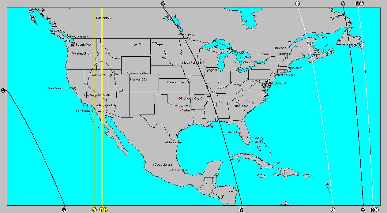
The Full Moon of September 15th comes into play with this storm. At the time of full moon, Mercury, Venus, and Mars were angular over the western U.S. at between 115 and 117 west longitude. Both Mercury and Venus were conjunct at 19 degrees Libra while Mars was close by at 17 degrees Libra. This troublesome trio is being activated as we speak. The transit Sun is at 19 degrees Libra today activating the storm potential.

The solar ingress map for the Fall season also placed a Mercury-Mars conjunction over the area promising windy conditions at times throughout the season.

Solar Eclipse Activation Fall 2008 Part 1
August's Lunar Eclipse and November's Storm
Introduction to the Weather Alternative
How Long-Range Forecasts Are Made

The American Revolution was preceded by the great religious revival of the middle of the eighteenth century, which had its effect both in England and in the colonies. When the common people turned to the reading of the Bible . . . when they were stirred by a great revival . . . the way was prepared . . . It was because religion gave the people a new importance and a new glory that they demanded a new freedom and a new government. We cannot in our generation reject the cause and retain the result.

If the institutions they adopted are to survive, if the governments which they founded are to endure, it will be because the people continue to have similar religious beliefs. It is idle to discuss freedom and equality on any other basis. It is useless to expect substantial reforms from any other motive. They cannot be administered from without. They must come from within. That is why laws alone are so impotent. To enact or to repeal laws is not to secure real reform. It is necessary to take these problems directly to the individual . . . There will be obedience to law when the individual feels that government represents a divine authority.

It is these beliefs, these religious convictions, that represent the strength of America, the strength of all civilized society . . . It is righteousness alone which exalteth the nation . . .

Calvin Coolidge

Saturday, October 04, 2008

Atmospheric Reactions to Solar Eclipse

Venus' square to the August 1, 2008 solar eclipse degree has produced the expected atmospheric reactions over portions of the U.S., Canada, and the tropics.


The Weather Alternative forecast for Sept 30-Oct 3, 2008 warned of a possible tropical wave south of Puerto Rico. It also called heavy rain over eastern Canada, and precipitation over the Northeast U.S.


Results

South of Puerto Rico

The National Weather Service reported yesterday AN UPPER LEVEL TROUGH WILL APPROACH FROM THE EAST AND BEGIN MOVING OVER THE LOCAL AREA OVERNIGHT THROUGH SATURDAY MORNING.MEANWHILE...A TROPICAL WAVE WILL MOVE SOUTH OF THE ISLAND. THESE SYSTEMS WILL COMBINE TO BRING AN INCREASE IN CLOUDINESS AND SHOWER ACTIVITY FROM TIME TO TIME ACROSS THE LOCAL AREA DURING THE WEEKEND.


Northeast U.S. and Eastern Canada

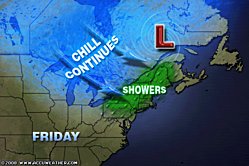
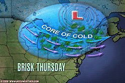
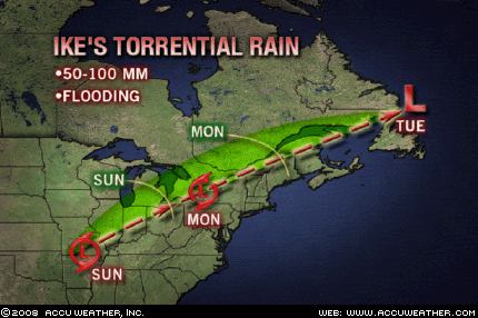
The Accuweather map at right, as well as the one above, shows
atmospheric conditions over the Northeast U.S. and eastern Canada on October 2nd and 3rd.
Accuweather reported that on the 2nd heavy rain fell across New England due to a low pressure area over Quebec.


Solar Eclipse Activation Fall 2008 Part 1
August's Lunar Eclipse and November's Storm
Introduction to the Weather Alternative
How Long-Range Forecasts Are Made

The negative person gradually loses sight of reality. It’s not a sudden thing, but gradually, bit by bit, negative attitudes take over one area of his thoughts, then another, and then another. When you take in a negative thought, it colors your spirit just a bit. As you accept more and more negative thoughts, it begins to darken your spirit.

This process inverts your perceptions, and over time it causes you to begin seeing negative things as good and good things as negative. What is happening is that you are slowly slipping into the Enemy’s upside-down, inside-out perceptions.

“Positive thinkers inevitably get positive and powerful results.”—Norman Vincent Peale

Tuesday, September 30, 2008

August's Lunar Eclipse and November's Storm

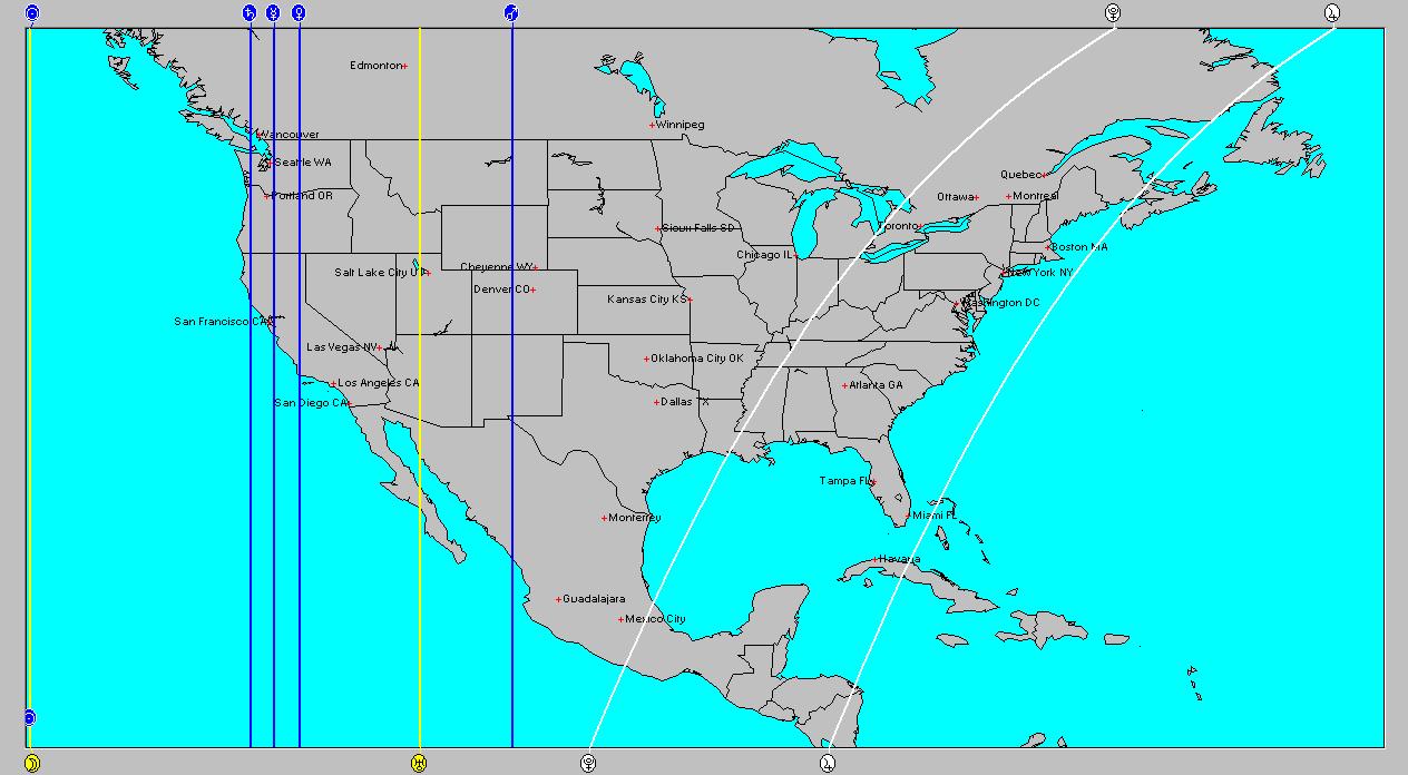
The lunar eclipse of August 16, 2008 set up a trio of sensitive planetary energies over the Pacific Northwest and California. As seen in the accompanying astro-locality map at left, Saturn, Mercury, and Venus occupied the Midheaven, or were directly overhead at the time of eclipse.


These will be spurred into action between November 29th and December 4, 2008. The result should be a potent storm that plows into the area on the above mentioned dates.

Solar Eclipse Activation Fall 2008 Part 1
Introduction to the Weather Alternative
How Long-Range Forecasts Are Made
Check out my article and interview in Saptarishis Astrology Volume 3

Good-bye
Good-bye, proud world! I'm going home
Thou art not my friend, and I'm not thine.
Long through thy weary crowds I roam;
A river-ark on the ocean brine,
Long I've been tossed like the driven foam;
But now, proud world! I'm going home.

Good-bye to Flattery's fawning face;
To Grandeur with his wise grimace;
To upstart Wealth's averted eye;
To supple Office, low and high;
To crowded halls, to court and street;
To frozen hearts and hasting feet;
To those who go, and those who come;
Good-bye, proud world! I'm going home.

I am going to my own hearth-stone,
Bosomed in yon green hills alone,
--A secret nook in a pleasant land,
Whose groves the frolic fairies planned;
Where arches green, the livelong day,
Echo the blackbird's roundelay,
And vulgar feet have never trod
A spot that is sacred to thought and God.

O, when I am safe in my sylvan home,
I tread on the pride of Greece and Rome;
And when I am stretched beneath the pines,
Where the evening star so holy shines,
I laugh at the lore and the pride of man
At the sophist schools and the learned clan;
For what are they all, in their high conceit,
Where man in the bush with God may meet?

Tuesday, September 23, 2008

Solar Eclipse Activation Fall 2008 Part 1

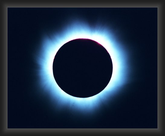
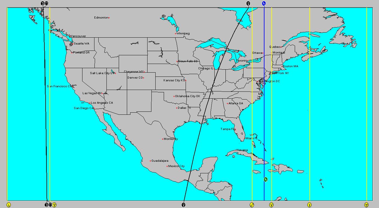
The Solar Eclipse of August 1, 2008 will receive a series of aspects this fall that are considered as activation stimuli to the energies represented by the eclipse. The Sun and Moon ascended across the Northeast U.S. at the time of eclipse. Following are some of the dates when the eclipse will be spurred into action and some of the most likely weather scenarios that will result.


September 30-Oct 3, 2008
Transit Venus will square the eclipse degree on October 1st. While the planets from Mars on out to Pluto are usually considered the most potent triggers, this square from Venus may result in some weather activity. The area south of Puerto Rico, in and around 66 west longitude and 14 north latitude is likely to exhibit atmospheric instability at this time. This may take the form of a tropical wave or depression that could soak the Isla del Encanto (Puerto Rico). Since Venus is parallel Neptune at this time, eastern Canada (around 66 west/49 north) may also be subject to heavy rain. The Northeast U.S. will also see an increase in moisture leading to precipitation.


October 16-19, 2008
Mars squares the eclipse degree on the 17th as it parallels Neptune. Mars is more energetic in its influence. The same areas mentioned above i.e. the area south of Puerto Rico, eastern Canada, and the Northeast U.S. will experience strong weather patterns involving rising masses of very moist warm air, and semi-tropical to tropical low pressure systems. Hence, Puerto Rico may catch some strong rains as a potential tropical system develops south of the island. Strong low pressure systems resulting in heavy downpours and isolated flash floods may result over the Northeast U.S. and eastern Canada.


Nov 1-4, 2008
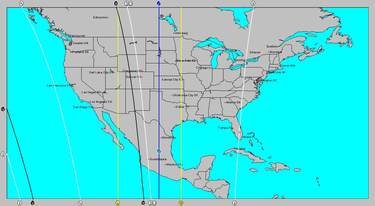
The Sun now squares the eclipse degree as it parallels Neptune. Once again, the area south of Puerto Rico bears watching for tropical storm genesis. The Northeast U.S. will be a target for severe storms as well as eastern Canada. One more area that should show an atmospheric reaction is area along the 114th line of west longitude. This takes in the central Baja California, the U.S. desert Southwest on into Idaho and Montana.
Severe weather is indicated over this area since it coincides with Saturn’s opposition to Uranus. This would suggest a possible tropical storm or hurricane strike over the Baja area or a robust cold front lowering temperatures and producing strong storms throughout the western U.S.


The Solar Eclipse of Sept 11, 2007


October 28-31, 2008
This Solar Eclipse is activated by Saturn’s conjunction on October 29th. The Sun and Moon ascended over the Rockies at the time. Saturn’s influence should trigger cold, and damp weather over the region. This may take the form of a major low pressure system. Since transit Mars is also sextile tranist Saturn this usually manifests as breezy or windy weather.
At the same time transit Mars is also parallel Pluto, which occupies the line of longitude along the far eastern Plains and Mississippi Valley (92 West). Pluto squares the ascendant along the entire length of the line. The area may be hit by a strong storm system or a tropical system that hits Louisiana.


The Solar Eclipse of March 18, 2007


Dec 18-22, 2008
The Last Quarter Moon of Dec 19th opposes and squares this Solar Eclipse degree. This may trigger a storm system or front over western Canada and pushing into the Pacific Northwest.
After the 21st temperatures should increase over the mid-Atlantic states leading to storms.
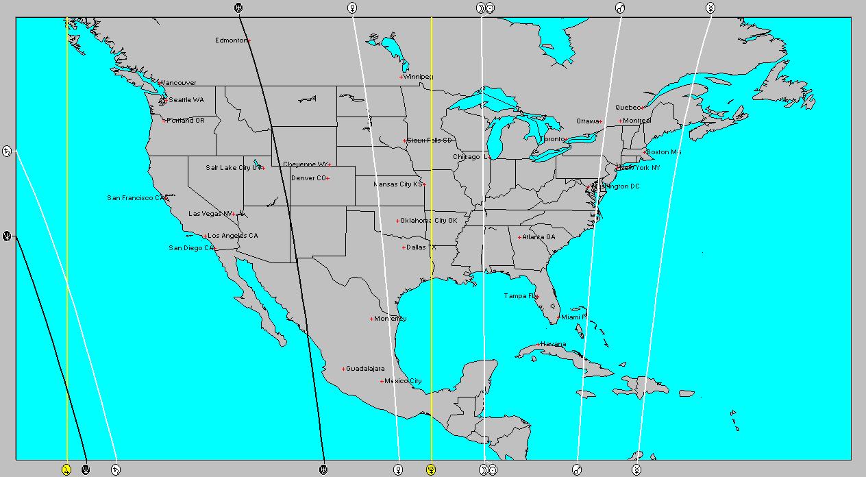
The Solar Eclipse of September 22, 2006


Nov 4-7, 2008
Pluto’s square to this Solar Eclipse degree is exact on Nov 5th but since Pluto lingers a long time at this degree, we might consider that the eclipse is active before then. The Sun-Moon line ran along 88 west longitude energizing the area from Mississippi and Alabama northward through the western Great Lakes. Pluto’s influence is of a cold nature and may correspond to a cold front pushing southward over the Great Lakes and triggering storms down the Mississippi Valley. Another scenario entails a tropical system hitting the Gulf Coast around Mississippi and Alabama.
Since Saturn opposes Uranus on the 4th and these fall over the western Plains in the Solar Eclipse chart, a powerful storm-producing cold front may push through the area.

Introduction to the Weather Alternative
How Long-Range Forecasts Are Made
Check out my article and interview in Saptarishis Astrology Volume 3


Dream a little dream--and pay attention
By Don Oldenburg, The Washington Post

The dream always started the same way: She walked up to the same gallery on the same street and looked over the ceramic art in the front window. Then she went inside and examined the beautiful clay sculptures on display.

"Each time I went into the gallery there were different pieces," says Grace Lewis, a potter who, starting in 1987, revisited her "gallery dream" about twice a week for five years.
Lewis soon began turning out the dream artworks in her studio. After she completed nearly 75 of the sculptures, her gallery dream stopped returning. "It just broke my heart," she says, "but I think my subconscious had other things it needed to tell me."

By other things, Lewis refers to the persistent cancer dreams. They stopped almost a year later, after she finally persuaded a skeptical doctor to conduct tests that confirmed she did, indeed, have cancer. The dreams caught it in time.

"Dreams are a lot more powerful than people like to give credit," says Lewis, conceding she probably wouldn't believe her own story if it hadn't happened to her. "They would tell us all sorts of things about ourselves if we paid attention to them."

Most people don't pay attention to their dreams. They dismiss them as sleeptime fictions or insist they don't dream at all. The traditional Western attitude toward dreaming can be summed up by the popular invective "in your dreams." Translation: "Never going to happen."
But, beyond a wealth of anecdotal testimony that for centuries has attributed remarkable value to dreams, there is mounting scientific evidence of their practical worth in solving real-life problems, gaining poignant insights and boosting creativity.

"The potential is limitless," says Karen Shanor, co-author of the 1999 book The Emerging Mind (Renaissance Books), a survey of research in the meaning of consciousness.
The noted sleep and dream expert William C. Dement tells of a dream he had 35 years ago that he believes saved his life. Then a heavy smoker, he had a vivid dream in which he was diagnosed with lung cancer. "I could barely breathe," he writes. "My life was over … and then I woke up." He says he has never lit another cigarette since.

History is replete with Nobel Prize winners, famous inventors and acclaimed authors and artists whose dreams unlocked their creativity and solved impenetrable problems. Sewing machine inventor Elias Howe credited a dream with inspiring his needle with the hole at the pointed end. Golfing great Jack Nicklaus dreamed a revised golf grip that improved his game by 10 strokes.
"I can't explain this phenomenon by means of science," says Russian mathematician Alexander A. Zenkin, who refers to his discoveries from dreaming as his "voice of night."

While a lecturer at Moscow State University in 1971, Zenkin tried fruitlessly for months to find a proof of mathematics' classical Waring's Problem. Frustrated, he stopped thinking about it--only to awaken one morning "with a happy feeling that I have the proof."

He sat at a table and wrote nonstop for seven hours--producing 18 mistake-free pages of "absolutely new ideas, methods, theorems." "I felt as if somebody dictated to me," he says, explaining that he didn't remember the work in his dreams that night, only the solution that morning. Since then, he has been revisited by his voice of night.
Thursday, September 18, 2008

Sept 7-10, 2008 Forecast Results

With all the attention that Hurricane Ike was getting, here's one forecast result that got overlooked.


The Weather Alternative forecast for September 7-10 expected cool but fair weather over the Rockies due to Jupiter's trine to Saturn.


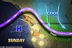
On the 7th, Accuweather reported "The northern Rockies and the West Coast will see some cooler conditions with a slight dip in the jet stream over the area...cooler weather will be found over the northern Rockies with a front moving off to the east. "

On the 9th, the Weather Channel reported "Afternoon highs across the region (Rockies) are expected to stay cooler than they were over the weekend.

Introduction to the Weather Alternative

How Long-Range Forecasts Are Made

Check out my article and interview in Saptarishis Astrology Volume 3

The key to peace is not in the absence of confusion, but in your frame of mind. Sometimes it might seem like you can’t even hear yourself think, but that isn’t an obstacle too great for Me to overcome. I will give you peace of mind and heart as you surrender your all to Me.

Saturday, September 13, 2008

Hurricane Ike Fulfills Long-range Forecast

Hurricane Ike's arrival over eastern Texas on September 12th and 13th fulfilled The Weather Alternative's long-range weather forecast posted on May 12th of this year. The forecast called for possible tropical storm or hurricane formation in the western Gulf of Mexico between September 9th and 14th.


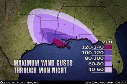
A more recent post (Sept 7) pinpointed Ike's landfall over eastern Texas. Conventional forecasters were somewhat perplexed as to Ike's track. As can be seen from the National Weather Service map for Sept 9th, the main track they thought Ike would take was further to the southwest. The Weather Alternative post stated It seems like the greater danger lies over eastern Texas.


It also seems that Ike's arrival over the Northeast and New England on Sept 15th and 16th may fulfill another Weather Alternative long-range forecast. This one was posted on June 13th and stated:

Sept 14-18

The conjunction of Mercury and Venus over the New England area keeps the astro-meteorological window open for tropical storm/hurricane activity to affect the region or for severe thunderstorms to afflict the area.

Summer 2008: The Eastern United States
Summer 2008: The West Coast Part 1
Summer 2008: The Rockies Part 1
Summer 2008: The Plains and Mississippi Valley- Part 1
Introduction to the Weather Alternative
How Long-Range Forecasts Are Made
Check out my article and interview in Saptarishis Astrology Volume 3

Sunday, September 07, 2008

Where Is Ike Headed?

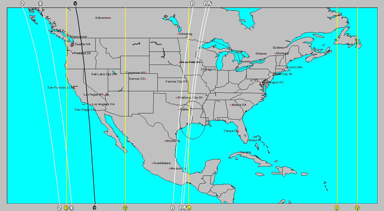
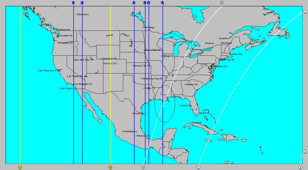
Conventional forecasters see Hurricane Ike headed into the Gulf of Mexico and close to the Gulf Coast around the 12th of September. I would say that the astrological factors involved at that time would back their forecast. Let's look at the astro-locality map for the First Quarter Moon of September 7th.


You'll notice the area I've circled over eastern Texas. These crossings of planetary lines are important. The yellow line represents Jupiter's position and the two white lines represent Mercury and Mars. Both Mercury and Mars will square Jupiter and then conjoin each other between Sept 7th and 8th. This is somewhat before Ike would arrive. The original crossings will be activated again around the 14th. This will probably coincide with Ike's arrival. So one good possibility is that Ike hits southeast Texas around the 14th.

The current lunar eclipse chart shows some of these same planets over the Florida Panhandle. As is usual with strong hurricanes, they usually affect a big area. It seems like the greater danger lies over eastern Texas. I will check you some other charts and see if anything else turns up.

P.S. I almost overlooked my own forecast for Sept 9-14 posted in the Summer 2008: The Plains and Mississippi Valley- Part 1 section posted in May. It read:

Another cold wave begins to affect the Plains triggering precipitation. From the 12th on, the Sun's opposition to Uranus brings a cold air mass out of the north lowering temperatures and setting off storms, which have the potential to reach severe limits. Possible tropical storm or hurricane formation is indicated in the western Gulf of Mexico.

Summer 2008: The Eastern United States
Summer 2008: The West Coast Part 1
Summer 2008: The Rockies Part 1
Summer 2008: The Plains and Mississippi Valley- Part 1
Introduction to the Weather Alternative
How Long-Range Forecasts Are Made
Check out my article and interview in Saptarishis Astrology Volume 3


Circumstances never create character; they merely reveal it.


Reputation is what men think you are; character is what God knows you are.

Friday, September 05, 2008

Hanna, Ike, and Other Predictions

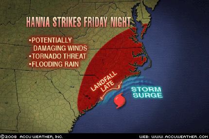
Tropical Storm Hanna is forecast to strike the Carolina coast somewhere between Myrtle Beach, S.C., and Wilmington, N.C. today according to Accuweather.com. This will fulfill The Weather Alternative long-range forecast for Sept 6-9 issued on June 13th of this year.


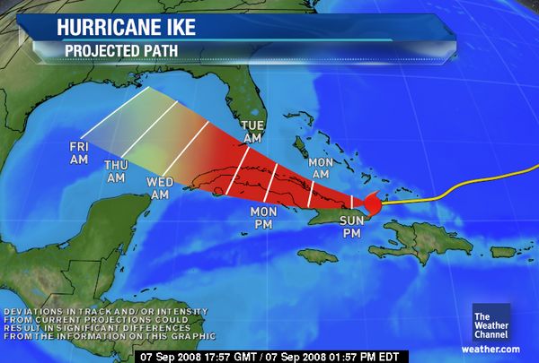
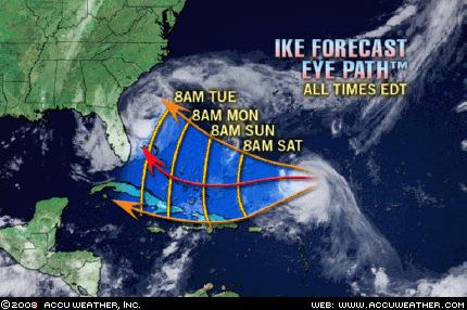
Hurricane Ike is next in line, and according to the National Weather Service's projected path will round the Florida Peninsula and head into the Gulf of Mexico. Accuweather, on the other hand, foresees Ike following more or less the same path as Hanna along the East Coast.


There are two long-range Weather Alternative forecasts that come into play here. One for Sept 10-14 shows a stormy East Coast based on the Venus-Mars conjunction of Sept 11th. The other forecast for Sept 14-18 warns of tropical storm or hurricane activity over New England. (Read forecasts here) Ike may be the fulfillment of this latter forecast if it reaches the New England area between the 14th and and 18th.


Another Weather Alternative long-range forecast for Aug 29-Sept 4 called for a cold air mass to move in over the Rockies and to bring precipitation. The Accuweather Map at left shows the front entering the West Coast on Saturday, August 30th. The Weather Channel reported on the 29th:


The cold front will move into the Northwest this weekend...
readings in Washington and Oregon behind the front will be 5 to 15 degrees below average...Sunday and Monday, the cold front will continue to plow through the West. High temperatures will be 5 to 30 degrees below average over much of the region.
Showers and thunderstorms will cover a wide area from Montana to Arizona and New Mexico. Snow will fall in the higher elevations of the northern Rockies.


The Weather Alternative long-range forecast for Sept 3-7 read

Weather gets nasty over the Plains as Mercury and Mars parallel Uranus provoking windy conditions or severe thunderstorms packing damaging winds. Severe weather then pushes eastward over the Mississippi Valley.

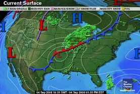
So far this has coincided with Gustav's arrival over the Plains and Mississippi Valley area as can be seen on this Weather Channel map for Sept 4th. Gustav brought heavy rain, flooding, and tornado wathes and warnings to the mid-Mississippi Valley and western Great Lakes area as well as soaking rains to nearly all of Arkansas and portions of Mississippi, eastern Oklahoma, western Tennessee, and much of Missouri.

Summer 2008: The Eastern United States

Summer 2008: The West Coast Part 1

Summer 2008: The Rockies Part 1

Summer 2008: The Plains and Mississippi Valley- Part 1

Introduction to the Weather Alternative

How Long-Range Forecasts Are Made

Check out my article and interview in Saptarishis Astrology Volume 3


10 excuses that are not recommended for ambitious men & women:
a) That's the way we've always done it.
b) I didn't know you were in a hurry for it.
c) That's not in my department.
d) No one told me to go ahead.
e) I'm waiting for an okay.
f) How did I know this was different?
g) That's his job, not mine.
h) Wait till the boss comes back & ask him.
i) I forgot.
j) I didn't think it was that important.

Monday, September 01, 2008

More On Gustav and Hanna

Gustav, a category 2 hurricane, hit the Louisiana coast today. Recently, I posted about the difference in Pluto's position in astro-locality maps, and how the "inmundo" position seemed to be more accurate than the "zodiacal" position. Gustav's arrival over Louisiana is another example of this.


The astro-locality map at left is for the New Moon of August 30th but with the planetary (inmundo) positions for September 1st. Notice the circled area over Louisiana where Mars, represented by the blue line, crosses with Pluto, represented by the white line. They make a convenient "X-marks-the -spot" over where Gustav made landfall. Planetary crossings such as these are important in weather forecasting as can be seen in previous posts. They don't happen all the time, but when they do they can be important. Mars is parallel Mercury today--a high wind breeder. Back in May when Cyclone Nargis hit Burma, it was under the aspect of Mercury parallel Mars.


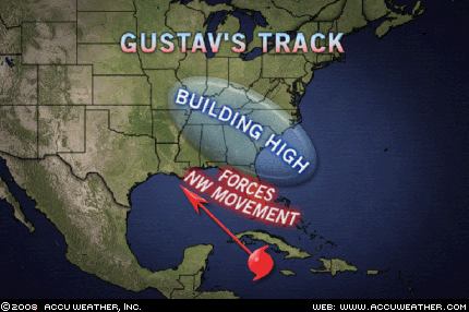
In my last post, I discussed another forecast I had made for Aug 30-Sept 2. Mercury and Mars in the Solar Ingress were over Florida and the East Central States. I wanted to see if windy conditions would develop there as well or if it would just be high pressure. The Accuweather map at right shows that windy conditions associated with Gustav have affected the Florida Panhandle. On the 31st, The Weather Channel reported that rain from Gustav was also affecting the Florida Peninsula with the possibility of a tornado or two.

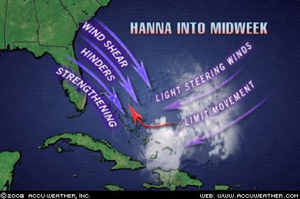
Another possibility that confirms windy conditions associated with the Mercury-Mars combo over the eastern portion of the country has to do with the Accuweather map at left that shows winds from over the Southeast U.S. shearing Tropical Storm Hanna.


Speaking of Tropical Storm Hanna, this next map issued today from the National Weather Service shows Hanna striking the Georgia-South Carolina state line around Friday, Sept 5th. If so, this will confirm my Sept 6-9 forecast issued in June of this year. The forecast called for a possible tropical storm or hurricane to make landfall over the Carolinas.

Sept 6-9
This is a very active period for the East Coast. Strong storms and high wind velocities are indicated for the mid-Atlantic area as Mercury, Venus, and Mars transit the area. Mars will parallel Uranus--a high wind breeder, and square Jupiter. Mercury also squares Jupiter and conjoins Mars--another wind maker. Lastly, Venus squares Jupiter and parallels Uranus. Tropical storm or hurricane landfall is possible over the Carolinas. If not a tropical system, powerful storms lash the mid-Atlantic and push eastward.

Summer 2008: The Eastern United States
Summer 2008: The West Coast Part 1
Summer 2008: The Rockies Part 1
Summer 2008: The Plains and Mississippi Valley- Part 1
Introduction to the Weather Alternative
How Long-Range Forecasts Are Made

Check out my article and interview in Saptarishis Astrology Volume 3

“We don’t stop laughing because we grow old; we grow old because we stop laughing.” Youth is not just a time of life; it is also a state of mind.

Doctor: That pain in your leg is caused by old age.
Grandpa: Don’t be silly—my other leg is the same age and it doesn’t hurt at all.

Friday, August 29, 2008

Where Are Gustav and Hanna Headed?

Current thinking says Gustav, as a strong hurricane, will most likely hit Louisiana around September 2nd. Of course, things could change. The Weather Alternative forecast for September 3-7 posted back in May and based on indications in the Solar Ingress chart warned that Weather gets nasty over the Plains as Mercury and Mars parallel Uranus provoking windy conditions or severe thunderstorms packing damaging winds. Severe weather then pushes eastward over the Mississippi Valley.


When considering other indications present in the New Moon chart, the area of southeast Texas and western Louisiana are highlighted again.


The Weather Alternative forecast for August 30-Sept 2 also warned of stormy weather and damaging winds over the East Central area due to Mercury's parallel to Mars. Both of these planets occupy the Midheaven through Florida in the Solar Ingress. Conventional forecasters are saying the a high pressure area is building over the Southeast U.S. It remains to be seen if this Mercury-Mars combo is indicative of the high pressure area or if some other type of severe weather will result there at that time, which was my leaning.


Meanwhile Tropical Storm Hanna is churning in the western Atlantic. Forecasters show Hanna curving southward and over the Bahamas by September 3rd.


The Weather Alternative forecast for Sept 6-9 stated This is a very active period for the East Coast. Strong storms and high wind velocities are indicated for the mid-Atlantic area as Mercury, Venus, and Mars transit the area. Mars will parallel Uranus--a high wind breeder, and square Jupiter. Mercury also squares Jupiter and conjoins Mars--another wind maker. Lastly, Venus squares Jupiter and parallels Uranus. Tropical storm or hurricane landfall is possible over the Carolinas. If not a tropical system, powerful storms lash the mid-Atlantic and push eastward.

We'll have to wait and see if Hanna plays into this or if Gustav is eventually pushed toward the East Coast. Perhaps it will be neither of them but some other weather pattern that affects the area.


Another Weather Alternative forecast was recently fulfilled as shown in the Accuweather map for August 25th. The forecast read a dose of cold air descends over the West generating a low pressure system over the Great Basin and Rockies.


Accuweather stated that showers would be present along with a noticeable chill. Temperatures were 10 to 20 degrees cooler in most locations as the front pushed eastward through the forecast area.


This next Weather Channel map for August 28th shows the fulfillment of two other Weather Alternative long-range forecasts.

The first one was for the East Coast between August 27-29 and stated Mercury and Venus square Pluto on the 27th and 29th respectively. Venus is also contra parallel Mars, which now occupies the Midheaven at 83 west longitude on the 28th. Although Pluto has been busted down from its status as a planet, it still exerts its full power on the weather. In the Ingress chart, Pluto runs along the East Coast, which should feel the strength of its storm-producing capabilities, while Mercury and Venus affect the East Central area with thunderstorms.

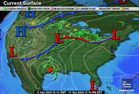
The remnants of Fay headed into the Northeast and spread rain and heavy downpours in the Southeast, Tennessee Valley, and Central Appalachians.

The second forecast was also for August 27-29 calling for summer storms to hit the Mississippi Valley. A low pressure area can be seen over the Mississippi Valley in the above map, which brought stormy weather to the region.

Summer 2008: The Eastern United States
Summer 2008: The West Coast Part 1
Summer 2008: The Rockies Part 1
Summer 2008: The Plains and Mississippi Valley- Part 1
Introduction to the Weather Alternative
How Long-Range Forecasts Are Made

Check out my article and interview in Saptarishis Astrology Volume 3

Knowledge is a collection of facts. Wisdom is knowing how to apply knowledge.

Sunday, August 24, 2008

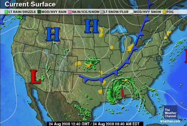
Fay Over the Gulf Coast and Other Weather Updates

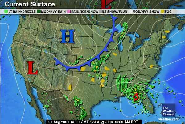
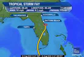
Former Tropical Storm Fay is now over the Gulf Coast area fulfilling The Weather Alternative's long-range forecast for August 23-25, which read:

Mars is now transiting across the East Central area at 86 west longitude. On the 26th, Mercury is contra parallel Mars. Heat increases and may result in storms and windy conditions.


86 west longitude centers around the western Florida Panhandle and Alabama. Accuweather reported today that "Tropical Rainstorm Fay was located about 60 miles north of Mobile, Ala., at 4:00 a.m. CDT. The storm continues its slow track moving west-northwest near 8 mph, and maximum-sustained winds are only near 30 mph. "

Another recent long-range forecast for August 20-24 stated This period starts with a warm and moist air mass pushing up over the Plains due to Mercury's conjunction with Venus. As these planets pass to the opposition of Uranus a cold air mass clashes with it resulting in storms throughout the Plains.

The Weather Channel map at left shows a front and storms pushing through the area. During the period severe thunderstorms were reported through North Dakota, Minnesota, Wisconsin, Iowa, Illinois, and 1 to 2 inches of rain in Missouri.


Going back a bit further, there were some Weather Alternative forecasts made for the period of Aug 15-17 and Aug 17-19 that need to be assessed.

First August 17-19: The Weather Channel map at left for August 20th shows a front and storms entering the Pacific Northwest. This fulfills what was mentioned in the "Solar Eclipse Time" post about a low pressure system off the U.S. West Coast developing between the 17th and 19th and pushing inland. The same post also mentioned possible hurricane formation further south along 128 west longitude. No hurricane formation resulted.

The long-range forecast for August 15-17 warned of heavy rains over western U.S. The National Weather Service reported the following on August 17th:

656 AM PDT SUN AUG 17 2008
...STRONG THUNDERSTORMS ARE POSSIBLE OVER PORTIONS OF WESTERN WASHINGTON TONIGHT......AN UNSEASONABLY STRONG AND WET STORM SYSTEM WILL AFFECT WESTERN WASHINGTON LATE TUESDAY INTO WEDNESDAY...


THE AIR MASS WAS BECOMING INCREASINGLY UNSTABLE OVER THE AREA AND IS EXPECTED TO BECOME EVEN MORE SO TONIGHT. THE THUNDERSTORMS THAT DEVELOP TONIGHT WILL POSE A RISK OF DIME SIZE HAIL OR LARGER.

The forecast also mentioned hurricane formation at 123 west longitude, which did not occur.

The same forecast pinpointed three locations outside of the U.S.--Iran; Brisbane, Australia; and the northeast Atlantic, 450 miles southwest of Ireland.

Iran

I was expecting some type of strong increase in heat and humidity over the country, and in an extreme case a tropical storm. I was unable to confirm any weather patterns over Iran.

Australia

The forecast called for a winter storm in and around the Brisbane area. A severe weather warning was issued on the 17th for damaging surf across the coastal areas and Strong Wind Warning. This was due to a pressure gradient resulting from a high pressure area over Australia and deep low pressure area near New Zealand.

Northeastern Atlantic

The forecast called for a strong low pressure system 450 miles southwest of Ireland heading toward Europe.

Accuweather reported the following on August 17th:

Flooding has occurred across parts of the United Kingdom over the past few days. A slow-moving area of low pressure has moved over Ireland, bringing locally heavy rainfall and gusty winds. As much as 3 inches of rain fell across Scotland and Ireland since Friday, in addition to the 1-2 inches which fell across much of the same area on Tuesday. Numerous trains were delayed across Scotland and Wales due to flooding, as well as downed trees. Limerick, in southwestern Ireland has received 8.44 inches of rain so far this month, more than 5 times the normal amount. Dublin, Ireland, has received more than 4 and a half times their normal rainfall so far this month. Rain is expected to continue across much of the British Isles on Sunday and Monday, as the low pressure system moves very slowly to the east.
Solar Eclipse Time

Summer 2008: The Eastern United States

Summer 2008: The West Coast Part 1

Summer 2008: The Rockies Part 1

Summer 2008: The Plains and Mississippi Valley- Part 1

Introduction to the Weather Alternative

How Long-Range Forecasts Are Made

Check out my article and interview in Saptarishis Astrology Volume 3

Wednesday, August 20, 2008

Fay, Why Florida? -- Other Weather Patterns

It's apparent that T.S. Fay is the offspring of the Mars-Pluto square that was exact on August 17th. But why Florida? I was expecting tropical activity further west along the Gulf Coast as posted in Solar Eclipse Time. Our all-important Cardinal Solar Ingress chart has some answers.


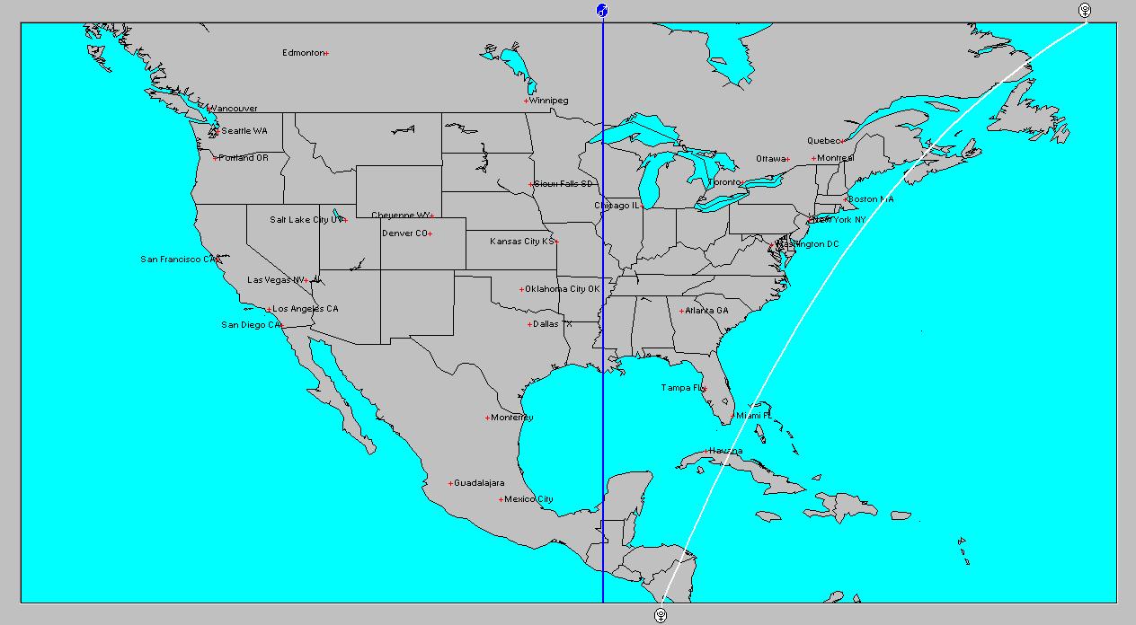
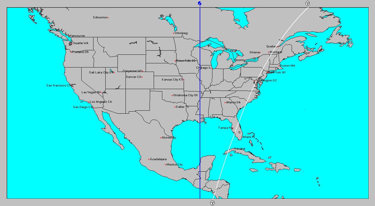
As shown in the astro-locality map at left, the Pluto line at the time of the Mars-Pluto square ran across Cuba (see diagonal white line). But there are two positions to choose from when looking at planetary lines. The position that I normally use is the zodiacal position.


The other position is the inmundo position as shown in this next astro-locality map for the moment of Mars square Pluto. Most planets, except Pluto, don't vary much when switching between these two positions. Because of Pluto's rather eccentric orbit there is a considerable difference at times.


Comparing Pluto's inmundo position to Fay's actual path as shown on this Weather Channel map, one can see that Fay was hugging the Pluto line in it's trip across Florida.


The geographical area mentioned in Solar Eclipse Time has been active nevertheless. The forecast called for an outbreak of storms or tropical activity along 88 west longitude roughly between August 17-19. The Accuweather Map at right shows drenching storms that have been over this general area lately.

Originally I had said the period starts on the 16th and 17th with severe weather over Arkansas. No severe weather was reported, but further south over Louisiana a front had stalled bringing numerous thunderstorms over the area.

Solar Eclipse Time
Summer 2008: The Eastern United States
Summer 2008: The West Coast Part 1
Summer 2008: The Rockies Part 1
Summer 2008: The Plains and Mississippi Valley- Part 1
Introduction to the Weather Alternative
How Long-Range Forecasts Are Made


Risk Taking

Sometimes the risks you take might even cost you. Not every single venture will be immediately successful. Some might not be successful at all, and that also applies to the opportunities that come your way. But it’s better to try something new and to discover that it doesn’t work than to never try anything different or outside-of-the-box.

Saturday, August 16, 2008

Saturn Lives Up To Its Cold, Dreary Name; TS Fay

Traditionally, Saturn’s astro-meteorological influence brings excessive cloudiness, wetness, and subnormal temperatures. It’s conjunction with Venus lowers the barometer, produces easterly winds and increasing cloudiness with characteristic dull, leaden skies.


The Weather Alternative forecast for August 12-15 has definitely been fulfilled. The forecast read:

Aug 12-15
The conjunctions and parallels of Mercury and Venus to Saturn will bring a storm system to the Rockies lowering temperatures after its passage.


The Accuweather weather maps shown here for August 13th and 16th show the easterly component of this weather pattern as well as the cold, and rainy side. The dull atmosphere and increased cloud cover are mentioned in the following Accuweather statements as well.


Dreary Weather, Heavy T-Storms Updated: Saturday, August 16, 2008 7:24 AM
Cooler flow will continue to wedge against the Rocky Mountains with an upper-level storm over the Four Corners
region today. This will cause dreary weather over the Colorado Rockies and over the Front Range. Thick clouds will
cover these areas. Areas of drizzle and light rain will add further misery to the gloomy, unseasonably cool weather.


The Weather Channel August 15th:
Meanwhile, a cold area of low pressure aloft and an easterly upslope flow will keep temperatures way below average over parts of Wyoming, Colorado and New Mexico.
Areas from Wyoming to eastern Colorado may see rain and highs in the 50s. Some very high elevation snow in the Rockies above 9000 to 10,000 feet is possible.
Rain and thunderstorms will plague the eastern sections of the central and southern Rockies and adjacent high Plains through the weekend.


Meanwhile in the tropics, Tropical Storm Fay has taken shape over the Dominican Republic. Present thinking has Fay developing into a stronger storm and moving into the Gulf and making landfall along the Gulf Coast area that I mentioned in a recent post. (See Solar Eclipse Time)

Solar Eclipse Time

Summer 2008: The Eastern United States

Summer 2008: The West Coast Part 1

Summer 2008: The Rockies Part 1

Summer 2008: The Plains and Mississippi Valley- Part 1

Introduction to the Weather Alternative

How Long-Range Forecasts Are Made


Wind of Love, Wind of God


Do you hear the wind? Listen to the wind of My love. Let the gentle breeze pick you up and carry you into My arms where you can abide with Me in sweet communion. Let it blow away all of your cares, all of your worries, and all of your burdens. The wind of My love will also whisper in your ears the love words that I wish to speak to you.


Let the wind of love cleanse you, carry you, and whisper to you. Let the wind of My love blow gently upon the embers of your spirit and light the fire of love in your heart so that it may burn brightly for Me.

Wednesday, August 13, 2008

Solar Eclipse Time

No, we're not expecting a solar eclipse, but Mars will trigger two past solar eclipses in the next few days. As we've shown a number of times on The Weather Alternative, when one of the outer planets makes a hard aspect to a recent solar eclipse degree, there is an atmospheric reaction over the geographic area where the Sun and Moon were angular. This reaction is in accordance with the nature of the planet making the hard aspect.


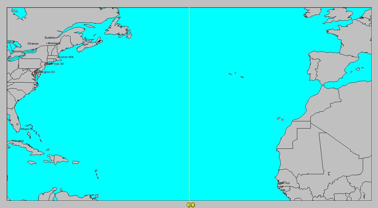
The first eclipse to be triggered is the March 18, 2007 solar eclipse. Mars will oppose this degree on August 18th. As shown in the map above, the Sun-Moon line ran through the central Atlantic around 38 west longitude. At the time of the solar eclipse, the Sun and Moon were square Pluto. On the 18th when Mars triggers this degree, Mars will also be square transit Pluto. This location should be watched roughly from August 17-20 for the formation or strengthening of tropical weather systems. Lately there has been concern amongst conventional meteorologists that the Atlantic hurricane season will spring to life soon. This is one indication that backs their concerns. There are others as well.


If we take a look at another view of the same eclipse, we see that the Sun and Moon descended over the eastern Pacific at that time. The southern part of the Sun-Moon line (at 128 west longitude) is another area to watch for hurricane formation between the same dates (Aug 17-19)--roughly between 15 and 25 north latitude. Further north, off the U.S. coast a front or low pressure system could develop in response to this and move inland. (For more info about this period see Summer 2008: The West Coast --link below)


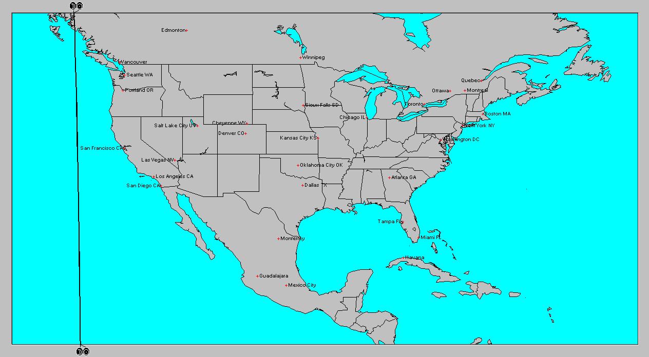
The September 22, 2006 solar eclipse is the other one that will be triggered by the conjunction of Mars on the 18th. In a recent post we saw the effect Mars had on U.S. weather when it triggered a recent heat wave. This time, as seen in the astro-locality map at left, the 88th degree of west longitude will be triggered. My forecast for August 16-17 for this area already warns of severe weather over this area. (See Summer 2008: The Plains and Mississippi Valley--link below) This will extend the period a bit. Once again we're watching from August 17th to 19th. Other factors involved here indicate that a tropical system could result in the Gulf and Yucatan of Mexico.


Summer 2008: The Eastern United States
Summer 2008: The West Coast Part 1
Summer 2008: The Rockies Part 1
Summer 2008: The Plains and Mississippi Valley- Part 1
Introduction to the Weather Alternative
How Long-Range Forecasts Are Made

FATHER FORGETS
W. Livingston Larned
Listen, son: I am saying this as you lie asleep, one little paw crumpled under your cheek and the blond curls stickily wet on your damp forehead. I have stolen into your room alone. Just a few minutes ago, as I sat reading my paper in the library, a stifling wave of remorse swept over me. Guiltily I came to your bedside.


There are the things I was thinking, son: I had been cross to you. I scolded you as you were dressing for school because you gave your face merely a dab with a towel. I took you to task for not cleaning your shoes. I called out angrily when you threw some of your things on the floor.
At breakfast I found fault, too. You spilled things. You gulped down your food. You put your elbows on the table. You spread butter too thick on your bread. And as you started off to play and I made for my train, you turned and waved a hand and called, "Goodbye, Daddy!" and I frowned, and said in reply, "Hold your shoulders back!"


Then it began all over again in the late afternoon. As I came up the road I spied you, down on your knees, playing marbles. There were holes in your stockings. I humiliated you before your friends by marching you ahead of me to the house. Stockings were expensive—and if you had to buy them you would be more careful! Imagine that, son, from a father!


Do you remember, later, when I was reading in the library, how you came in timidly, with a sort of hurt look in your eyes? When I glanced up over my paper, impatient at the interruption, you hesitated at the door. "What is it you want?" I snapped.


You said nothing, but ran across in one tempestuous plunge, and threw your arms around my neck and kissed me, and your small arms tightened with an affection that God had set blooming in your heart and which even neglect could not wither. And then you were gone, pattering up the stairs.


Well, son, it was shortly afterwards that my paper slipped from my hands and a terrible sickening fear came over me. What has habit been doing to me? The habit of finding fault, of reprimanding—this was my reward to you for being a boy. It was not that I did not love you; it was that I expected too much of youth. I was measuring you by the yardstick of my own years.
And there was so much that was good and fine and true in your character. The little heart of yours was as big as the dawn itself over the wide hills. This was shown by your spontaneous impulse to rush in and kiss me good night. Nothing else matters tonight, son. I have come to your bedside in the darkness, and I have knelt there, ashamed!


It is a feeble atonement; I know you would not understand these things if I told them to you during your waking hours. But tomorrow I will be a real daddy! I will chum with you, and suffer when you suffer, and laugh when you laugh. I will bite my tongue when impatient words come. I will keep saying as if it were a ritual: "He is nothing but a boy—a little boy!"


I am afraid I have visualized you as a man. Yet as I see you now, son, crumpled and weary in your cot, I see that you are still a baby. Yesterday you were in your mother's arms, your head on her shoulder. I have asked too much, too much.

Friday, August 08, 2008

Tropical Storm Edouard and Other Weather

The Solar Ingress map for the summer season, as you recall, placed Uranus angular through the Plains. The astro-locality map at left shows Uranus as a yellow line. Transit Mars opposed Uranus on the 6th as Tropical Storm Edouard made landfall along the Texas coast and pushed westward.


The Weather Channel map at right shows Edouard's position on the 6th. The Weather Alternative forecast for August 5-7 stated "Mars-Uranus signifies storm emergencies and windy conditions, which will hit the Plains. Tornadoes may be a by-product of these storms."


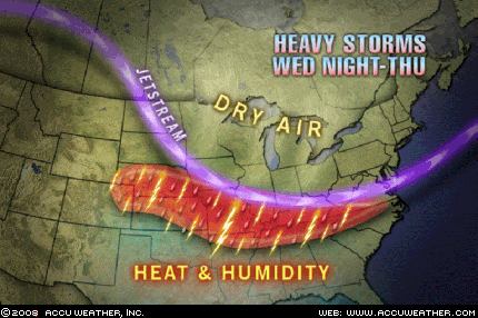
Besides Edouard's arrival, Accuweather reported on the 6th that "Strong thunderstorms will unleash torrents of rain across a large swath of the country Wednesday night and Thursday. These storms have enough moisture to dump 2-3 inches of rain on some locations causing temporary flooding. Tornadoes are unlikely, but some of the storms will produce wind damage." This area included the Plains.


Another Weather Alternative forecast for August 6-8 stated "More moisture is pumped into the western US resulting in a low pressure area or front that sets off storms. Wind may be a salient feature."


On the 7th, Accuweather reported "...some moisture will make its way into the Sierra and Cascades, increasing the potential of dry thunderstorms in the tinder-dry areas that have not already burned." So although moisture was pumped into the western US, it did not make it to the Pacific Northwest as I anticipated.


The last Weather Alternative forecast was for August 7-9. It read "Chilly and damp weather develops over the Great Basin and Rockies." The Accuweather map at right shows a cool air mass pushing into the Pacific Northwest but not fully entering the Great Basin and Rockies as forecast.


However, damp conditions will exist as thunderstorms will be focused...across the mountains of eastern Arizona, New Mexico, Colorado and Utah according to Accuweather.

Summer 2008: The Eastern United States

Summer 2008: The West Coast Part 1

Summer 2008: The Rockies Part 1

Summer 2008: The Plains and Mississippi Valley- Part 1

Introduction to the Weather Alternative

How Long-Range Forecasts Are Made

Got a Problem? Try Thanking God For It

One Army wife came to me, convinced that her problem had but one solution. Her husband had developed an excessive drinking problem and for the past several years had been an alcoholic. Often he would pass out drunk on the living room floor where the wife or his teenage children would find him, stark naked. In this condition he'd also been found in the hallway of the apartment house where sev­eral other families lived.

In final desperation the wife decided to take the children and leave. Friends persuaded her to at least come talk to me first.

"Whatever you say, Chaplain, don't tell me to stay with him," she said. "I just can't do it."

"I don't care whether you stay with him or not," I said. "I just want you to thank God that your husband is like he is."

Carefully I explained what the Bible had to say about thanking God for all things, and that if she tried it, God would be able to solve her problem in the best way.

She thought it sounded ridiculous, but finally agreed to kneel while I prayed that God would release in her enough faith to believe that He is a God of love and power who holds the universe in His hand.

At last she said, "I do believe."Two weeks later I called her."I feel absolutely marvelous," she said. "My husband is a different man. He hasn't had a drink in two weeks."

"That's wonderful," I said. "I'd like to talk to him."

"What do you mean?" She sounded surprised.

"I just think it would be good if I talked to your husband about the power that is working in your lives."

"Didn't you tell him already?" She sounded puzzled.

"No, I haven't met him yet."

"Chaplain, this is a miracle," she cried out. "The day I was in your office he came home from work and for the first time in seven years he didn't go to the refrigerator for a beer. Instead he went into the living room and talked to the children. I was sure you had talked to him." --Merlin Carothers

Monday, August 04, 2008

Heat Wave

This is from a 2002 news article.

One deadly natural disaster: The heat wave

By Tara Bahrampour, NY Times News Service


Natural disasters usually come rife with drama. Hurricanes, tornadoes, forest fires, earthquakes-all make for good headlines and even better visuals.


But it would be hard to make a blockbuster movie about a heat wave. Heat waves come on subtly, raising summer temperatures just a little higher than normal and then receding. But they kill more people in the United States than all other natural disasters combined.


According to the Center for Climatic Research at the University of Delaware, an average of 1,500 American city dwellers die each year because of the heat. Annual deaths from tornadoes, earthquakes and floods together total fewer than 200.


The most deadly US heat wave in recent years occurred in Chicago over a week in July 1995, when temperatures hovered around 100 degrees. Then, over 50,000 people were left without electricity, nearly two dozen hospitals closed their doors to new patients, ambulances lined up around the block waiting to drop off victims, and the county buried 68 people in a 160-foot-long trench. Scientists say that 739 people died that week.


For context, the great Chicago fire of 1871 killed half that many. The San Francisco earthquake of 1989 killed 62, and Hurricane Andrew in 1992 killed 26.


People find it hard to consider heat as a disaster, said Dr. Eric Klinenberg, a sociologist at New York University and the author of Heat Wave: A Social Autopsy of Disaster in Chicago. Heat waves cause little visible destruction. "If a tornado touches down, the moment it hits, you can assess the damage," he said. With heat, at worst, roads buckle, trains derail and livestock die.


It does not take a lot of extra heat to kill the vulnerable. "The body works in a very small temperature range," said Dr. Lawrence Robinson, deputy health commissioner of Philadelphia. "The body circulates blood to the skin and perspiration removes heat from the skin. In extreme heat, the heart has to pump faster and harder," leading to heart attacks or strokes. Even a healthy person who overexerts in the heat can die of heat stroke.