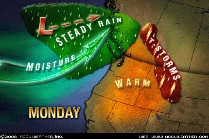
 The precipitation forecast for May 19-20 in The Weather Alternative long-range forecast for May is on its way. The forecast was based on the square between Venus and Neptune. The map at left shows the storm system pushing into the U.S. West Coast. Rain will push into the Olympic Peninsula by this afternoon with showers reaching Seattle and Portland overnight.
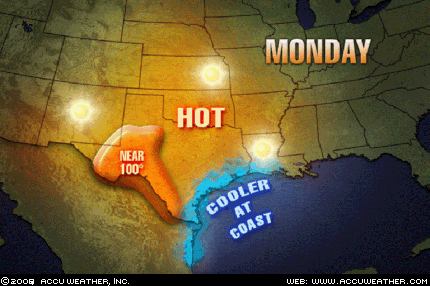
 The next Weather Alternative forecast being fulfilled is for the period of May 20-23. This forecast called for warm air to surge northward over the Plains raising temperatures over Texas, Oklahoma, and Kansas. As can be seen from the Accuweather map at right temperatures will push well into the 90s with some places in West Texas reaching 100 degrees. The Weather Alternative forecast calls for storms to be triggered over this area on the 22nd. We'll keep an eye out for those storms.
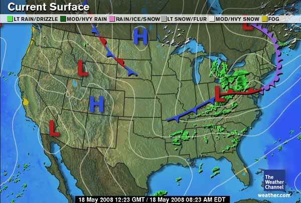
 The long-range forecast for May 17-19 called for fair conditions over the Rockies and storms and windy conditions over the Plains and Mississippi Valley. The Weather Channel map at left for May 18th shows a high pressure system over the Rockies. Windy conditions were reported by the National Weather Service on the 18th and 19th over Wyoming, Nebraska, Oklahoma, Arkansas, North Dakota, South Dakota, Missouri.
413 AM CDT MON MAY 19 2008
...WIND ADVISORY THIS AFTERNOON THROUGH EARLY EVENING FOR ALL OF WESTERN AN PORTIONS OF CENTRAL NORTH DAKOTA...
332 AM CDT MON MAY 19 2008 MEMPHIS
SOUTHWEST WINDS WILL BECOME STRONG AND GUSTY TODAY. SUSTAINED WINDS NEAR 25 MPH WITH GUSTS TO NEAR 35 MPH ARE EXPECTED TO DEVELOP LATE THIS MORNING AND CONTINUE INTO THIS AFTERNOON.
Summer 2008: The West Coast Part 1
Summer 2008: The Rockies Part 1
Summer 2008: The Plains and Mississippi Valley- Part 1
Introduction to the Weather Alternative
How Long-Range Forecasts Are Made
2 comments:
I've been looking for Thursday forecast on Central Plains and looks like it will be a more active day with possible severe thunderstorm. Looking forward for what might likewise to happen,potential severe weather ahead..
Thanks. That would fit perfect!
Ken
Post a Comment