Wednesday, November 11, 2009

Tropical Storm Phyan

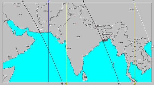
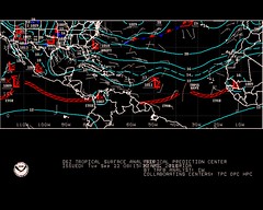
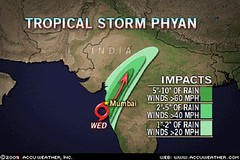
Tropical Storm Phyan is produced heavy rain over portions of west India Monday and Tuesday. It will make landfall near Mumbai on Wednesday.


What is the astro-meteorological connection? The square aspect between Saturn and Pluto (exact on the 15th, but triggered by the Moon's aspects on the 12th).

The astro-locality map below for the 3rd Quarter Moon of Nov 9th shows a Saturn line passing through the very area. It's the yellow line running north to south through west India.


Introduction to the Weather Alternative

How Long-Range Forecasts Are Made

Thanksgiving 2009 Forecast

Christmas and New Year's Weather Forecast United States and Europe

The Dangers of Genetically Modified Organisims

Saturday, November 07, 2009

Christmas Weather Forecast and New Year's Weather Forecast United States and Europe

The long-range weather forecasts presented here at The Weather Alternative are based on the ancient study of astro-meteorology or planetary cycles.

Here are some forecasts for the Christmas season and New Year's Eve in the United States and Europe.

United States

New England

Forecast
Dec 20, 2009 - Jan 1, 2010
Dec 20-22
: Somebody left the faucet on! Heavy rain is possible for New England as warm moist air is drawn up over the East Coast and New England.
Dec 25-27: Windy and cold weather is in store for the Northeast and New England. If enough moisture is in place, storms ensue.
Jan 1, 2010: Another blast of cold winds out of Canada for the Northeast and New England.

East Coast

Forecast
Dec 20, 2009 - Jan 1, 2010

Dec 20-22: A front moves through to the East Coast. This has the potential to unleash heavy rainfall from the North Carolina coast through the Northeast.
Dec 25-27: Cold and windy over the Northeast.
Dec 31-Jan 1: Another front producing storms through the Mid-Atlantic and Northeast.


Mississippi Valley and East Central U.S.

Forecast
Dec 22, 2009 - Jan 1,
2010
Dec 22-23: A potent storm system begins to gear up over the Mississippi Valley as moisture from the Gulf interacts with cold air out of Canada.
Dec 24-26: A strong winter storm hits the East Central States from Michigan down through the Florida Panhandle. Expect major travel problems and airport delays. Special intensity is shown over the Southeast U.S. in and around Georgia and South Carolina.
Dec 28-31: The area stays stormy as another low pressure system or front pushes through the East Central area leading up to New Year’s Eve.

Rockies

Forecast
Dec 28-31

Warm, moist air filters up over the Rockies from south to north. This may result in foggy conditions but more importantly strong downpours are possible.

West Coast


Forecast
Dec 20-Jan 01
Dec 20-22
: An energetic front enters the U.S. West Coast bringing a good amount of precipitation.
Dec 24: A warm up over the Pacific NW.
Jan 1: A cold front out of British Columbia begins to enter the Pacific Northwest.


Europe


Forecast
Dec 22-23: On the 22nd and 23rd, a cold, dry air mass descends over the United Kingdom and begins to interact with a moist, low pressure area just north of Ireland driving clouds and precipitation over the British Isles.
Dec 24-25: By the 24th and 25th a strong front or storm system is battering France, Germany, and the surrounding areas.
Dec 26: From the 26th on, cold, windy conditions set in over the British Isles, southward into France.
Dec 27-29: A series of fronts or a lingering low pressure area continues to keep the region in and around France and Germany under stormy conditions. Heavy precipitation is shown for the British Isles.


Introduction to the Weather Alternative

How Long-Range Forecasts Are Made

Thanksgiving 2009 Forecast

Action is Everything

If learning about success was all that it took to do great things with your life, then your success would be guaranteed. The bookstores are full of self-help books, each one of them loaded with ideas that you can use to be more successful. The fact is, however, that all the best advice in the world will only help you if you can motivate yourself to take persistent, continuous action in the direction of your goals until you succeed. --Brian Tracy

Wednesday, November 04, 2009

Nor'easter and Oct-Nov 2009 Forecast Results

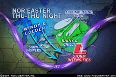
The Weather Alternative forecast for Nov 5-7 is being fulfilled by the developing Nor'easter over New England. Today's Accuweather article "Cold Winds to Grip Northeast" explains how a storm will intensify as it moves off the New England coast tomorrow, Thursday, and Friday (Nov 5-6). Temps will feel like they're in the teens due to strong northerly winds on the back side of the storm. Some areas of the Northeast will have an early season snowfall.


The Weather Alternative forecast for this time period was posted on June 16, 2009 and stated Mars conjoins the solar eclipse degree over the Northeast U.S. Expect storms through the area. This may also affect the Windward Islands, which may see some tropical activity.

As far as tropical activity affecting the Windward Islands, the National Weather Service today reported that two small low pressure systems are centered north of the Leeward Islands.


Another long-range forecast for October 30-Nov 2, 2009 mentioned to watch for possible tropical storm formation in the western Atlantic around 52 west longitude and 15 north latitude.

On October 29th, the National Weather Service reported a tropical wave along 55 west to the south of 16 north was bringing strong showers and thunderstorms to the area.

On November 2nd, they reported another tropical wave along 55 west.


Another forecast for October 29-Nov 2, 2009 called for a storm system over the U.S. Intermountain West and possible tropical storm activity 540 miles southwest of Cabo San Lucas.

No tropical storm activity was reported, but on October 29th, a storm system hit the Pacific Northwest and British Columbia. Rain hit Washington, Oregon, and Idaho. About 1-3 inches of snow covered the northern Rockies.


Introduction to the Weather Alternative

How Long-Range Forecasts Are Made

Thanksgiving 2009 Forecast


The Future Belongs to the Risk Takers

The future belongs to the risk takers, not the security seekers. Life is perverse in the sense that the more you seek security, the less of it you have. But the more you seek opportunity, the more likely it is that you will achieve the security that you desire. --Brian Tracy

Friday, October 30, 2009

Thanksgiving 2009 Forecast

The Weather Alternative long-range weather forecast based on planetary cycles for November 23-27, 2009.


West U.S.

Forecast
Most charts coincide with a storm system moving through the Pacific Northwest into the Intermountain West on the 23rd and 24th. The coastal Pacific Northwest might get some pleasant weather on the 25th, but further inland over the Intermountain West the 26th and 27th looks stormy.

Plains

Forecast
The 23rd starts with moist air being drawn up over Texas and the southern and eastern Plains initiating storms. Cooler air is drawn southward at this time over the Rockies triggering storms along the Front Range area. Around the 24th, the southern Rockies area centering around New Mexico will have unsettled weather. More cooler Canadian air makes it way southward on the 25th and 26th over the Northern Plains and then meets with moist air creating storms over the Plains.


Mississippi Valley

Forecast
The mid-Mississippi Valley area in and around Missouri shows a low pressure area or front bringing rain around the 24th. By the 25th and 26th this develops into more rainy weather for the Mississippi Valley.
East U.S.

Forecast
On the 23rd, a front is indicated running the length of the East Coast from Florida through New York generating showers. On the 24th, with more moisture being funneled up over Florida and the Southeast, storms are indicated over the area in and around North Carolina and Virginia. Fair conditions seem to make it into the Southeast, Mid-Atlantic, and Northeast by the 25th and 26th.

New England

Forecast

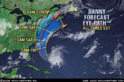
The 26th and 27th are very stormy over the New England area. Indications of severe weather in the lunar eclipse chart of August 5, 2009 will be activated now. The last time these were triggered tropical rainstorm Danny gave a glancing blow to the New England area bringing winds gusting between 40-60 mph and flash flooding due to torrential rainfall that dropped between 2-5 inches of rain. Yikes!

Introduction to the Weather Alternative

How Long-Range Forecasts Are Made

Solar Eclipse Action October and November 2009

Here's an interesting video clip on the polar bear photo used by Global Warming advocates. You know, the one with the polar bears floating on the ice.

Saturday, October 24, 2009

More October 2009 Forecast Results

Here are the results of a number of long-range weather forecasts for various dates in October. The first was for October 21-24, 2009. The forecast was posted on June 16th of this year.

Forecast
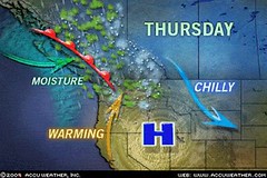
October 21-24, 2009: The transit Sun will make it’s first square to the eclipse degree. The Rockies once again should see a front triggering storms or low pressure area.

Results
The Accuweather map above is for October 21st showing a low pressure system over the southern Rockies. Heavy snow buried the mountains of southern Colorado and northern New Mexico. Seventeen inches of snow fell near Cuchara, Colorado. Other portions of Colorado received between 4 to 15 inches.
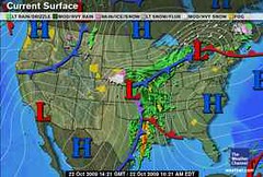


Another Weather Alternative forecast posted back in June is the following:

Forecast

Oct 22-25, 2009: Saturn conjoins the solar eclipse along 88 west longitude, which is roughly the Mississippi Valley area. Since the Gulf of Mexico, and Central America are also affected, this should be a time of strong storms and possible hurricane activity there.

Results

The Weather Channel map (above right) is for October 22nd and shows a strong low pressure area and front affecting the Mississippi Valley. Accuweather reported the area was hit with drenching rain. Moisture from Hurricane Rick enhanced the torrential downpours.


The forecast also mentioned possible strong storms or hurricane activity in the Gulf of Mexico and Central America.

Nothing tropical developed in the Gulf but, as shown in the Accuweather Map at left for October 22nd, an area of low pressure formed in the southwestern Caribbean causing heavy rain and thunderstorms across Costa Rica, Nicaragua, and Honduras.
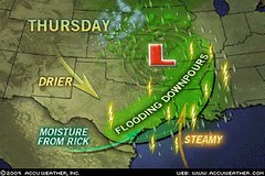


Another forecast for eastern Texas read as follows:

Forecast

Oct 23-24, 2009 ...the weather over eastern Texas at this time should include storms that generate strong winds be they from a tropical system, tornadoes, or severe thunderstorms etc.

Results

As shown in the Accuweather map for the 22nd (a day before my forecast) eastern Texas was getting flooding downpours. There were tornadoes and damaging wind gusts. (See below)

Accuweather, Oct 22nd: In only 3 hours, 4.29 inches of rain poured down and inundated Fannett, Texas, on Thursday. Arkadelphia, Ark., had 5 inches of rain. High floodwaters stranded motorists and kept firefighters busy with high water rescues. Water was up to windows of cars in Beaumont, Texas. Some communities located along swollen bodies of water had flooding. Many homes and businesses were flooded by up to a foot of water in Farmerville, La. Some of the storms became severe and produced damaging wind gusts on top of the heavy downpours. Tornadoes touched down in the Cameron and Jefferson Davis Parishes of Louisiana during the midday and afternoon hours.


This next forecast was posted in September.

Forecast

Oct 24-26, 2009 Moisture is drawn up over the Plains resulting in storms over the Dakotas and Nebraska.

Results

From Accuwether October 24:

The latest storm system will put a damper on some outdoor plans through Monday (Oct 26) as it spreads rain from the Dakotas and Nebraska to the Great Lakes and Ohio Valley.
The rain will mix with or change over to snow on the western fringe, including in places like Scottsbluff, Neb., Rapid City, S.D., and Bismarck, N.D., through Sunday. Several inches could accumulate in the Black Hills of South Dakota by Sunday.

Introduction to the Weather Alternative

How Long-Range Forecasts Are Made

Solar Eclipse Action October and November 2009

Is Obama Poised to Cede US Sovereignty? Check out these comments by Lord Christopher Monckton
Monday, October 19, 2009

Recent Forecast Results for October 2009

Here are the results of three recent long-range weather forecasts posted here on The Weather Alternative. The first forecast, posted on June 16, 2009 was for possible tropical storm formation in the western Atlantic (around 52 west longitude and 15 north latitude) between Oct. 11-14, 2009.

On Oct 13, the National Weather Service reported the following:

TROPICAL WAVE EXTENDS FROM 14N 4W TO 8N 6W MOVING W NEAR 15 KT....AS THE WAVE CURRENTLY INTERACTS WITH AN UPPER LEVEL LOW CENTERED NEAR 15N 5W...SCATTERED MODERATE CONVECTION IS FROM 8N-14N BETWEEN 52W-59W.


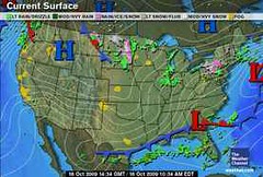
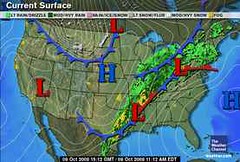
The next forecast was for October 14-17. The conjunction of Mars to the July 21, 2009 solar eclipse degree was forecast to generate storms over the Rockies. As can be seen from the Weather Channel map at left for Oct 16, no storms resulted. High pressure brought warm and dry air to the region. Why I thought storms, I can't figure out. Mars is historically the author or hot and dry conditions, which was exactly what was experienced.


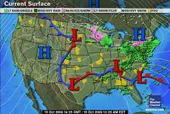
The last forecast was for Oct 16-17, 2009, which was to bring a low pressure area to eastern Texas. The Weather Channel map at right for October 15th, shows a low pressure system over Texas and a front over eastern Texas, which hit a day earlier than anticipated.

Introduction to the Weather Alternative
How Long-Range Forecasts Are Made
Solar Eclipse Action October and November 2009
A Few More Forecasts for October 2009
October 2009 Severe Weather Outlook for Eastern Texas


"To one who has faith, no explanation is necessary. To one without faith, no explanation is possible."--Thomas Aquinas (1224-1274), philosopher and theologian

Just for Fun

Four Catholic men and a Catholic woman were having coffee. The first Catholic man tells his friends, "My son is a priest. When he walks into a room, everyone calls him 'Father'."
The second Catholic man chirps, "My son is a Bishop. When he walks into a room people call him 'Your Grace'."

The third Catholic gent say s, "My son is a Cardinal. When he enters a room everyone says 'Your Eminence'."

The fourth Catholic man chirps, "My son is the Pope. When he walks into a room people call him 'Your Holiness'."

Since the lone Catholic woman was sipping her coffee in silence, the four men give her a subtle, "Well....?" She replies, "I have a daughter. She is slim, tall and 38D-24-36. When she walks into a room, people say, 'Oh My God'."

Wednesday, October 14, 2009

October 12-15, 2009 Forecast Results

The long-range astrometeorological forecast for October 12-15, 2009 was posted here on The Weather Alternative on June 16 of this year.


The first part of the forecast stated:


Solar Eclipse of March 18, 2007

October 12-15, 2009: The Venus-Saturn conjunction on the 13th will oppose the solar eclipse degree off the US West Coast at 129 west. Venus and Saturn are parallel on the 12th. The eclipse was square Pluto. This may bring a strong storm system into the US west coast and/or tropical activity along 128 west in the tropical regions.


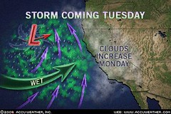
No tropical activity was reported but on Tuesday, Oct. 13, a major storm system slammed into the U.S. West Coast unleashing torrential rainfall and producing tropical storm-force winds across California. Among the hindrances caused by the storm are mudslides and flooding, airport delays, and potential power outages.


In part, the storm is made up of the remnants of Typhoon Melor, which struck Japan late last week. Some locations along California's central coast have picked up 4 inches of rain. Many other places have had rainfall totals of 1.5 to 3 inches. The storm is one of the strongest to hit the area in decades.

Introduction to the Weather Alternative

How Long-Range Forecasts Are Made

Solar Eclipse Action October and November 2009

A Few More Forecasts for October 2009

October 2009 Severe Weather Outlook for Eastern Texas

Got Flu Vaccine?

Flu vaccines revealed as the greatest quackery ever pushed in the history of medicine

Monday, October 12, 2009

October 10-12, 2009 Forecast Results

The Weather Alternative's long-range forecast for October 10-22, 2009 was posted 17 days beforehand. The forecast described a storm system pushing through the Plains and a low pressure system tracking to the south affecting eastern Texas and Oklahoma as it continued into the Mississippi Valley and the Southeast.

The low over eastern Texas and Oklahoma hit a day earlier (Oct 9th) than forecast. Thunderstorms over southeastern Texas were expected to turn severe. Three inches of rain were common across east Texas and Oklahoma.

Today, Oct 12, heavy rain is expected across the Southeast as Gulf moisture overrides a stalled frontal boundary.

Introduction to the Weather Alternative
How Long-Range Forecasts Are Made
Solar Eclipse Action October and November 2009
A Few More Forecasts for October 2009
October 2009 Severe Weather Outlook for Eastern Texas

Vaccine revolt! Swine flu vaccine support crumbles

Tuesday, October 06, 2009

October 3-5, 2009 Forecast Results

The Weather Alternative long-range forecast for October 3-5, 2009 was posted on September 22nd.


The forecast read as follows:


Oct 3-5, 2009 Stormy conditions are shown for the northern Plains. A low pressure system, perhaps an Alberta Clipper, affects the Great Lakes area as it moves into the Northeast. Another low pressure system or front affects the Delmarva Peninsula.


The Accuweather map above is for Oct 5th and shows a low pressure system hitting the northern Plains. The storm system spread a cold, soaking rain over the northern Plains into the Upper Midwest. Three to six inches of snow was expected as well over the Black Hills, Buffalo, S.D. , and Bowman and Dickinson, N.D.


The same forecast called for a low pressure system, perhaps and Alberta Clipper, to affect the Great Lakes area and Northeast. Another low or front was to affect the Delmarva Peninsula.

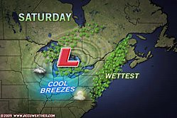
The Accuweather map at right is for Saturday, October 3rd. A low pressure system sits squarely over the Great Lakes area as it moves toward the Northeast. The rain extends down over the Delmarva Peninsula as well.

Introduction to the Weather Alternative

How Long-Range Forecasts Are Made

Solar Eclipse Action October and November 2009

A Few More Forecasts for October 2009

October 2009 Severe Weather utlook for Eastern Texas


The Art of Praise
There is a very basic courtesy that should apply in all human relations--taking the time to thank people who help us. My friend Mike Somdal is a specialist at this. One reason he is so successful in business is that he has mastered the fine art of making people feel good by thanking them regularly. Often he will call customers simply to thank them again for the order they placed last week or for the recommendation they made to another customer, or for the lunch. Anything. And before the conversation is over, Mike has often secured another order. Of course, if he called simply with ulterior motives, his clients would recognize the manipulation and resist. But Mike has made gratitude a lifelong habit, and those of us who do business with him appreciate that quality. And we respond.


The art of praise--what is known as positive reinforcement in the current psychological jargon--is an essential art for an executive or teacher [or anyone dealing with people] to master. If there is a complaint employees most often express, it is this: "I never get any feedback from the boss--except when something goes wrong." And the teenagers who sit in my office tell me again and again, "My dad gets all over my case when I mess up at school, but when I bring home a good grade he acts as if it's nothing--that I'm finally doing what I should have been doing all along." Stop and think. How long has it been since you took a full 60 seconds to talk to your son or daughter about some fine thing they've just done? Or your secretary, or the managers who work under you?


When someone comes along who genuinely thanks us, we will follow that person a very long way.--Alan Loy McGinnis

Friday, October 02, 2009

October 2009 Severe Weather Outlook for Eastern Texas


The Full Moon of October 4th, 2009 sets up a sensitive planetary crossing over eastern Texas. Here we find the Sun, Moon, and Mars in angular positions. As explained many times on The Weather Alternative blog, when planets are in these angular positions they manifest their influence on the weather in and around that location.


There are three sets of dates when there will likely be a manifestation of severe weather over this area which includes eastern Texas, Oklahoma, Louisiana, and Arkansas. The first time period was brought out in a previous post. It read as follows:


Oct 10-12, 2009
A storm system pushes through the Plains. The low pressure system may track to the south affecting the area in and around eastern Texas and Oklahoma as it pushes into the Mississippi Valley and Southeast.


Oct 16-17, 2009
The planetary crossing is activated once again and should result in a low pressure system affecting the area.


Oct 23-24, 2009
This third time slot also coincides with another forecast posted earlier calling for tropical storm or hurricane formation in the central Gulf of Mexico between October 22-25. One possible scenario is that the severe weather indicated for the eastern Texas area is related to the Gulf of Mexico forecast. This could mean that if a storm forms in the Gulf it could head to the Louisiana, eastern Texas, Arkansas, and Oklahoma region. Of course, it could play out differently as sometimes the weather indicated by these different planetary alignments are not describing one event but separate events. In any case, the weather over eastern Texas at this time should include storms that generate strong winds be they from a tropical system, tornadoes, or severe thunderstorms etc.


Introduction to the Weather Alternative
How Long-Range Forecasts Are Made
Solar Eclipse Action October and November 2009
A Few More Forecasts for October 2009


Change


Change is the wind catching you—the kite—and sending you soaring into the sky. My wind of change is always there, you just have to be in position for it, and charge into it with your whole heart. At first, change may not look like it’s helping, as it buffets and bounces you around, but as you face it head-on—accepting it wholeheartedly—it will lift you high.


I hold your kite strings, and I know just when to pull you forward into the winds of change and when to let them carry you along for a while. You just have to keep facing the wind and you’ll feel the thrill of riding high, even when there’s nothing visible to support you.


Close your eyes and feel the wind as I point you ever upward. It’s time to fly once more!

Wednesday, September 30, 2009

Sept 29-Oct 1, 2009 Forecast Results

The Weather Alternative forecast for Sept 29-Oct 1, 2009 stated:

Mercury turns direct on the 29th as it parallels Saturn. A cold front will come pushing out of Canada over the Great Lakes region heading southward over Michigan, Ohio towards the Southeast U.S. triggering storms on its way.

The Weather Channel map for Sept 29th at left shows a strong low pressure system over the Great Lakes kicking up some serious wind, and a cold front that has pushed all the way into the Southeast U.S. and Deep South fulfilling the above mentioned forecast.

Winds in Ohio, Minnesota, Michigan, and New York gusted to over 50 mph. The storm system over the Great Lakes generated hail and downed trees. Windswept rain also added to the miserable weather.

Introduction to the Weather Alternative

How Long-Range Forecasts Are Made

Solar Eclipse Action October and November 2009

A Few More Forecasts for October 2009

Fathering helps self-esteem


A study by the British parenting research project Tomorrow's Men found that fathers who spend a few minutes each day one on one with their sons greatly increase their sons' chances of growing into confident adults.


Of the boys who said that their fathers spent time with them and took an active interest in their progress, more than 90 percent fell in the "can do" category, whereas 72 percent of the boys who said that their fathers rarely or never spent time with them fell into the group with the lowest levels of self-esteem and were also more likely to have emotional and behavioral problems.


More surprisingly, the study found little difference between the positive effects of good father/son relationships in two-parent homes and homes where the father was absent (as in divorce situations) but nevertheless took time with his son. Similar studies have found that in a father's absence, another father figure such as a stepfather, uncle, grandfather, teacher, or mentor, by assuming an active role, can have an equally positive effect.


Monday, September 28, 2009

Sept 23-26, 2009 Forecast Results

According to the long-range weather forecast posted on June 8, 2009, the Mercury-Uranus opposition of Sept 23rd, along with Jupiter's activation of the Feb 6, 2008 solar eclipse, was to trigger possible tropical storm development about 450 miles east of the Windward Islands between Sept 23rd and 26th. This area lies roughly between 52 and 60 west longitude around 17 north latitude.

The National Weather Service map at left for Sept 22nd shows a low pressure system over the forecast area.


On September 24th, the NWS reported:
AN ATLANTIC OCEAN TROPICAL WAVE HAS BEEN MOVED TO 54W/55W TO THE SOUTH OF 19N...MOVING WEST 15 KT... IT IS POSSIBLE THAT STRONG ITCZ PRECIPITATION FROM9N TO 12N BETWEEN 52W AND 55W IS BEING ENHANCED BY THE WAVE.

Accuweather reported on Sept 25th:
Another tropical wave is along 58 west and south of 19 north and is moving west at 10-15 mph. Satellite shows most of the convection with this tropical wave south of 14 north. As it progresses westward, there will be an increase in showers and thunderstorms across the southern Windward Islands, but further development, if any, will be slow to occur.

Introduction to the Weather Alternative
How Long-Range Forecasts Are Made
Solar Eclipse Action October and November 2009
A Few More Forecasts for October 2009

Education


An American woman living in India was having a simple electrical installation done by a native electrician. He troubled her so much for instructions that she at last said irritably, "You know what I want; just use your common sense & do it." The electrician salaamed politely & said, "Madam, common sense is a rare gift of God. I have only a technical education."

Tuesday, September 22, 2009

A Few More Forecasts for October 2009

Here are a few more long-range weather forecasts for October 2009. These forecasts are based on astrometeorology or planetary cycles.
Introduction to the Weather Alternative
How Long-Range Forecasts Are Made


Forecasts
Sept 29-Oct 1, 2009

Mercury turns direct on the 29th as it parallels Saturn. A cold front will come pushing out of Canada over the Great Lakes region heading southward over Michigan, Ohio towards the Southeast U.S. triggering storms on its way.

Oct 3-5, 2009
Stormy conditions are shown for the northern Plains.
A low pressure system, perhaps an Alberta Clipper, affects the Great Lakes area as it moves into the Northeast.
Another low pressure system or front affects the DelMarVa Peninsula.


Oct 10-12, 2009
A storm system pushes through the Plains. The low pressure system may track to the south affecting the area in and around eastern Texas and Oklahoma as it pushes into the Mississippi Valley and Southeast.


Oct 24-26, 2009
Moisture is drawn up over the Plains resulting in storms over the Dakotas and Nebraska.

More October forecasts can be found here:
Solar Eclipse Action October and November 2009
Solar Eclipse Action for August and September 2009

Why Are Governments So Stupid?

Friday, September 18, 2009

Southern Flooding Forecast Results for Sept 11-18, 2009

It's time to look at the results of the September 11-18, 2009 forecast, which was posted on September 1st.

...the Gulf Coast area, roughly from New Orleans to the Florida Peninsula, will be under some very severe weather patterns. This was based on the Saturn-Uranus opposition, among other things. The forecast also stated there may be some tropical storm or hurricane development in the Gulf of Mexico. The strike zone could be from New Orleans to the Florida Panhandle.

During the beginning of the forecast period, conventional meteorologists thought that a low pressure system in the Gulf might develop into some sort of tropical system. Although this never happened lots of moisture from the Gulf has been pumped up over the very forecast area mentioned, and as of today is still being pulled up over the area--thus fulfilling the severe weather prediction for the area from New Orleans to the Florida Peninsula.

A whopping 5.92 inches of rain has soaked Pensacola, Florida, and flash flooding problems have followed torrential rain from Arkansas and Louisiana through Georgia. Multiple high water rescues were preformed in Birmingham, Alabama just to mention some of the recent troubles due to the excessive rain.

The next part of the forecast stated Central America also shows potential for severe weather; possibly a tropical storm or hurricane strike. No hurricanes were reported but on the 11th and 12th the National Weather Service announced that due to a tropical wave AN UPPER LEVEL LOW OVER NICARAGUA... HAS ENHANCED A LARGE CLUSTER OF NUMEROUS STRONG CONVECTION FROM 11N-16N BETWEEN 81W-85W. The map at right shows the low over Central America on the 11th.


The next portion of the forecast was for the Northeast and New England. Here's the forecast: Staring on the 11th, weather conditions are building in intensity and seem to be at their strongest from the 15th through the 18th when storms bringing heavy rainfall are likely. A tropical system cannot be ruled out.


On the 11th, a coastal storm pounded the mid-Atlantic with flooding rain, gusty winds, rough surf, beach erosion and isolated tornadoes. The storm continued on the 12th and because it had tropical characteristics, Accuweather referred to it as The Unnamed Storm. The storm also affected the Northeast and southern New England with flooding rain. This was the main storm during the forecast period although I envisioned more intense storms to take place around the 15th through the 18th.

The last portion of the forecast had to do with Nova Scotia. From the 11th through the 18th, a build up of planetary influence points strongly to a severe weather pattern to affect the area or to the likelihood of a tropical system making landfall around the 17th and 18th.


On the 13th, the aforementioned Unnamed Storm passed by Nova Scotia. The Canadian Weather Service stated A low pressure system south of Nova Scotia will intensify as it tracks northeastward today and tonight. The low is forecast to track across Newfoundland Monday afternoon. Ahead of the low, southeast winds gusting to 100 km/hour...


The 18th (see map at left) brought a low pressure system and front to the area triggering showers.

September 11-18, 2009 Forecast for Eastern U.S. and Nova Scotia
Solar Eclipse Action for August and September 2009
Solar Eclipse Action October and November 2009
Introduction to the Weather Alternative
How Long-Range Forecasts Are Made


Good Science
Good science--good physics, good biology, good chemistry and good economics--depend upon the ability to predict. In other words, if a physicist correctly predicts the moment at which a projectile will strike its target, or a biologist correctly predicts the effect a change in temperature will have on a population of insects, then we can say that these scientists are using good science. On the other hand, if the predictions are wrong, then the science is flawed. --Richard Maybury

Thursday, September 10, 2009

Sept 7-10, 2009 Forecast Results

The Weather Alternative long-range forecast for Sept 7-10 was based on the Solar Eclipse of March 29, 2006. Here's what the forecast called for:

Mars will trigger the solar eclipse of March 29, 2006. The Sun and Moon ascended through Nova Scotia and transit Mars will cut through the Windward Islands at this time. Severe weather, which may be tropical in nature, may afflict these areas now.

As can be seen from the Accuweather map above, the main action was a storm system along the U.S. East Coast. No storm system affected the Nova Scotia area as high pressure held on tight over eastern Canada.

As far as the Windward Islands go, the National Weather Service reported on September 8th that due to the approach of a tropical wave showers would increase in coverage across the Leeward Islands, which are just north of the Windwards.


September 11-18, 2009 Forecast for Eastern U.S. and Nova Scotia
Solar Eclipse Action for August and September 2009
Solar Eclipse Action October and November 2009
Introduction to the Weather Alternative
How Long-Range Forecasts Are Made

Many of life's failures are people who did not realize how close they were to success when they gave up.-- Thomas Edison

Tuesday, September 01, 2009

September 11-18, 2009 Forecast for Eastern U.S. and Nova Scotia

September 11-18, 2009


Forecast for the Southeast
Judging principally from the Solar Ingress chart and the main aspects such as Pluto’s direct station, the Saturn-Uranus opposition, the oppositions of Venus to Jupiter and Neptune, and Mercury’s square to Pluto, the Gulf Coast area, roughly from New Orleans to the Florida Peninsula, will be under some very severe weather patterns.

The crossings between planets in the Solar Ingress and the Lunar Eclipse chart suggest that there may be some tropical storm or hurricane development in the Gulf of Mexico. The strike zone could be from New Orleans to the Florida Panhandle. Central America also shows potential for severe weather; possibly a tropical storm or hurricane strike.

If not an actual tropical system, a severe weather system is possible from the Mississippi Valley eastward to the Southeast and Mid-Atlantic States. Pluto’s station suggests a cold air mass descending out of Canada. The Saturn-Uranus opposition suggests high wind velocities. The Venus oppositions to Jupiter and Neptune suggest warm and moist air masses. Taken together, a clashing of atmospheric elements have the potential to engender very strong storms packing damaging winds, hail, and maybe spawning tornadoes.


Northeast and New England
The New Moon and Full Moon charts place the planet Neptune in key positions over this area. The main aspects at this time are Venus opposition Jupiter and Venus opposition Neptune. These tend to increase warmth and moisture. In extreme cases, Neptune has to do with flooding conditions. Staring on the 11th, weather conditions are building in intensity and seem to be at their strongest from the 15th through the 18th when storms bringing heavy rainfall are likely. A tropical system cannot be ruled out.


Nova Scotia
The Last Quarter Moon places a special emphasis over this area. From the 11th through the 18th, a build up of planetary influence points strongly to a severe weather pattern to affect the area or to the likelihood of a tropical system making landfall around the 17th and 18th.

Solar Eclipse Action for August and September 2009
Solar Eclipse Action October and November 2009
Introduction to the Weather Alternative
How Long-Range Forecasts Are Made

Drinking

Don't try to drown your sorrow in alcohol because sorrow is an expert swimmer.

In ten years 46,000 Americans died in Vietnam. During that same time 250,000 persons were killed in the U.S. by drunk drivers.

Sunday, August 30, 2009

Danny's Track and Other Forecast Results

Astrometeorological indications showed that Danny would have a close encounter with the New England area due to configurations in the Full Moon chart of August 5, 2009. (See post)


Accuweather reported today that While Danny was downgraded to a tropical rainstorm early Saturday morning, he still delivered a blow to eastern New England. Torrential downpours and flash flooding were the primary impacts as 2-4 inches of rain deluged places from southeast Massachusetts through eastern Maine. A few locations had even more than 5 inches of rain. Gusty winds added to the miserable weather, and gusts of 40-60 mph were recorded in Cape Cod and the islands of Massachusetts.


In a previous post, I mentioned the possibility of tropical storm development about 240 miles south of Hispaniola (70 west /15 north) between August 21-26. The National Weather Service reported a tropical wave over this area on August 23rd and 24th.


On the 24th they reported A CARIBBEAN SEA TROPICAL WAVE IS ALONG 73W TO THE SOUTH OF 18N MOVING WEST 15 TO 20 KT. DISORGANIZED ISOLATED MODERATE SHOWERS AND THUNDERSTORMS ARE FROM 11N TO 15N BETWEEN 69W AND 77W.


My post of June 8, 2009, warned of possible tropical storm development between August 22-24 in the intertropical convergence zone along longitude 128 west. Tropical Storm Ignacio was centered at at 124 west and 21 north on the 26th of August and at 126 west and 24 north on the 27th--a few days too late and too a bit further north and west to be called a "hit."


The June 8th post also contained a long-range forecast for August 23-26. This forecast warned of possible tropical trouble in the Gulf as well as severe storms for the Midwest.

No tropical development occurred in the Gulf but 23rd through the 25th brought a dose of strong thunderstorms across the Midwest and Plains. The main threats were damaging winds, large hail, and heavy rain.

Solar Eclipse Action for August and September 2009Solar Eclipse Action October and November 2009

Introduction to the Weather Alternative

How Long-Range Forecasts Are Made

Success and Failure


I don’t measure a man’s
success by how high he
climbs, but how high he
bounces when he hits
bottom.
—General George Patton (1885–1945)


A failure means you put
forth some effort. That’s
good. Failure gives you
an opportunity to learn a
better way to do it. That’s
positive. A failure teaches
you something and adds
to your experience. That’s
very helpful. Failure is an
event, never a person; an
attitude, not an outcome; a
temporary inconvenience;
a stepping stone. Our
response to it determines
just how helpful it can be.
—Zig Ziglar (b. 1926)


Even a mistake may turn
out to be the one thing
necessary to a worthwhile
achievement.
—Henry Ford (1863–1947)

Wednesday, August 26, 2009

TS Danny Comin' At Ya!

Taking a quick look at some of the key charts used in astrometeorological forecasts we find that the Full Moon of August 5, 2009 may provide some information as to where Tropical Storm Danny is headed.

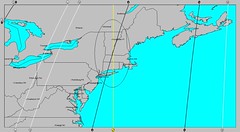
The lunation chart placed a crossing of planetary lines, shown at left, over New England. These two lines tell us that at the time of the Full Moon, Mercury and Mars set up an important influence over that area.

These will be spurred into action on the 27th just a few days before Danny moves near. This is one indication that the New England area might sustain a direct hit or a close brush with Danny. Of course, it could mean some other type of severe weather affects the area. Conventional meteorologists, however, seem to think that Danny will move closer to the East Coast than Bill did, and I'm thinking they may be right.


Solar Eclipse Action for August and September 2009
Solar Eclipse Action October and November 2009
Introduction to the Weather Alternative
How Long-Range Forecasts Are Made


It's what you do when you have nothing to do that reveals what you are.

Sunday, August 23, 2009

Bill's Track and Update on Recent Forecasts


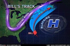
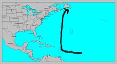
Hurricane Bill's track has pretty much followed the track that I pointed out in a recent post entitled Where Are the Atlantic Storms Headed?


This track took it north toward Nova Scotia but not close enough to the U.S. East Coast to be much of a problem.


Here is my crude little hand-drawn map showing the track headed toward Nova Scotia and Newfoundland. I did expect Bill to come closer to the Lesser Antilles then it did.


Recent Forecasts


A recent Weather Alternative post from July 31st entitled Atlantic Hurricane and Southern Texas Rain made a number of forecasts regarding upcoming hurricane activity in the Atlantic and Pacific Basins as well as forecasts regarding rain for southern Texas. Here's how the forecasts have shaped up.


I expected the Atlantic hurricane season to really get kick in between August 17-19. Things really started to get underway on the 15th with the formation of Tropical Storms Ana and Bill--a bit earlier and further west than I forecast.


Another area I expected to experience strong storms was the Arizona-New Mexico region around the same dates. There have been no storms, just high heat and wildfires further west.


From the 19th to the 21st I forecast rain for southern Texas. The only thing the atmosphere delivered at this time was isolated showers along the southern Texas coast on the 18th and 19th. I did mention that there was a chance of of things staying hot and dry with the planetary pair involved, but I was hoping for the needed rain.

In re-studying key charts that might be involved in producing this extreme drought, I've come across what I think may be the culprit. The Solar Eclipse of Sept 11, 2007 places Mars, the author of heat and dryness, over this area of the country. I'm beginning to see that as long as this chart is active, or until another key chart replaces this one as occasionally happens (see Beneficial Rain for Texas), we might not see much drought relief. When this might happen is a project I'll be working on.


The last of the forecasts in the above mentioned post concerned the possible formation of a tropical system off the coast of Mexico around 102 west longitude and 15 north latitude between August 19th and 21st. The satellite image at left for today the 21st shows a tropical wave over the forecast area. It's the red, orange, and yellow glob at the lower left of the image.


Solar Eclipse Action for August and September 2009

Introduction to the Weather Alternative

How Long-Range Forecasts Are Made

Where is Hurricane Bill Headed?

Motives

How our smallest efforts are magnified when the motives behind them are unselfish!--Francis Gay


Sunday, August 16, 2009

Southeast Soaker and Where are the Atlantic Storms Headed?

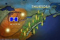
The Weather Alternative's long-range weather forecast for August 14th and 15th was posted on July 20th. Planetary alignments between Mercury, Venus, and Saturn were cited as the astrometeorological factors behind a storm system (possibly tropical in nature) that would affect the East Coast States of North Carolina, Maryland, Delaware, Pennsylvania, and New Jersey. Locally drenching rains moved into the Northeast and Mid-Atlantic on Thursday the 13th of August.


Thunderstorms dumped 2.72 inches of rain on Norfolk closing sections of Interstate 264. Flooding also occurred in Millville, N.J., Andover, N.Y., and Bridgeton, N.J.


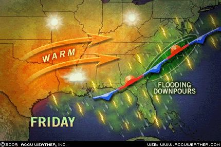
As mentioned in the forecast, a special concentration of planetary influence was to take place over North Carolina, Maryland, and Delaware. The Accuweather map at right shows a stalled front over the Southeast U.S. on the 14th. This front sparked another round of soaking showers and thunderstorms along the Middle Atlantic, Southeast, and Gulf Coasts. The storms brought torrential downpours and flash flooding. Storms over the eastern Carolinas were expected to be particularly heavy.


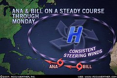
Meanwhile the tropical Atlantic has sprung to life and now boasts two tropical systems, Ana and Bill, with others expected to form soon off the coast of Africa. In a recent post, I mentioned the possibility of the Atlantic hurricane season getting underway around August 17th especially around 27 west longitude and 18 north latitude in the eastern Atlantic. Things have started a few days earlier but my guess is that even more powerful storms will form in this area around these dates.


Here are some observations of where some of these tropical systems might be headed. Between the 21st and 26th of August some very nasty planetary alignments take place. These frequently have coincided with hurricane or tropical storm systems. These aspects are Mercury opposition Uranus, Mercury square Mars, Mercury square Pluto, and Mars opposition Pluto. The map at right shows where the majority of these aspects play themselves out in certain key charts. The basic idea being that around the 21st the Lesser Antilles are in for some tropical storm or hurricane activity. This would probably coincide with Bill's passage at this time. The rest of the aspects between Mercury, Mars, and Pluto affect the area north of the islands up toward Nova Scotia. Perhaps Bill, or some other tropical system, will then head northward from there.

Another place that might show signs of tropical storm development or where a tropical system may pass through is about 240 miles south of Hispaniola around 70 west longitude and 15 north latitude.

A previous post entitled Solar Eclipse Action for August and September 2009 also contains other forecasts for both the Atlantic and Pacific during the period between August 22-26. The central Gulf is highlighted for possible tropical storm or hurricane activity then.

Atlantic Hurricane and Southern Texas Rain
Solar Eclipse Action for August and September 2009
August 10-15, 2009
Introduction to the Weather Alternative
How Long-Range Forecasts Are Made

Charity
With malice toward none, with charity for all. --Abraham Lincoln

Charity should begin at home, but should not stay there. --Phillip Brooks

The best thing to give to your enemy is forgiveness; to an opponent, tolerance; to a friend, your heart; to your child, a good example...to all men, charity. --Francis Maitland Balfour

Thursday, August 13, 2009

Recent Severe Weather Fulfills Long-range Forecast

The recent severe weather sustained over the Central and Northeast U.S. fulfilled The Weather Alternative's long-range forecast for August 10-12, 2009. The forecast, posted on July 20th, cited the Mars-Saturn square as a severe weather breeder for the area in and around Kansas, Nebraska, and Missouri. Pennsylvania and West Virgina were also pinpointed for strong storms.


The outbreak began as early as the 9th. Accuweather reported the following: Lycoming Co., Pa., was one place that was hit hard by the severe weather. The thunderstorms downed large trees throughout the county. These trees caused additional destruction by landing on numerous homes and cars. Trees littering Route 44 forced officials to close the road.

They also warned that Monday, the 10th of August, would bring more of the same: Places from upstate New York, northern Pennsylvania and portions of New England all the way to Kansas could be dealing with locally violent storms, especially during the afternoon and evening on Monday.
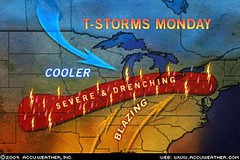
These are the exact locations (Pennsylvania and Kansas) that were mentioned in the long-range forecast.

The area of concern into tonight (Aug 10th) stretches from the northern Texas Panhandle, eastern Colorado and much of Kansas Kansas to Southwest Ontario, New York State, Pennsylvania, New Jersey and southern New England. As a cold front and the associated upper level trough swing eastward Tuesday, the storms will focus from Tennessee and Arkansas to southern Maine, southward to much of Virginia.


The National Weather Service reported the following on August 10th:

SEVERE WEATHER STRUCK PARTS OF NORTHERN AND CENTRAL KANSAS DURING THE LATE MORNING...PRODUCING DAMAGING WINDS...HAIL AND HEAVY RAIN. HAIL TO THE SIZE OF HALF DOLLARS WAS REPORTED FROM ONE STORM 6 MILES SOUTH OF ZURICH IN ROOKS COUNTY KANSAS AT 9 AM.

SHOWERS AND THUNDERSTORMS DEVELOPED OVER NORTHEAST COLORADO NEAR MIDNIGHT...AND THEN SPENT A GOOD PART OF THE LATE NIGHT AND EARLY MORNING HOURS OVER SOUTHWESTERN NEBRASKA. THE MOST INTENSE STORMS OCCURRED IN SOUTHERN CHASE COUNTY...WHERE AS MUCH AS 1.62 INCHES OF RAIN WAS REPORTED 5 MILES SOUTH OF ENDERS...THEY CAUSED WINDS TO GUST AS HIGH AS 47 MPH IN THE NORTH PLATTE AREA JUST BEFORE 7 AM CDT.

Atlantic Hurricane and Southern Texas Rain
Solar Eclipse Action for August and September 2009
August 10-15, 2009
Introduction to the Weather Alternative
How Long-Range Forecasts Are Made


Black Bart
A dropped handkerchief: a surprising end to the career of California's most colorful stage-coach robber. "Black Bart" had terrorized stages for six years, committing twenty-eight robberies between 1877 and 1883 in the rugged foothills of the Sierras. Dressed in a long linen duster with a flour sack over his head, he would brandish a shotgun while demanding, "Will you please throw down your treasure box, sir?"

Finally, near Copperopolis, Bart was wounded while escaping a holdup and dropped a handkerchief with the laundry mark "FX07." This was traced to San Francisco, where police made one of the most surprising arrests in the city's history. "Black Bart," the highwayman, turned out to be Charles E. Bolton, one of San Francisco's leading citizens with close connections in the police department.

Bolton had a reputation as a non-smoking, non-drinking, God-fearing man with big business interest in the gold mines. Amid much publicity he confessed his crime and was sentenced to six years in San Quentin for his deception.

Monday, August 10, 2009

August 6-9, 2009 Forecast Results

The Weather Alternative post of June 8th made note of the fact that Mars would trigger the Solar Eclipse degree of September 11, 2007. In astrometeorology, solar eclipses are sensitive to the hard aspects of the outer planets for about a 3 year period. The forecast mentioned a sensitive spot about 170 miles south of Guadalajara, Mexico where a tropical system may form. This is roughly 103 west longitude and 18 north latitude.

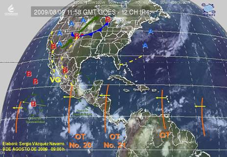
The weather map above from the Mexican Weather Service shows tropical wave #20 over this area on August 9th. (labeled OT No. 20) Their meteorologists reported on Aug 8th Onda tropical No. 20 A lo largo de 100°W y al Sur de 20°N, sobre el Centro y Sur de México, favorecerá fuerte actividad convectiva, con nublados densos y lluvias acompañadas de actividad eléctrica. (Tropical Wave # 10 along 100 west and south of 20 north, over central and southern Mexico, will favor strong convective activity with thick clouds and rain accompanied by electrical activity)


The forecast also warned of a low pressure system or front affecting the Rockies. The Accuweather map at left for August 6th shows a potent storm system that brought a wide variety of adverse weather. Thunderstorms brought damaging winds, hail, and drenching rain to Idaho and Montana.


The Weather Channel map at right is for August 7th. Notice the two low pressure systems over the northern Rockies. The Weather Channel reported A vigorous upper-level disturbance moving from the Northwest into the northern Plains will pop more thunderstorms across the Great Basin, Rockies and northern high Plains today.
The thunderstorms could become severe again especially in Montana.
Gusty winds will keep the fire danger high across the Four Corners Region.

Atlantic Hurricane and Southern Texas Rain
Solar Eclipse Action for August and September 2009
August 10-15, 2009
Introduction to the Weather Alternative
How Long-Range Forecasts Are Made

Success and Motive


Your success in life depends on your motive. There is an old fable about a dog that boasted of his ability as a runner. One day he chased a rabbit and failed to catch it. The other dogs ridiculed him on account of his previous boasting. His reply was, "You must remember that the rabbit was running for his life, while I was only running for my dinner." The incentive is all-important.

Tuesday, August 04, 2009

The Summer That Never Was

Accuweather has report that for residents of the Midwest and Northeast the month of July was strikingly cool. Cities like Chicago, Madison, and Cincinnati experienced their coolest July on record! Here are the stats: When record low temperatures and record low high temperatures are considered, more than 3,000 records were broken across the country, many of these were in the Midwest and Northeast. The reason? A storm system and the associated jet stream over Canada that continuously dipped farther south than usual.


The astrometeorological cause can be traced to the Cardinal Solar Ingress chart for the summer season. Above you'll see this chart set for Chicago. A few things will become apparent. The planet Uranus, associated with cold air masses is exactly on the Ascendant. This is the 9 o'clock position on the wheel where you see a blue symbol that is similar to the letter H. Let's go farther east to New York and view the chart from there.


Uranus is now far from the Ascendant, but another cold or cool weather maker is at work. My experience with long-range weather forecasting points to the fact that Pluto is associated with cooler weather patterns. At the time of the Carding Solar Ingress for the summer season, the Sun was forming an opposition to Pluto. You can see these in the sectors marked 3 and 9 in the above figure. The Sun occupies the 3rd sector and Pluto the 9th. These two sectors are important because they represent areas directly west of the place in question; in this case New York City. This is important since weather patterns in the mid-latitude areas of the globe travel from west to east.
Atlantic Hurricane and Southern Texas Rain

Solar Eclipse Action for August and September 2009

August 10-15, 2009

Introduction to the Weather Alternative

How Long-Range Forecasts Are Made

The Game of Love


Let the game of love occupy your mind and dictate your actions all the time. Remember, your game improves with practice. Never pass--always take that turn to show love and appreciation. Perform great feats of love when you can, but never underestimate the simple moves. You'll be surprised what the simple maneuvers will do. Simple little turns taken regularly and consistently add up the points!