Friday, June 27, 2008

Uranus Retrograde and Central Plains Weather

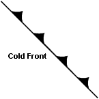
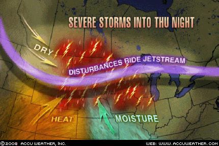
Severe thunderstorms, capable of producing large hail and damaging winds, are traversing the northern Plains and parts of the Midwest in fulfillment of The Weather Alternative's long-range forecast for June 25-29, 2008. The forecast called for a strong cold front to push southward over the northern Plains lowering temperatures and triggering precipitation and windy conditions. The forecast was based on Uranus' retrograde station, and was posted on May 12, 2008.


Accuweather reports the following today:


Severe Storms Rock Flood Zones Heavy thunderstorms will blast the Upper Midwest and central Plains today...


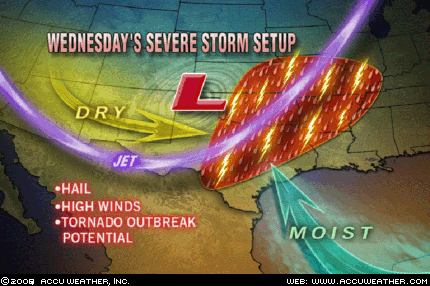
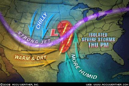
The Severe Weather Center warns a cold front diving down from Canada's Prairie Provinces today will ignite an outbreak of severe weather across the Upper Midwest and central Plains. The thunderstorms will erupt as incoming cooler air slices into the warm, moist air flowing north from the Gulf of Mexico. The presence of a strong jet stream will add to the instability in the atmosphere...


The strongest thunderstorms will be capable of producing damaging winds, pounding hail, frequent lightning and drenching downpours. The greatest threat for tornado development will be over the central Plains.
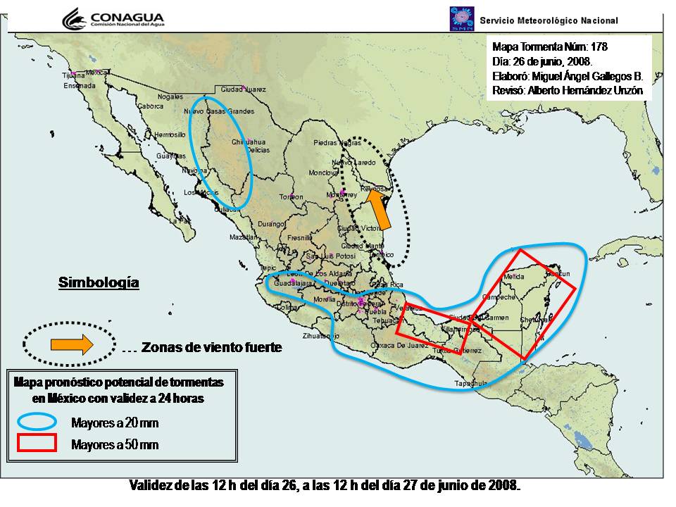


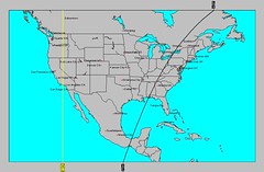
The long-range forecast also called for the possibility of a low pressure system to affect Brownsville and southern Texas. No low pressure system has been reported over the area as of yet. The map at right from Mexico's National Weather Service for yesterday, June 26th, shows the Brownsville area subjected to high wind warnings (zona de viento fuerte).

Summer 2008: The Eastern United States

Summer 2008: The West Coast Part 1

Summer 2008: The Rockies Part 1

Summer 2008: The Plains and Mississippi Valley- Part 1

Introduction to the Weather Alternative

How Long-Range Forecasts Are Made

More Views on the Yearning for Zion Ranch Incident


Kidnapped by government
ByVox Day, WorldNetDaily


Not since the Waco massacre have I been so completely appalled by an American government action. The recent kidnapping of more than 400 children from their parents by Texas Child Protective Service agents is an unconscionable renunciation of not only the U.S. and Texas constitutions, but a rejection of the very meaning of what it is to be an American.


Angie Voss, the CPS kidnapper in chief, stated that five of the 416 FLDS children were pregnant or had given birth; assuming that half of the 416 are female, that is a pregnancy rate of 24 per 1,000. The Texas pregnancy rate among women 15 to 19 is 101 per 1,000.


It’s also worth noting that the "numerous" pregnant 13-year-olds hypothesized by one government worker mysteriously transformed into five "under 18s" when Voss testified in court.


If the family lives of hundreds of American citizens living peacefully can be brutally invaded and destroyed on the basis of a single anonymous phone call that increasingly looks to have been a fraud, then every American family is at risk.


As history has shown, the next time it may not be some heretical Mormons in the government’s gun sights, but Jews, homeschoolers or evangelical Christians.

Tuesday, June 24, 2008

Mars Opposition Neptune and the Pacific Northwest

The Weather Alternative posted a long-range forecast last April 20th calling for an increase in moisture and storm emergencies over the Pacific Northwest between June 20-23. The opposition between Mars and Neptune was the astrological factor behind the forecast.

An anonymous writer posted the following comment on this blog: Nice call regarding June 20 - 23. We had moisture without rain but lightning and thunder in the sierras starting numerous fires... and Ely Nevada a shower and thunder and lightning as well. Humidity levels were up.

The National Weather Service summed it up as follows:

THERE IS A THREAT OF THUNDERSTORMS ACROSS ALL OF CENTRAL AND NORTHEAST OREGON AND SOUTH CENTRAL AND SOUTHEAST WASHINGTON THROUGH THIS EVENING. THE AIR MASS IS BECOME INCREASINGLY MOIST AND UNSTABLE...THUNDERSTORMS WILL INCREASE IN COVERAGE AND INTENSITY THIS AFTERNOON AND EVENING. A PACIFIC FRONT WILL ENCOUNTER THE MOIST AND UNSTABLE AIR MASS AND TRIGGER ISOLATED TO SCATTERED THUNDERSTORMS AS IT MOVES EAST OF THE CASCADES. THE BIGGEST THREAT FROM THUNDERSTORMS WILL BE STRONG WINDS...PARTICULARLY IN THE JOHN DAY VICINITY, THE BLUE MOUNTAINS AND THE BLUE MOUNTAIN FOOTHILLS, THE GRANDE RONDE VALLEY, AND WALLOWA COUNTY. IN THESE AREAS...THERE IS A POTENTIAL FOR DAMAGING WIND GUSTS OF 60 MPH OR GREATER.

Storm emergencies weren't too severe--just enough to warn of strong winds.

Summer 2008: The Eastern United States
Summer 2008: The West Coast Part 1
Summer 2008: The Rockies Part 1
Summer 2008: The Plains and Mississippi Valley- Part 1
Introduction to the Weather Alternative
How Long-Range Forecasts Are Made

Some Thoughts About the Yearning For Zion Ranch Incident


Is the secular state really better at determining what’s best for the children of the YFZ Ranch than are the parents of those children?

According to the experts, 62 percent of girls are sexually abused by the age of 18—outside the YFZ Ranch.

According to the experts, 31 percent of boys are sexually abused by the age of 18—outside the YFZ Ranch.

According to the experts, most rape victims are under 12 years old—outside the YFZ Ranch.

I want to see children raised in polygamist groups? No.

But neither do I want to see children abused at the hands of the state—which, I hate to say, happens every single day throughout America. It happens in government-run schools.

Was this raid really necessary? Was it really justified? --By Joesph Farah World Net Daily

Friday, June 13, 2008

Summer 2008: The Eastern United States

The planetary positions at the time of the Vernal Equinox are some of the main factors to be considered in assessing summer weather conditions over a given area. The following long-range forecasts are based solely on planetary movement as seen through this chart. In this installment, we look at weather conditions and possible hurricane landfalls over the Eastern United States. Hopefully, in the future, more information will be added by consulting with other important charts such as solar and lunar eclipses, new and full moon charts, etc.


July 1-3

Venus opposes transit Jupiter on the 2nd. The Moon conjoins and opposes them as well. These square the Midheaven through New England bringing a warm and moist air mass that will result in precipitation.

July 5-8
Mercury descends along the entire East Coast and squares transit Uranus on the 5th. Venus trines Uranus on the 6th, and the Moon conjoins Uranus on the 8th.
A cold air mass descends over the Plains out of Canada setting off storms. A cold front along the East Coast brings storms from Florida to New England.


July 9-11
The Sun's opposition to Jupiter and Mercury's opposition to Pluto at the time of the First Quarter Moon show the potential for a low pressure system or front to develop off the U.S. East Coast around the latitude of North Carolina and bring severe weather to the New England area.


July 18-20
Mercury’s opposition Jupiter on the 19th and its contra parallel to Jupiter on the 21st will bring stormy conditions throughout the Northeast U.S.


Aug 23-25
Mars is now transiting across the East Central area at 86 west longitude. On the 26th, Mercury is contra parallel Mars. Heat increases and may result in storms and windy conditions.


Aug 27-29
Mercury and Venus square Pluto on the 27th and 29th respectively. Venus is also contra parallel Mars, which now occupies the Midheaven at 83 west longitude on the 28th. Although Pluto has been busted down from its status as a planet, it still exerts its full power on the weather. In the Ingress chart, Pluto runs along the East Coast, which should feel the strength of its storm-producing capabilities, while Mercury and Venus affect the East Central area with thunderstorms.


Aug 30-Sept 2
At this time Mercury parallels Mars and Uranus. Stormy weather and damaging winds will result as air masses clash over the East Central U.S.


Sept 6-9
This is a very active period for the East Coast. Strong storms and high wind velocities are indicated for the mid-Atlantic area as Mercury, Venus, and Mars transit the area. Mars will parallel Uranus--a high wind breeder, and square Jupiter. Mercury also squares Jupiter and conjoins Mars--another wind maker. Lastly, Venus squares Jupiter and parallels Uranus. Tropical storm or hurricane landfall is possible over the Carolinas. If not a tropical system, powerful storms lash the mid-Atlantic and push eastward.


Sept 10-14
Venus conjoins Mars on the 11th increasing temperatures that may lead to storms. By the 14th, Mercury conjoins Venus, another aspect that increases temperatures and may trigger thunderstorms.


Sept 14-18
The conjunction of Mercury and Venus over the New England area keep the astro-meteorological window open for tropical storm/hurricane activity to affect the region or for severe thunderstorms to afflict the area.
The planetary positions at the time of the Vernal Equinox are some of the main factors to be considered in assessing summer weather conditions over a given area. The following long-range forecasts are based solely on planetary movement as seen through this chart. In this installment, we look at weather conditions and possible hurricane landfalls over the Eastern United States. Hopefully, in the future, more information will be added by consulting with other important charts such as solar and lunar eclipses, new and full moon charts, etc.


Summer 2008: The West Coast Part 1
Summer 2008: The Rockies Part 1
Summer 2008: The Plains and Mississippi Valley- Part 1
Introduction to the Weather Alternative
How Long-Range Forecasts Are Made

Al Capone

Capone was allowed to serve out the rest of his sentence in the newly-opened Federal Correctional Institution at Terminal Island, Los Angeles, partially paralysed. Here one Sunday at the Sunday service, the prisoners were asked by the preacher, "Do any of you feel the need of prayer?" Amongst the first to raise his hand was Capone. To the next question, "Are any of you here feeling the need of a Saviour? Is so, stand up before your fellows and confess the fact." Capone stood up. -- John Kobler

Saturday, May 31, 2008

Three-day Severe Weather Outbreak

G.J. McCormack, known as The Weather Prophet of Fair Lawn, New Jersey, was the 20th century's ablest astro-meteorologist. He wrote that the weather resulting from the Sun's parallel aspect with Mercury was invariably accompanied by winds of high velocities. Over the last few days, the Sun has been approaching its exact parallel with Mercury (exact on the 31st). This was the basis for The Weather Alternative's long-range forecast for May. By the 28th, the Moon squares Mercury again. This, coupled with the Sun's parallel to Mercury should trigger colder conditions, wind, and storms from the Mississippi Valley to the East Coast from the 28th through the 31st.


The Accuweather map above shows the severe weather set-up for Friday (May 30th) over the Mississippi Valley. Large hail, damaging winds, and tornadoes were expected in keeping with the nature of the Sun's parallel with Mercury. Tornadoes were reported on Friday in Minnesota, Missouri, Illinois and Indiana. No injuries were reported. Two tornado reports were also made in northwestern Ohio.


The East Coast will also feel the effects of severe weather as indicated in the long-range forecast. According to today's Accuweather report, The area at greatest risk for strong and severe storms will be from New York City to eastern Virginia. Large hail, heavy downpours and localized flooding, damaging winds and isolated tornadoes will be spawned by the strongest storms.
The storm system will bring heavy showers and thunderstorms to much of the balance of the Northeast.


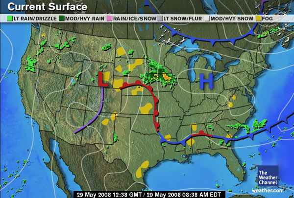
According to The Weather Alternative long-range forecast for May 28-31, the Rockies were to experience a stormy period. The Weather Channel map at left for Thursday, May 29th, shows a low pressure system over Wyoming. Showers and thunderstorms pushed eastward into Montana and Wyoming with some isolated storms billowing up over eastern Colorado and eastern New Mexico.

May Forecasts

Summer 2008: The West Coast Part 1

Summer 2008: The Rockies Part 1

Summer 2008: The Plains and Mississippi Valley- Part 1

Introduction to the Weather Alternative

How Long-Range Forecasts Are Made

Check out this new movie: Expelled


Science wants to deny any evidence of a supreme being precisely because it wants to be a supreme being. Intelligent Critique by Dave Berg

Texas had no right to take polygamist sect kids: court

The state of Texas had no right to remove hundreds of children from a polygamist sect because it has not proven they were in imminent danger, an appeals court ruled Thursday.

Wednesday, May 28, 2008

What's Going On With The Tropics?

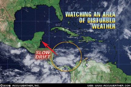
Meteorologists are monitoring an area of disturbed weather in the Southern Caribbean. This area of low pressure will likely bring heavy rain to central America later in the week.


What is happening astro-meteorologically that would show the formation of a low pressure system there?


Remember, in astro-meteorology we always consult a key chart, such as a solar ingress, lunation, eclipse etc. and look for angular planets (planets on the 1st, 7th, 4th, or 10th cusps) that are in aspect (conjunctions, sextiles, squares, trines, oppositions, stationary etc.).


The New Moon map of May 5th at left shows Neptune on the Midheaven with Mercury crossing it over the area where this low pressure system is developing. On the 26th, Neptune turned retrograde and transit Venus conjoined the degree of Mercury in the New Moon map on the 27th activating the storm potential shown.

In The Weather Alternative's May forecast, we've been keeping an eye on Mercury's position in the Solar Ingress. The forecast pinpointed the 26th as a day when cold air and windy conditions would start to enter the East Coast area. The 26th was Monday. As can be seen from the Accuweather map at left, a cold front started its descent over the area.


The next Accuweather map at left is for today and shows the breezy conditions that are occurring over the Northeast and New England.


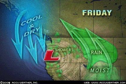
The Weather Alternative forecast for May 25-29 referred to Neptune's retrograde movement and Venus' square to Saturn. The forecast called for a good-sized storm over the West Coast and Rockies.

The Accuweather map at left shows the upper-level low pressure system that is bringing unsettled weather to the region, which extend eastward into Montana and Wyoming.

One interesting observation has to do with the flood advisories that are being issued over the Northwest.

FLOOD ADVISORY NATIONAL WEATHER SERVICE SPOKANE WA234 PM PDT TUE MAY 27 2008

RIVER LEVELS HAVE INCREASED IN RESPONSE TO RECENT WARM TEMPERATURES AND SNOW MELT.

Neptune, which occupies and angular position over the western U.S. in the Solar Ingress map is also known for thaws, and flooding. This particular aspect of Neptune was not mentioned in the May forecast.

May Forecasts
Summer 2008: The West Coast Part 1
Summer 2008: The Rockies Part 1
Summer 2008: The Plains and Mississippi Valley- Part 1

Introduction to the Weather Alternative
How Long-Range Forecasts Are Made


Love: The greatest four-letter word. (Denis Waitley)
L—is for Listen. To love someone is to listen unconditionally to his or her needs without prejudice.


O—is for Overlook. To love someone is to overlook the flaws and faults in favor of looking for the good.


V—is for Voice. To love someone is to voice your approval on a regular basis. There is no substitute for honest encouragement, positive strokes, and praise.

E—is for Effort. To love someone is to make a constant effort to spend the time, to make the sacrifice, to show your interest.

Check out this new movie: Expelled


Science wants to deny any evidence of a supreme being precisely because it wants to be a supreme being. Intelligent Critique by Dave Berg

Friday, May 23, 2008

Saturn and Mars Rock the West

The Sun's square to Saturn on the 22nd and Venus' parallel to Mars on the 24th are resulting in rare May thunderstorms for Southern California, Arizona, and New Mexico; flooding concerns in Montana; and the unusual movement of a low pressure system over the Northwest bringing the storms to the area from the east. The Weather Alternative forecast for May 22-25 was posted on April 15th and called for a clashing of cold and warm air masses as represented by Saturn and Mars resulting in storms over the Rockies.


Much of Montana and northern Wyoming could have in excess of 2 inches of rain Thursday into Thursday night.


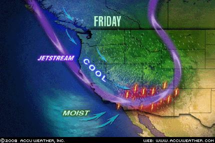
An unusually strong southerly dip in the jet stream is helping to spark some rare May thunderstorms in Southern California, Arizona and New Mexico. Southern California will have extreme weather for a second day today after hail, tornadoes, floods and mudslides all made the headlines yesterday in the region. Today will be mainly a flooding threat, although thunderstorms containing severe weather are possible.


More snow is falling across the Rockies from Montana to Arizona with snow levels lowering to between 6000 to 7000 feet. Some of the highest elevations could pick up over 2 feet of snow, especially the Tetons, and southwest mountains in Montana. Is it May 23rd or February 23rd?

(All weather maps courtesy of Accuweather)

May Forecasts

Summer 2008: The West Coast Part 1

Summer 2008: The Rockies Part 1

Summer 2008: The Plains and Mississippi Valley- Part 1

Introduction to the Weather Alternative

How Long-Range Forecasts Are Made

Temperature Monitors Report Widescale Global Cooling

Not by chance: From bacterial propulsion systems to human DNA, evidence of intelligent design is everywhere

Check out this new movie: Expelled

Science wants to deny any evidence of a supreme being precisely because it wants to be a supreme being. Intelligent Critique by Dave Berg

Wednesday, May 21, 2008

Mercury Weather Watch

The Weather Alternative's long-range weather forecast for May 2008 reminded residents of the Southeast, mid-Atlantic, and Northeast that the planet Mercury was setting up shop over the East Coast during the last half of the month. Mercury's astro-meteorological influence has long been observed to coincide with cooler air masses and windy conditions.


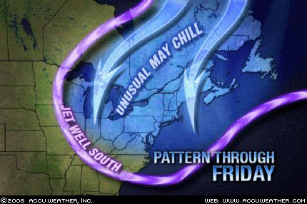
The forecast called for a shot of colder air over the East Coast by the 21st of May. As can be seen from the Accuweather map at left an unusual May chill will grip the Northeast and New England today. The unseasonable chill is being transported out of Canada by a persistent flow from the north resulting in much-below-normal temperatures.


The long-range weather forecast for May 20-23 pinpointed storms over the Plains due to the Sun's square to Saturn. The latest from Accuweather (see map) shows severe thunderstorms scheduled to hit the Plains on Thursday the 22nd and Friday the 23rd. Right on schedule. Watch out for tornadoes and severe thunderstorms if you're a resident of the area.


May Forecasts
Summer 2008: The West Coast Part 1
Summer 2008: The Rockies Part 1
Summer 2008: The Plains and Mississippi Valley- Part 1


Introduction to the Weather Alternative
How Long-Range Forecasts Are Made


Temperature Monitors Report Widescale Global Cooling
Not by chance: From bacterial propulsion systems to human DNA, evidence of intelligent design is everywhere


Heaven Is Full Of Sinners


Castro "rediscovered Jesus while at the point of death." (El Mercurio, Chile)

Alina Fernandez Revuelta, Fidel Castro’s daughter, affirmed to the Italian newspaper Corriera Della Sera that her father has come closer to religion in his latter years, rediscovering Jesus while at the door of death; "but this does not surprise me, because he was educated by the Jesuits." Alina, who has lived in exile since 1993, affirmed that, "My dad thinks about God and not so much about Cuba now. After his death, Raul will gradually be imposing an economy modeled after China."

Monday, May 19, 2008

Northwest Moisture and Plains Heat

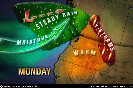
The precipitation forecast for May 19-20 in The Weather Alternative long-range forecast for May is on its way. The forecast was based on the square between Venus and Neptune. The map at left shows the storm system pushing into the U.S. West Coast. Rain will push into the Olympic Peninsula by this afternoon with showers reaching Seattle and Portland overnight.


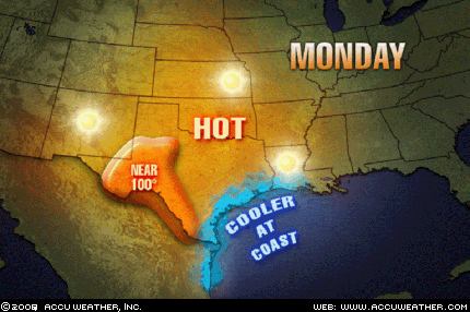
The next Weather Alternative forecast being fulfilled is for the period of May 20-23. This forecast called for warm air to surge northward over the Plains raising temperatures over Texas, Oklahoma, and Kansas. As can be seen from the Accuweather map at right temperatures will push well into the 90s with some places in West Texas reaching 100 degrees. The Weather Alternative forecast calls for storms to be triggered over this area on the 22nd. We'll keep an eye out for those storms.


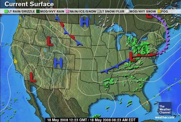
The long-range forecast for May 17-19 called for fair conditions over the Rockies and storms and windy conditions over the Plains and Mississippi Valley. The Weather Channel map at left for May 18th shows a high pressure system over the Rockies. Windy conditions were reported by the National Weather Service on the 18th and 19th over Wyoming, Nebraska, Oklahoma, Arkansas, North Dakota, South Dakota, Missouri.

413 AM CDT MON MAY 19 2008
...WIND ADVISORY THIS AFTERNOON THROUGH EARLY EVENING FOR ALL OF WESTERN AN PORTIONS OF CENTRAL NORTH DAKOTA...


332 AM CDT MON MAY 19 2008 MEMPHIS

SOUTHWEST WINDS WILL BECOME STRONG AND GUSTY TODAY. SUSTAINED WINDS NEAR 25 MPH WITH GUSTS TO NEAR 35 MPH ARE EXPECTED TO DEVELOP LATE THIS MORNING AND CONTINUE INTO THIS AFTERNOON.

May Forecasts

Summer 2008: The West Coast Part 1

Summer 2008: The Rockies Part 1

Summer 2008: The Plains and Mississippi Valley- Part 1

Introduction to the Weather Alternative

How Long-Range Forecasts Are Made

Temperature Monitors Report Widescale Global Cooling

Not by chance: From bacterial propulsion systems to human DNA, evidence of intelligent design is everywhere


Saturday, May 17, 2008

Some May Forecasts and Their Results

The long-range Weather Alternative forecast for May 10-13 called for fair conditions over the Rockies, which would spread to the Plains and the Mississippi Valley.


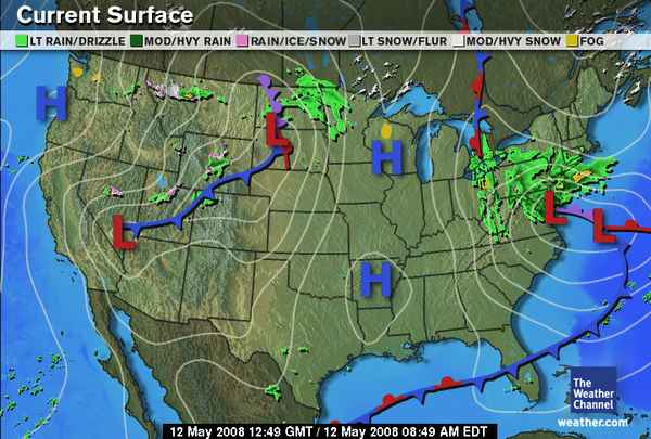
The 10th brought violent storms over the southern Plains. The 11th (see Weather Channel map at left), was fair over the Rockies and Plains, while the 12th was fair over the Mississippi Valley and most of the Plains as can be seen from the Weather Channel map at right.


The next long-range forecast was for May 13-15. The Sun square Neptune was the main feature. The forecast called for a clashing of warm moist air (as represented by Neptune) with a cold air mass that was to result in storms. As can be seen by the Accuweather graphic at left, a great heat wave surged into the west on the 14th.
As for me, I can't figure out why I thought cold air was indicated at this time since the other planet involved in the aspect was the Sun, which is usually considered a warm planet.
The Weather Alternative May forecast also made mention of Mercury's position over the eastern United States between May 13th and 31st. Here's the first of the forecasts:
Transit Mercury sets up residence over the eastern US by the 13th. The Southeast, mid-Atlantic, and Northeast should begin to feel its effects from this time on. Mercury is associated with cooler air masses and windy conditions. On the 13th the Moon will square Mercury propelling some cold air throughout the region.

The Weather Channel reported soaking rains on the 12th over the mid-Atlantic and gusty winds all across the region. For the 13th, the Weather Channel warned "Windy conditions are expected across parts of the Northeast today, in particular areas near the coast."

May Forecasts

Summer 2008: The West Coast Part 1

Summer 2008: The Rockies Part 1

Summer 2008: The Plains and Mississippi Valley- Part 1

Introduction to the Weather Alternative

How Long-Range Forecasts Are Made

Temperature Monitors Report Widescale Global Cooling


U.S. mothers deserve $134,121 in salary.

(Reuters)--A full-time stay-at-home mother would earn $134,121 a year if paid for all her work, an amount similar to a top U.S. ad executive, a marketing director or a judge, according to a new study.
To reach the projected pay figures, the survey calculated the earning power of the 10 jobs respondents said most closely comprise a mother's role--housekeeper, day-care teacher, cook, computer operator, laundry machine operator, janitor, facilities manager, van driver, chief executive and psychologist--at an average 91.6 hours a week the stay-at-home mother worked.

Thursday, May 15, 2008

Burma and China

On May 2nd and 3rd, Cyclone Nargis hit the impoverished
nation of Burma resulting in the deadliest natural disaster in the
history of that nation. Tens of thousands of fatalities have been
confirmed with tens of thousands of people still missing. The
Burmese government has formally asked the United Nations for
help, but in many ways remains resistant to the most basic
assistance.


As has been shown time and again on The Weather Alternative, weather patterns correspond to planetary alignments. The last
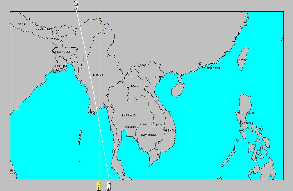
lunar eclipse of February 2, 2008 provides us with a glimpse of the astrological aspects at the time of the cyclone's landfall. On the 3rd, Mercury was parallel Mars. Conjunctions, squares, oppositions, and parallels between these two planets have long been known to produce whipping winds. The astro-locality
map at right shows the angular positions of Mars and Venus on May 3rd. The two planets cross very near where the cyclone hit. Venus was square it own position at the time of lunar eclipse.


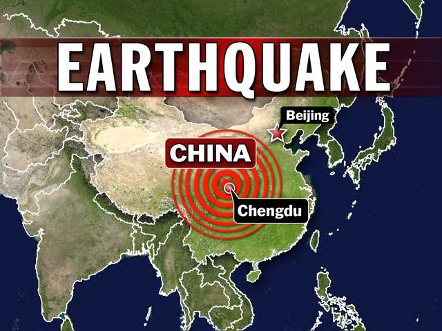
On May 12th, a 7.9 magnitude earthquake took place near
Chengdu in central China. Chinese government officials warn
that the death toll could reach 50,000.

Earthquake prediction using astrology is not the same as using
astrology for weather forecasting. It has been common
knowledge amongst astrologers that the planet Jupiter exerts a
strong electro-magnetic pull on the earth and is instrumental in
producing seismic phenomena. My knowledge in the area of
earthquake prediction is virtually nil. But here is an interesting
observation regarding Jupiter and the Chengdu earthquake.


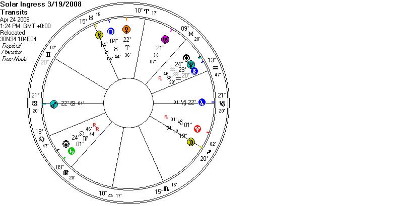
At left is a chart for the transits to the Solar Ingress chart at Chengdu for April 24th. On this date, Mars perfected its opposition to Jupiter exactly on the Ascendant and Descendant
at Chengdu. As you will notice, Venus is also square both Mars and Jupiter forming a T-square. One possible explanation for
the earthquake on May 12th is that the Sun on this date trined Jupiter, now retrograde. Theoretically, the Sun may have released the energy of the T-square by its trine. It is not unusual
for an aspect pattern to be triggered later in time by another
planet's aspect.

May Forecasts
Summer 2008: The West Coast Part 1
Summer 2008: The Rockies Part 1
Summer 2008: The Plains and Mississippi Valley- Part 1

Introduction to the Weather Alternative
How Long-Range Forecasts Are Made
Temperature Monitors Report Widescale Global Cooling

Is that you Hillary?

Before William Branham died, that great and humble prophet, one of the last revelations and visions he had was that the final ruler of the United States who was going to bring the U.S.A. to
its doom and would be the worst ruler they ever had, would be a very beautiful, but very cruel woman.

Monday, May 12, 2008

Summer 2008: The Plains and Mississippi Valley- Part 1

Both Mercury and Uranus will affect weather patterns over the Plains and Mississippi Valley this summer. This is due to their angular positions in the Summer Solstice Chart. (See map) These two planets share an affinity for unseasonable coolness and sporadic strong winds especially when negatively aspected. In season, negative aspects to Mercury (oppositions, squares, and some conjunctions) often spawn hurricanes. Uranus seems to be a more intense version of Mercury and activates descending cold air not only from the Arctic but also from rivers of intensely frigid air in very high levels of the atmosphere.

I've listed important dates below when these planets are activated, and I've included some ideas as to their effect on weather patterns over the US midsection.


June 25-29
Uranus turns retrograde on the 26th. This presages a strong cold front pushing southward over the northern Plains lowering temperatures, and triggering precipitation and windy conditions. There is the possibility of a low pressure system affecting Brownsville and southern Texas.


July 5-8
A cold air mass descends over the Plains out of Canada setting off storms. A cold front along the East Coast brings storms from Florida to New England.


July 13-15
The Sun's trines to Uranus indicates cool and fair over the Plains.


July 22-24
Mercury trines Uranus over the Plains and brings cool, dry air southward. Mars influence adds stormy and windy conditions over the Mississippi Valley.


Aug 5-7
Mars opposes transit Uranus on the 6th. The Moon triggers them earlier on the 4th.
Mars-Uranus signifies storm emergencies and windy conditions, which will hit the Plains. Tornadoes may be a by-product of these storms.


Aug 16-17
An outbreak of storms is shown over the Midwest states and the southern and central Mississippi Valley areas. Particularly severe storms are indicated in and around Arkansas. This may be due to either a tropical storm system originating in the Gulf of Mexico or a low pressure system traversing the southern states.


Aug 20-24
This period starts with a warm and moist air mass pushing up over the Plains due to Mercury's conjunction with Venus. As these planets pass to the opposition of Uranus a cold air mass clashes with it resulting in storms throughout the Plains.


Aug 27-29
Mercury and Venus square Pluto on the 27th and 29th.
Summer storms hit the Mississippi Valley as contrary air masses scuffle over the area.


Sept 3-7
Weather gets nasty over the Plains as Mercury and Mars parallel Uranus provoking windy conditions or severe thunderstorms packing damaging winds. Severe weather then pushes eastward over the Mississippi Valley.


Sept 9-14
Another cold wave begins to affect the Plains triggering precipitation. From the 12th on, the Sun's opposition to Uranus brings a cold air mass out of the north lowering temperatures and setting off storms, which have the potential to reach severe limits. Possible tropical storm or hurricane formation is indicated in the western Gulf of Mexico.


May Forecasts


Summer 2008: The West Coast Part 1


Summer 2008: The Rockies Part 1


Introduction to the Weather Alternative


How Long-Range Forecasts Are Made


Temperature Monitors Report Widescale Global Cooling


A Bible, but no e-mail. (From interview with Vladimir Putin by Richard Stengel, Time magazine)


What role does faith play in your leadership? Putin: First and foremost, we should be governed by common sense. But common sense should be based on moral principles first. And it is not possible today to have morality separated from religious values.


Have you read the Bible? Putin: Yes, I have. And the Bible is on my plane.
Do you use e-mail? Do you blog? Putin: Well, it’s a big shame. I don’t use these technologies. I don’t even use a telephone. My staff do it for me. But they do it wonderfully.

Tuesday, May 06, 2008

Hail and High Winds Hit Plains

Severe thunderstorms producing destructive twisters are expected over the Plains as a storm system ejects out of the Rockies. This confirms The Weather Alternative's long-range forecast for May 7-8, 2008 that called for Windy conditions and precipitation over the Rockies pushing out into the Plains.

The Accuweather map at left shows the low pressure area moving out of the southern Rockies and affecting the southern Plains and Texas.

May Forecasts

Summer 2008: The West Coast Part 1

Summer 2008: The Rockies Part 1

Introduction to the Weather Alternative

How Long-Range Forecasts Are Made

Temperature Monitors Report Widescale Global Cooling

"Want a face-lift? Wear a smile."

Friday, May 02, 2008

Storms Blast Plains and Rockies

Hurricane-force winds, hail and heavy rain, generated in response to a strong jet stream, are battering the Plains. Near-blizzard conditions will also affect Wyoming and the Dakotas. The long-range weather forecast for this period, posted on The Weather Alternative back in April, warned of this storm system in its comment for May 3-5.


The long-range forecast called for "a storm system with energetic winds over the Plains." That is certainly happening although a bit earlier than expected. This forecast was based on Mercury's parallel aspect to Mars (which usually excites high winds) and Mercury's square to Saturn.


Since a key astrological chart places Saturn's influence over the Great Basin and Rockies the forecast for May 2-5 called for major storm activity over the West Coast, Intermountain West, and Rockies. As can be seen in the Accuweather map at right, the northern Rockies is being affected by the combination of an upper-level trough, cold air, and a storm system over the central Plains that will bring snow and wind over the northern Rockies.


This next Accuweather graphic shows the invasion of cold air over the Rockies that is so characteristic of Saturn's astro-meteorological influence.

May Forecasts

Summer 2008: The West Coast Part 1

Summer 2008: The Rockies Part 1

Introduction to the Weather Alternative

How Long-Range Forecasts Are Made

Temperature Monitors Report Widescale Global Cooling

Junk Science: The Great Global Warming Race
Thursday, May 01, 2008
By Steven Milloy

Can global warming’s vested interests close the deal on greenhouse gas regulation before the public wises up to their scam?
A new study indicates alarmist concern and a need to explain away the lack of actual global warming. Researchers belonging to the U.N. Intergovernmental Panel on Climate Change, or IPCC, reported in Nature (May 1) that after adjusting their climate model to reflect actual sea surface temperatures of the last 50 years, "global surface temperature may not increase over the next decade, as natural climate variations … temporarily offset the projected anthropogenic warming." read more

Tuesday, April 29, 2008

April 27-29, 2008 Forecast Results

The long-range weather forecasts posted by The Weather Alternative for April 27-29, 2008 took into consideration Mercury's trine to Uranus, and Mercury's square to Neptune. Cool and fair conditions were forecast for the Rockies and Plains between April 27-29 due to Mercury trine Uranus. The Weather Channel map at left for April 28th shows a cold front pushing southward over the Plains.


The National Weather Service on the 28th made the following statement:
AS SURFACE HIGH PRESSURE CONTINUES TO BUILD IN TO THE PLAINS BEHIND THE SURFACE FRONT. THIS AREA OF HIGH PRESSURE AGAIN KEEPS COOLER AIR ACROSS A GOOD PORTION OF THE PLAINS.

The Rockies, however, were experiencing warmer temps.


Mercury's square to Neptune was the basis for the storm system forecast to affect the West Coast between April 28-29.

This Accuweather map shows rain entering the Pacific Northwest on the 28th bringing cool and damp conditions.

April Forecasts

May Forecasts

Summer 2008: The West Coast Part 1

Summer 2008: The Rockies Part 1

Introduction to the Weather Alternative

How Long-Range Forecasts Are Made

Temperature Monitors Report Widescale Global Cooling


Mikhail Gorbachev admits he is a Christian
By Malcolm Moore, Electronic Telegraph


Mikhail Gorbachev, 77, the last communist leader of the Soviet Union, has acknowledged his Christian faith for the first time, paying a surprise visit to pray at the tomb of St. Francis of Assisi.
Accompanied by his daughter Irina, Mr. Gorbachev spent half an hour on his knees in silent prayer at the tomb.
"St. Francis is, for me, the alter Christus, the other Christ," said Mr. Gorbachev. "His story fascinates me and has played a fundamental role in my life," he added.
Mr. Gorbachev’s surprise visit confirmed decades of rumors that, although he was forced to publicly pronounce himself an atheist, he was in fact a Christian.

Sunday, April 27, 2008

Summer 2008: The Rockies Part 1

Saturn's astro-meteorological influence is related to the cold blue ray in the solar spectrum. It brings major low pressure systems resulting in cold and wet weather when negatively aspected. Negative aspects include squares, oppositions, and some conjunctions. Under positive aspects like the sextile, trine, and positive conjunctions, lower ranges of temperatures and fair weather are to be expected. Saturn will be a key player in this summer's weather since it appears on the Midheaven at 113 west longitude in the Vernal Equinox chart affecting the Great Basin area and the Rocky Mountains.


Included below are some dates when Saturn is aspected by other planets as well as the most likely weather scenarios that will result from those aspects.


July 7-10
Mars will parallel Saturn on the 7th and conjoin Saturn on the 10th. The Mars-Saturn cojunctions usually result in destructive, windy storms due to the clashing of contrary air masses.


Aug 7-9
Chilly and damp weather develops over the Great Basin and Rockies.


Aug 12-15
The conjunctions and parallels of Mercury and Venus to Saturn will bring a storm system to the Rockies lowering temperatures after its passage.


Aug 25-27
A dose of cold air descends over the West generating a low pressure system over the Great Basin and Rockies.


Aug 29-Sept 4
This six-day stretch features the Sun's parallel and conjunction to Saturn. Lower temperatures are to be expected as a cold air mass moves in over the Rockies resulting in precipitation.


Sept 7-10
Jupiter's trine to Saturn on the 8th will bring cool but fair weather to the Rockies

April Forecasts

May Forecasts

Summer 2008: The West Coast Part 1

Introduction to the Weather Alternative

How Long-Range Forecasts Are Made

Temperature Monitors Report Widescale Global Cooling

Food Crisis Starts Eclipsing Climate Change Worries
By Josh Gerstein, New York Sun


The campaign against climate change could be set back by the global food crisis, as foreign populations turn against measures to use foodstuffs as substitutes for fossil fuels. With prices for rice, wheat, and corn soaring, food-related unrest has broken out in places such as Haiti, Indonesia, and Afghanistan. Several countries have blocked the export of grain. There is even talk that governments could fall if they cannot bring food costs down. (Read more)


(Inspirational message received from Jesus in prayer:) Calamities can happen anywhere. I want you to always be ready and prepared for whatever comes up. Your primary preparation is of course spiritual. At the same time, there is a time and place to be prepared physically with a survival stock of basic essentials—which could include food, water, and whatever else I show you is necessary. Preparations for survival-type situations, and having some stock of essentials on hand, is not a thing of the past. There will be times when you will find it helpful and even essential, and if it becomes necessary in your situation, you’ll want to be prepared, and not be caught short when it’s too late.

Friday, April 25, 2008

Neptune Warms The West

Neptune's astro-meteorological effect is that of "prevalent southerly air flows." The chart for the Vernal Equinox placed Neptune in an angular position over the western United States. The Weather Alternative, in its long-range weather forecast for April 24-26 stated Venus now sextiles Neptune bringing an increase in temperatures and fair conditions over the western states. Today's Accuweather map at left shows the warming trend beginning to take place fulfilling the long-range forecast.

The Weather Channel has the following to say about the warming trend:

Overall, a ridge of high pressure will build across the Western States into the weekend, allowing for a return to above average temperatures along the Western Coastal States, into the Pacific Northwest.

According to Accuweather: Brilliant sunshine will allow the air to progressively warm into Sunday, the warmest of the upcoming days. Temperatures will crack the century mark Sunday in the deserts of southeastern California and Arizona.

April Forecasts

May Forecasts

Summer 2008: The West Coast Part 1

Introduction to the Weather Alternative

How Long-Range Forecasts Are Made

Temperature Monitors Report Widescale Global Cooling

Pre-death Visions

Here is one example of a pre-death vision that was reported by a nurse who was at the deathbed of a man in his forties:

"He was unsedated, fully conscious, and had a low temperature. He was a rather religious person and believed in life after death. We expected him to die, and he probably did too, as he was asking us to pray for him. In the room where he was lying, there was a staircase leading to the second floor.

Suddenly he exclaimed: 'See, the angels are coming down the stairs. The glass has fallen and broken.' All of us in the room looked toward the staircase where a drinking glass had been placed on one of the steps. As we looked, we saw the glass break into a thousand pieces without any apparent cause. It did not fall; it simply exploded. The angels, of course, we did not see. A happy and peaceful expression came over the patient's face, and the next moment he expired. Even after his death, the serene, peaceful expression remained on his face."

CLOSER TO THE LIGHT
Learning from the Near-Death Experiences of Children
Amazing Revelations of What It Feels Like to Die
Melvin Morse, M.D.

Wednesday, April 23, 2008

Midwest Front and Storms

Apr 22
The Weather Alternative, in its long-range forecast for April 22-24, expected cool and breezy weather over the eastern Plains and Mississippi Valley. The above Weather Channel map for April 22nd does indeed show a cold front passing through the eastern Plains and Mississippi Valley, however, cool temperatures were not experienced. Temperatures over the Plains and Midwest, through Thursday, will be 10 to 20 degrees above average according to the Weather Channel.

Breezy conditions have not resulted either. The area has been experiencing showers and some strong thunderstorms.

April Forecasts

May Forecasts

Summer 2008: The West Coast Part 1

Introduction to the Weather Alternative

How Long-Range Forecasts Are Made

Temperature Monitors Report Widescale Global Cooling

"There Was A Continuous Rhythm"

Jim is a fifty-year-old supervisor at an aircraft manufacturing plant in Seattle,Washington. He has been married for thirty years and has two children. When he was six years old, he had a bout with scarlet fever that left him critically ill.

One night, as he labored for breath in his room, he felt as though he was slipping away from this life.

"Suddenly, I found myself in a long dark tube, with some strange and different music.There was a continuous rhythm that reminds me of sound you can hear when you place your ear against the mouth of a long pipe.

"I was just flying down this tunnel toward a light. There was something at the end of this tunnel, but I can't really say what it was. I could see my body zooming toward the Light so I know I was out of my body. I was convinced that I was dead, and I really wanted to get to the end of the tunnel to see what the next life held. But I never reached it, and I don't know why.

"The experience had a profound effect upon Jim's life. He feels that it caused him to have a better relationship with both man and God. As he put it: "Even as a wild young man, I always had a strong desire to help others. The experience caused me to have compassion for others, especially those who face death. I have no fear of death, and it is my responsibility to help others who have that fear.

"He feels that the experience brought him to God, even though he insists that this wasn't a religious experience for him. "I just know that there is something greater out there than us because I have experienced it. I realize that others have seen God when they have these experiences. I didn't. I only saw the Light, but that was enough for me."


CLOSER TO THE LIGHT

Learning from the Near-Death Experiences of Children
Amazing Revelations of What It Feels Like to Die
Melvin Morse, M.D.

Sunday, April 20, 2008

Summer 2008: The West Coast Part 1

Mars and Neptune
The Vernal Equinox chart is one of the main charts used to assess weather patterns for the summer season. This coming summer season, which begins on June 20, 2008, brings a powerful Mars-Neptune opposition that falls on the Midheaven/IC of the Vernal Equinox chart over the Pacific Northwest. This opposition is known to induce southerly air flows characterized by tropical moisture. Temperatures and humidity increase, and downfall can be substantial.


Here are a few dates when the opposition is triggered.

June 20-23

The opposition between Mars and Neptune is exact and triggered by the Moon's aspect to both of them on the 23rd. This should coincide with an increase in moisture from southern regions resulting in storm emergencies.

July 11-13

A low pressure area or moisture drawn up from the south generates storms over the Pacific Northwest.

July 31-Aug 2

Venus opposes Neptune on the 31st and by the end of the forecast period the Moon will trigger their opposition. Further west, the Sun-Mercury conjunction takes place at about 140 west longitude on the 29th. These aspects may work together to produce a severe weather system over the Pacific Northwest. Temperatures rise and southerly winds preponderate. Downpours may be heavy resulting in flooding.


Mars-Neptune

Aug 6-8
Mercury now opposes Neptune and the First Quarter Moon also affects the Pacific Northwest. More moisture is pumped into the western US resulting in a low pressure area or front that sets off storms. Wind may be a salient feature.


Aug 15-17
The Sun opposes Neptune but the power of this opposition is enhanced by the Sun also being in opposition to the Moon. In other words, the Full Moon of August 16th lands directly on Neptune. The Sun's trigger will unleash the full potential of the Mars-Neptune opposition. (See Link 1 and Link 2) The resulting weather pattern now may be stronger than the previous planetary triggers to this pair.
Expect abundant moisture to pour into the western US region resulting in high temperatures and humidity accompanied by heavy rains.
Tropical storm or hurricane formation may take place in the eastern Pacific at 123 west longitude and 15 north latitude or about 1000 miles southwest of Cabo San Lucas.

Iran
Around the World

Interesting weather patterns may develop in other areas during the August 15-17 period. In the Vernal Equinox chart, the Mars-Neptune opposition crosses with Mercury over Iran. This trio of planets will also be activated now and may produce some weather anomalies there. I'm not too familiar with weather patterns in Iran but since their summers are usually very hot and Mars-Neptune is known for it's effect of increasing temperatures and humidity this could signify an unusual heat wave. Since Mercury is involved, high winds may figure into the weather picture. A very unusual scenario would be a tropical storm or hurricane hitting the area. While this is not very likely it has happened in recent years.

Another Mars-Neptune-Mercury crossing is found about 450 miles southwest of Ireland in the northeastern Atlantic. This may coincide with a strong low pressure system that heads toward Europe. It's not unusual for the remnants of hurricanes to be blown this way, which may be the case here.

The Mars-Neptune opposition also grazes the east coast of Australia near Brisbane. They may be affected by a winter storm of sorts around this time.

April Forecasts

May Forecasts

Introduction to the Weather Alternative

How Long-Range Forecasts Are Made

Temperature Monitors Report Widescale Global Cooling

The Saving Light
In 1986, David Young and his family carried an arsenal of weapons and a bomb into an elementary school in Cokeville, Wyoming. After holding 156 children hostage and threatening to kill them all, Young detonated the bomb, destroying the entire school. None of the children was harmed.

How did this miracle of survival happen?

Many of the children described seeing people of light who directed them to safety before the explosion occurred. Others talked about hearing the voice of an adult who told them where to go to avoid the bomb's blast.

One girl described her experience in detail: "They [the people of light] were standing there above us. There was a mother and a father and a lady holding a tiny baby and a little girl with long hair. There was a family of people. The woman told us that a bomb was going off soon and to listen to our brother. She said to be sure we did what he told us. They were dressed in white, bright like light bulbs, but brighter around the face. The woman made me feel good. I knew she loved me.

"The girl's brother stated: "I didn't see anything. I just heard a voice tell me to find my little sisters and take them over by the window, and keep them there. They were playing with their friends, and they did not want to move. I took them to the window and helped them through.

Another six-year-old child also testified that "a lady told me that a bomb was going to go off soon. She said to go over by the window and hurry out."

CLOSER TO THE LIGHT
Learning from the Near-Death Experiences of Children Amazing Revelations of What It Feels Like to Die -- Melvin Morse, M.D.

Friday, April 18, 2008

Stubborn Cold Shot


18 Snow for Seattle
Originally uploaded by kvp8

A harsh blast of cold air will bring very pronounced cooling to the western states and then push eastward as can be seen from the Accuweather map at left.

This confirms The Weather Alternative's long-range weather forecast for April 18-22. The forecast issued on March 15th stated A series of trines and parallels from both the Sun and Mercury to Saturn will lower temperatures over the Rockies and may trigger precipitation.

Forecasters are expecting near-blizzard conditions over northern Montana and the southern half of the Canadian provinces. The cold will continue through the weekend as another shot of cold air keeps temperatures well below normal into next week.

April Forecasts

May Forecasts

Introduction to the Weather Alternative

How Long-Range Forecasts Are Made

Temperature Monitors Report Widescale Global Cooling

“We find by losing. We hold fast by letting go. We become something new by ceasing to be something old.”—Frederick Buechner, cleric


Tuesday, April 15, 2008

Forecasts For May 2008


off14_temp
Originally uploaded by kvp8
The forecasts that follow are based on planetary aspects and how they are viewed from Sun's ingress into Aries, which is the main chart for the spring season. The month of May brings us aspects such as Mercury square Saturn, Sun trine Jupiter, and Jupiter sextile Uranus. We also note that Merucy and Neptune will both turn retrograde on May 26th. In the ingress chart these planets are found on the eastern and western sides of the country. Hence at that time the eastern portion of the country will be experiencing "mercurial" weather, which relates to colder and sometimes windier conditions, while the western portion of the country at that time will experience "neptunian" weather. This relates to increased moisture (sometimes extreme) due to southerly air flows.


These forecasts are pretty basic since I have not included information from the lunation charts such as Full Moon and New Moon charts. Nor have I included other charts such as solar and lunar eclipse charts. All of these can add other information that can be useful in formulating forecasts.


May 2-5
Saturn turns direct on May 2nd followed by a square from Mercury to Saturn on May 3rd. Venus parallels Saturn on the 5th. All this infers major storm activity associated with a cold front over the West Coat, Intermountain West, and Rockies.


May 3-5
Mercury is parallel Mars on the 3rd and also square Saturn. This presages a storm system with energetic winds over the Plains.

May 7-8
Windy conditions and precipitation over the Rockies pushing out into the Plains are indicated at this time.


May 10-13
The Sun's sextile to Uranus and its trine to Jupiter should result in fair conditions over the Rockies, which spreads to the Plains and Mississippi Valley.

May 13-15
On the 14th, the Sun will square Neptune over the western US. Warm moist air collides with cold air bring precipitation.


Mercury and Neptune
Originally uploaded by kvp8
May 13-31 Mercury's Influence
Transit Mercury sets up residence over the eastern US by the 13th. The Southeast, mid-Atlantic, and Northeast should begin to feel its effects from this time on. Mercury is associated with cooler air masses and windy conditions. On the 13th the Moon will square Mercury propelling some cold air throughout the region.


By the 21st, Mercury will descend along the length of the US east coast. As the Moon opposes Mercury, another good shot of colder air should lower temperatures.

On the 26th, Mercury begins its retrograde motion, which will once again bring cold air spilling into the the region with windy and/or stormy results.

By the 28th, the Moon squares Mercury again. This, coupled with the Sun's parallel to Mercury should trigger colder conditions, wind, and storms from the Mississippi Valley to the East Coast from the 28th through the 31st.

May 17-19
Venus sextiles Uranus and trines Jupiter. Fair conditions are expected over the Rockies.
At the same time a cold air mass will trigger storms and windy conditions over the Plains and on into the Mississippi Valley.

May 19-20
Venus' square to Neptune over the western US at 118 west longitude will bring warm moist air resulting in precipitation.

May 20-23
As the Sun parallels Mars, warm air surges northward over the Plains raising temperatures over Texas, Oklahoma, and Kansas. Storms will ensue as the Sun squares Saturn on the 22nd.

May 22-25
The Sun squares Saturn on the 22nd (111 West) while Venus parallels Mars on the 24th. These together should trigger a clashing of cold and warm air masses as represented by Saturn and Mars resulting in storms over the Rockies.

May 25-29
Neptune goes retrograde on the 26th over the West Coast states as the Moon conjoins and parallels it. Neptune pulls moisture up from the south in large quantities. Venus also squares Saturn, which is found over the Rockies and is also triggered by the Moon. A good-sized storm should be the results for the West Coast and Rockies.

May 28-31
A stormy period for the Rockies.

April Forecasts

Introduction to the Weather Alternative

How Long-Range Forecasts Are Made

Temperature Monitors Report Widescale Global Cooling

Better Understanding Of Hurricane Trajectories Learned From Patterns On Soap Bubbles
ScienceDaily (Apr. 15, 2008) — Researchers at the Centre de Physique Moléculaire Optique et Hertzienne (CPMOH) (CNRS/Université Bordeaux (1) and the Université de la Réunion(1) have discovered that vortices created in soap bubbles behave like real cyclones and hurricanes in the atmosphere. Soap bubbles have enabled the researchers to characterize for the first time the random factor that governs the movement and paths of vortices. These results, published in the journal Physical Review Letters, could lead to a better understanding of such increasingly common and often devastating atmospheric phenomena.